Woodstock is the shire town (county seat) of Windsor County, Vermont, United States. As of the 2020 census, the town population was 3,005. It includes the villages of Woodstock, South Woodstock, Taftsville, and West Woodstock.
| Name: | Woodstock village |
|---|---|
| LSAD Code: | 47 |
| LSAD Description: | village (suffix) |
| State: | Vermont |
| County: | Windsor County |
| Elevation: | 702 ft (214 m) |
| Total Area: | 44.6 sq mi (115.6 km²) |
| Land Area: | 44.4 sq mi (114.9 km²) |
| Water Area: | 0.3 sq mi (0.7 km²) |
| Total Population: | 3,005 |
| Population Density: | 67/sq mi (26/km²) |
| ZIP code: | 05091 |
| Area code: | 802 |
| FIPS code: | 5085900 |
| GNISfeature ID: | 1462272 |
| Website: | www.woodstockvt.com#&www.townofwoodstock.org |
Online Interactive Map
Click on ![]() to view map in "full screen" mode.
to view map in "full screen" mode.
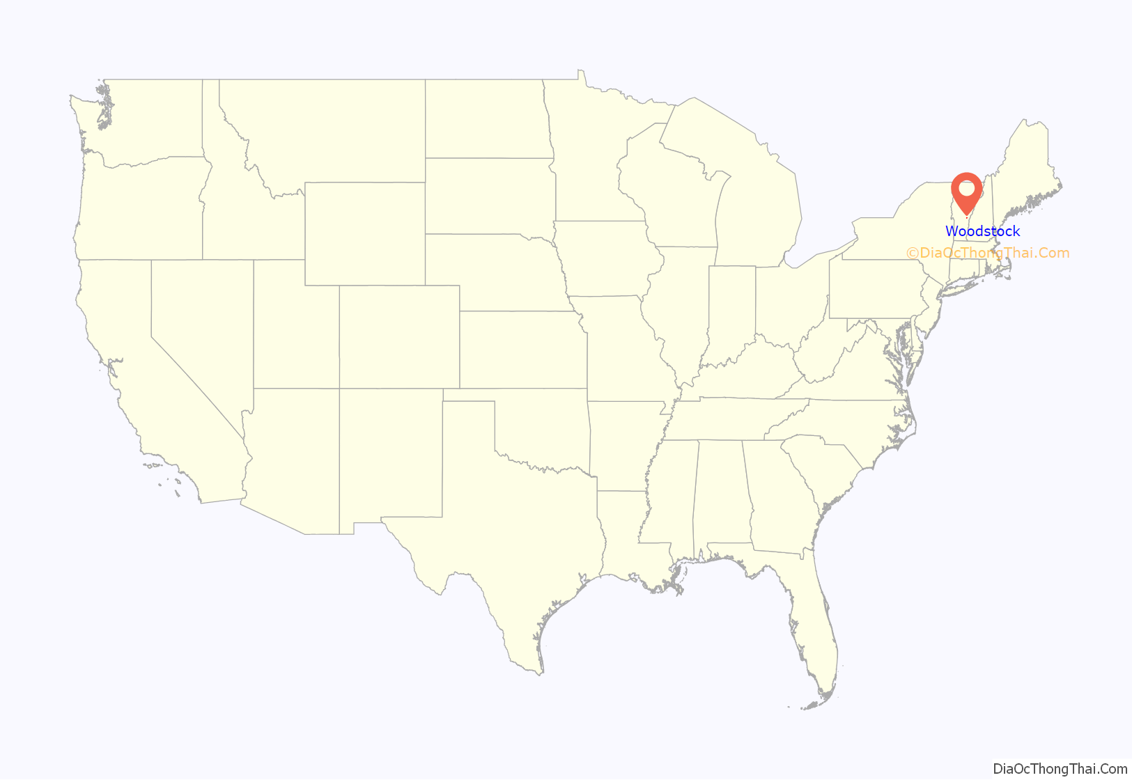
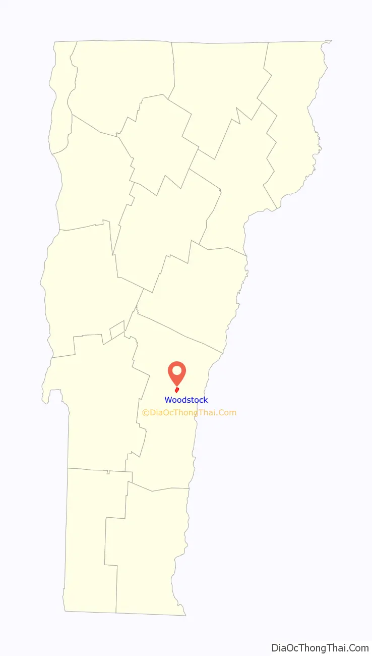
Woodstock location map. Where is Woodstock village?
History
Chartered by New Hampshire Governor Benning Wentworth on July 10, 1761, the town was a New Hampshire grant to David Page and 61 others. It was named after Woodstock in Oxfordshire, England, as a homage to both Blenheim Palace and its owner, George Spencer, 4th Duke of Marlborough. The town was first settled in 1768 by James Sanderson and his family. In 1776, Joab Hoisington built a gristmill, followed by a sawmill, on the south branch of the Ottauquechee River. The town was incorporated in 1837.
Although the Revolution slowed settlement, Woodstock developed rapidly once the war ended in 1783. The Vermont General Assembly met here in 1807 before moving the next year to the new capital at Montpelier. Waterfalls in the Ottauquechee River provided water power to operate mills. Factories made scythes and axes, carding machines, and woolens. There was a machine shop and gunsmith shop. Manufacturers also produced furniture, wooden wares, window sashes and blinds. Carriages, horse harnesses, saddles, luggage trunks and leather goods were also manufactured. By 1859, the population was 3,041. The Woodstock Railroad opened to White River Junction on September 29, 1875, carrying freight and tourists. The Woodstock Inn opened in 1892.
The Industrial Revolution helped the town grow prosperous. The economy is now largely driven by tourism. Woodstock has the 20th highest per-capita income of Vermont towns as reported by the United States Census, and a high percentage of homes owned by non-residents. The town’s central square, called the Green, is bordered by restored late Georgian, Federal Style, and Greek Revival houses. The cost of real estate in the district adjoining the Green is among the highest in the state. The seasonal presence of wealthy second-home owners from cities such as Boston and New York has contributed to the town’s economic vitality and livelihood, while at the same time diminished its accessibility to native Vermonters.
The town maintains a free (paid for through taxation) community wi-fi internet service that covers most of the village of Woodstock, dubbed “Wireless Woodstock”.
Village from Mount Tom in 1913
Norman Williams Public Library c. 1910, built in 1883–1884
Original Woodstock Inn in 1907, open from 1892 to the late 1960s
F. H. Gillingham & Sons, Elm Street, early 1900s
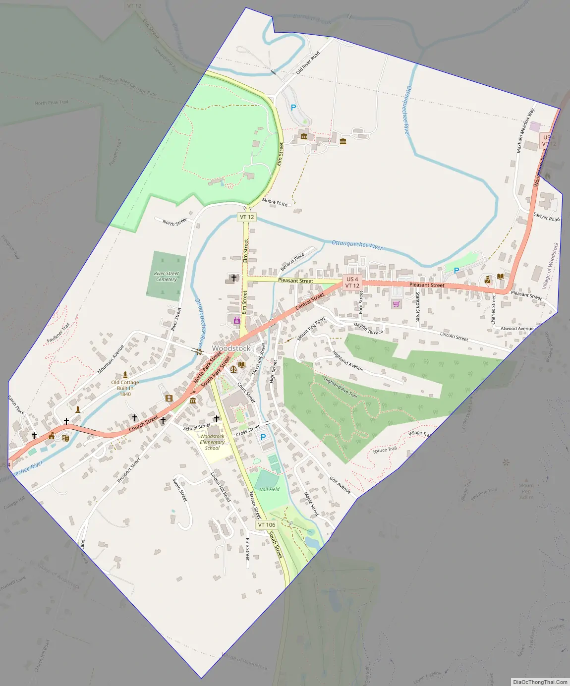
Woodstock Road Map
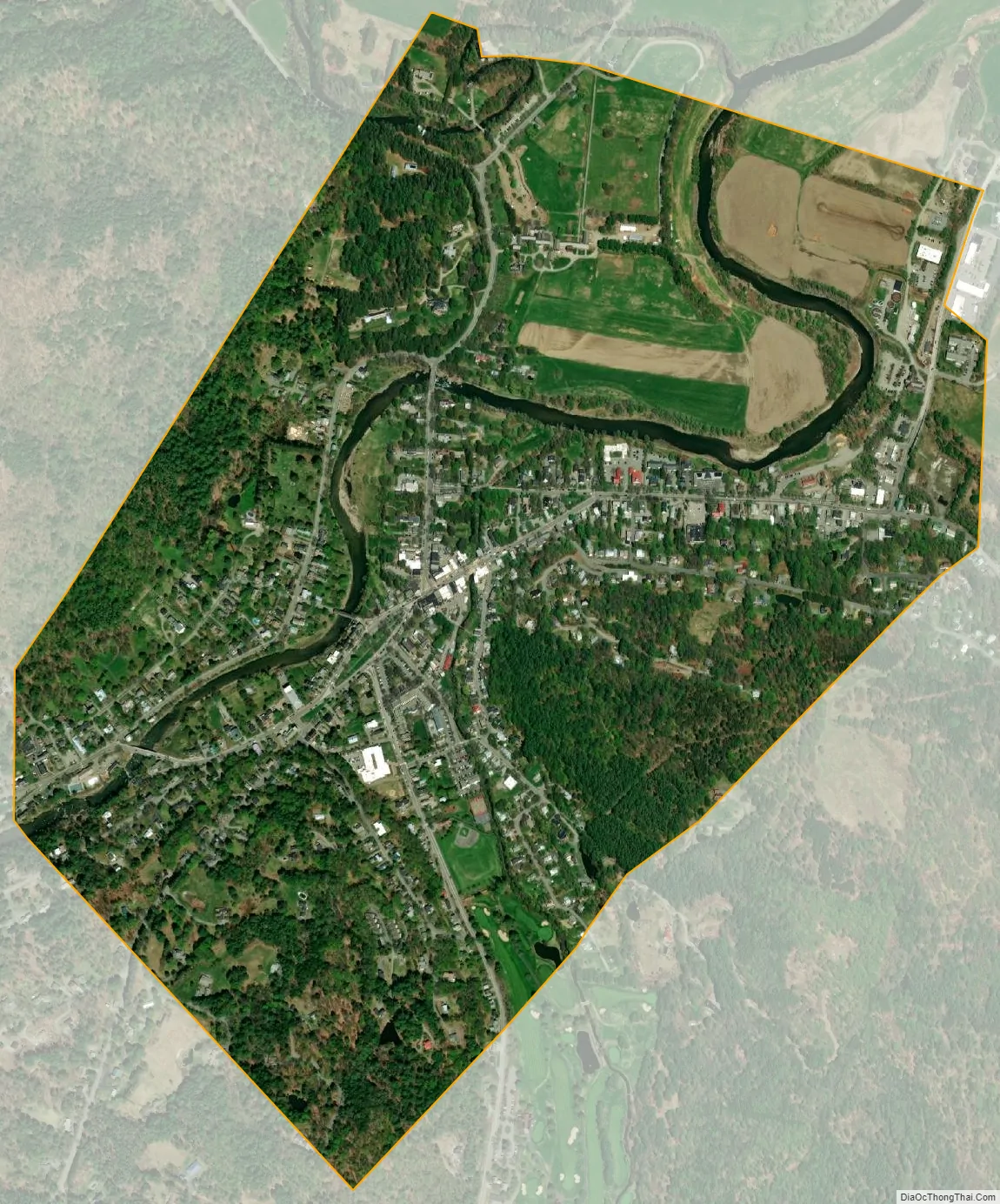
Woodstock city Satellite Map
Geography
According to the United States Census Bureau, the town has a total area of 44.6 square miles (115.6 km), of which 44.4 square miles (114.9 km) is land and 0.27 square miles (0.7 km), or 0.63%, is water. The Ottauquechee River flows through the town.
Woodstock is crossed by U.S. Route 4, Vermont Route 12 and Vermont Route 106. Interstate 89 does not pass through the town, it is served by exit 1 in nearby Quechee. It is bordered the town of Pomfret to the north, Hartford to the northeast, Hartland to the east, Reading to the south, and Bridgewater to the west.
Woodstock is a three-hour drive from Boston and is 250 miles (400 km) away from New York City. It is easily accessible via car or plane to Rutland or Lebanon Airports. Vermont Translines operates a daily intercity bus route between Rutland and Lebanon, stopping in Woodstock along the way. The closest regular public transportation hubs are in White River Junction (12 miles (19 km) east) and Rutland (48 miles (77 km) west).
Climate
This climatic region is typified by large seasonal temperature differences, with warm to hot (and often humid) summers and cold (sometimes severely cold) winters. According to the Köppen Climate Classification system, Woodstock has a humid continental climate, abbreviated “Dfb” on climate maps.
See also
Map of Vermont State and its subdivision: Map of other states:- Alabama
- Alaska
- Arizona
- Arkansas
- California
- Colorado
- Connecticut
- Delaware
- District of Columbia
- Florida
- Georgia
- Hawaii
- Idaho
- Illinois
- Indiana
- Iowa
- Kansas
- Kentucky
- Louisiana
- Maine
- Maryland
- Massachusetts
- Michigan
- Minnesota
- Mississippi
- Missouri
- Montana
- Nebraska
- Nevada
- New Hampshire
- New Jersey
- New Mexico
- New York
- North Carolina
- North Dakota
- Ohio
- Oklahoma
- Oregon
- Pennsylvania
- Rhode Island
- South Carolina
- South Dakota
- Tennessee
- Texas
- Utah
- Vermont
- Virginia
- Washington
- West Virginia
- Wisconsin
- Wyoming