Beluga is a census-designated place (CDP) in Kenai Peninsula Borough, Alaska, United States. The population was 20 at the 2010 census, down from 32 in 2000.
| Name: | Beluga CDP |
|---|---|
| LSAD Code: | 57 |
| LSAD Description: | CDP (suffix) |
| State: | Alaska |
| County: | Kenai Peninsula Borough |
| Elevation: | 112 ft (34 m) |
| Total Area: | 99.84 sq mi (258.58 km²) |
| Land Area: | 99.13 sq mi (256.74 km²) |
| Water Area: | 0.71 sq mi (1.84 km²) |
| Total Population: | 34 |
| Population Density: | 0.34/sq mi (0.13/km²) |
| ZIP code: | 99695 |
| Area code: | 907 |
| FIPS code: | 0206245 |
| GNISfeature ID: | 1865548 |
Online Interactive Map
Click on ![]() to view map in "full screen" mode.
to view map in "full screen" mode.
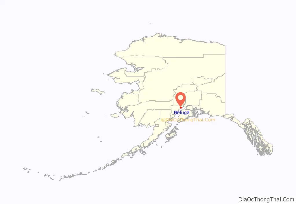
Beluga location map. Where is Beluga CDP?
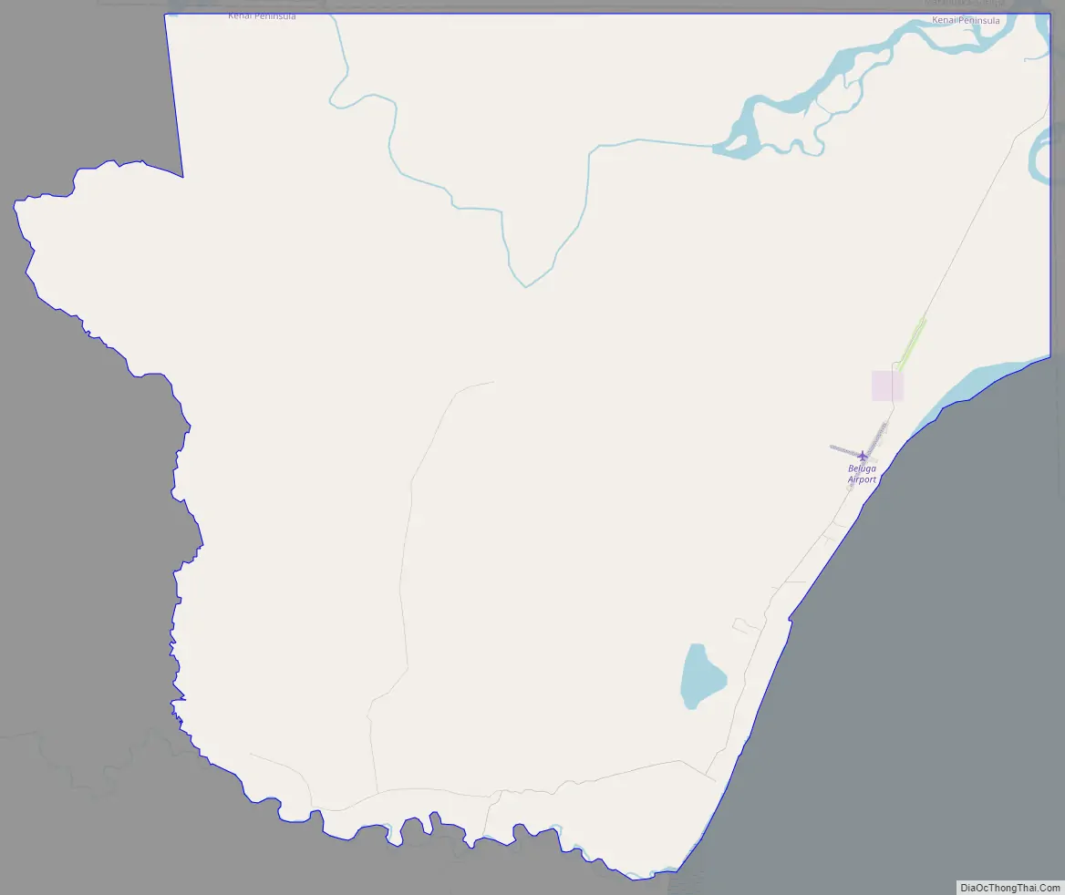
Beluga Road Map
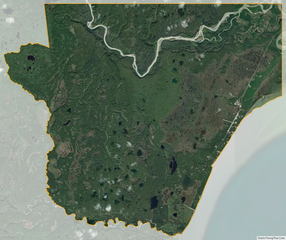
Beluga city Satellite Map
Geography
Beluga is located in the northern part of Kenai Peninsula Borough at 61°8′2″N 151°9′53″W / 61.13389°N 151.16472°W / 61.13389; -151.16472 (61.133962, -151.164741), on the northwest side of Cook Inlet. The community is on the Alaskan mainland rather than the Kenai Peninsula proper. It is bordered to the north by Matanuska-Susitna Borough and to the south by the Tyonek CDP. Access is by air or by water, as the road network is local only.
According to the United States Census Bureau, the CDP has a total area of 100.8 square miles (261.1 km), of which 100.1 square miles (259.2 km) are land and 0.73 square miles (1.9 km), or 0.72%, are water. The southern border of the CDP is the Chuitna River, and the Beluga River flows through the northern part of the CDP.
See also
Map of Alaska State and its subdivision:- Aleutians East
- Aleutians West
- Anchorage
- Bethel
- Bristol Bay
- Denali
- Dillingham
- Fairbanks North Star
- Haines
- Juneau
- Kenai Peninsula
- Ketchikan Gateway
- Kodiak Island
- Lake and Peninsula
- Matanuska-Susitna
- Nome
- North Slope
- Northwest Arctic
- Prince of Wales-Outer Ketchi
- Sitka
- Skagway-Yakutat-Angoon
- Southeast Fairbanks
- Valdez-Cordova
- Wade Hampton
- Wrangell-Petersburg
- Yukon-Koyukuk
- Alabama
- Alaska
- Arizona
- Arkansas
- California
- Colorado
- Connecticut
- Delaware
- District of Columbia
- Florida
- Georgia
- Hawaii
- Idaho
- Illinois
- Indiana
- Iowa
- Kansas
- Kentucky
- Louisiana
- Maine
- Maryland
- Massachusetts
- Michigan
- Minnesota
- Mississippi
- Missouri
- Montana
- Nebraska
- Nevada
- New Hampshire
- New Jersey
- New Mexico
- New York
- North Carolina
- North Dakota
- Ohio
- Oklahoma
- Oregon
- Pennsylvania
- Rhode Island
- South Carolina
- South Dakota
- Tennessee
- Texas
- Utah
- Vermont
- Virginia
- Washington
- West Virginia
- Wisconsin
- Wyoming


