Anchor Point (Dena’ina: K’kaq’) is an unincorporated community and census-designated place (CDP) in Kenai Peninsula Borough, in the U.S. state of Alaska. As of the 2010 census the population was 1,930, up from 1,845 in 2000. The community is located along the Sterling Highway, part of Alaska State Route 1. Anchor Point is the westernmost point in the North American highway system.
| Name: | Anchor Point CDP |
|---|---|
| LSAD Code: | 57 |
| LSAD Description: | CDP (suffix) |
| State: | Alaska |
| County: | Kenai Peninsula Borough |
| Elevation: | 118 ft (36 m) |
| Total Area: | 91.76 sq mi (237.66 km²) |
| Land Area: | 91.65 sq mi (237.36 km²) |
| Water Area: | 0.12 sq mi (0.30 km²) |
| Total Population: | 2,105 |
| Population Density: | 22.97/sq mi (8.87/km²) |
| ZIP code: | 99556 |
| Area code: | 907 |
| FIPS code: | 0203110 |
| GNISfeature ID: | 1412516 |
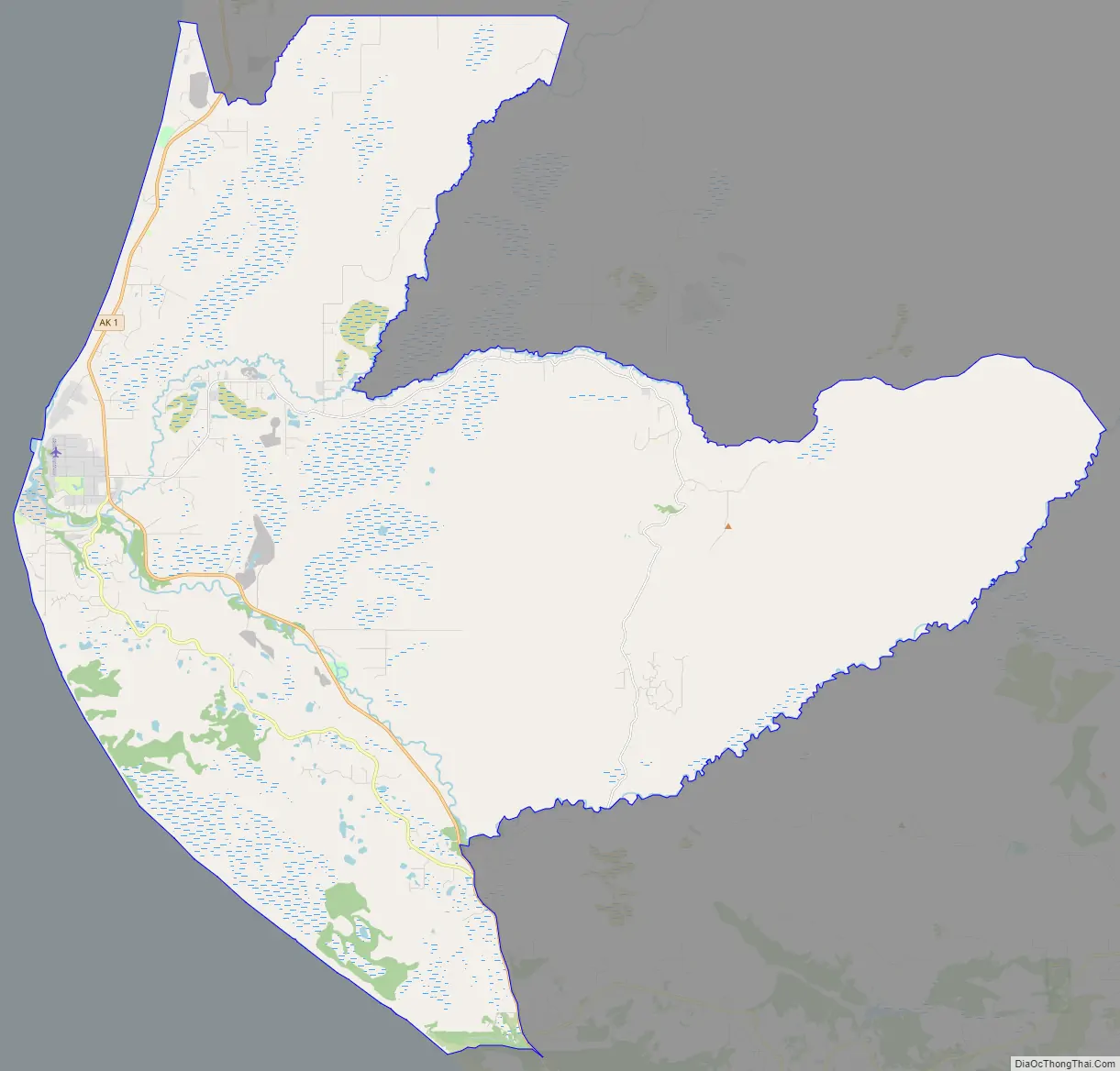
Online Interactive Map
Click on ![]() to view map in "full screen" mode.
to view map in "full screen" mode.
Anchor Point location map. Where is Anchor Point CDP?

History
The name “Anchor Point” comes from a legend that when Captain James Cook discovered the area, he lost an anchor. Settlers came beginning in the early 1900s.
Anchor Point Road Map
Anchor Point city Satellite Map

Geography
Anchor Point is located at 59°46′39″N 151°46′13″W / 59.77750°N 151.77028°W / 59.77750; -151.77028 (59.777468, -151.770220) on the eastern shore of Cook Inlet. It is bordered to the north by Happy Valley, to the northeast by Nikolaevsk, and to the south by Diamond Ridge. The Anchor River runs through the southern part of the CDP, entering Cook Inlet just west of the town center.
The town is the furthest west on the U.S. highway system. Alaska Route 1 runs southeast from Anchor Bay 15 miles (24 km) to Homer and northeast 59 miles (95 km) to Soldotna. Anchorage is 206 miles (332 km) to the northeast via Route 1.
According to the United States Census Bureau, the Anchor Bay CDP has a total area of 92.0 square miles (238.2 km), of which 91.8 square miles (237.7 km) are land and 0.2 square miles (0.5 km), or 0.23%, are water.
See also
Map of Alaska State and its subdivision:- Aleutians East
- Aleutians West
- Anchorage
- Bethel
- Bristol Bay
- Denali
- Dillingham
- Fairbanks North Star
- Haines
- Juneau
- Kenai Peninsula
- Ketchikan Gateway
- Kodiak Island
- Lake and Peninsula
- Matanuska-Susitna
- Nome
- North Slope
- Northwest Arctic
- Prince of Wales-Outer Ketchi
- Sitka
- Skagway-Yakutat-Angoon
- Southeast Fairbanks
- Valdez-Cordova
- Wade Hampton
- Wrangell-Petersburg
- Yukon-Koyukuk
- Alabama
- Alaska
- Arizona
- Arkansas
- California
- Colorado
- Connecticut
- Delaware
- District of Columbia
- Florida
- Georgia
- Hawaii
- Idaho
- Illinois
- Indiana
- Iowa
- Kansas
- Kentucky
- Louisiana
- Maine
- Maryland
- Massachusetts
- Michigan
- Minnesota
- Mississippi
- Missouri
- Montana
- Nebraska
- Nevada
- New Hampshire
- New Jersey
- New Mexico
- New York
- North Carolina
- North Dakota
- Ohio
- Oklahoma
- Oregon
- Pennsylvania
- Rhode Island
- South Carolina
- South Dakota
- Tennessee
- Texas
- Utah
- Vermont
- Virginia
- Washington
- West Virginia
- Wisconsin
- Wyoming


