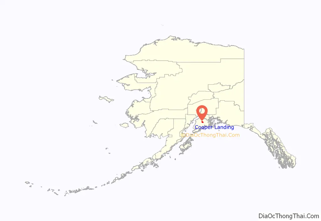
Cooper Landing is a census-designated place (CDP) in Kenai Peninsula Borough, Alaska, United States, about 100 miles (160 km) south of Anchorage, at the outlet of Kenai Lake into the Kenai River. The town was first settled in the 19th century by gold and mineral prospectors, and has become a popular summer tourist destination thanks to its scenic location and proximity to the salmon fishery of the Kenai River and Russian River. As of the 2010 census, the population in Cooper Landing was 289, down from 369 in 2000.
| Name: | Cooper Landing CDP |
|---|---|
| LSAD Code: | 57 |
| LSAD Description: | CDP (suffix) |
| State: | Alaska |
| County: | Kenai Peninsula Borough |
| Elevation: | 410 ft (123 m) |
| Total Area: | 69.84 sq mi (180.87 km²) |
| Land Area: | 65.75 sq mi (170.29 km²) |
| Water Area: | 4.09 sq mi (10.58 km²) |
| Total Population: | 344 |
| Population Density: | 5.23/sq mi (2.02/km²) |
| ZIP code: | 99572 |
| Area code: | 907 |
| FIPS code: | 0217190 |
| GNISfeature ID: | 1421192 |
Online Interactive Map
Click on ![]() to view map in "full screen" mode.
to view map in "full screen" mode.
Cooper Landing location map. Where is Cooper Landing CDP?
History
Cooper Landing was named for Joseph Cooper, a miner who discovered gold there in 1884. However, Peter Doroshin, a Russian engineer, had identified gold prospects as far back as 1848 when the territory was still part of Russian America.
Cooper Creek was first recorded in 1898 by the U.S. Geological Survey. In 1900, the Census found 21 miners and 1 wife living at Cooper Creek. The Riddiford Post Office began operations in 1924, and the Riddiford School opened in 1928.
In 1938, a road was constructed east to Seward. In 1948, a road west to Kenai was opened, and by 1951, residents could drive north to Anchorage. The Cooper Landing Community Club was first formed in 1949. The Cooper Lake Hydroelectric Facility was constructed in 1959-60.
In 1946, Pat and Helen Gwin arrived in Cooper Landing which had about 100 residents then. The Gwins eked out a living by operating a small packaged goods store out of a tent. That same year, construction began on the highway from Cooper Landing to Homer. The Sterling Highway, the road that is the artery of the Kenai Peninsula, opened in 1950, and subsequently the Seward Highway opened in 1951. Gwin’s Lodge was built from spruce logs harvested from the surrounding Chugach National Forest. Cutting, hauling and hand-peeling the logs, Pat and Helen Gwin completed and opened the lodge on January 1, 1952. Pat and Helen parted ways in 1959, but Helen stayed to run the lodge and retired in 1976. The historic Gwin’s Lodge is one of the oldest log roadhouses in Alaska and is still in operation today.
The Cooper Landing Post Office is the oldest building in the area that is still used and is listed on the National Register of Historic Places.
Cooper Landing Road Map

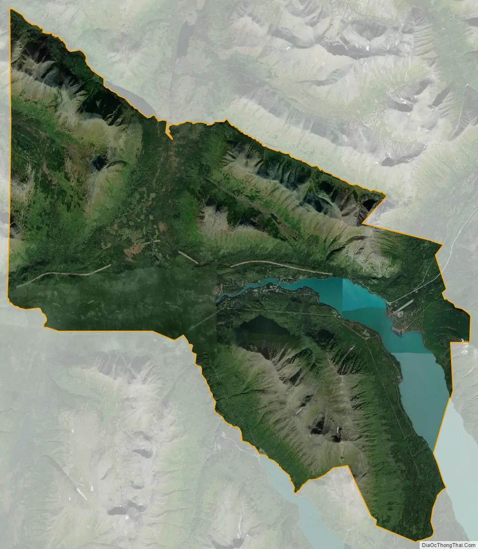
Cooper Landing city Satellite Map
Geography
Cooper Landing is located in the north-central part of the Kenai Peninsula at 60°29′26″N 149°47′40″W / 60.49056°N 149.79444°W / 60.49056; -149.79444 (60.490529, -149.794519). The center of the community is at the west end of Kenai Lake, where the lake flows into the Kenai River. The CDP extends east up Kenai Lake beyond the mouth of Quartz Creek from the north. To the south the CDP reaches Cooper Lake, and Cooper Creek, the lake’s outlet, forms a portion of the CDP’s southern border. The CDP reaches west down the Kenai River as far as the mouth of the Russian River, and to the north the CDP extends up the valley of Juneau Creek as far as Trout Lake. Elevations in the CDP range from approximately 330 feet (100 m) above sea level at the mouth of the Russian River, to 436 feet (133 m) at Kenai Lake, to 4,576 feet (1,395 m) at the summit of Cecil Rhode Mountain between Kenai Lake and Cooper Creek.
Alaska Route 1, the Sterling Highway, passes through the community, leading north 102 miles (164 km) to Anchorage and southwest 120 miles (190 km) to Homer. Soldotna, the Kenai Peninsula Borough seat, is 45 miles (72 km) to the west on AK-1, and Seward is 47 miles (76 km) to the southeast via routes 1 and 9.
According to the United States Census Bureau, the Cooper Landing CDP has a total area of 69.8 square miles (180.9 km), of which 65.8 square miles (170.3 km) are land, and 4.1 square miles (10.6 km), or 5.85%, are water.
See also
Map of Alaska State and its subdivision:- Aleutians East
- Aleutians West
- Anchorage
- Bethel
- Bristol Bay
- Denali
- Dillingham
- Fairbanks North Star
- Haines
- Juneau
- Kenai Peninsula
- Ketchikan Gateway
- Kodiak Island
- Lake and Peninsula
- Matanuska-Susitna
- Nome
- North Slope
- Northwest Arctic
- Prince of Wales-Outer Ketchi
- Sitka
- Skagway-Yakutat-Angoon
- Southeast Fairbanks
- Valdez-Cordova
- Wade Hampton
- Wrangell-Petersburg
- Yukon-Koyukuk
- Alabama
- Alaska
- Arizona
- Arkansas
- California
- Colorado
- Connecticut
- Delaware
- District of Columbia
- Florida
- Georgia
- Hawaii
- Idaho
- Illinois
- Indiana
- Iowa
- Kansas
- Kentucky
- Louisiana
- Maine
- Maryland
- Massachusetts
- Michigan
- Minnesota
- Mississippi
- Missouri
- Montana
- Nebraska
- Nevada
- New Hampshire
- New Jersey
- New Mexico
- New York
- North Carolina
- North Dakota
- Ohio
- Oklahoma
- Oregon
- Pennsylvania
- Rhode Island
- South Carolina
- South Dakota
- Tennessee
- Texas
- Utah
- Vermont
- Virginia
- Washington
- West Virginia
- Wisconsin
- Wyoming


