Fox River is a census-designated place (CDP) in Kenai Peninsula Borough, Alaska, United States. At the 2010 census the population was 685, up from 616 in 2000. It was first reported by the U.S. Geological Survey in 1895. The Fox River, which flows by the CDP, might have been named for Theodore Fox, a local mining magnate.
| Name: | Fox River CDP |
|---|---|
| LSAD Code: | 57 |
| LSAD Description: | CDP (suffix) |
| State: | Alaska |
| County: | Kenai Peninsula Borough |
| Elevation: | 525 ft (160 m) |
| Total Area: | 128.28 sq mi (332.23 km²) |
| Land Area: | 125.39 sq mi (324.76 km²) |
| Water Area: | 2.88 sq mi (7.47 km²) |
| Total Population: | 644 |
| Population Density: | 5.14/sq mi (1.98/km²) |
| Area code: | 907 |
| FIPS code: | 0226910 |
| GNISfeature ID: | 1866945 |
Online Interactive Map
Click on ![]() to view map in "full screen" mode.
to view map in "full screen" mode.
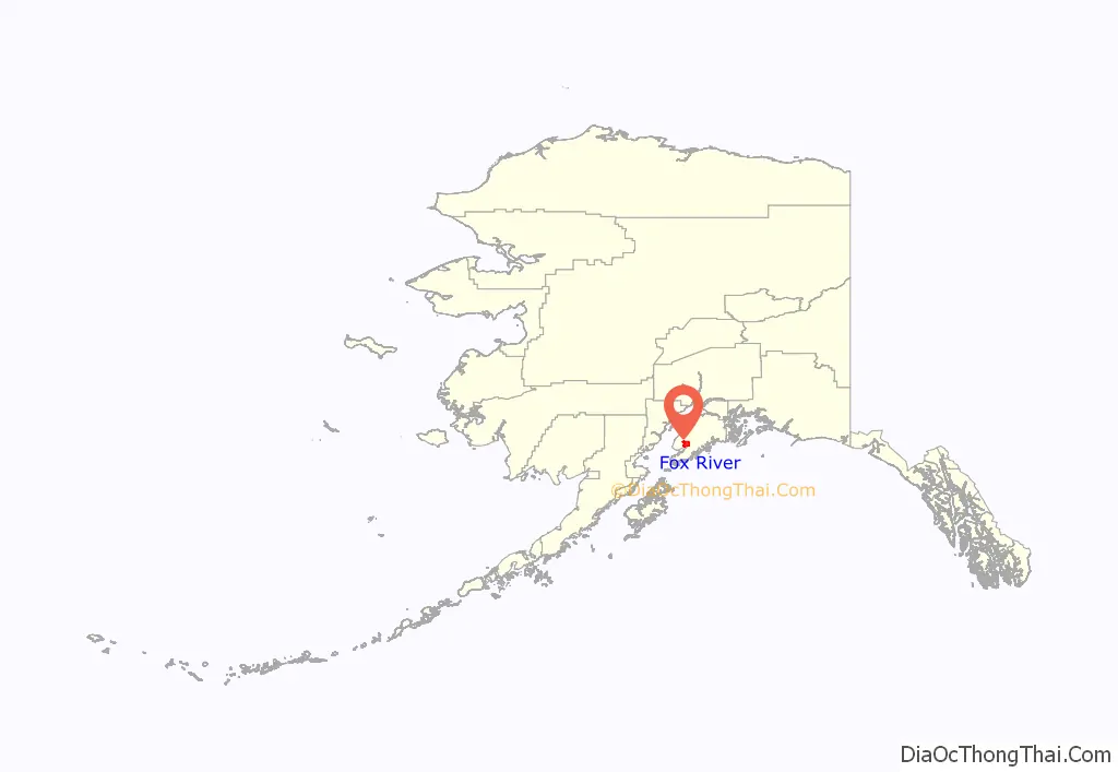
Fox River location map. Where is Fox River CDP?
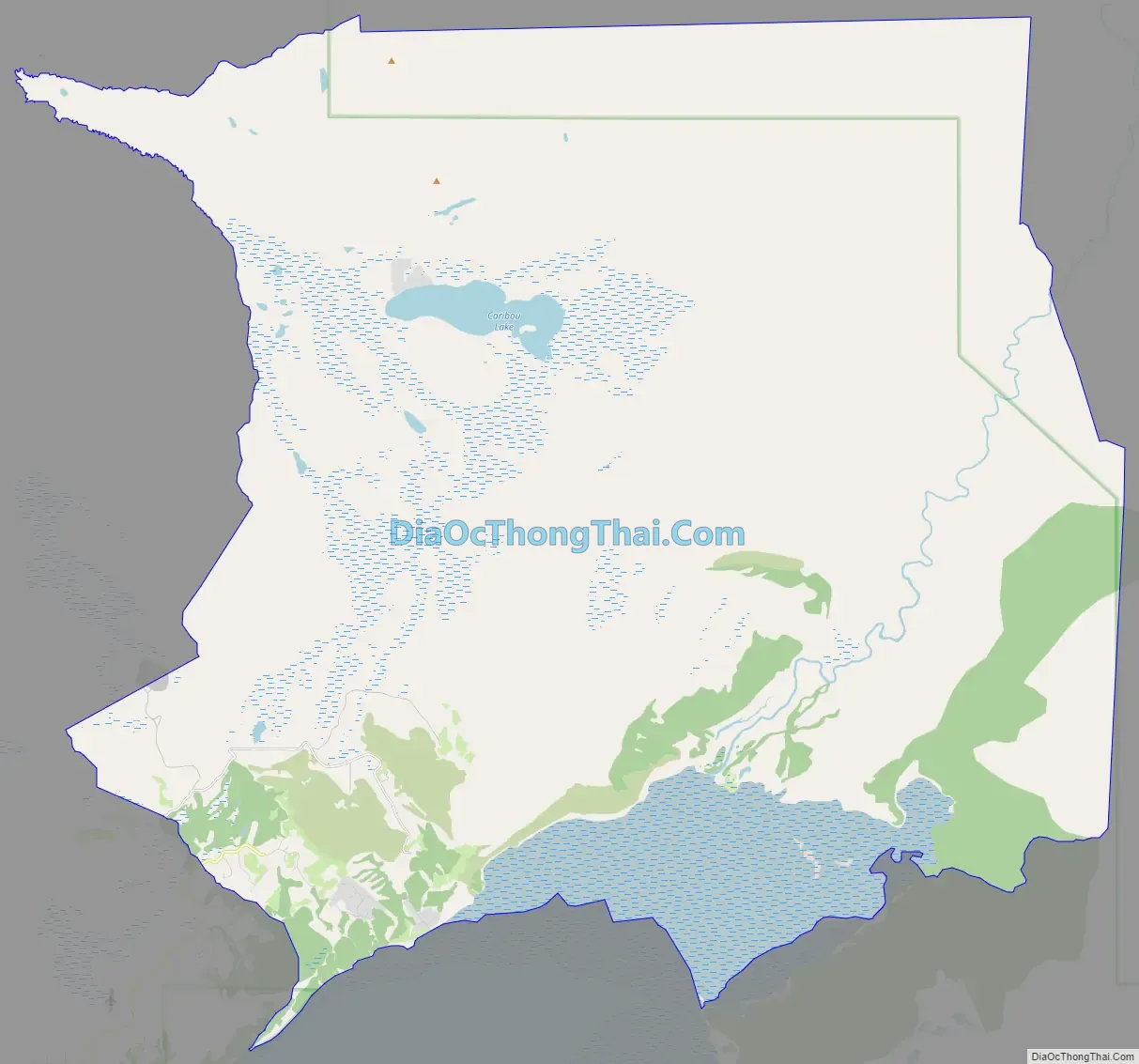
Fox River Road Map
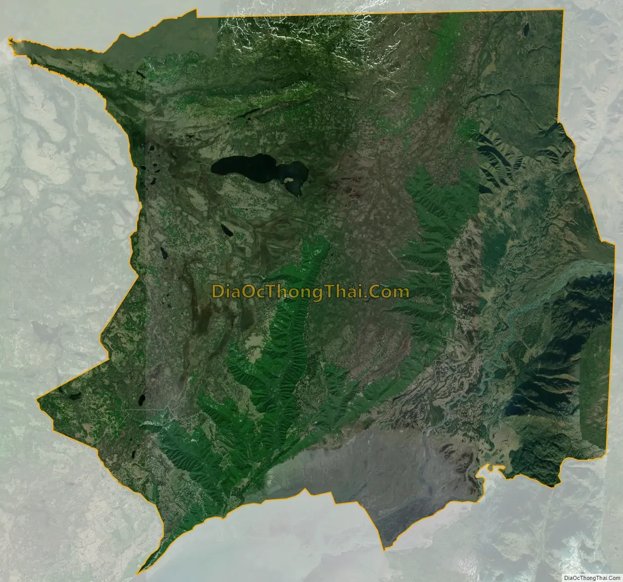
Fox River city Satellite Map
Geography
Fox River is located on the western side of the Kenai Peninsula at 59°50′51″N 150°55′34″W / 59.84750°N 150.92611°W / 59.84750; -150.92611 (59.847372, -150.926178). It is at the head of Kachemak Bay, where the Fox River enters it. The CDP extends north from the bay to high ground north of Caribou Lake. It is bordered to the southwest by Falls Creek, which separates the community from the Fritz Creek CDP. Most of the current population of Fox River is in the southwest part of the CDP, on high ground overlooking Falls Creek, Swift Creek, and Moose Creek.
According to the United States Census Bureau, the CDP has a total area of 128.3 square miles (332.2 km), of which 125.4 square miles (324.8 km) are land and 2.9 square miles (7.5 km), or 2.25%, are water.
The populated area is known locally as “The Head of the (Kachemak) Bay”. Its population resides for the most part in the three Russian Old Believer villages of Voznesenka, Kachemak Selo, and Razdolna. Most of the remainder of the CDP is inside the Kenai National Wildlife Refuge and has no population.
See also
Map of Alaska State and its subdivision:- Aleutians East
- Aleutians West
- Anchorage
- Bethel
- Bristol Bay
- Denali
- Dillingham
- Fairbanks North Star
- Haines
- Juneau
- Kenai Peninsula
- Ketchikan Gateway
- Kodiak Island
- Lake and Peninsula
- Matanuska-Susitna
- Nome
- North Slope
- Northwest Arctic
- Prince of Wales-Outer Ketchi
- Sitka
- Skagway-Yakutat-Angoon
- Southeast Fairbanks
- Valdez-Cordova
- Wade Hampton
- Wrangell-Petersburg
- Yukon-Koyukuk
- Alabama
- Alaska
- Arizona
- Arkansas
- California
- Colorado
- Connecticut
- Delaware
- District of Columbia
- Florida
- Georgia
- Hawaii
- Idaho
- Illinois
- Indiana
- Iowa
- Kansas
- Kentucky
- Louisiana
- Maine
- Maryland
- Massachusetts
- Michigan
- Minnesota
- Mississippi
- Missouri
- Montana
- Nebraska
- Nevada
- New Hampshire
- New Jersey
- New Mexico
- New York
- North Carolina
- North Dakota
- Ohio
- Oklahoma
- Oregon
- Pennsylvania
- Rhode Island
- South Carolina
- South Dakota
- Tennessee
- Texas
- Utah
- Vermont
- Virginia
- Washington
- West Virginia
- Wisconsin
- Wyoming


