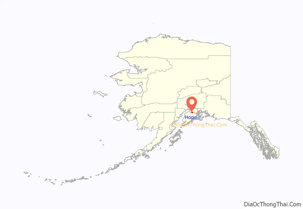
Hope is a census-designated place (CDP) in Kenai Peninsula Borough in the U.S. state of Alaska. It is eighty-seven miles south from Anchorage. As of the 2010 census the population was 192, up from 137 in 2000.
| Name: | Hope CDP |
|---|---|
| LSAD Code: | 57 |
| LSAD Description: | CDP (suffix) |
| State: | Alaska |
| County: | Kenai Peninsula Borough |
| Elevation: | 43 ft (13 m) |
| Total Area: | 51.79 sq mi (134.14 km²) |
| Land Area: | 51.72 sq mi (133.96 km²) |
| Water Area: | 0.07 sq mi (0.18 km²) |
| Total Population: | 161 |
| Population Density: | 3.11/sq mi (1.20/km²) |
| ZIP code: | 99605 |
| Area code: | 907 |
| FIPS code: | 0233580 |
| GNISfeature ID: | 1422645 |
Online Interactive Map
Click on ![]() to view map in "full screen" mode.
to view map in "full screen" mode.
Hope location map. Where is Hope CDP?
History
“Hope City” was a mining camp for Resurrection Creek, established in 1896. The Hope post office began operating in 1897. Portions of the town were destroyed in the 1964 Good Friday earthquake.
There are two community associations.
The Hope Community Library was established in 1987. It resides in the Historic Hope schoolhouse, originally built in 1938.
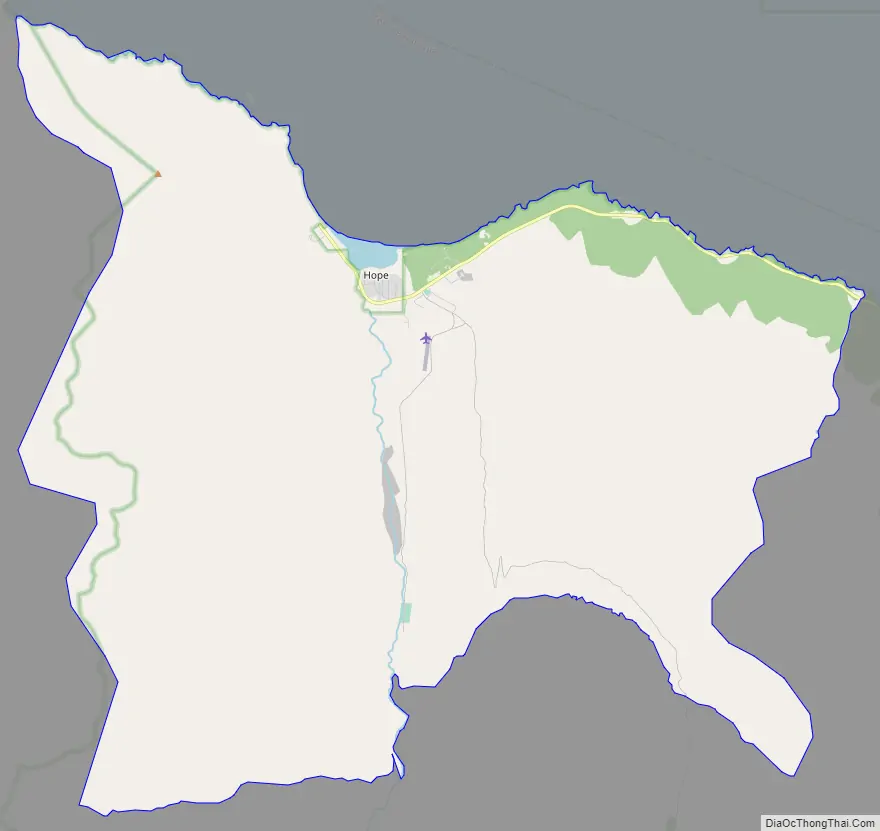
Hope Road Map
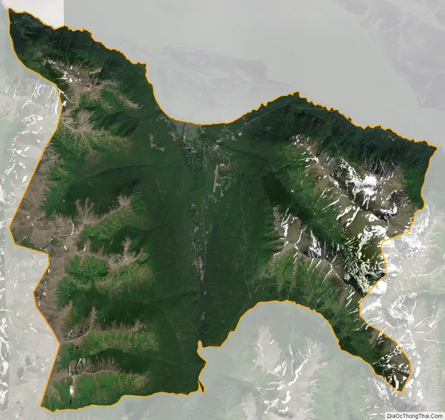
Hope city Satellite Map
Geography
Hope is located at 60°55′10″N 149°38′31″W / 60.91944°N 149.64194°W / 60.91944; -149.64194 (60.920280, -149.64028) (Sec. 33, T010N, R002W, Seward Meridian). Hope is located in the Seward Recording District.
Hope lies on the northern end of Kenai Peninsula, on the south shore of the Turnagain Arm of Cook Inlet. The community lies at the end of the 17-mile (27 km) Hope Highway, northwest of the Seward Highway, near the mouth of Resurrection Creek. Winter temperatures range from 14 to 27 °F (−10 to −3 °C); summer temperatures vary from 45 to 65 °F (7 to 18 °C). Average annual precipitation is 20 inches (510 mm).
According to the United States Census Bureau, the CDP has a total area of 51.8 square miles (134.1 km), of which 0.07 square miles (0.18 km), or 0.13%, are water. The CDP includes the settlement of Hope in the valley of Resurrection Creek and extends east and west to the ridgecrests that define the valley. To the south it extends up Resurrection Creek to Palmer Creek on the east side and Gold Gulch on the west side. It is bordered to the east by the Sunrise CDP.
See also
Map of Alaska State and its subdivision:- Aleutians East
- Aleutians West
- Anchorage
- Bethel
- Bristol Bay
- Denali
- Dillingham
- Fairbanks North Star
- Haines
- Juneau
- Kenai Peninsula
- Ketchikan Gateway
- Kodiak Island
- Lake and Peninsula
- Matanuska-Susitna
- Nome
- North Slope
- Northwest Arctic
- Prince of Wales-Outer Ketchi
- Sitka
- Skagway-Yakutat-Angoon
- Southeast Fairbanks
- Valdez-Cordova
- Wade Hampton
- Wrangell-Petersburg
- Yukon-Koyukuk
- Alabama
- Alaska
- Arizona
- Arkansas
- California
- Colorado
- Connecticut
- Delaware
- District of Columbia
- Florida
- Georgia
- Hawaii
- Idaho
- Illinois
- Indiana
- Iowa
- Kansas
- Kentucky
- Louisiana
- Maine
- Maryland
- Massachusetts
- Michigan
- Minnesota
- Mississippi
- Missouri
- Montana
- Nebraska
- Nevada
- New Hampshire
- New Jersey
- New Mexico
- New York
- North Carolina
- North Dakota
- Ohio
- Oklahoma
- Oregon
- Pennsylvania
- Rhode Island
- South Carolina
- South Dakota
- Tennessee
- Texas
- Utah
- Vermont
- Virginia
- Washington
- West Virginia
- Wisconsin
- Wyoming


