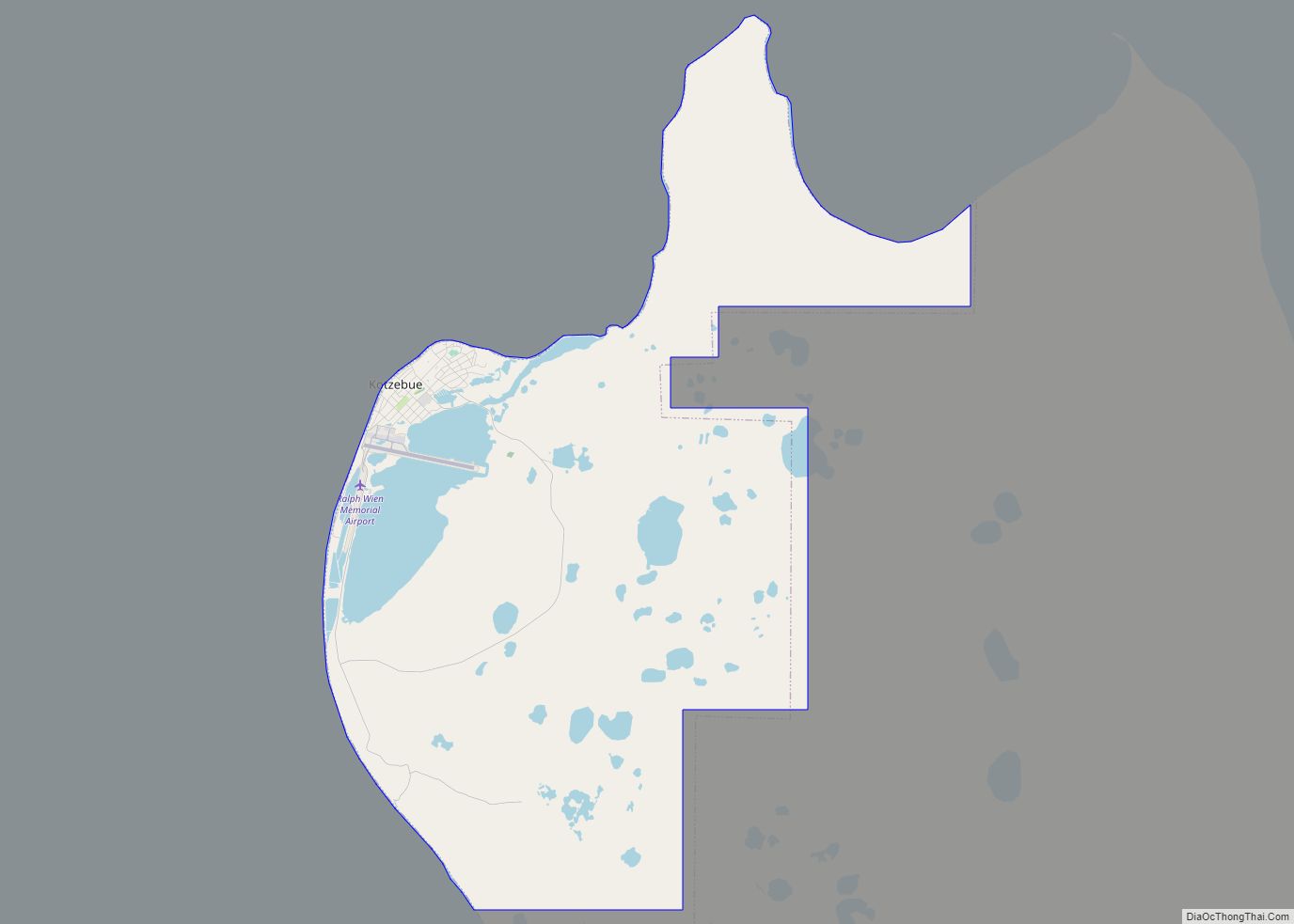
Kotzebue (/ˈkɒtsəbjuː/ KOTS-ə-bew) or Qikiqtaġruk (/kɪkɪkˈtʌɡrʊk/ kik-ik-TUG-rook, Inupiaq: [qekeqtɑʁʐuk]) is a city in the Northwest Arctic Borough in the U.S. state of Alaska. It is the borough’s seat, by far its largest community and the economic and transportation hub of the subregion of Alaska encompassing the borough. The population of the city was 3,102 as of the 2020 census, down from 3,201 in 2010. The city has received an All-America City award.
| Name: | Kotzebue city |
|---|---|
| LSAD Code: | 25 |
| LSAD Description: | city (suffix) |
| State: | Alaska |
| County: | Northwest Arctic Borough |
| Incorporated: | October 14, 1958 |
| Elevation: | 20 ft (6 m) |
| Total Area: | 26.50 sq mi (68.64 km²) |
| Land Area: | 24.76 sq mi (64.12 km²) |
| Water Area: | 1.75 sq mi (4.52 km²) |
| Total Population: | 3,102 |
| Population Density: | 125.30/sq mi (48.38/km²) |
| ZIP code: | 99752 |
| Area code: | 907 |
| FIPS code: | 0241830 |
| GNISfeature ID: | 1413378 |
Online Interactive Map
Click on ![]() to view map in "full screen" mode.
to view map in "full screen" mode.
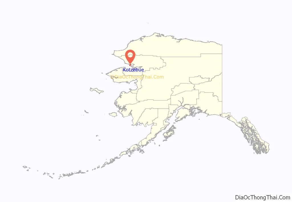
Kotzebue location map. Where is Kotzebue city?
History
Etymology and prehistory
Owing to its location and relative size, Kotzebue served as a trading and gathering center for the various communities in the region. The Noatak, Selawik and Kobuk Rivers drain into the Kotzebue Sound near Kotzebue to form a center for transportation to points inland. In addition to people from interior villages, inhabitants of far-eastern Asia, now the Russian Far East, came to trade at Kotzebue. Furs, seal-oil, hides, rifles, ammunition, and seal skins were some of the items traded. People also gathered for competitions like the current World Eskimo Indian Olympics. With the arrival of the whalers, traders, gold seekers, and missionaries the trading center expanded.
Kotzebue is also known as Qikiqtaġruk, means “small island” or “resembles an island” in the Iñupiaq language. In the words of the late Iñupiaq elder Blanche Qapuk Lincoln of Kotzebue:
Kotzebue gets its name from the Kotzebue Sound, which was named after Otto von Kotzebue, a Baltic German who explored the sound while searching for the Northwest Passage in the service of Russia in 1818.
19th century
A United States post office was established in 1899.
20th and 21st century
In 1958, Kotzebue Air Force Station was completed. The radar site would be operated by on-site personnel until its deactivation in 1983 and the subsequent demolition of most of the station’s structures. The radome continues to operate, but is now mostly unattended.
In 1997, three 66-kw wind turbines were installed in Kotzebue, creating the northernmost wind farm in the United States. Today, the wind farm consists of 19 turbines, including two 900 kW EWT turbines. The total installed capacity has reached 3-MW, displacing approximately 250,000 gallons of diesel fuel every year.
On September 2, 2015, U.S. President Barack Obama gave a speech on global warming in Kotzebue, becoming the first sitting president to visit a site north of the Arctic Circle.
Since 2016, the United States Coast Guard has deployed MH-60 Jayhawk helicopters to Kotzebue from the beginning of July to the end of October as part of Operation Arctic Shield.
On December 3rd, 2018, Mike Dunleavy was sworn in as the 12th governor of Alaska in Kotzebue’s high school gymnasium after inclement weather thwarted his plan to hold the ceremony in Noorvik.
Kotzebue Road Map
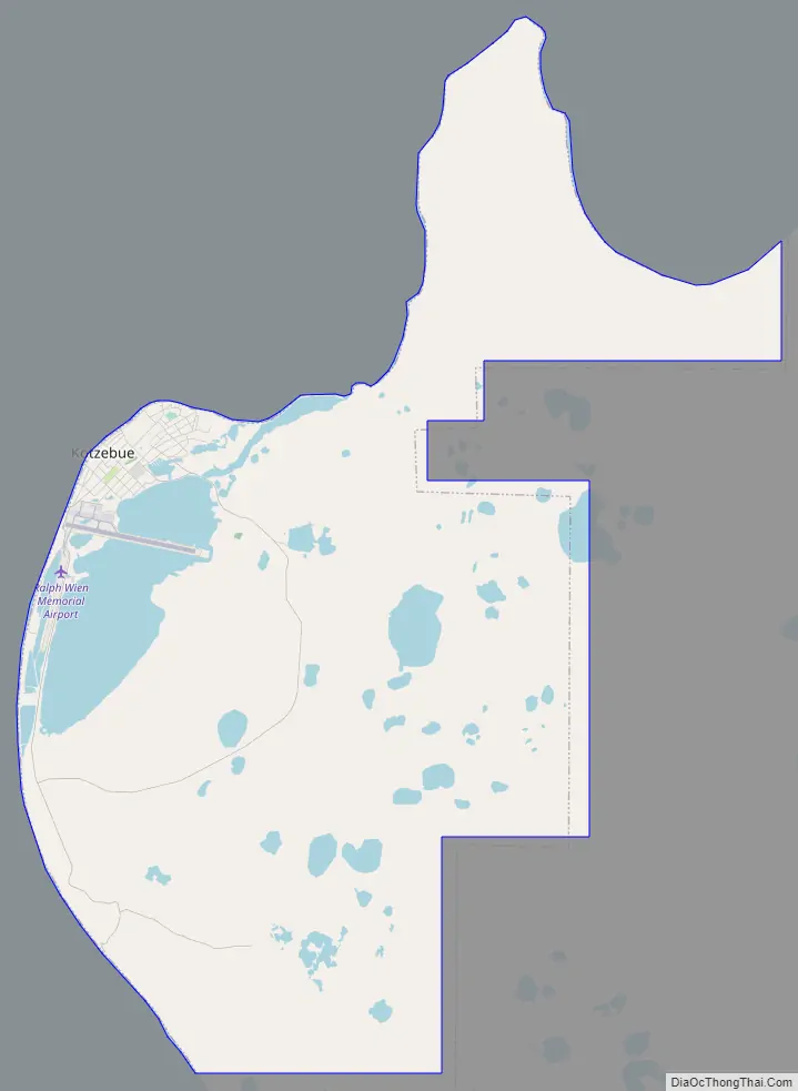
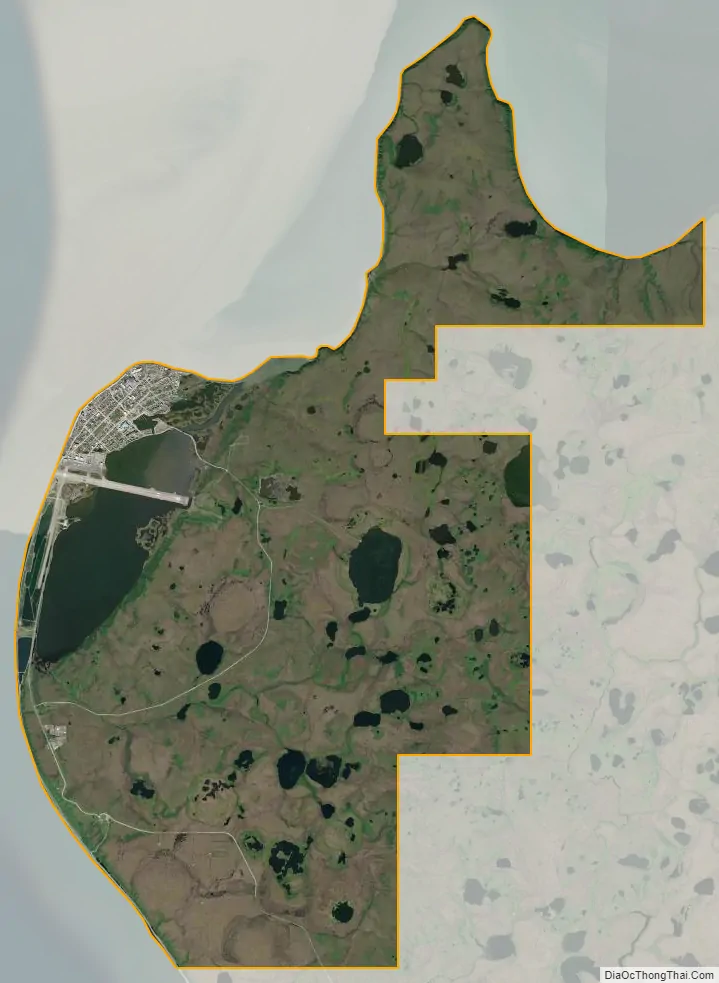
Kotzebue city Satellite Map
Geography
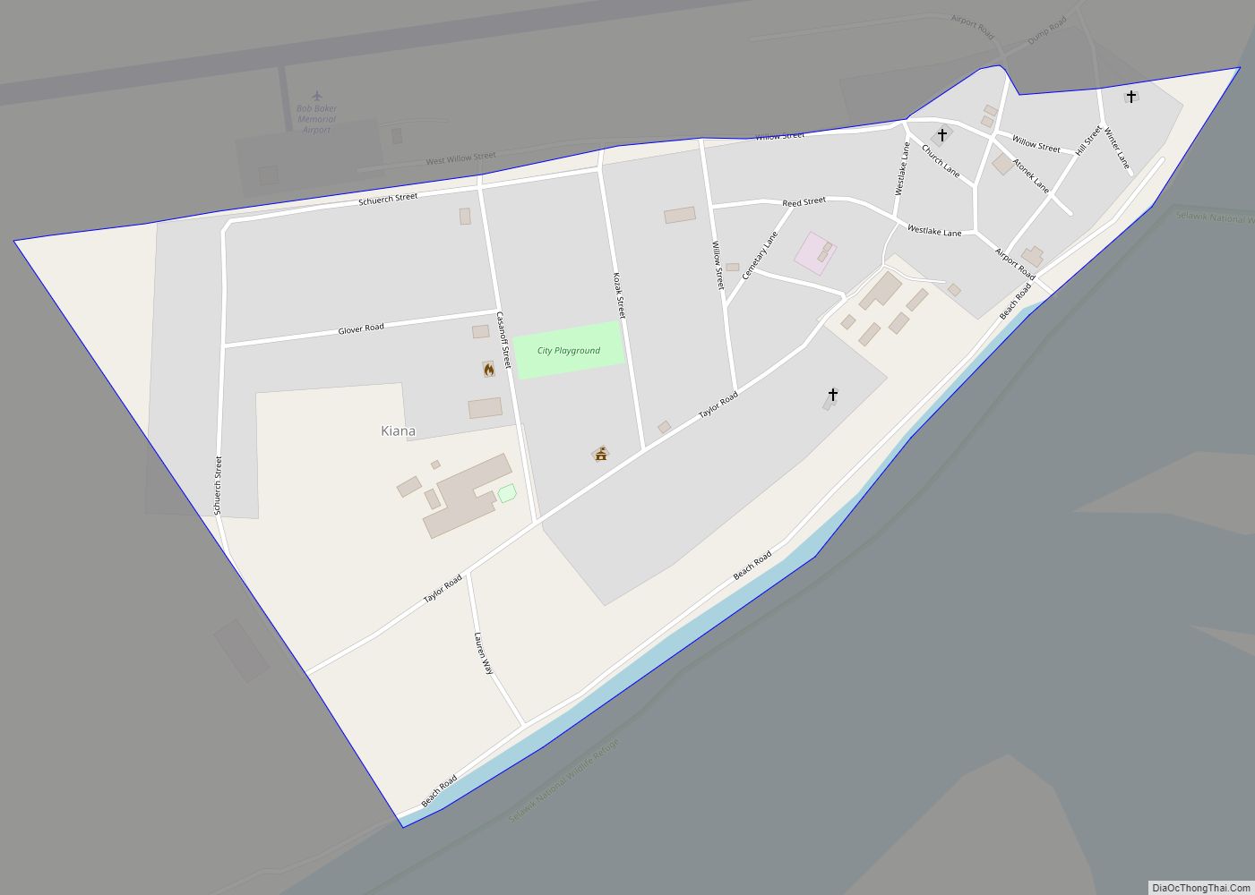
Kotzebue lies on a gravel spit at the end of the Baldwin Peninsula in the Kotzebue Sound. It is located at 66°53′50″N 162°35′8″W / 66.89722°N 162.58556°W / 66.89722; -162.58556 (66.897192, −162.585444), approximately 30 miles (48 km) from Noatak, Kiana, and other nearby smaller communities. It is 33 miles (53 km) north of the Arctic Circle on Alaska’s western coast.
According to the United States Census Bureau, the city has a total area of 28.7 square miles (74 km), of which 27.0 square miles (70 km) is land, and 1.6 square miles (4.1 km), or 5.76%, is water.
Kotzebue is home to the NANA Regional Corporation, one of thirteen Alaska Native Regional Corporations created under the Alaska Native Claims Settlement Act of 1971 (ANCSA) in settlement of Alaska Native land claims.
Kotzebue is a gateway to Kobuk Valley National Park and other natural attractions of northern Alaska. The Northwest Arctic Heritage Center, operated by the National Park Service, serves as a community meeting space and visitor center to Kobuk Valley National Park, Noatak National Preserve and Cape Krusenstern National Monument. Nearby Selawik National Wildlife Refuge also maintains office space in the town.
Climate
Kotzebue has a dry subarctic climate (Köppen Dfc), with long, somewhat snowy, and very cold winters, and short, mild summers; diurnal temperature variation is low to minimal throughout the year, with an annual normal of 11.6 °F (6.4 °C) and a minimum normal of 8.0 °F (4.4 °C) in October. Monthly daily average temperatures range from −1.9 °F (−18.8 °C) in January to 55.3 °F (12.9 °C) in July, with an annual mean of 24.0 °F (−4.4 °C). Days with the maximum reaching at or above 70 °F (21 °C) can be expected an average of six days per summer. Precipitation is both most frequent and greatest during the summer months with August the wettest month averaging 2.13 in (54 mm). Kotzebue average precipitation is 11.36 in (289 mm) per year. Snowfall averages about 64.2 in (163 cm) a season (July through June of the next year). Extreme temperatures have ranged from −58 °F (−50 °C) on March 16, 1930 to 85 °F (29 °C) as recently as June 19, 2013. The coldest has been January 1934 with a mean temperature of −27.3 °F (−32.9 °C), while the warmest month was July 2009 at 60.0 °F (15.6 °C); the annual mean temperature has ranged from 16.5 °F (−8.6 °C) in 1964 to 29.7 °F (−1.3 °C) in 2016.
See or edit raw graph data.
- ^ The July 2019 average measured an average temperature of 63.7 °F (17.6 °C), but NOAA later rescinded its recognition of the temperature record and deleted the May-August 2019 temperature data from its database.
- ^ Mean monthly maxima and minima (i.e. the highest and lowest temperature readings during an entire month or year) calculated based on data at said location from 1991 to 2020.
See also
Map of Alaska State and its subdivision:- Aleutians East
- Aleutians West
- Anchorage
- Bethel
- Bristol Bay
- Denali
- Dillingham
- Fairbanks North Star
- Haines
- Juneau
- Kenai Peninsula
- Ketchikan Gateway
- Kodiak Island
- Lake and Peninsula
- Matanuska-Susitna
- Nome
- North Slope
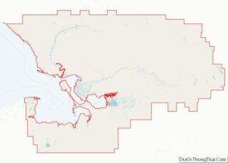
- Northwest Arctic
- Prince of Wales-Outer Ketchi
- Sitka
- Skagway-Yakutat-Angoon
- Southeast Fairbanks
- Valdez-Cordova
- Wade Hampton
- Wrangell-Petersburg
- Yukon-Koyukuk
- Alabama
- Alaska
- Arizona
- Arkansas
- California
- Colorado
- Connecticut
- Delaware
- District of Columbia
- Florida
- Georgia
- Hawaii
- Idaho
- Illinois
- Indiana
- Iowa
- Kansas
- Kentucky
- Louisiana
- Maine
- Maryland
- Massachusetts
- Michigan
- Minnesota
- Mississippi
- Missouri
- Montana
- Nebraska
- Nevada
- New Hampshire
- New Jersey
- New Mexico
- New York
- North Carolina
- North Dakota
- Ohio
- Oklahoma
- Oregon
- Pennsylvania
- Rhode Island
- South Carolina
- South Dakota
- Tennessee
- Texas
- Utah
- Vermont
- Virginia
- Washington
- West Virginia
- Wisconsin
- Wyoming