Nightmute (Central Yupik: Negtemiut or Negta) is a city and village in Bethel Census Area, Alaska, United States. The population was 208 at the 2000 census and 280 as of the 2010 census.
| Name: | Nightmute city |
|---|---|
| LSAD Code: | 25 |
| LSAD Description: | city (suffix) |
| State: | Alaska |
| County: | Bethel Census Area |
| Incorporated: | April 30, 1974 |
| Elevation: | 75 ft (23 m) |
| Total Area: | 104.39 sq mi (270.38 km²) |
| Land Area: | 98.96 sq mi (256.30 km²) |
| Water Area: | 5.43 sq mi (14.08 km²) |
| Total Population: | 306 |
| Population Density: | 3.09/sq mi (1.19/km²) |
| ZIP code: | 99690 |
| Area code: | 907 |
| FIPS code: | 0253930 |
| GNISfeature ID: | 1407008 |
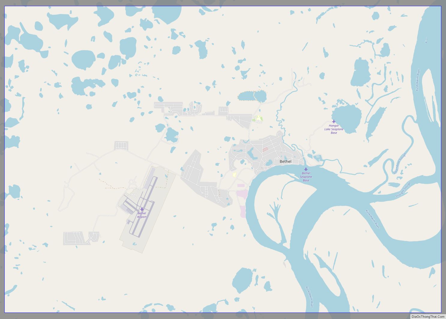
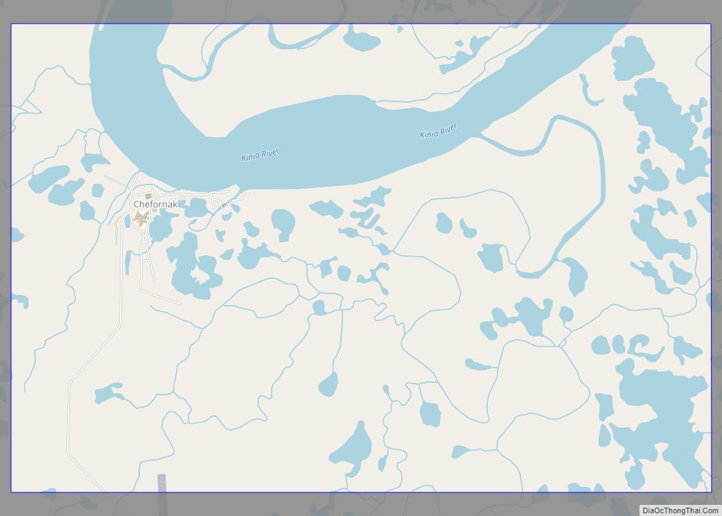
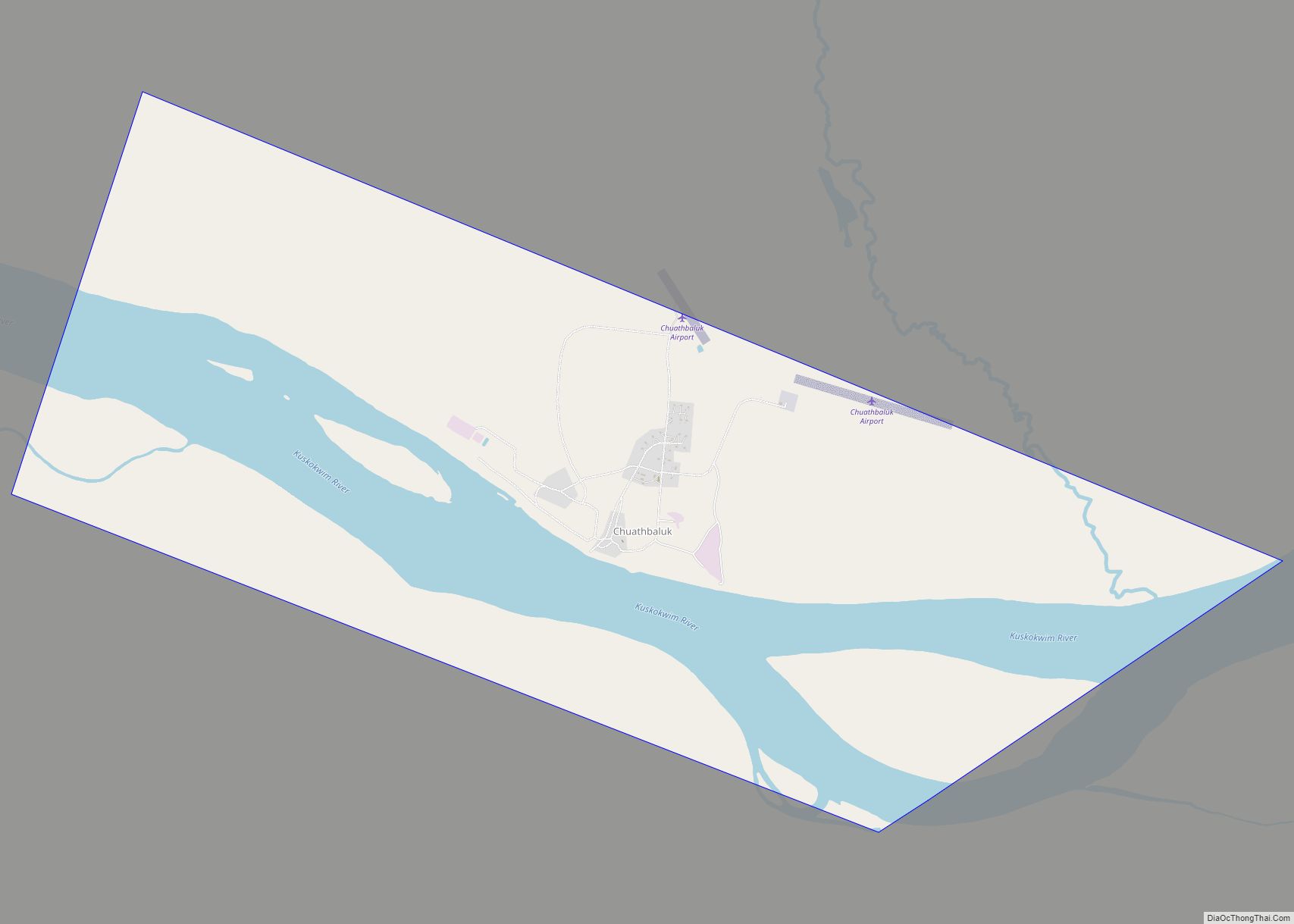
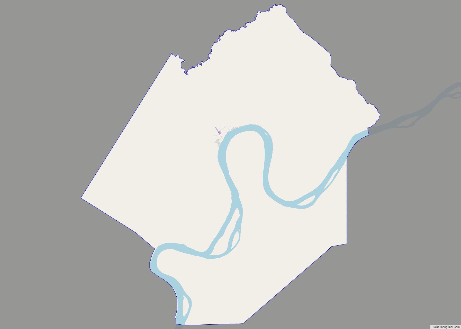
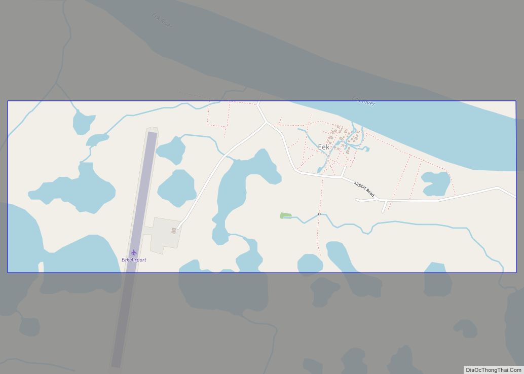
Online Interactive Map
Click on ![]() to view map in "full screen" mode.
to view map in "full screen" mode.
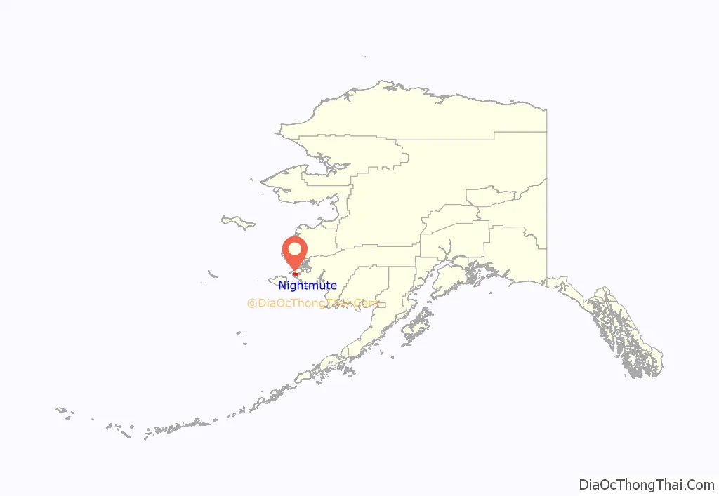
Nightmute location map. Where is Nightmute city?
History
Negtemiut literally means ‘the people of the pressed-down place’. The first element is negte- ‘to press down on’. The suffix is -miut ‘people’.
It first appeared on the 1940 U.S. Census as the unincorporated native village of “Nigtmuit”. In 1950 and 1960, it was spelled “Nigtmute”. In 1970, the spelling used was “Nightmute”. It formally incorporated in 1974.
In 1964, many of its residents relocated by dogsled and founded the bayside community of Toksook Bay about 15 miles (24 km) downriver. The relocation was to avoid the yearly spring-winter migration to and from Umkumiut and Nightmute.
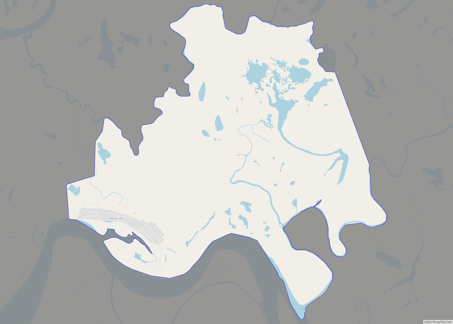
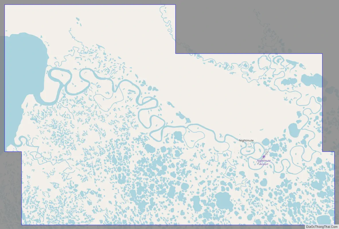
Nightmute Road Map
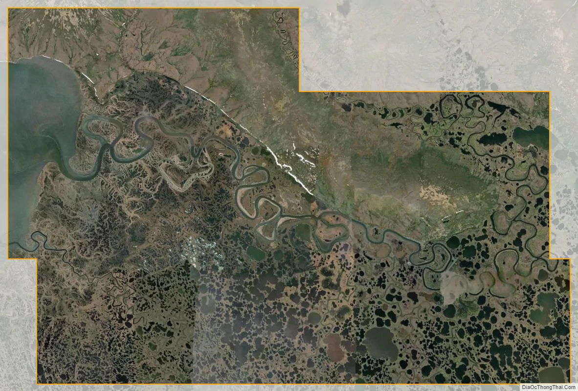
Nightmute city Satellite Map
Geography
Nightmute is located on Nelson Island near Toksook Bay. The two villages connect by snowmachine trail in winter.
According to the United States Census Bureau, the city has a total area of 101.5 square miles (263 km), of which 97.0 square miles (251 km) is land and 4.6 square miles (12 km) (4.50%) is water. Nightmute lies 15 to 17 miles east of the neighboring village of Toksook Bay.
See also
Map of Alaska State and its subdivision:- Aleutians East
- Aleutians West
- Anchorage
- Bethel
- Bristol Bay
- Denali
- Dillingham
- Fairbanks North Star
- Haines
- Juneau
- Kenai Peninsula
- Ketchikan Gateway
- Kodiak Island
- Lake and Peninsula
- Matanuska-Susitna
- Nome
- North Slope
- Northwest Arctic
- Prince of Wales-Outer Ketchi
- Sitka
- Skagway-Yakutat-Angoon
- Southeast Fairbanks
- Valdez-Cordova
- Wade Hampton
- Wrangell-Petersburg
- Yukon-Koyukuk
- Alabama
- Alaska
- Arizona
- Arkansas
- California
- Colorado
- Connecticut
- Delaware
- District of Columbia
- Florida
- Georgia
- Hawaii
- Idaho
- Illinois
- Indiana
- Iowa
- Kansas
- Kentucky
- Louisiana
- Maine
- Maryland
- Massachusetts
- Michigan
- Minnesota
- Mississippi
- Missouri
- Montana
- Nebraska
- Nevada
- New Hampshire
- New Jersey
- New Mexico
- New York
- North Carolina
- North Dakota
- Ohio
- Oklahoma
- Oregon
- Pennsylvania
- Rhode Island
- South Carolina
- South Dakota
- Tennessee
- Texas
- Utah
- Vermont
- Virginia
- Washington
- West Virginia
- Wisconsin
- Wyoming