Nikolaevsk (Russian: Никола́евск, IPA: [nʲɪkɐˈɫa(j)ɪfsk]) is a census-designated place (CDP) in Kenai Peninsula Borough in the U.S. state of Alaska. As of the 2020 census, the population of the CDP is 328, up from 318 in 2010. Nikolaevsk School serves school-age children from the area.
| Name: | Nikolaevsk CDP |
|---|---|
| LSAD Code: | 57 |
| LSAD Description: | CDP (suffix) |
| State: | Alaska |
| County: | Kenai Peninsula Borough |
| Elevation: | 840 ft (256 m) |
| Total Area: | 34.84 sq mi (90.25 km²) |
| Land Area: | 34.84 sq mi (90.25 km²) |
| Water Area: | 0.00 sq mi (0.00 km²) |
| Total Population: | 328 |
| Population Density: | 9.41/sq mi (3.63/km²) |
| ZIP code: | 99556 |
| Area code: | 907 |
| FIPS code: | 0254085 |
| GNISfeature ID: | 1417063 |
Online Interactive Map
Click on ![]() to view map in "full screen" mode.
to view map in "full screen" mode.
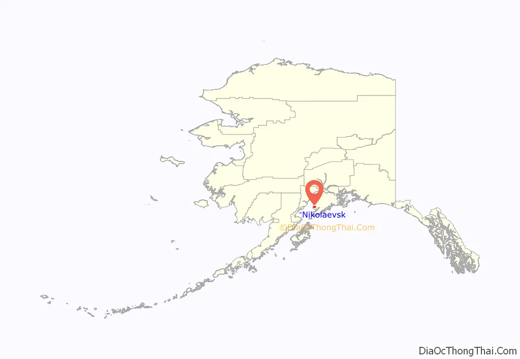
Nikolaevsk location map. Where is Nikolaevsk CDP?
History
The town was settled by a group of Old Believers of the Russian Orthodox Old-Rite Church around 1968, and remains a largely ethnic Russian town to this day. The travels of the group from Russia, as well as the story of the founding of Nikolaevsk, is told in a 1972 article in National Geographic, a 2013 episode on the NatGeo channel called Russian Alaska, and a 2013 article in The Atlantic magazine.
The first church (pictured) was built in 1983. The second church was constructed in 2014.
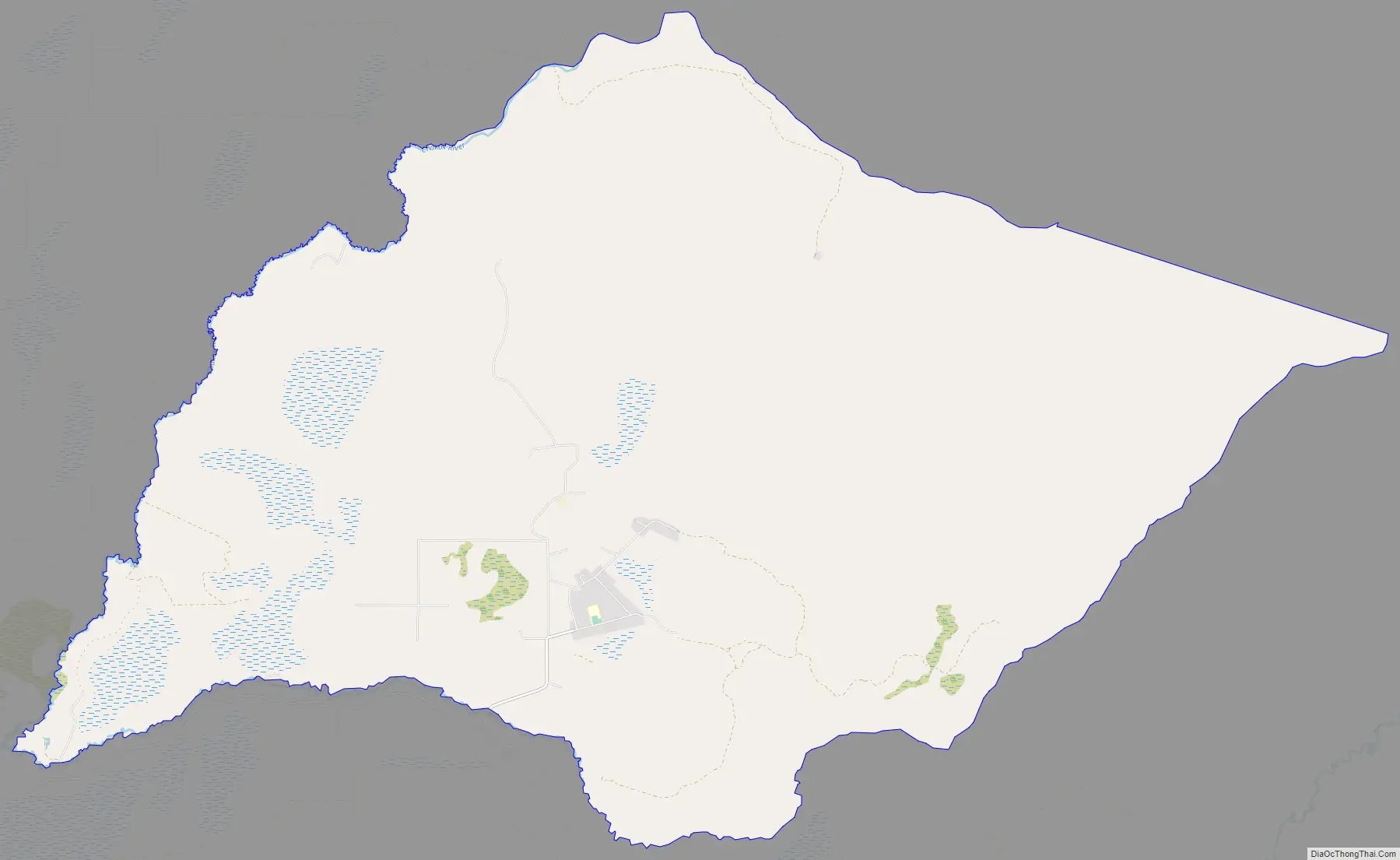
Nikolaevsk Road Map
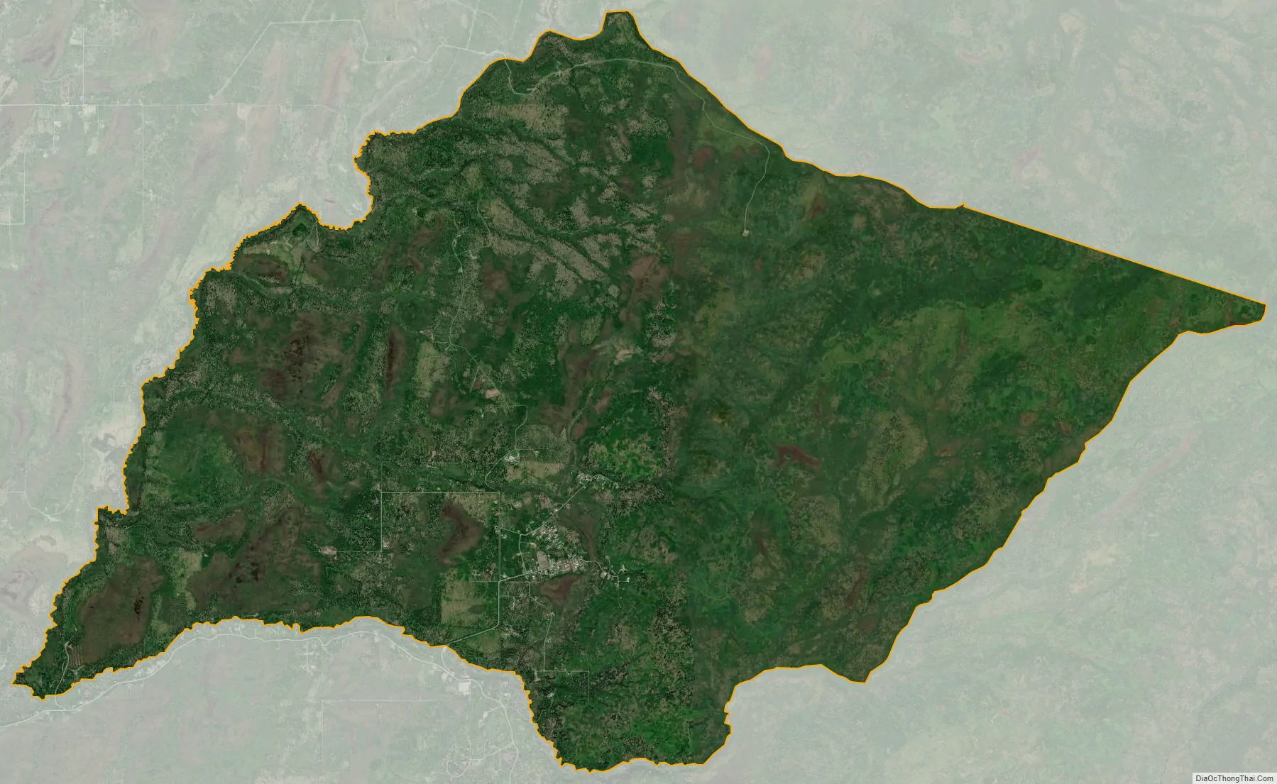
Nikolaevsk city Satellite Map
Geography
Nikolaevsk is on the west side of the Kenai Peninsula at 59°48′47″N 151°40′6″W / 59.81306°N 151.66833°W / 59.81306; -151.66833 (59.813043, -151.668387). It is bordered to the south and west by the Anchor Point CDP and to the north by the Happy Valley CDP. Road access is via the North Fork Road, which junctions with the Sterling Highway 9 miles (14 km) to the west in Anchor Point.
According to the United States Census Bureau, the CDP has a total area of 34.8 square miles (90.2 km), all of it recorded as land. The North Fork of the Anchor River forms the southern border of the community, and the Chakok River forms the western border.
Nikolaevsk is in the boreal wet forest biome, according to the Holdridge life zones system.
See also
Map of Alaska State and its subdivision:- Aleutians East
- Aleutians West
- Anchorage
- Bethel
- Bristol Bay
- Denali
- Dillingham
- Fairbanks North Star
- Haines
- Juneau
- Kenai Peninsula
- Ketchikan Gateway
- Kodiak Island
- Lake and Peninsula
- Matanuska-Susitna
- Nome
- North Slope
- Northwest Arctic
- Prince of Wales-Outer Ketchi
- Sitka
- Skagway-Yakutat-Angoon
- Southeast Fairbanks
- Valdez-Cordova
- Wade Hampton
- Wrangell-Petersburg
- Yukon-Koyukuk
- Alabama
- Alaska
- Arizona
- Arkansas
- California
- Colorado
- Connecticut
- Delaware
- District of Columbia
- Florida
- Georgia
- Hawaii
- Idaho
- Illinois
- Indiana
- Iowa
- Kansas
- Kentucky
- Louisiana
- Maine
- Maryland
- Massachusetts
- Michigan
- Minnesota
- Mississippi
- Missouri
- Montana
- Nebraska
- Nevada
- New Hampshire
- New Jersey
- New Mexico
- New York
- North Carolina
- North Dakota
- Ohio
- Oklahoma
- Oregon
- Pennsylvania
- Rhode Island
- South Carolina
- South Dakota
- Tennessee
- Texas
- Utah
- Vermont
- Virginia
- Washington
- West Virginia
- Wisconsin
- Wyoming


