Nikolski (Chalukax̂ in Aleut; Russian: Никольский) is a census-designated place (CDP) on Umnak Island in Aleutians West Census Area, Alaska, United States. The population was 39 at the 2020 census, up from 18 in 2010. Nikolski is on Nikolski Bay, off the southwest end of the island. It is 116 air miles west of Unalaska, and 900 air miles from Anchorage. Residents are known as Unangan, and Aleut is spoken in most of the remaining homes.
| Name: | Nikolski CDP |
|---|---|
| LSAD Code: | 57 |
| LSAD Description: | CDP (suffix) |
| State: | Alaska |
| County: | Aleutians West Census Area |
| Total Area: | 132.78 sq mi (343.91 km²) |
| Land Area: | 132.05 sq mi (342.01 km²) |
| Water Area: | 0.73 sq mi (1.90 km²) |
| Total Population: | 39 |
| Population Density: | 0.30/sq mi (0.11/km²) |
| ZIP code: | 99638 |
| Area code: | 907 |
| FIPS code: | 0254260 |
Online Interactive Map
Click on ![]() to view map in "full screen" mode.
to view map in "full screen" mode.
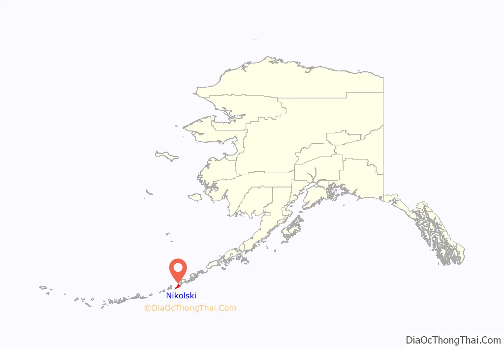
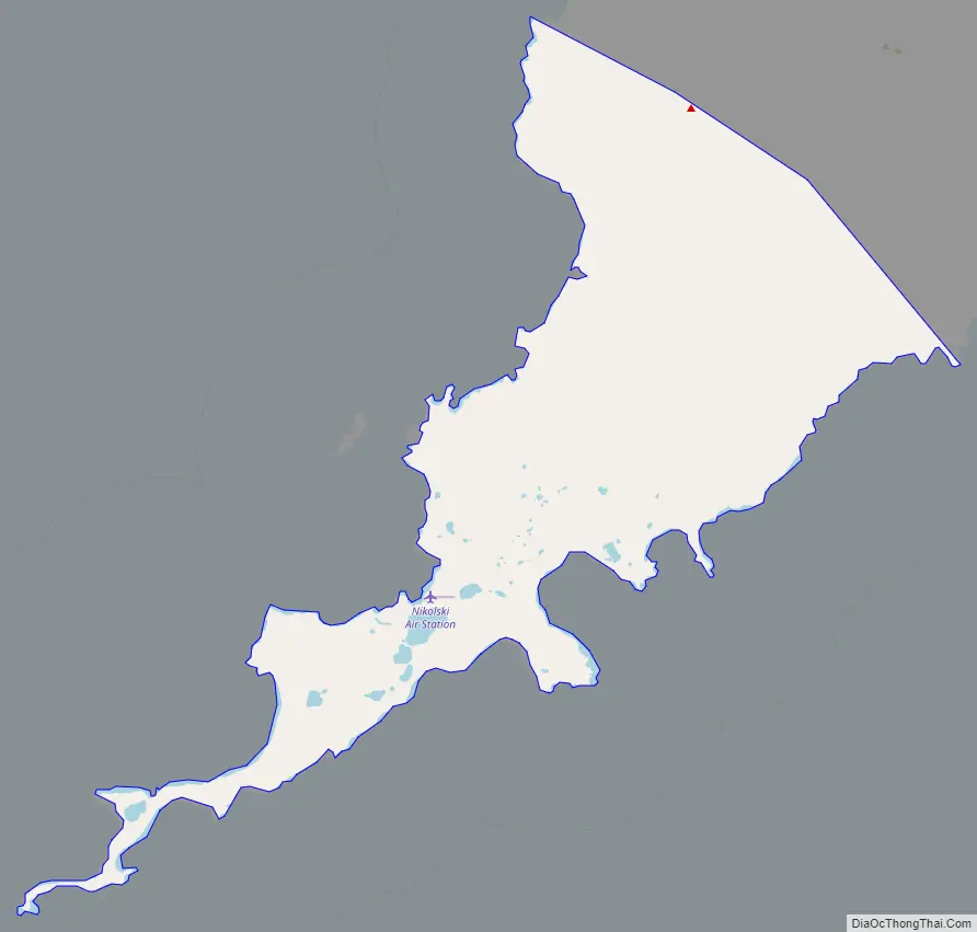
Nikolski location map. Where is Nikolski CDP?
History
The Aleutian Pribilof Islands Association reports that Nikolski is thought to be one of the oldest continuously-occupied communities in the world. Archaeological evidence from Ananiuliak Island, 5 km offshore in Nikolski Bay, dates human habitation to 8,500 years ago. A site known as Chaluka in Nikolski shows 4,000 years of virtually continuous occupation. Subsistence activities, sheep and cattle raising, and fishing are the main livelihoods and the latter has been traced back thousands of years by archaeologists, through analysis of midden sites and fish hook designs in the 1960s. Previous activities from the 1800s included sea otter hunting and fox farming. A sheep ranch was established in 1926 as part of the Aleutian Livestock Company and there are thousands on the island today. In the early 1900s the residents purchased a large fishing boat with money made from those activities, the “Umnak Native”, but it was wrecked in 1933.
In June 1942 during World War II, the Japanese attacked Unalaska to the East and had also seized Attu and Kiska islands, to the west. Residents of Umnak Island were evacuated to the Ketchikan area in far southeastern Alaska, although an American airstrip and military base on the north of the island, Fort Glenn Army Air Base (abandoned by 1950) repelled Japanese forces. The Battle of Attu and associated campaigns in 1943 recaptured the lost islands to the west. Nikolski locals returned in 1944, but some had experienced the outside world for the first time and since then, many natives have remained offshore, working in canneries or on fishing vessels. The US Air Force built a White Alice radar communication site on the edge of town in the 1950s, but it was abandoned by 1977. A 3,500 foot gravel runway, the unattended Nikolski Air Station remains, and there are passenger, mail and cargo services depending on the harsh weather conditions. Nikolski has no harbour.
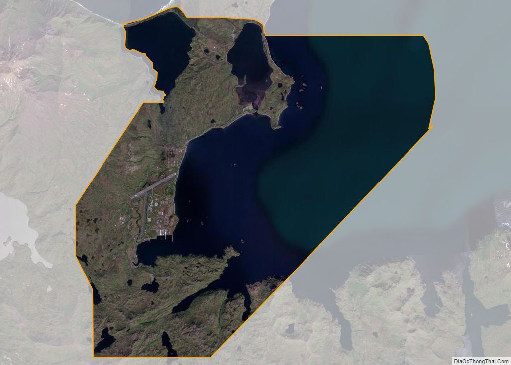
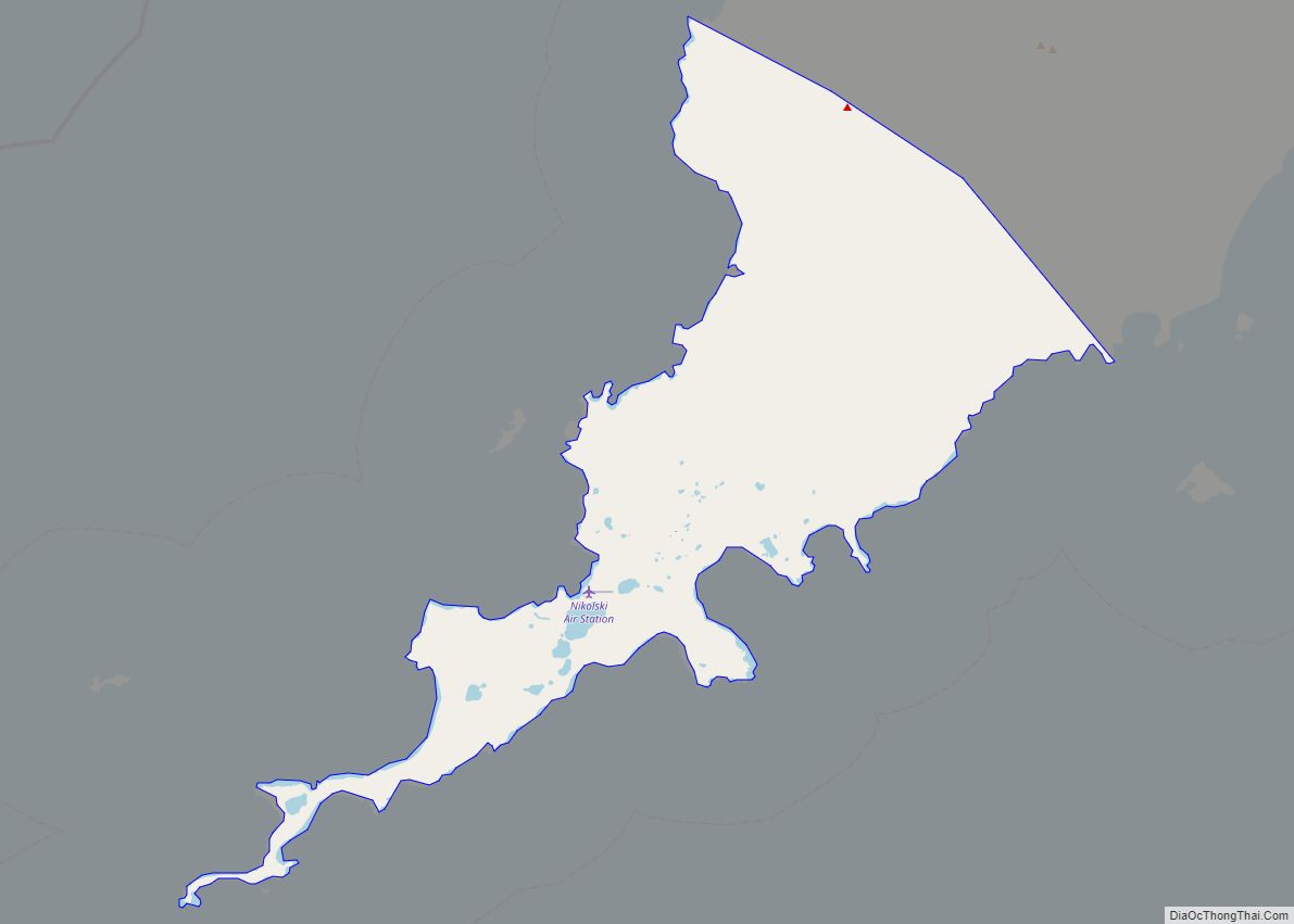
Nikolski Road Map
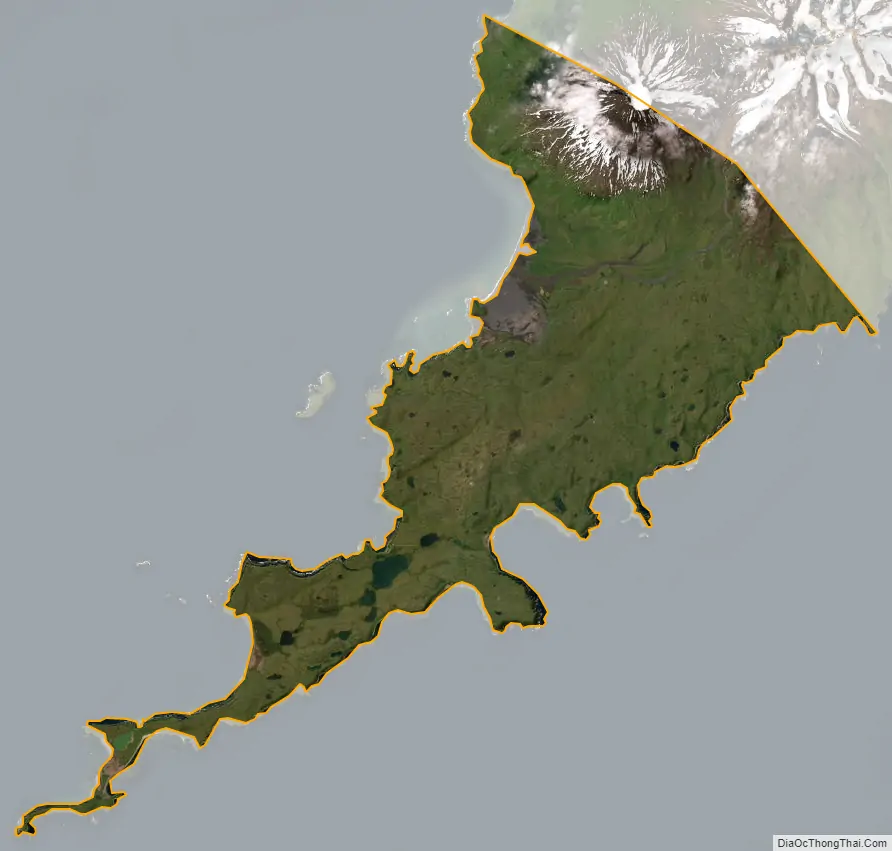
Nikolski city Satellite Map
Geography
Nikolski is located at 52°56′29″N 168°51′39″W / 52.941485°N 168.860765°W / 52.941485; -168.860765.
According to the U.S. Census Bureau, the CDP has a total area of 132.8 square miles (344 km), of which, 132.1 square miles (342 km) of it is land and 0.7 square miles (1.8 km) of it (0.55%) is water. The island is in the maritime climate zone. Temperatures range from 11 degrees F (-11 C) to 65 degrees (18 C). Snowfall is considerable and covers Mount Vsevidof and other peaks, with rain and strong winds much of the year, and summer fog.
On a clear day the view from Nikolski is dominated by Mount Vsevidof to the northeast, the highest point on Umnak Island (7,051 ft, 2,149 m). Vsevidof is tectonically active, and an eruption last occurred on March 11, 1957, following an earthquake. A cataclysmic eruption of Mount Okmok in the northernmost part of the island severely affected Nikolski residents in July 2008.
The boundary between the Alaska Time Zone (UTC-9) and Hawaii-Aleutian Time Zone (UTC-10) passes just west of Nikolski, along the line of 169°30’W through Samalga Pass. This places Nikolski in the Alaska Time Zone. However, as Nikolski is part of the Aleutian Region School District the settlement effectively observes Hawaii-Aleutian time.
See also
Map of Alaska State and its subdivision:- Aleutians East
- Aleutians West
- Anchorage
- Bethel
- Bristol Bay
- Denali
- Dillingham
- Fairbanks North Star
- Haines
- Juneau
- Kenai Peninsula
- Ketchikan Gateway
- Kodiak Island
- Lake and Peninsula
- Matanuska-Susitna
- Nome
- North Slope
- Northwest Arctic
- Prince of Wales-Outer Ketchi
- Sitka
- Skagway-Yakutat-Angoon
- Southeast Fairbanks
- Valdez-Cordova
- Wade Hampton
- Wrangell-Petersburg
- Yukon-Koyukuk
- Alabama
- Alaska
- Arizona
- Arkansas
- California
- Colorado
- Connecticut
- Delaware
- District of Columbia
- Florida
- Georgia
- Hawaii
- Idaho
- Illinois
- Indiana
- Iowa
- Kansas
- Kentucky
- Louisiana
- Maine
- Maryland
- Massachusetts
- Michigan
- Minnesota
- Mississippi
- Missouri
- Montana
- Nebraska
- Nevada
- New Hampshire
- New Jersey
- New Mexico
- New York
- North Carolina
- North Dakota
- Ohio
- Oklahoma
- Oregon
- Pennsylvania
- Rhode Island
- South Carolina
- South Dakota
- Tennessee
- Texas
- Utah
- Vermont
- Virginia
- Washington
- West Virginia
- Wisconsin
- Wyoming