Selawik (/ˈsɛləwɪk/) (Iñupiaq: Siiḷ(i)vik or Akuliġaq) is a city in Northwest Arctic Borough, Alaska, United States. At the 2010 census the population was 829, up from 772 in 2000.
Selawik comes from siiḷivik, which means “place of sheefish” in Inupiaq.
| Name: | Selawik city |
|---|---|
| LSAD Code: | 25 |
| LSAD Description: | city (suffix) |
| State: | Alaska |
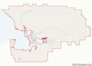
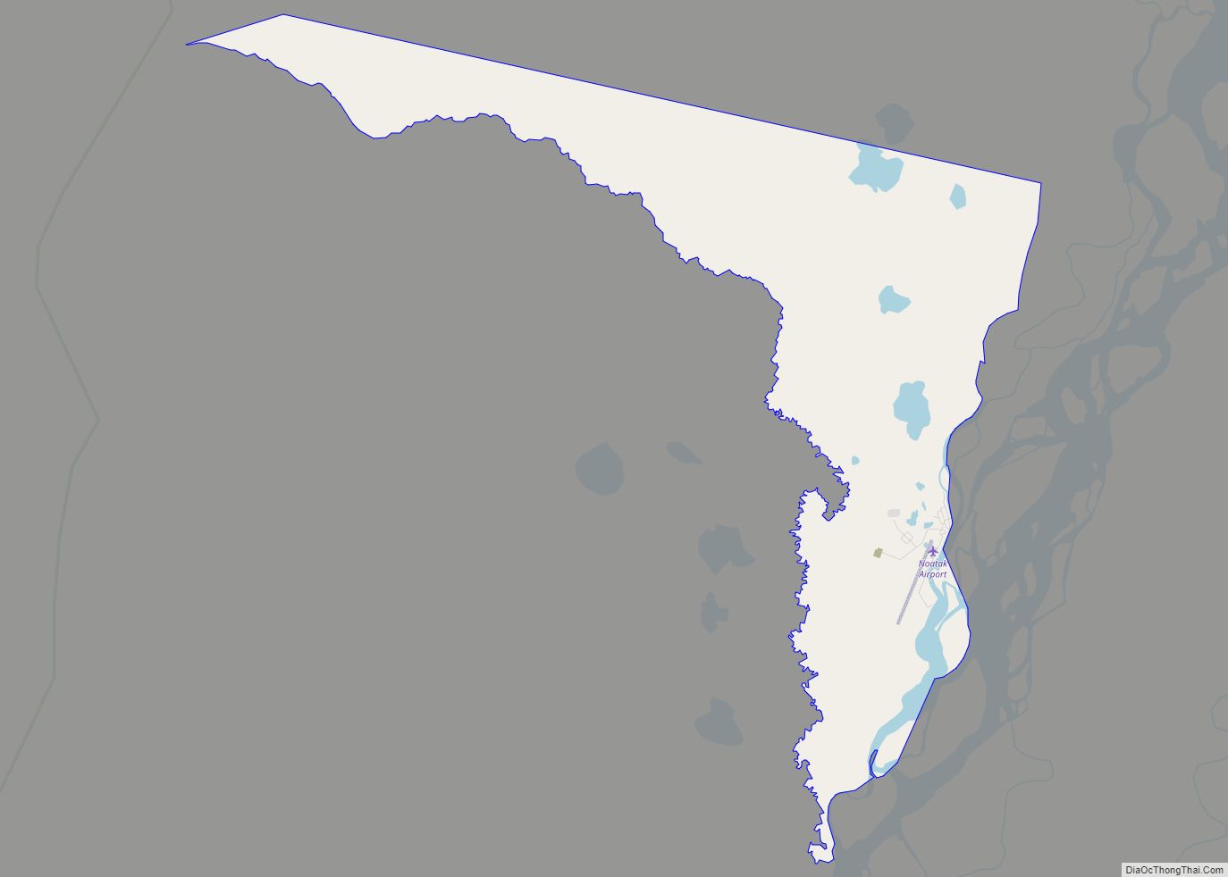
| County: | Northwest Arctic Borough |
| Incorporated: | 1977 |
| Elevation: | 0 ft (0 m) |
| Total Area: | 2.94 sq mi (7.62 km²) |
| Land Area: | 2.33 sq mi (6.04 km²) |
| Water Area: | 0.61 sq mi (1.59 km²) |
| Total Population: | 809 |
| Population Density: | 347.06/sq mi (133.99/km²) |
| ZIP code: | 99770 |
| Area code: | 907 |
| FIPS code: | 0268230 |
| GNISfeature ID: | 1413930 |
Online Interactive Map
Click on ![]() to view map in "full screen" mode.
to view map in "full screen" mode.
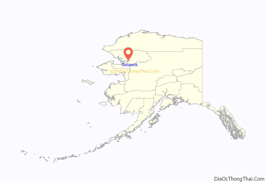
Selawik location map. Where is Selawik city?
History
A Lt. Lavrenty Zagoskin of the Imperial Russian Navy first reported the village in the 1840s as “Chilivik.” In his census study in 1880, Ivan Petrof counted 100 “Selawigamute” people.
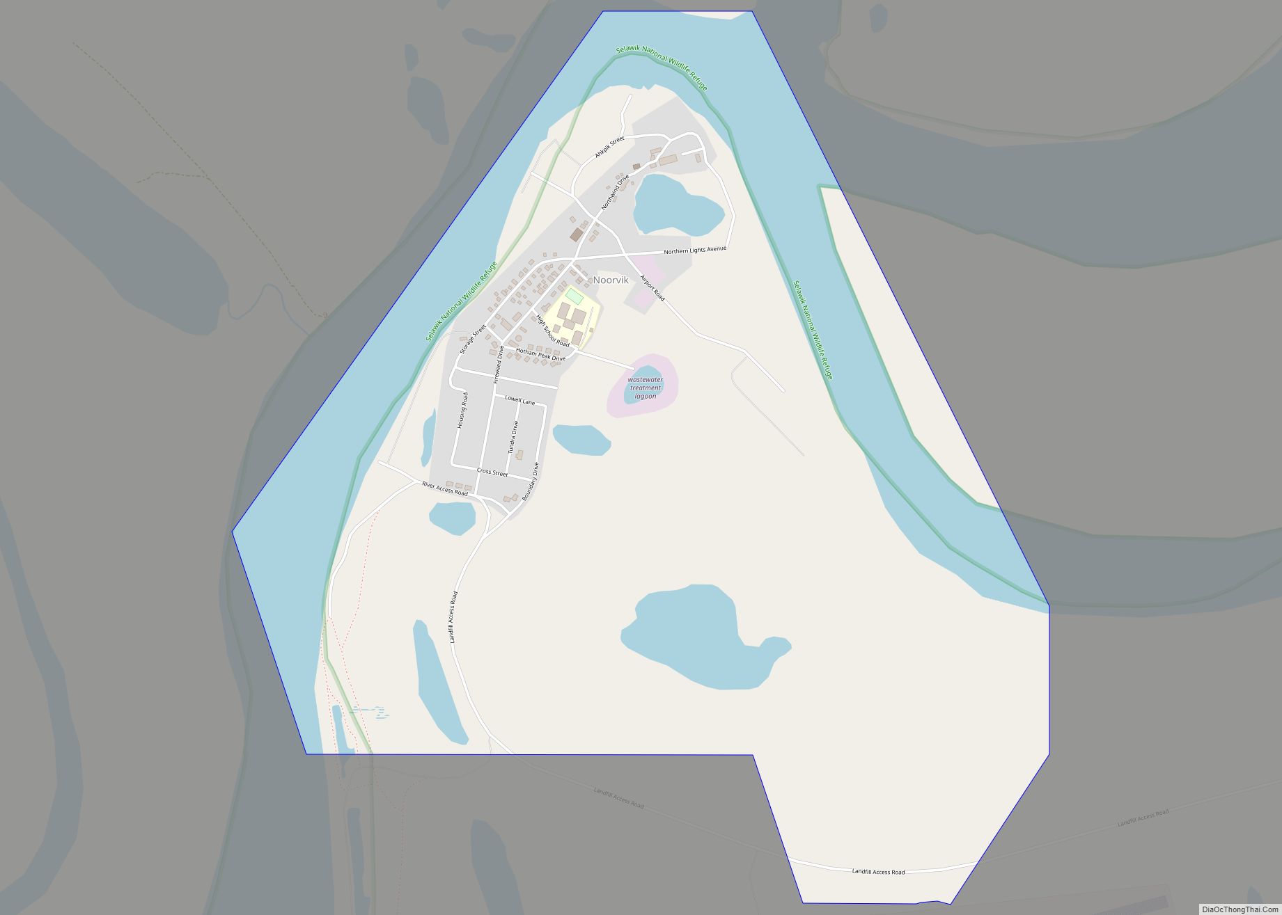
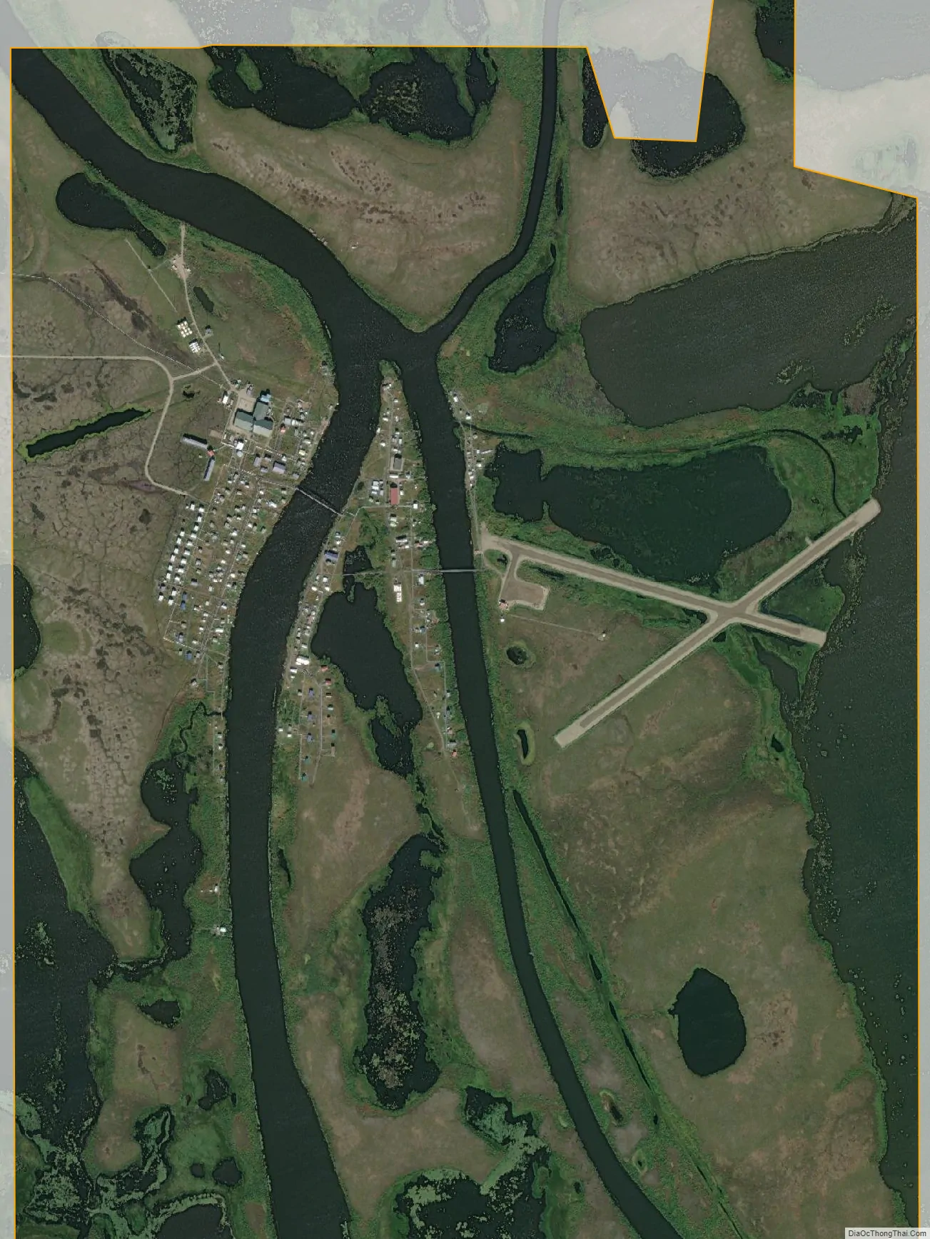
Around 1908, the village site had a small wooden schoolhouse and church. The village now has expanded across the Selawik River onto three banks, linked by bridges.
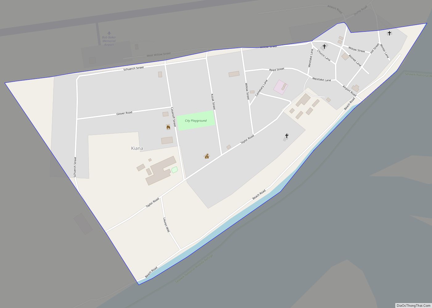
Selawik Road Map
Selawik city Satellite Map
Geography
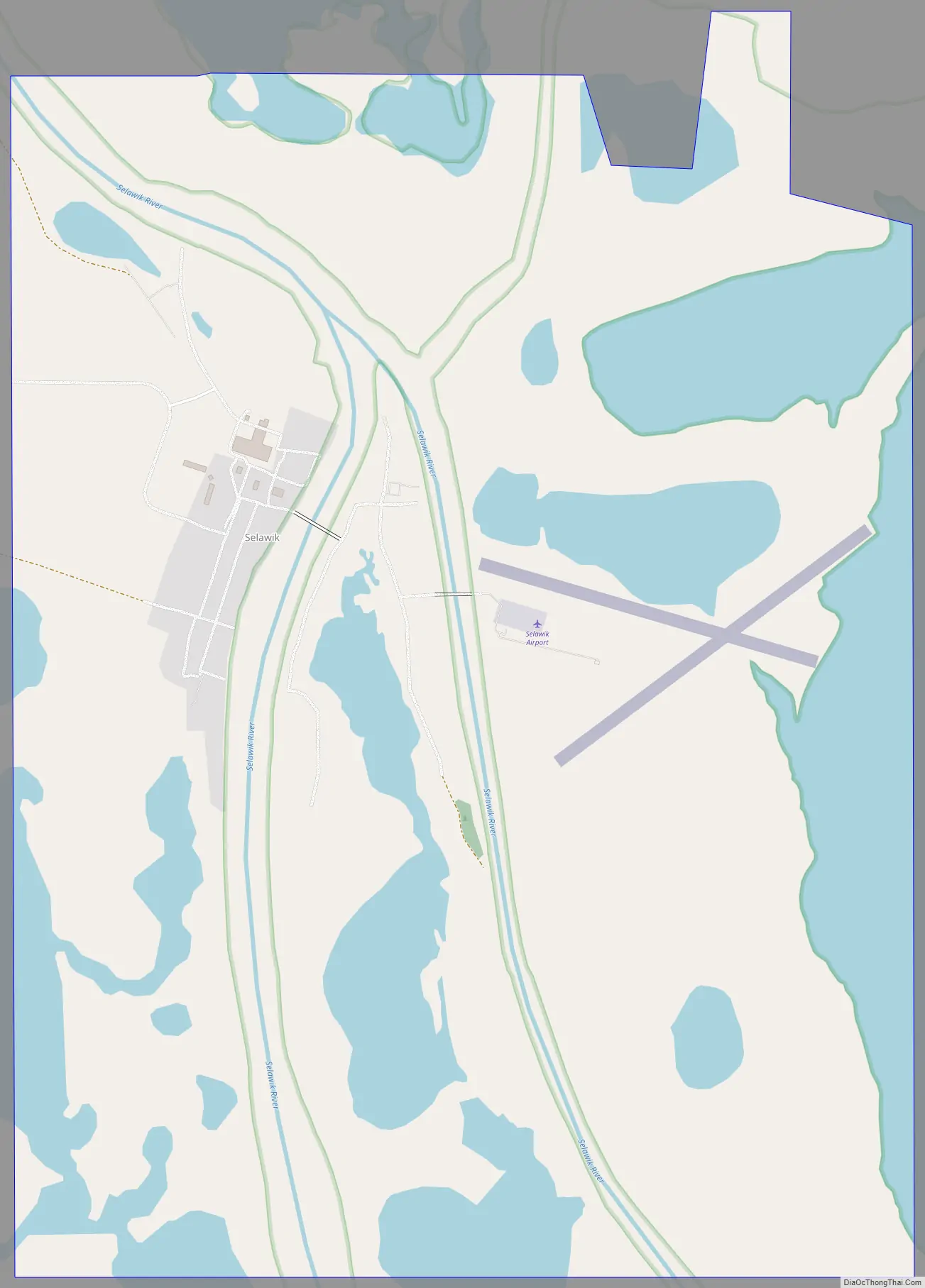
Selawik is located at 66°35′49″N 160°0′49″W / 66.59694°N 160.01361°W / 66.59694; -160.01361 (66.597043, -160.013674).
Selawik is located at the mouth of the Selawik River where it empties into Selawik Lake, about 112 km (70 mi) southeast of Kotzebue.
Selawik is near the Selawik National Wildlife Refuge, a breeding and resting area for migratory waterfowl.
According to the United States Census Bureau, the city has a total area of 3.4 square miles (8.8 km), of which, 2.5 square miles (6.5 km) of it is land and 0.9 square miles (2.3 km) of it (26.24%) is water.
See also
Map of Alaska State and its subdivision:- Aleutians East
- Aleutians West
- Anchorage
- Bethel
- Bristol Bay
- Denali
- Dillingham
- Fairbanks North Star
- Haines
- Juneau
- Kenai Peninsula
- Ketchikan Gateway
- Kodiak Island
- Lake and Peninsula
- Matanuska-Susitna
- Nome
- North Slope
- Northwest Arctic
- Prince of Wales-Outer Ketchi
- Sitka
- Skagway-Yakutat-Angoon
- Southeast Fairbanks
- Valdez-Cordova
- Wade Hampton
- Wrangell-Petersburg
- Yukon-Koyukuk
- Alabama
- Alaska
- Arizona
- Arkansas
- California
- Colorado
- Connecticut
- Delaware
- District of Columbia
- Florida
- Georgia
- Hawaii
- Idaho
- Illinois
- Indiana
- Iowa
- Kansas
- Kentucky
- Louisiana
- Maine
- Maryland
- Massachusetts
- Michigan
- Minnesota
- Mississippi
- Missouri
- Montana
- Nebraska
- Nevada
- New Hampshire
- New Jersey
- New Mexico
- New York
- North Carolina
- North Dakota
- Ohio
- Oklahoma
- Oregon
- Pennsylvania
- Rhode Island
- South Carolina
- South Dakota
- Tennessee
- Texas
- Utah
- Vermont
- Virginia
- Washington
- West Virginia
- Wisconsin
- Wyoming