Sunrise is a census-designated place (CDP) in Kenai Peninsula Borough, Alaska, United States. The population was 18 at the 2010 census, unchanged from 2000.
| Name: | Sunrise CDP |
|---|---|
| LSAD Code: | 57 |
| LSAD Description: | CDP (suffix) |
| State: | Alaska |
| County: | Kenai Peninsula Borough |
| Elevation: | 269 ft (82 m) |
| Total Area: | 13.02 sq mi (33.73 km²) |
| Land Area: | 13.02 sq mi (33.73 km²) |
| Water Area: | 0.00 sq mi (0.00 km²) |
| Total Population: | 15 |
| Population Density: | 1.15/sq mi (0.44/km²) |
| Area code: | 907 |
| FIPS code: | 0273950 |
| GNISfeature ID: | 1415091 |
Online Interactive Map
Click on ![]() to view map in "full screen" mode.
to view map in "full screen" mode.
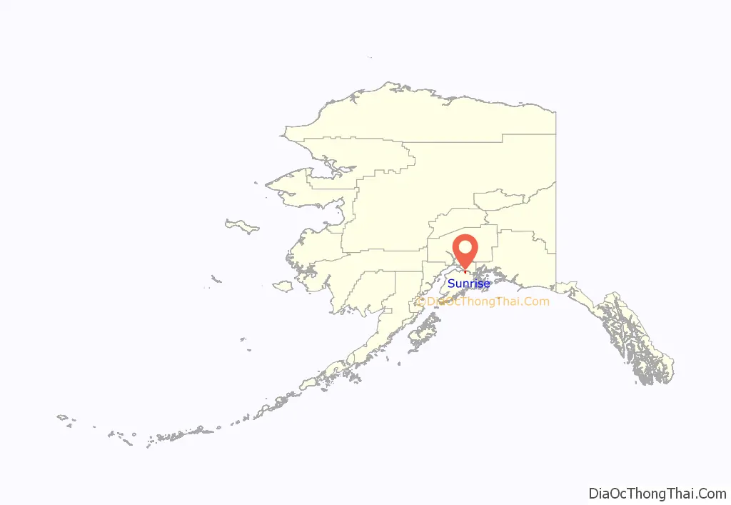
Sunrise location map. Where is Sunrise CDP?
History
Sunrise was established in 1895 and incorporated in 1896, and grew rapidly as a supply center for miners participating in the gold rush along Turnagain Arm in the late 1890s. It was briefly the largest city in the Alaska Territory. At its height in 1898, the community had a summertime population of 800, with several general stores, saloons, and a restaurant and hotel. The city declined after 1900, with miners drawn to richer gold fields elsewhere in Alaska. Many of its buildings burned in the following years, and the last store closed in 1939. Remnants of the town on either side of Sixmile Creek have been designated an archaeological historic district, and were listed on the National Register of Historic Places in 1997.
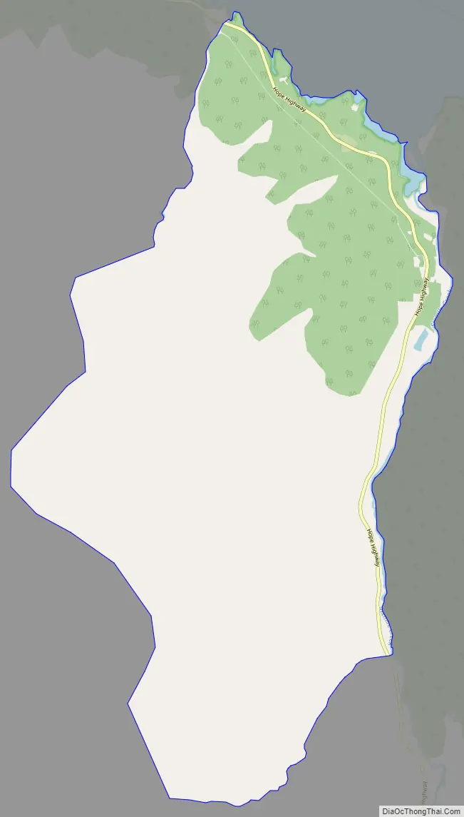
Sunrise Road Map
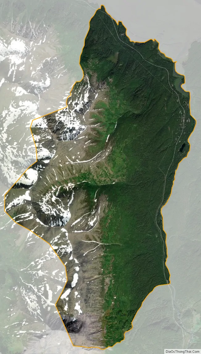
Sunrise city Satellite Map
Geography
Sunrise is located on the northern side of the Kenai Peninsula at 60°53′8″N 149°25′28″W / 60.88556°N 149.42444°W / 60.88556; -149.42444 (60.885663, -149.424556), on the south shore of Turnagain Arm, a branch of Cook Inlet. It is bordered to the west by the community of Hope. To the south the Hope Highway leads 7 miles (11 km) to Alaska Route 1, the Sterling Highway.
According to the United States Census Bureau, the Sunrise CDP has a total area of 13.0 square miles (33.7 km), all of it recorded as land. Sunrise sits in a valley on the west side of Sixmile Creek. It is overlooked by 4,600-foot-high (1,400 m) peaks to the west and by 3,001-foot (915 m) Bradley Peak to the east.
See also
Map of Alaska State and its subdivision:- Aleutians East
- Aleutians West
- Anchorage
- Bethel
- Bristol Bay
- Denali
- Dillingham
- Fairbanks North Star
- Haines
- Juneau
- Kenai Peninsula
- Ketchikan Gateway
- Kodiak Island
- Lake and Peninsula
- Matanuska-Susitna
- Nome
- North Slope
- Northwest Arctic
- Prince of Wales-Outer Ketchi
- Sitka
- Skagway-Yakutat-Angoon
- Southeast Fairbanks
- Valdez-Cordova
- Wade Hampton
- Wrangell-Petersburg
- Yukon-Koyukuk
- Alabama
- Alaska
- Arizona
- Arkansas
- California
- Colorado
- Connecticut
- Delaware
- District of Columbia
- Florida
- Georgia
- Hawaii
- Idaho
- Illinois
- Indiana
- Iowa
- Kansas
- Kentucky
- Louisiana
- Maine
- Maryland
- Massachusetts
- Michigan
- Minnesota
- Mississippi
- Missouri
- Montana
- Nebraska
- Nevada
- New Hampshire
- New Jersey
- New Mexico
- New York
- North Carolina
- North Dakota
- Ohio
- Oklahoma
- Oregon
- Pennsylvania
- Rhode Island
- South Carolina
- South Dakota
- Tennessee
- Texas
- Utah
- Vermont
- Virginia
- Washington
- West Virginia
- Wisconsin
- Wyoming


