Antares is an unincorporated community and census designated place (CDP) in Mohave County, Arizona, United States. As of the 2020 census, it had a population of 132. It exists along part of historic U.S. Route 66.
| Name: | Antares CDP |
|---|---|
| LSAD Code: | 57 |
| LSAD Description: | CDP (suffix) |
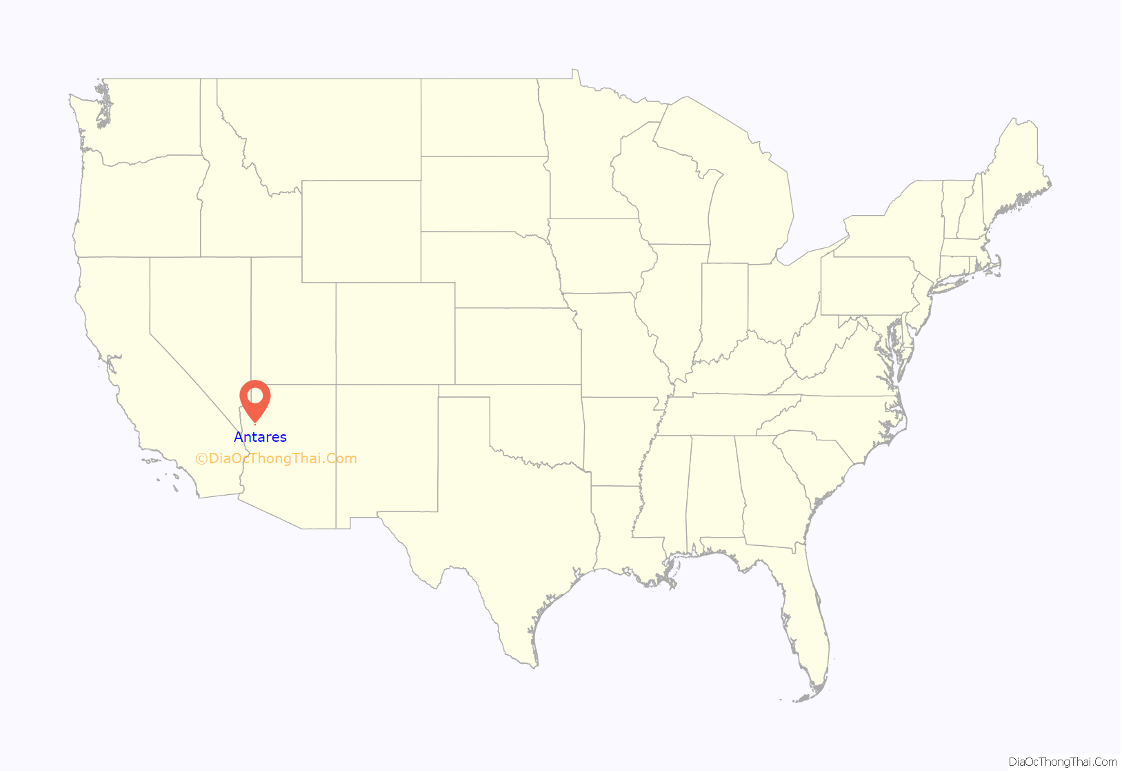
| State: | Arizona |
| County: | Mohave County |
| Elevation: | 3,556 ft (1,084 m) |
| Total Area: | 0.65 sq mi (1.7 km²) |
| Land Area: | 0.65 sq mi (1.7 km²) |
| Water Area: | 0 sq mi (0 km²) |
| Total Population: | 132 |
| Population Density: | 200/sq mi (78/km²) |
| ZIP code: | 86401 |
| Area code: | 928 |
| FIPS code: | 0402410 |
Online Interactive Map
Click on ![]() to view map in "full screen" mode.
to view map in "full screen" mode.
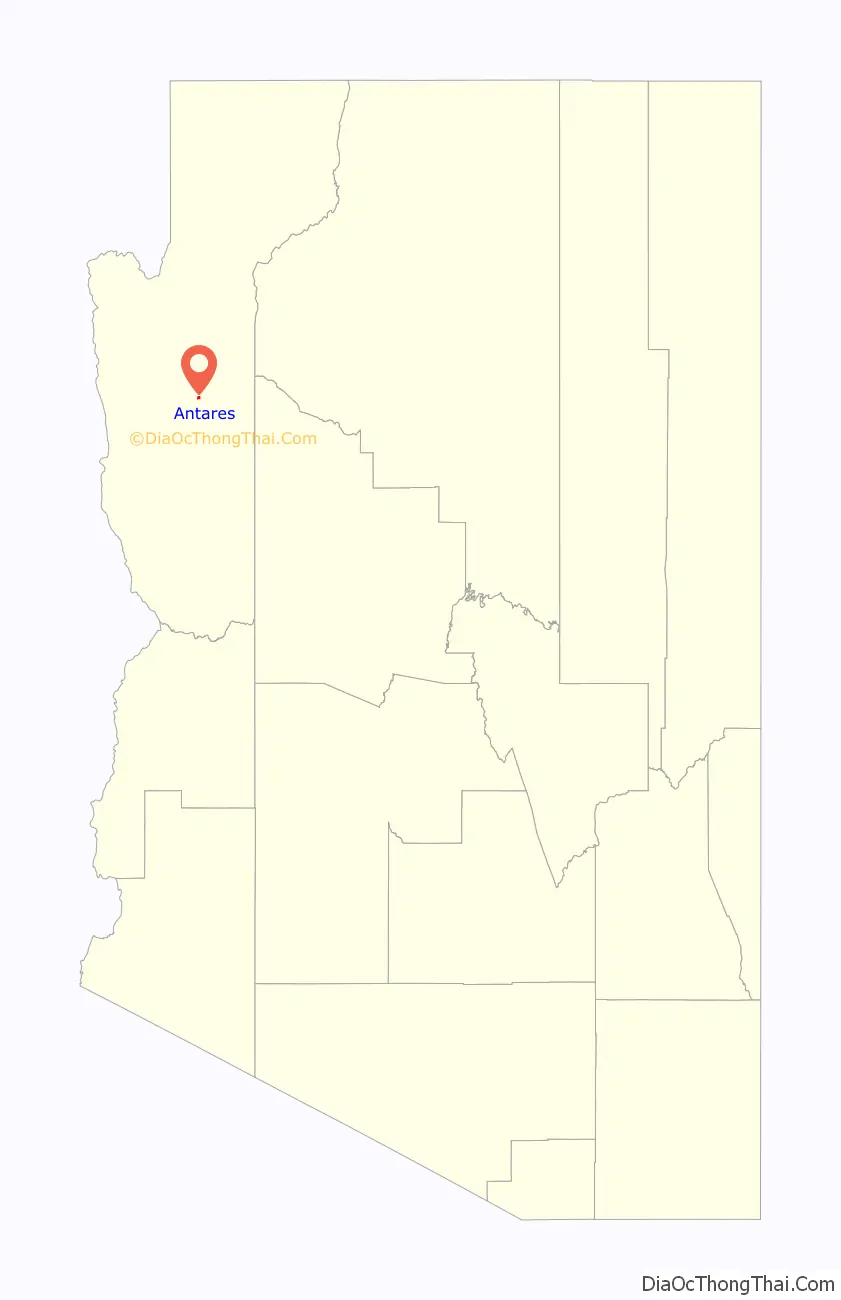
Antares location map. Where is Antares CDP?
History
The village of Antares began as a railroad siding. The Atlantic and Pacific Railroad was laying tracks through the area in 1883 and had to reroute around the Peacock Mountains, diverting south of the mountains to the easier gradient through nearby Hackberry; when continuing west, the gradient was lower in the Hualapai Valley 6 miles (10 km) to the north of Hackberry, where Antares now lies. The railroad thus took a large curve to travel through this point down into Kingman. The siding built on the curve became incorporated as Antares after the National Old Trails Highway was constructed in 1910, following the railroad in this part of Arizona; when Route 66 was built in 1926 it also ran parallel to the railroad. Antares was first recorded as a “town and railroad station” in the United States Geological Survey of 1923.
There are over 6,000 mining claims in and around Antares, of which 5,566 are closed. There are 213 identifiable mines in the area, which primarily dug for copper, gold, lead, and silver.
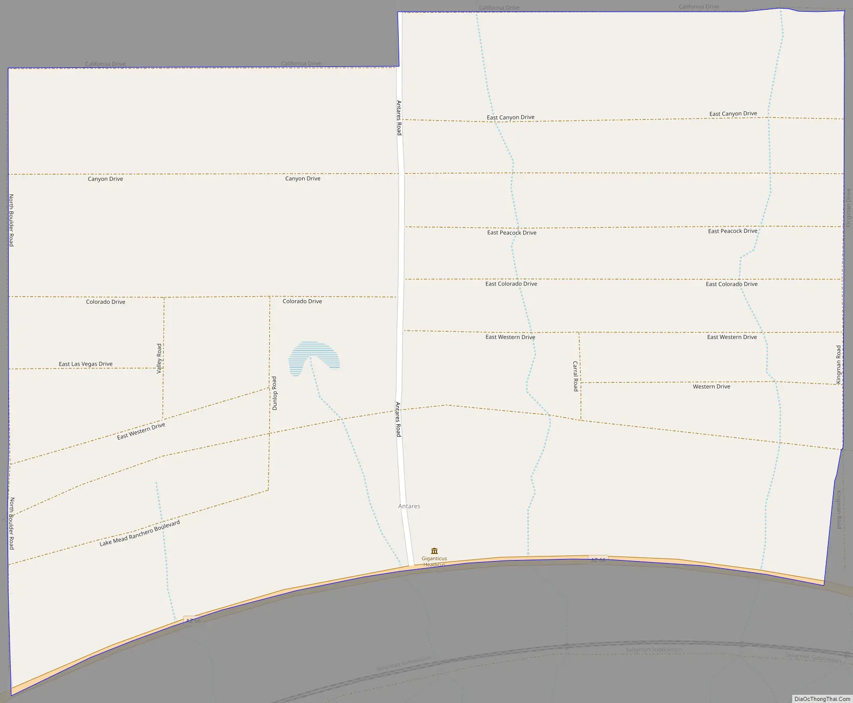
Antares Road Map
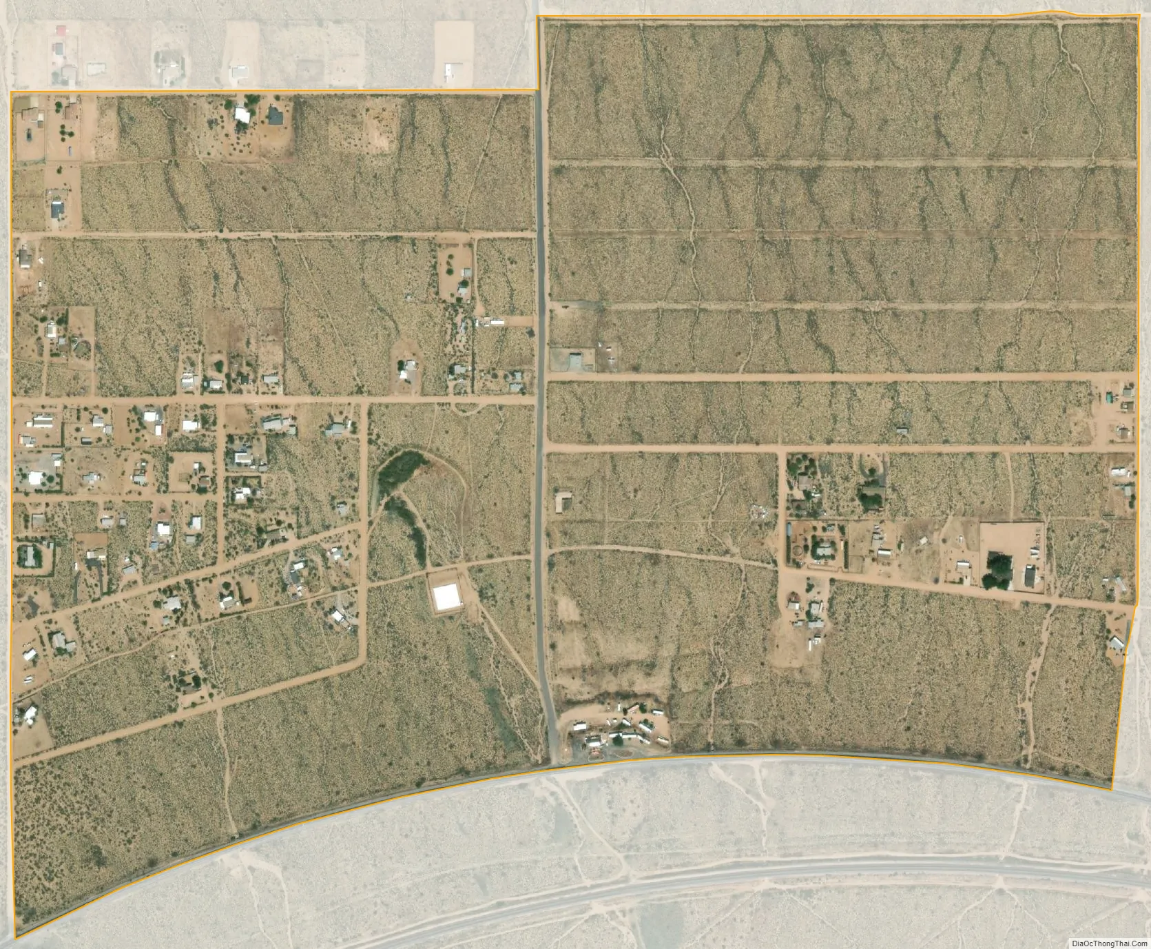
Antares city Satellite Map
Geography
Antares is located in northwestern Arizona, in central Mohave County, 21 miles (34 km) northeast of Kingman, the county seat. The Antares census-designated place encompasses 0.65 square miles (1.7 km) of land, and is at 3,556 feet (1,084 m) elevation above sea level. The southern edge of the CDP follows State Route 66 (former U.S. 66) and so curves, peaking near the center of the village. The eastern border is a roughly south–north road that is called Kingman Road south of Colorado Drive, and Kingman Drive north of this intersection. The western border runs parallel and is called Boulder Road. The village is bisected by Antares Road, which forms part of the northern border where California Drive, the west–east road at the village limit, staggers: the California Drive section from Boulder Road to Antares Road is slightly further south than East California Drive, which continues due east of the village until it reaches North Music Mountain Road. Only the eastern border road and California Drive west of Antares Road are entirely contained within Antares village limits. There are several other roads in the village, all named for nearby features and locations. The Valle Vista planned community is 4 miles (6 km) west of Antares.
Most of the buildings in Antares lie to the west of Antares Road, though there are some in the southeast corner, some in the tourist spots in the center-south on Route 66, and a few buildings on the extension of Boulder Road that lies to the northwest of the village limits. Mailboxes for the residents all lie at the Route 66–Antares Road intersection.
See also
Map of Arizona State and its subdivision: Map of other states:- Alabama
- Alaska
- Arizona
- Arkansas
- California
- Colorado
- Connecticut
- Delaware
- District of Columbia
- Florida
- Georgia
- Hawaii
- Idaho
- Illinois
- Indiana
- Iowa
- Kansas
- Kentucky
- Louisiana
- Maine
- Maryland
- Massachusetts
- Michigan
- Minnesota
- Mississippi
- Missouri
- Montana
- Nebraska
- Nevada
- New Hampshire
- New Jersey
- New Mexico
- New York
- North Carolina
- North Dakota
- Ohio
- Oklahoma
- Oregon
- Pennsylvania
- Rhode Island
- South Carolina
- South Dakota
- Tennessee
- Texas
- Utah
- Vermont
- Virginia
- Washington
- West Virginia
- Wisconsin
- Wyoming


