Oro Valley, incorporated in 1974, is a suburban town located 6 miles (9.7 km) north of Tucson, Arizona, United States, in Pima County. According to the 2020 census, the population of the town is 47,070, an increase from 29,700 in 2000. Dubbed the “Upscale Tech Mecca” of Southern Arizona by the Arizona Daily Star newspaper, Oro Valley is home to over 10 high tech firms and has a median household income nearly 50% higher than the U.S. median. The town is located approximately 110 miles (180 km) southeast of the state capital of Phoenix.
Oro Valley is situated in the western foothills of the Santa Catalina Mountains at the base of Pusch Ridge. The Tortolita Mountains are located north of the town, and vistas of the Tucson valley are to the south. The town occupies the middle Cañada del Oro Valley. Oro Valley hosts a large number of residents from around the US who maintain second or winter homes in the town.
The town hosted the 2006 Pac-10 Women’s Golf Championships at the Oro Valley Country Club. Oro Valley Country Club was also the site for the 2006 Girls’ Junior America’s Cup, a major amateur golf tournament for the Western United States. Annual events in Oro Valley include the Oro Valley Festival of the Arts, El Tour de Tucson bicycle race, the Oro Valley Music Festival, the Tucson Marathon, the Cactus Speed Classic for inline skaters, the Oro Valley Triathlon, and the Arizona Distance Classic.
| Name: | Oro Valley town |
|---|---|
| LSAD Code: | 43 |
| LSAD Description: | town (suffix) |
| State: | Arizona |
| County: | Pima County |
| Founded: | 1974 |
| Incorporated: | 1974 |
| Elevation: | 2,620 ft (798.57 m) |
| Total Area: | 34.99 sq mi (90.63 km²) |
| Land Area: | 34.87 sq mi (90.32 km²) |
| Water Area: | 0.12 sq mi (0.30 km²) |
| Total Population: | 47,070 |
| Population Density: | 1,349.72/sq mi (521.13/km²) |
| ZIP code: | 85704, 85737, 85742, 85755 |
| Area code: | 520 |
| FIPS code: | 0451600 |
| GNISfeature ID: | 37458 |
| Website: | www.orovalleyaz.gov |
Online Interactive Map
Click on ![]() to view map in "full screen" mode.
to view map in "full screen" mode.
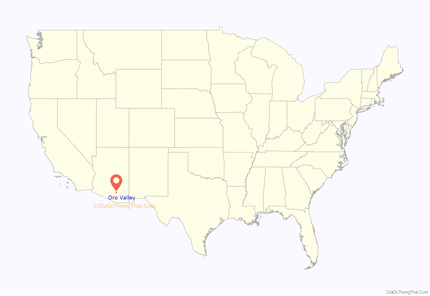
Oro Valley location map. Where is Oro Valley town?
History
Pre-U.S. annexation period
The area of Oro Valley has been inhabited discontinuously for nearly two thousand years by various groups of people. The Native American Hohokam tribe lived in the Honeybee Village in the foothills of the Tortolita Mountains on Oro Valley’s far north side around 450 A.D. Hohokam artifacts continue to be discovered in the Honeybee Village that the Hohokam inhabited continuously for nearly 800 years, and studied by archaeologists around the globe.
Early in the 16th century, Native American tribes known as the Apache arrived in the southern Arizona area, including Oro Valley. These tribes inhabited the region only a few decades prior to the arrival of the Spanish Conquistadors, including Francisco Coronado. The Spanish established forts in the area, including the Presidio at Tucson (1775) beginning in the late 16th century.
Arizona Territorial period
Beginning in the 19th century, Americans increasingly settled in the Arizona Territory, following the Mexican–American War and the subsequent Gadsden Purchase including Southern Arizona. Following the Civil War and several Army efforts to pacify the Apaches, Tucson settlers ventured north to settle Oro Valley. Francisco Romero, from a Hispanic family tracing its Tucson roots to the early nineteenth century, established a ranch in what is Catalina State Park today by 1869. He constructed ranch buildings on the foundations of the Hohokam ruins in the park. Romero lived there intermittently from 1869 to his death in 1905. Members of the Romero family occupied land in that same area until 1930.
George Pusch, a German immigrant, occupied land in the area of Oro Valley after 1874, establishing a cattle ranch. This ranch was unique because it utilized a steam pump to provide water, eventually popularizing Pusch’s property as the Steam Pump Ranch on the Cañada del Oro. The steam pump was one of only two in the Arizona Territory. Pusch and his family never lived on the ranch. They visited frequently and employed caretakers to manage the property. George Pusch, and later the Pusch Land and Cattle Company, owned Steam Pump Ranch until 1925. Pusch’s ranch provided respite for settlers and travelers entering and leaving the Tucson area. Pusch Ridge is named in honor of George Pusch.
Ranching continued to flourish in the area as greater numbers of Americans settled in the Arizona Territory and the state of Arizona. Federal homesteads became available after 1903 when surveys of land were completed. Homesteads were claimed by individuals from 1903 until the 1940s. Hispanic homesteaders included Francisco Romero, Jesus Elias, Francisco Marin, Francisco Aragon and others. Female homesteaders included Ina Gittings, Mabel Burke Johnson, Margaret Moodie and others. Other prominent homesteaders included William Sutherland, James Reidy and David Morgan.
Large ranching families came to the Oro Valley area in the period 1930–1960. Many of these were wealthy individuals from the Midwest and the East. They vacationed in Tucson during the period and became interested in living in the desert. They purchased many of the homesteads occupied by original settlers who sold out after 1930. These wealthy ranchers obtained properties of 1000 to 7000 acres. They usually lived on the ranches in the winter months and employed caretakers to manage the property and cattle. These wealthy ranchers included Walter McDonald, John Procter, Lawrence Rooney, Joseph McAdams and Lloyd and Betty Golder.
Gold rushers into the American West also were attracted to southern Arizona, where gold was said to be in abundance in and around the Santa Catalina Mountains north of Tucson. Fueled by the legend of the lost Iron Door Gold Mine in the mountains, those in search of gold trekked through the Oro Valley area focusing their attention along the Cañada del Oro washbed. No significant amounts of gold were found locally.
Post-World War II period
After World War II, the Tucson area experienced dramatic population growth, impacting Oro Valley as well. Property owners began subdividing local real estate for development in the early 1930s. Construction of Campo Bello, the first suburban development, began in 1948. Lots in the Linda Vista Citrus Tracts were sold from the late 1930s to the 1960s and occupied by residents. In the early 1950s the Oro Valley Country Club opened at the base of Pusch Ridge, affirming the area’s future as an affluent community. The Suffolk Hills development was constructed in the period 1960–1962. Although one tract housing development was built in the area in the early 1950s, the majority of homes in the Oro Valley area were built by individual land owners on large lots in a low density residential style.
Founding of the town
The community continued to grow gradually, and area residents increasingly desired local control of the land in the area. In the late 1960s, incorporation became a greater focus in Oro Valley. Tucson mayor James M. Corbett, Jr. expressed great interest in expanding the Tucson city limits to the far north side of Pima County. Corbett vowed to bring the Oro Valley area into Tucson “kicking and screaming,” alluding to the reservations Oro Valley residents expressed in joining Tucson.
A petition to incorporate began circulation in Oro Valley in 1968. The Pima County Board of Supervisors officially refused to allow Oro Valley to incorporate, and litigation followed. Ultimately, the Arizona Supreme Court ruled in favor of incorporation, and in 1974 the Town of Oro Valley was incorporated with only 2.4 square miles (6.2 km). The original town limits included the Linda Vista Citrus Tracts, Campo Bello Estates, Shadow Mountain Estates, and Oro Valley Country Club Estates. Activity in Oro Valley centered primarily around the Oro Valley Country Club and Canyon del Oro High School. While originally referred to as Palo Verde, town founders proceeded with incorporation efforts with the official name of Oro Valley to garner support from influential residents of Oro Valley Country Club. The town began with a population of nearly 1,200.
Through the 1980s and particularly in the 1990s Oro Valley experienced significant residential and commercial growth. In 1990 the town had a population of 6,670, and by 2000 that figure had increased to 29,700 residents. During that time, residential communities of all housing-unit densities were developed in the town, including several master-planned communities. For several years in the 1990s Oro Valley was the fastest growing municipality in Arizona.
Current state of the town
Formed by citizens of Oro Valley, the not-for-profit Oro Valley Historical Society has a mission in “preserving the Town’s heritage for future generations.”
Oro Valley Road Map
Oro Valley city Satellite Map
Geography
Oro Valley is located at 32°25′N 110°59′W / 32.417°N 110.983°W / 32.417; -110.983 (32.4212, −110.9760) in the middle Cañada del Oro Valley. Oro Valley sits at an average elevation of 2,620 feet (800 m) above sea level.
According to the United States Census Bureau (2000), the town has a total area of 31.9 square miles (83 km), of which 31.8 square miles (82 km) is land and 0.1 square miles (0.26 km) (0.31%) is water.
The topography of Oro Valley is distinguished by the Cañada del Oro riverbed bisecting the town. The eastern banks of the Cañada del Oro rise dramatically to the Santa Catalina Mountains. The western banks of the Cañada del Oro rise more gradually to a plateau and the foothills of the Tortolita Mountains farther north.
Notable geographic features include:
- Pusch Ridge (peak elevation: 5,366 ft.) & Pusch Ridge Wilderness Area
- Santa Catalina Mountains (peak elevation: 9,157 ft.)
- Cañada del Oro
- Tortolita Mountains (peak elevation: 4,696 ft.)
Parks
Major parks in Oro Valley include the oldest, James D. Kriegh Park (formerly Dennis Weaver Park), with an Olympic-sized swimming pool, recreational fields, and racquetball courts. The Cañada del Oro Riverfront Park features tennis and basketball courts, recreational fields, walking trails, and connections to equestrian trails along the Cañada del Oro wash. West Lambert Lane Park in Cañada Hills is a nature park with a number of hiking trails.
The largest park, Naranja Park, is a 213-acre regional park located in the middle of the town. The park features four multi-sport fields, a playground, a dog park, an archery range, multiple walking trails, and is home to the Sonoran Desert Flyers, an organization dedicated to radio control model aircraft. The park is currently undergoing a $25 million expansion that will add four new multi-sport fields, six pickleball courts, two basketball courts, a splash pad, a BMX track and a skate park.
Catalina State Park and the Coronado National Forest in the Santa Catalina Mountains form the eastern boundary of Oro Valley.
Linda Vista Trail, located east of Oracle Road on Linda Vista Drive, south of 1st Avenue, is a nature trail that provides views of Oro Valley, Pusch Ridge, and the surrounding vicinity.
The Oro Valley Historical Society (founded 2005), in cooperation with the Town of Oro Valley and Pima County, is working to maintain, restore, and interpret two park sites in Oro Valley.
- Honeybee Village
- Steam Pump Ranch
La Cholla Airpark, a private airport community, is also in northwestern Oro Valley. La Cholla Airpark was founded in 1972 and includes nearly 100 residential estates. A 4,500-foot (1,400 m) air strip is situated at the center of the community for member use.
See also
Map of Arizona State and its subdivision: Map of other states:- Alabama
- Alaska
- Arizona
- Arkansas
- California
- Colorado
- Connecticut
- Delaware
- District of Columbia
- Florida
- Georgia
- Hawaii
- Idaho
- Illinois
- Indiana
- Iowa
- Kansas
- Kentucky
- Louisiana
- Maine
- Maryland
- Massachusetts
- Michigan
- Minnesota
- Mississippi
- Missouri
- Montana
- Nebraska
- Nevada
- New Hampshire
- New Jersey
- New Mexico
- New York
- North Carolina
- North Dakota
- Ohio
- Oklahoma
- Oregon
- Pennsylvania
- Rhode Island
- South Carolina
- South Dakota
- Tennessee
- Texas
- Utah
- Vermont
- Virginia
- Washington
- West Virginia
- Wisconsin
- Wyoming
