Roosevelt is a census-designated place (CDP) in Gila County, Arizona, United States. The population was 28 at the 2010 census.
| Name: | Roosevelt CDP |
|---|---|
| LSAD Code: | 57 |
| LSAD Description: | CDP (suffix) |
| State: | Arizona |
| County: | Gila County |
| Elevation: | 2,215 ft (675 m) |
| Total Area: | 2.70 sq mi (6.99 km²) |
| Land Area: | 2.69 sq mi (6.97 km²) |
| Water Area: | 0.01 sq mi (0.02 km²) |
| Total Population: | 26 |
| Population Density: | 9.67/sq mi (3.73/km²) |
| ZIP code: | 85545 |
| Area code: | 928 |
| FIPS code: | 0461300 |
| GNISfeature ID: | 2582854 |
Online Interactive Map
Click on ![]() to view map in "full screen" mode.
to view map in "full screen" mode.
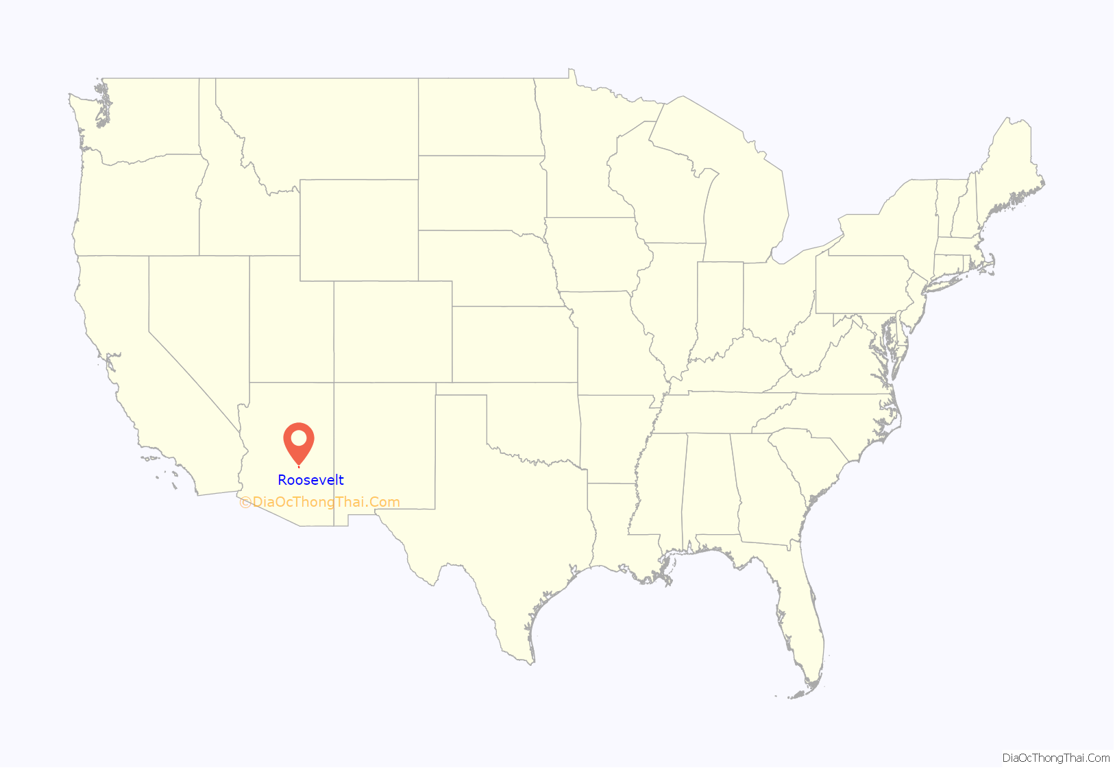
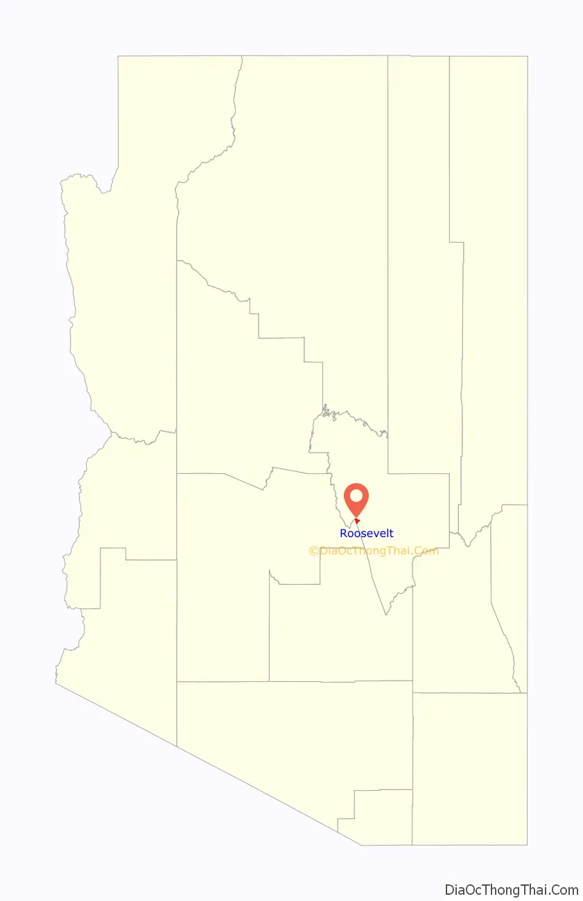
Roosevelt location map. Where is Roosevelt CDP?
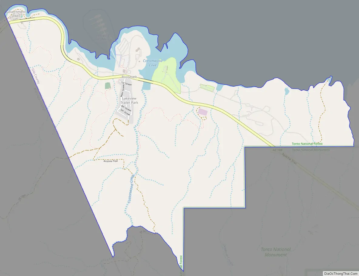
Roosevelt Road Map
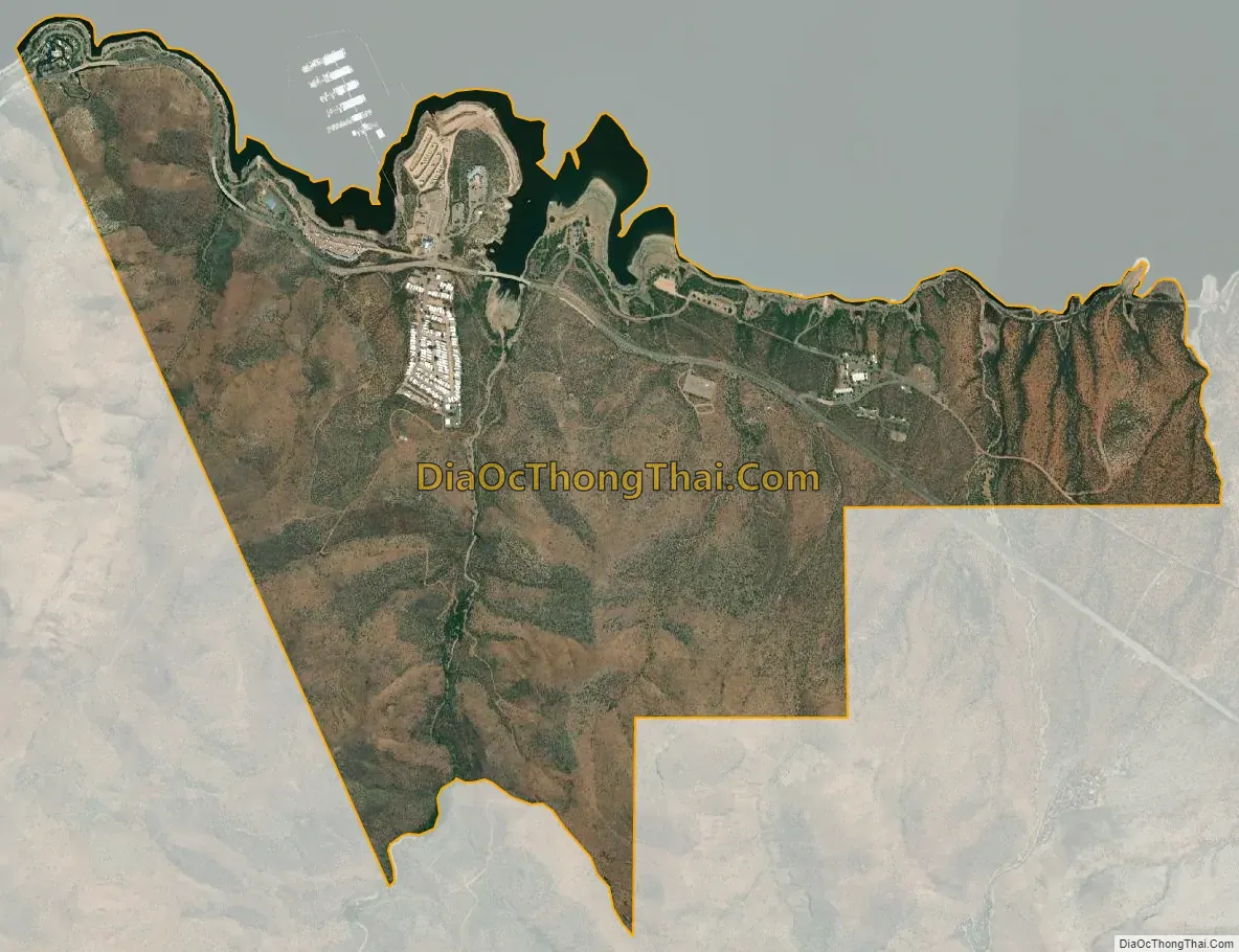
Roosevelt city Satellite Map
Geography
The CDP is located on the western edge of Gila County, on the south side of Theodore Roosevelt Lake, a reservoir on the Salt River. The western boundary of the CDP is the Maricopa County line. Arizona State Route 188 runs through Roosevelt, leading southeast 31 miles (50 km) to Globe, the Gila County seat, and northwest 48 miles (77 km) to Payson. Arizona State Route 88, the Apache Trail, has its northern terminus just west of Roosevelt at the Theodore Roosevelt Dam. The highway, which is unpaved for much of its distance, is a National Scenic Byway and leads southwest 45 miles (72 km) to Apache Junction at the eastern edge of the Phoenix area. The Roosevelt CDP is bordered to the southeast by Tonto National Monument.
According to the United States Census Bureau, the CDP has a total area of 3.1 square miles (8.0 km), of which 0.01 square miles (0.02 km), or 0.28%, is water.
See also
Map of Arizona State and its subdivision: Map of other states:- Alabama
- Alaska
- Arizona
- Arkansas
- California
- Colorado
- Connecticut
- Delaware
- District of Columbia
- Florida
- Georgia
- Hawaii
- Idaho
- Illinois
- Indiana
- Iowa
- Kansas
- Kentucky
- Louisiana
- Maine
- Maryland
- Massachusetts
- Michigan
- Minnesota
- Mississippi
- Missouri
- Montana
- Nebraska
- Nevada
- New Hampshire
- New Jersey
- New Mexico
- New York
- North Carolina
- North Dakota
- Ohio
- Oklahoma
- Oregon
- Pennsylvania
- Rhode Island
- South Carolina
- South Dakota
- Tennessee
- Texas
- Utah
- Vermont
- Virginia
- Washington
- West Virginia
- Wisconsin
- Wyoming


