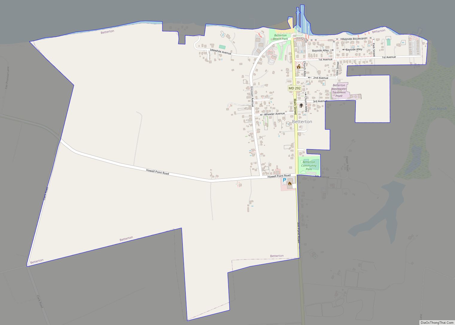
Betterton is a town in Kent County, Maryland, United States. The population was 345 at the 2010 census.
| Name: | Betterton town |
|---|---|
| LSAD Code: | 43 |
| LSAD Description: | town (suffix) |
| State: | Maryland |
| County: | Kent County |
| Incorporated: | 1906 |
| Elevation: | 72 ft (22 m) |
| Total Area: | 1.00 sq mi (2.58 km²) |
| Land Area: | 0.99 sq mi (2.56 km²) |
| Water Area: | 0.01 sq mi (0.02 km²) |
| Total Population: | 286 |
| Population Density: | 288.89/sq mi (111.54/km²) |
| ZIP code: | 21610 |
| Area code: | 410 |
| FIPS code: | 2407200 |
| GNISfeature ID: | 0583196 |
| Website: | townofbetterton.com |
Online Interactive Map
Click on ![]() to view map in "full screen" mode.
to view map in "full screen" mode.
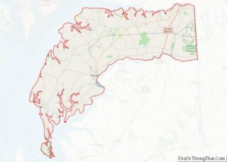
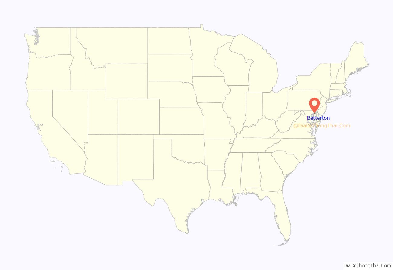
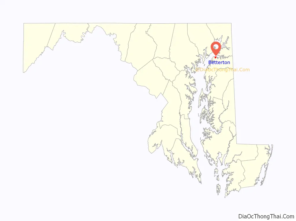
Betterton location map. Where is Betterton town?
History
The recorded history of Betterton dates back to the 17th century. The Fishall Patent was granted in 1664, later becoming known as Fish Hall. The house located at 104 Ericsson Avenue contains foundation bricks dating back to 1698. In 1715, Edward Crew leased Fish Hall and the name was changed to Crews Landing. For the next 100 years, Crews Landing was a small fishing village and then later a port for the waterborne transport of local farm produce to urban markets. In 1851, Richard Townsend Turner (a Quaker) named the town “Betterton” after the family of his wife Elizabeth Betterton. The Turner pier, and later the Ericsson pier, provided access to the town for the shipping trade. Eventually townspeople rented out rooms to the travelers, salesmen, and shippers attracted to the beach. Mr. Turner built the Rigbie Hotel (demolished in August 1986) and Mr. Crownhart built the Belmont Hotel (destroyed by fire in 1956). These were joined by such lodging establishments as the Betterton, the Chesapeake, the Country Cousin, the Southern, and many others.
Steamboat traffic from downtown Baltimore’s “The Basin” (now Inner Harbor) and Philadelphia on the excursion cruises like the Old Bay Line (Baltimore Steam Packet Company, 1840-1962) and the competing Ericsson Line (and others, such as the Wilson Line later) brought the visitors and vacationers from the Middle Atlantic cities. The Ericsson Line was named after John Ericsson (1803-1889), the Swedish-American inventor of the “screw propeller” (and of Civil War revolutionary naval Ironclad warships) to more speedily and efficiently power ships. It was this invention that allowed steamboats to be built with narrow enough beam to allow them to traverse the recently opened Chesapeake and Delaware Canal then only 25 feet wide (before it was later widened and improved), connecting the upper Chesapeake with the Delaware River and Bay. Betterton was an easy and natural stop for boats using the canal and the explosion in steamboat traffic along the American East Coast brought growth and prosperity to Betterton. For some time before the turn of the 20th century, there were 11 scheduled steamboat landings daily at Betterton’s piers. The boom period for Betterton is generally thought to be from 1918 to 1930, when increasing numbers of restaurants, taverns, dance halls, bowling alleys, and amusement arcades all helped create the bayside town’s pleasure resort image.
It eventually declined along with neighboring competing Tolchester and Tolchester Beach after the 1949-1952 construction of the Chesapeake Bay Bridge from Annapolis to Kent Island and increasing automobile traffic over improved U.S. Routes and Interstate Highways systems in following decades to North Atlantic Ocean beaches and growing resort towns there like Ocean City, Maryland and Rehoboth Beach, Delaware
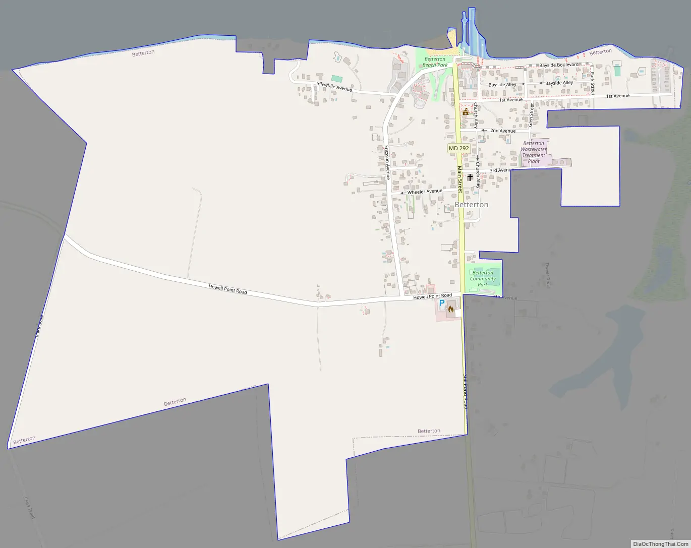
Betterton Road Map
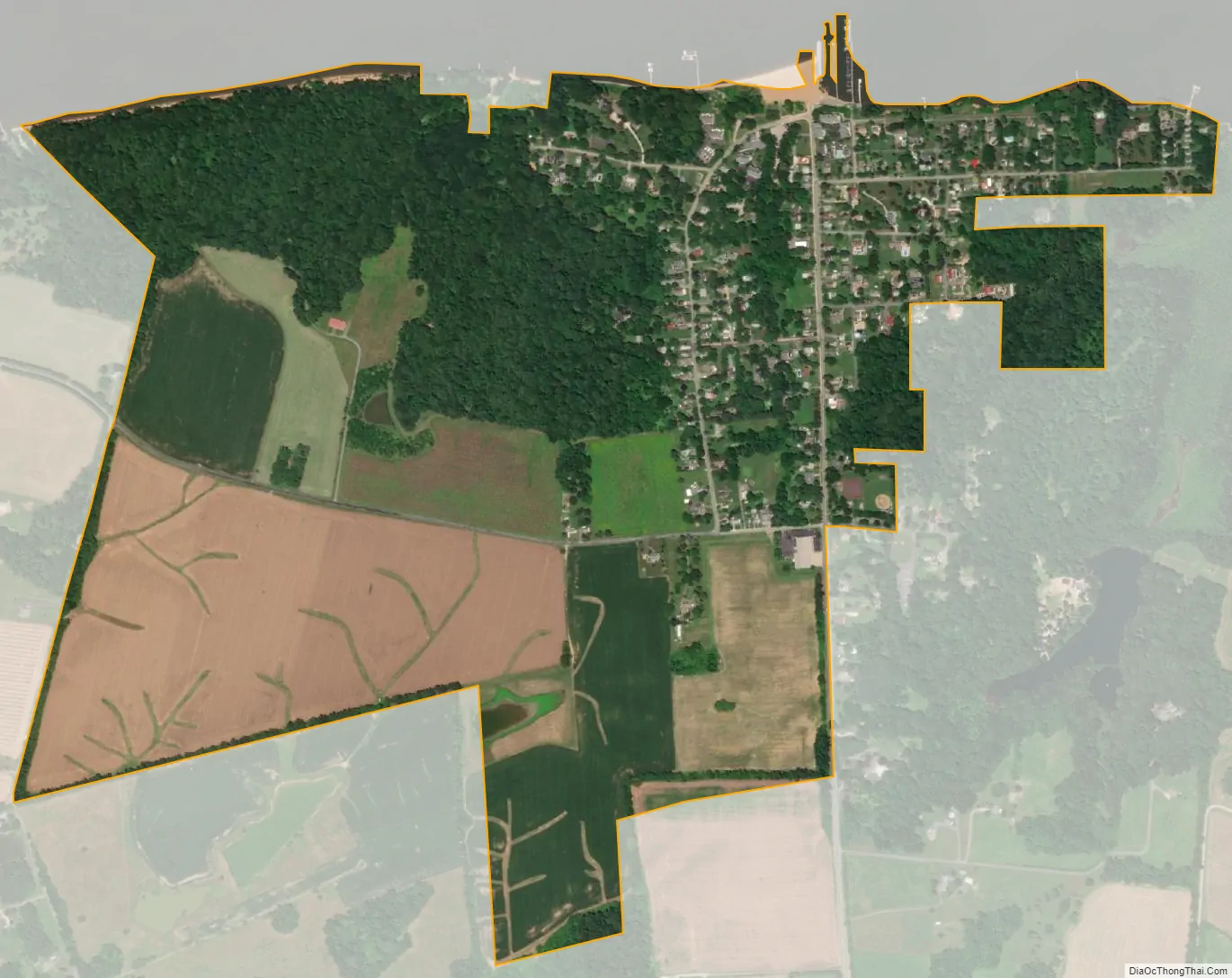
Betterton city Satellite Map
Geography
Betterton is located at the mouth of the Sassafras River on the upper Chesapeake Bay in Kent County, Maryland, on the Eastern Shore region of the Bay and Delmarva Peninsula in the Eastern United States). The GPS coordinates are 39°22′4″N 76°3′39″W / 39.36778°N 76.06083°W / 39.36778; -76.06083 (39.367863, -76.060877).
According to the United States Census Bureau, the town has a total area of 1.00 square mile (2.59 km), of which 0.99 square miles (2.56 km) is land and 0.01 square miles (0.03 km) is water.
See also
Map of Maryland State and its subdivision: Map of other states:- Alabama
- Alaska
- Arizona
- Arkansas
- California
- Colorado
- Connecticut
- Delaware
- District of Columbia
- Florida
- Georgia
- Hawaii
- Idaho
- Illinois
- Indiana
- Iowa
- Kansas
- Kentucky
- Louisiana
- Maine
- Maryland
- Massachusetts
- Michigan
- Minnesota
- Mississippi
- Missouri
- Montana
- Nebraska
- Nevada
- New Hampshire
- New Jersey
- New Mexico
- New York
- North Carolina
- North Dakota
- Ohio
- Oklahoma
- Oregon
- Pennsylvania
- Rhode Island
- South Carolina
- South Dakota
- Tennessee
- Texas
- Utah
- Vermont
- Virginia
- Washington
- West Virginia
- Wisconsin
- Wyoming