Braddock Heights is an unincorporated community and census-designated place (CDP) in Frederick County, Maryland, United States. The population was 2,608 at the 2010 census. The local ZIP codes are 21714 (post office boxes only) and 21703.
| Name: | Braddock Heights CDP |
|---|---|
| LSAD Code: | 57 |
| LSAD Description: | CDP (suffix) |
| State: | Maryland |
| County: | Frederick County |
| Elevation: | 912 ft (278 m) |
| Total Area: | 5.35 sq mi (13.85 km²) |
| Land Area: | 5.34 sq mi (13.82 km²) |
| Water Area: | 0.01 sq mi (0.03 km²) |
| Total Population: | 3,075 |
| Population Density: | 576.27/sq mi (222.50/km²) |
| ZIP code: | 21703 |
| Area code: | 301, 240 |
| FIPS code: | 2409100 |
| GNISfeature ID: | 0589794 |
Online Interactive Map
Click on ![]() to view map in "full screen" mode.
to view map in "full screen" mode.
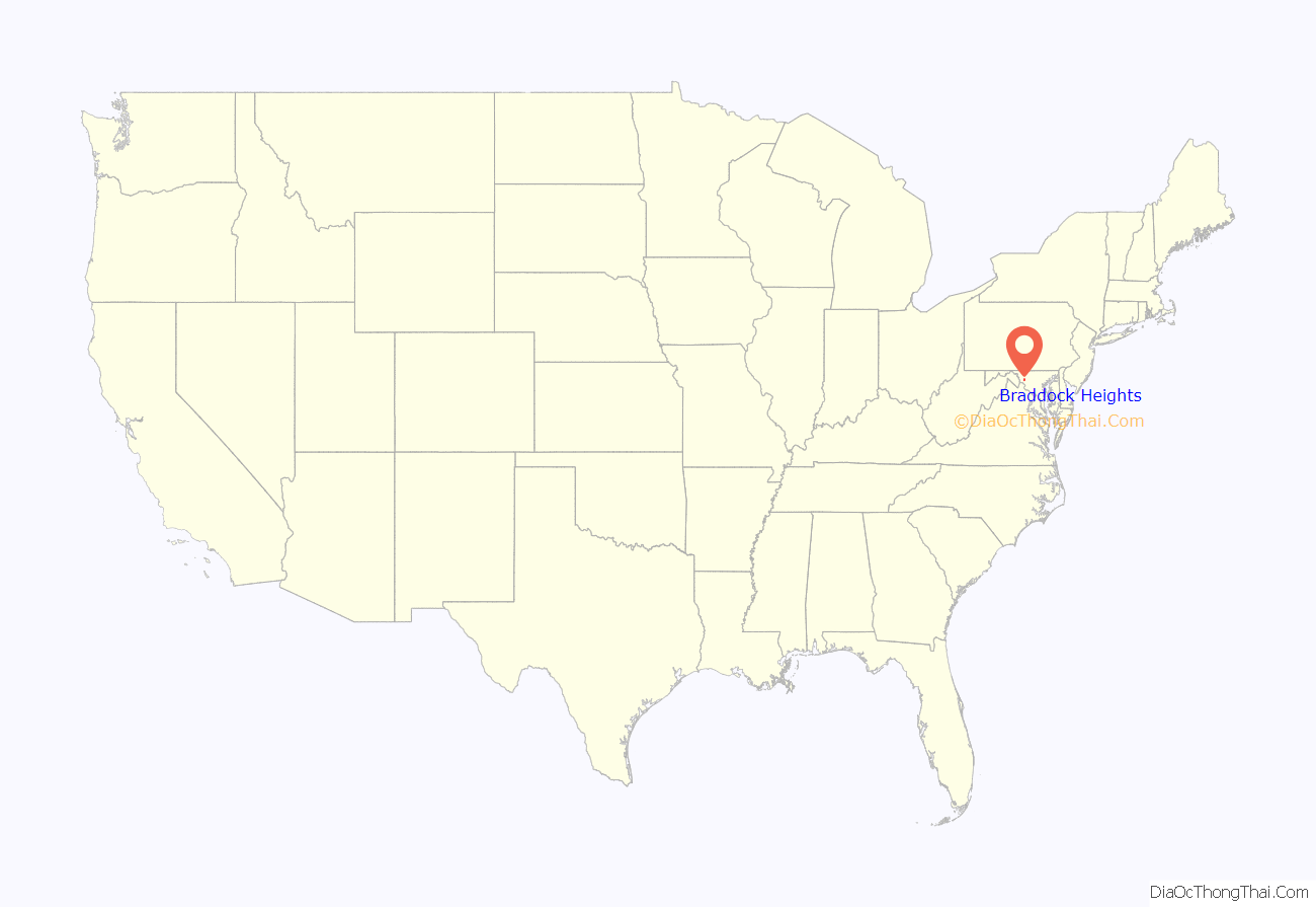
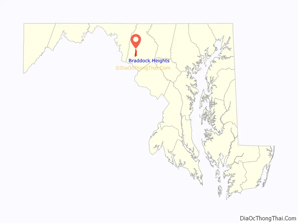
Braddock Heights location map. Where is Braddock Heights CDP?
History
Braddock Heights is located at an elevation of 950 feet (290 m) atop Braddock Mountain (as Catoctin Mountain is locally known) near the pass at Braddock Springs, so named after British General Edward Braddock and Lt. Colonel George Washington’s use of the mountain pass on their way to Fort Duquesne during the French and Indian War on April 29, 1755. During the Civil War, Braddock Heights was the site of a minor cavalry battle between generals J.E.B. Stuart (CSA) and Alfred Pleasonton (USA) on September 13, 1862; it was at that time known as “Fairview Pass”. One mile east of Braddock Heights, near the base of Braddock Mountain, are the older communities of Clifton and Old Braddock.
The picturesque view of the city of Frederick from Old Braddock, also known as “Fairview”, elevation 550 feet (170 m), was the inspiration for Oliver Wendell Holmes, Sr. to record in his 1862 journal:
This journal entry was in turn an inspiration for Holmes’ close friend John Greenleaf Whittier when composing the famous Civil War poem Barbara Fritchie.
Braddock Pass is near the locations at which Interstate 70 and the National Pike (U.S. Route 40) cross Catoctin Mountain. Braddock Heights was founded in 1896 by George William Smith as a summer resort community that eventually included several hotels, a community pool, a wooden-floor skating rink, an amusement park, scenic overlooks, nature trails, and until 1980, a small ski resort. Braddock Heights has been host to many national political figures, including Oliver Wendell Holmes, Sr., Edwin Warfield, President Franklin D. Roosevelt, Earl Warren, Ethel Kennedy, and (then) Senator Richard Nixon.
Braddock Heights was one of the first modern planned communities in the United States, and custom housing development has continued since 1901. Braddock Heights is now known for its eclectic houses and its views of Frederick and the Monocacy and Middletown valleys. Following the end of World War II, and the decline of the amusement park, Braddock Heights’ demographic changed from commercial summer boarding houses to that of an unincorporated community with permanent residents.
Braddock Heights, similar to the other Maryland cottage parks of Pen Mar and Glen Echo, has evolved into an artisans’ community. The Braddock Heights Community Association and the Braddock Heights Historical Society continue to maintain and hold public events at Braddock Heights Park.
Braddock Heights was once home to the oldest roller rink in the United States, the Stargaze Skateway. It burned to the ground as the result of arson on August 18, 1998.
Braddock Heights is said to be the roost of the Snallygaster, a chimeric bird-like creature claimed to be responsible for the disappearance of livestock, and the occasional Middletown Valley resident, since the mid-18th century.
Hagerstown & Frederick Railway
The Hagerstown & Frederick Railway, a suburban and interurban trolley system, was developed by George William Smith and initially called the Frederick and Middletown Railway. Service between Frederick and Braddock Heights commenced on August 22, 1896. The Jefferson branch was added in 1906, running down the east side of Jefferson Boulevard. The right of way is still visible as a strip between the set-back sidewalk and the street.
Service to Jefferson lasted until 1940, although a short section was kept open to serve the Vindobona Hotel. Service to Braddock Heights and Middletown from Frederick was finally discontinued in 1946.
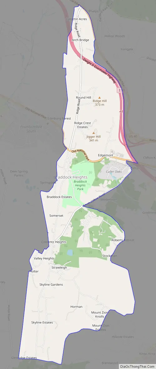
Braddock Heights Road Map
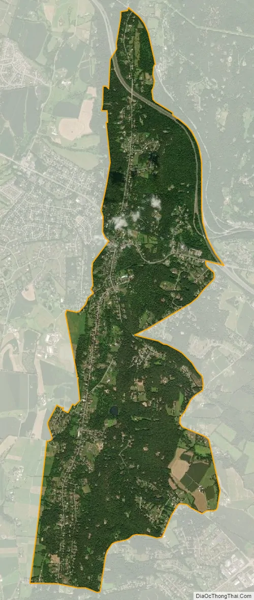
Braddock Heights city Satellite Map
Geography
Braddock Heights is located in west-central Frederick County at 39°25′15″N 77°30′18″W / 39.42083°N 77.50500°W / 39.42083; -77.50500 (39.420895, −77.504931), along the ridgecrest of Catoctin Mountain, known locally as “Braddock Mountain”. U.S. Route 40 Alternate crosses the mountain near the center of the community, leading east 5 miles (8 km) to Frederick and west 2.5 miles (4.0 km) to Middletown. Interstate 70 crosses the northern part of the CDP, with access from partial Exit 49 (U.S. Route 40 Alt.) at the east base of the mountain. U.S. Route 40 forms the northern edge of the CDP.
According to the United States Census Bureau, the Braddock Heights CDP has a total area of 4.7 square miles (12.2 km), of which 0.01 square miles (0.03 km), or 0.23%, is water.
See also
Map of Maryland State and its subdivision: Map of other states:- Alabama
- Alaska
- Arizona
- Arkansas
- California
- Colorado
- Connecticut
- Delaware
- District of Columbia
- Florida
- Georgia
- Hawaii
- Idaho
- Illinois
- Indiana
- Iowa
- Kansas
- Kentucky
- Louisiana
- Maine
- Maryland
- Massachusetts
- Michigan
- Minnesota
- Mississippi
- Missouri
- Montana
- Nebraska
- Nevada
- New Hampshire
- New Jersey
- New Mexico
- New York
- North Carolina
- North Dakota
- Ohio
- Oklahoma
- Oregon
- Pennsylvania
- Rhode Island
- South Carolina
- South Dakota
- Tennessee
- Texas
- Utah
- Vermont
- Virginia
- Washington
- West Virginia
- Wisconsin
- Wyoming


