Cabin John is a census-designated place and an unincorporated area in Montgomery County, Maryland, United States. Its original southern boundary encompassed a section of the Chesapeake and Ohio Canal (C&O) including locks 8–12, and the northern shore of the Potomac River. It is also the access point to Plummers Island, originally owned by The Washington Biologists’ Field Club and called “the most thoroughly studied island in North America.” Cabin John is the location of the Union Arch Bridge built between 1857 and 1864; at the time of its completion, the bridge embodied the longest single-span masonry arch in the world and remains the longest in the United States.
| Name: | Cabin John CDP |
|---|---|
| LSAD Code: | 57 |
| LSAD Description: | CDP (suffix) |
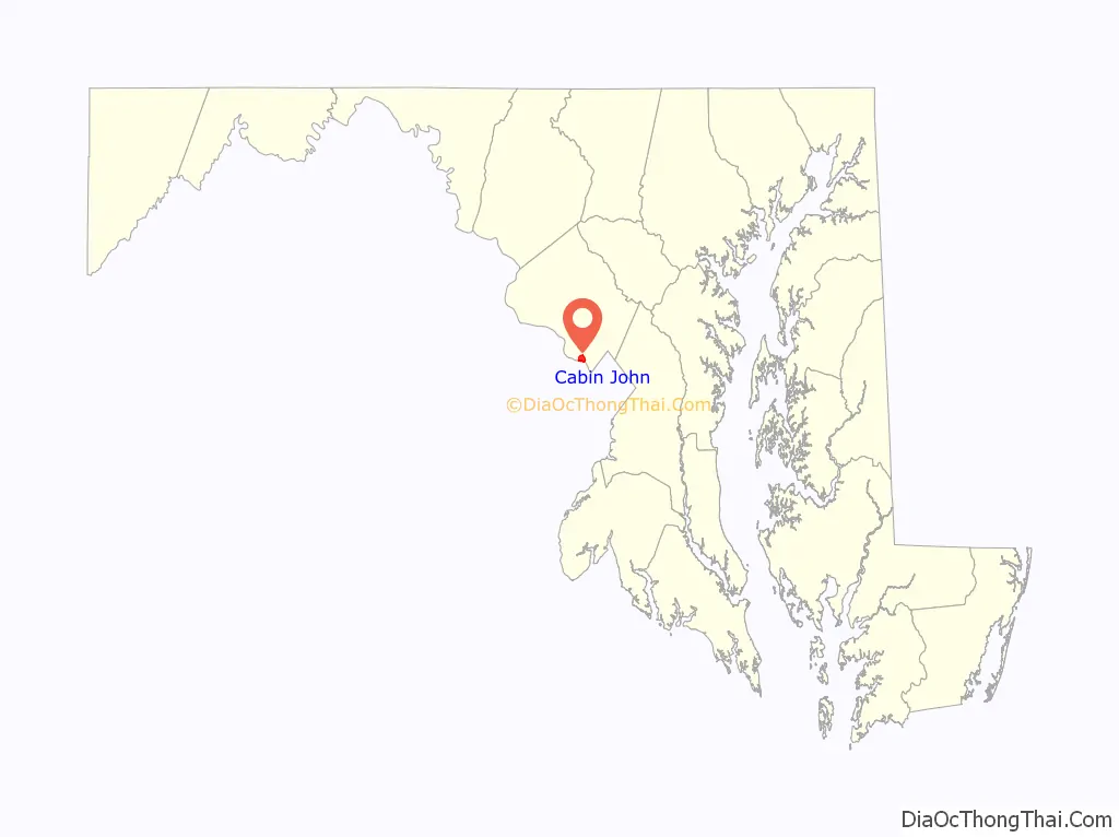
| State: | Maryland |
| County: | Montgomery County |
| Elevation: | 171 ft (52 m) |
| Total Area: | 1.64 sq mi (4.25 km²) |
| Land Area: | 1.22 sq mi (3.16 km²) |
| Water Area: | 0.42 sq mi (1.09 km²) |
| Total Population: | 2,459 |
| Population Density: | 2,015.57/sq mi (778.25/km²) |
| ZIP code: | 20818 |
| Area code: | 301, 240 |
| FIPS code: | 2412075 |
| GNISfeature ID: | 0589873 |
Online Interactive Map
Click on ![]() to view map in "full screen" mode.
to view map in "full screen" mode.
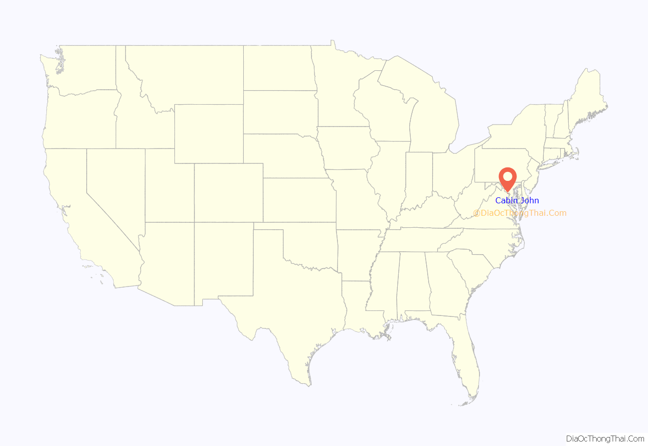
Cabin John location map. Where is Cabin John CDP?
History
Early land records in 1715 cite Captain John’s Run, now Cabin John Creek. The toponym “Cabin John” is thought to be a corruption of the name “Captain John”, but the origin of the name remains unresolved. Immediately adjacent to the west end of the Union Arch Bridge, overlooking the river, was the historic Cabin John Bridge Hotel. Originally a refreshment stand and boarding house for bridge workers, it grew into “a sumptuous establishment frequented by the most powerful politicians and important social figures of Washington, D.C.” In its heydays of the 1890s to early 1900s, “the hotel was so lavish and became so important a destination for Washingtonians that The Washington Post reported about it regularly.”
Bordering Cabin John to the west is Carderock, Maryland where in 1936–1939 the Navy built the David Taylor Model Basin, one of the largest test facilities for ship design in the world. The test basin facility was originally planned for Cabin John, but instead the original 19.27 acre site, bought from Mary Ellen Bobinger, widow of the owner of the Cabin John Hotel, was used to build housing for workmen. “The Navy had 125 homes constructed… 100 for white workers and 25 for black.” The homes were in two small neighborhoods, Cabin John Gardens, off MacArthur Blvd, and Carver Road, off Seven Locks Road. The Cabin John Gardens homes were constructed on the site of the former hotel and sold by the government to employees, with the land itself held as a cooperative—the only single-family development of its kind in the county. Carver Road homes were located about 1/3 of a mile to the northwest and originally rented out for $28 a month. “Of the families who moved there, many are still there, as adult children and grandchildren stayed on.”
Cabin John Road Map

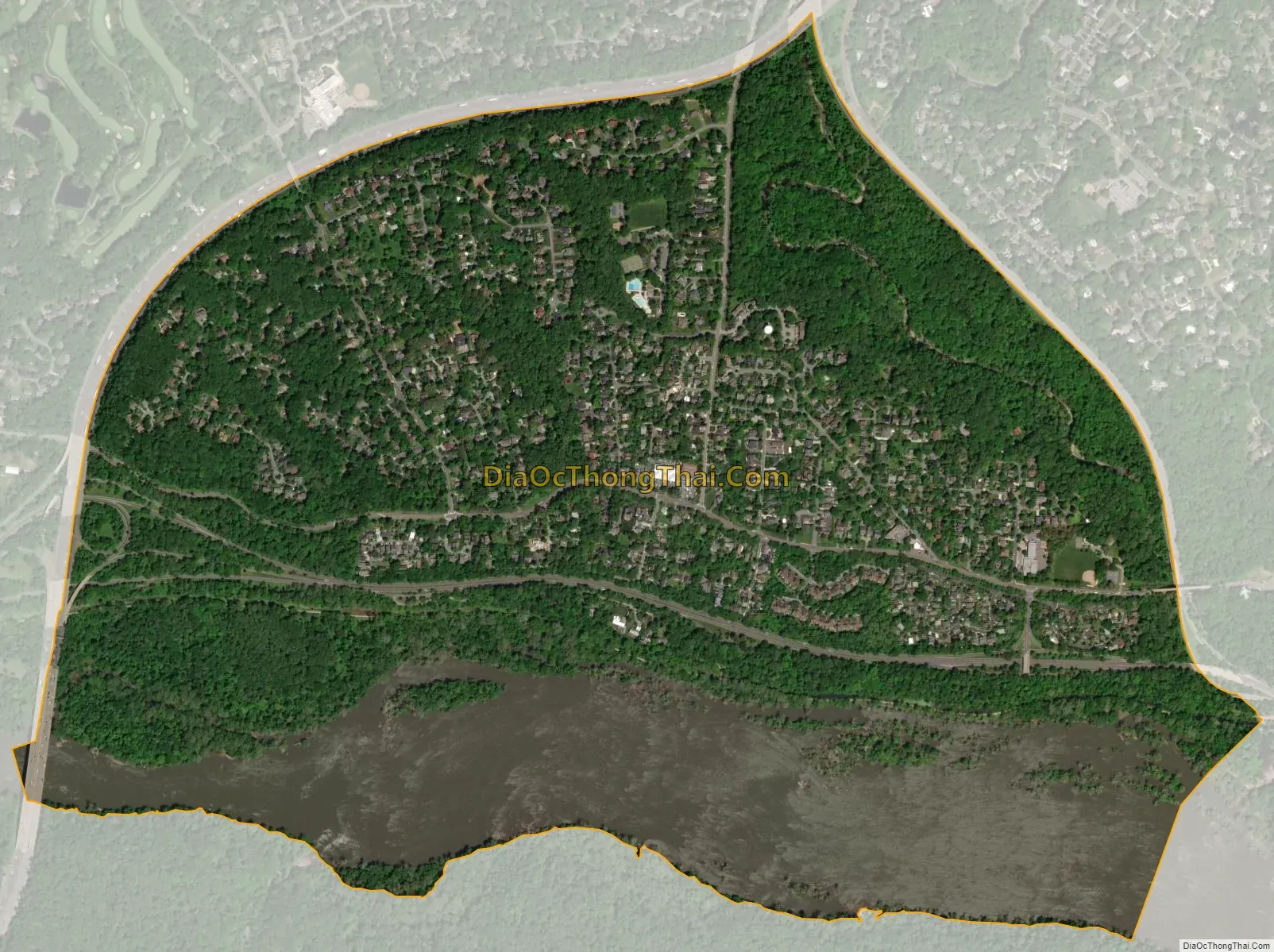
Cabin John city Satellite Map
Geography
As an unincorporated area, Cabin John’s boundaries are not officially defined. Cabin John is, however, recognized by the United States Census Bureau as a census-designated place, and by the United States Geological Survey as a populated place located at 38°58′30″N 77°9′33″W / 38.97500°N 77.15917°W / 38.97500; -77.15917 (38.975110, −77.159281). The borders are roughly defined as the area of land outlined by the Capital Beltway, Cabin John Parkway, and the Clara Barton Parkway.
According to the United States Census Bureau, the place has a total area of 1.3 square miles (3.4 km), of which 1.0 square mile (2.6 km) is land and 0.3 square miles (0.78 km) (25.56%) is water.
Prior to the Clara Barton Parkway, Cabin John was historically viewed as extending down to the northern bank of the Potomac and before the construction of the Cabin John Parkway in the mid-1960s, the area was also considered to extend north to River Road. The Cabin John Parkway is a spur road which connects the Clara Barton Parkway to Capital Beltway following the Cabin John Creek and passing under the Union Arch Bridge. Originally, the banks of the creek nearly reached the full width of the arch, but the parkway required approximately half the creek’s width be converted into roadway.
Historically, Cabin John has been part of the region known as the Potomac Gorge (Potomac Palisades), which is an approximately 15-mile-long corridor or “fall zone” that transitions between the hard bedrock of the Piedmont to the softer rocks and soils of the Atlantic Coastal Plain and representing a drop in elevation from 140 feet to about 10 feet above sea level.
See also
Map of Maryland State and its subdivision: Map of other states:- Alabama
- Alaska
- Arizona
- Arkansas
- California
- Colorado
- Connecticut
- Delaware
- District of Columbia
- Florida
- Georgia
- Hawaii
- Idaho
- Illinois
- Indiana
- Iowa
- Kansas
- Kentucky
- Louisiana
- Maine
- Maryland
- Massachusetts
- Michigan
- Minnesota
- Mississippi
- Missouri
- Montana
- Nebraska
- Nevada
- New Hampshire
- New Jersey
- New Mexico
- New York
- North Carolina
- North Dakota
- Ohio
- Oklahoma
- Oregon
- Pennsylvania
- Rhode Island
- South Carolina
- South Dakota
- Tennessee
- Texas
- Utah
- Vermont
- Virginia
- Washington
- West Virginia
- Wisconsin
- Wyoming


