Bethesda (/bəˈθɛzdə/) is an unincorporated, census-designated place in southern Montgomery County, Maryland, United States. It is located just northwest of Washington, D.C. It takes its name from a local church, the Bethesda Meeting House (1820, rebuilt 1849), which in turn took its name from Jerusalem’s Pool of Bethesda. The National Institutes of Health’s main campus and the Walter Reed National Military Medical Center are in Bethesda, in addition to a number of corporate and government headquarters.
As an unincorporated community, Bethesda has no official boundaries. According to the 2020 U.S. census, the community had a total population of 68,056.
| Name: | Bethesda CDP |
|---|---|
| LSAD Code: | 57 |
| LSAD Description: | CDP (suffix) |
| State: | Maryland |
| County: | Montgomery County |
| Elevation: | 318 ft (97 m) |
| Total Area: | 13.33 sq mi (34.52 km²) |
| Land Area: | 13.26 sq mi (34.35 km²) |
| Water Area: | 0.07 sq mi (0.17 km²) |
| Total Population: | 68,056 |
| Population Density: | 5,131.65/sq mi (1,981.30/km²) |
| FIPS code: | 2407125 |
| GNISfeature ID: | 0583184 |
Online Interactive Map
Click on ![]() to view map in "full screen" mode.
to view map in "full screen" mode.
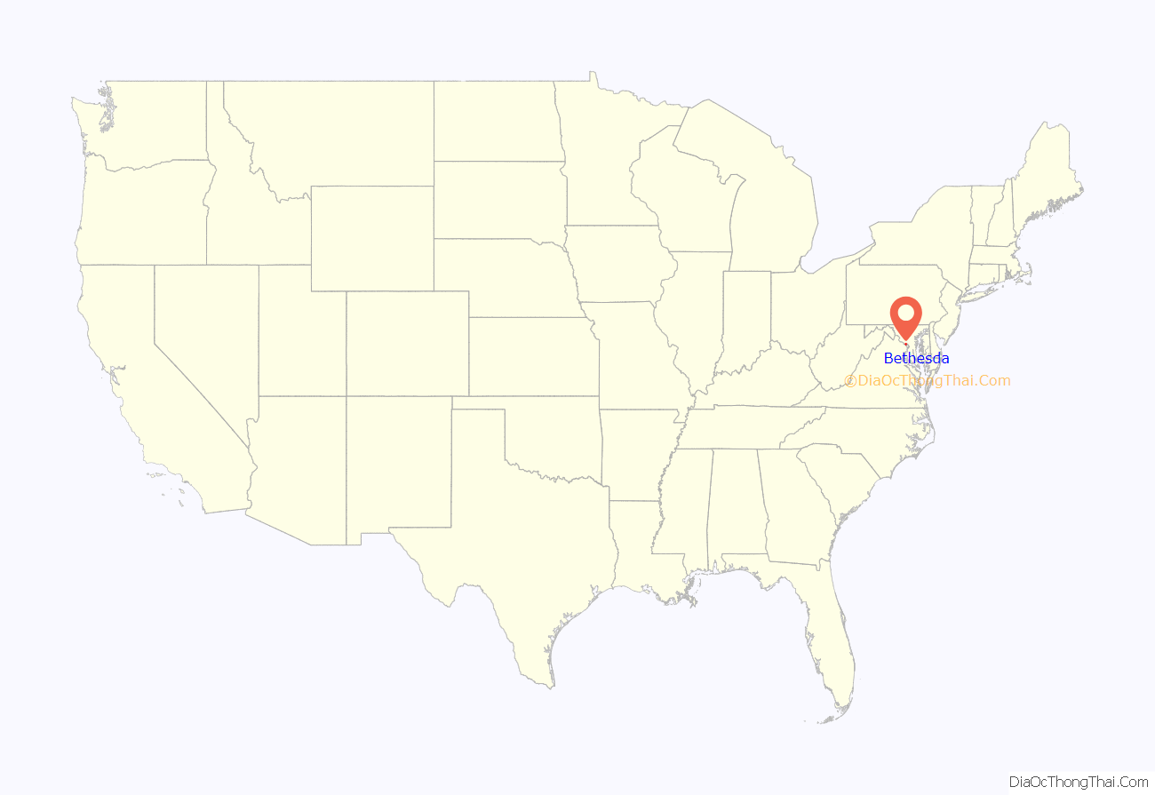
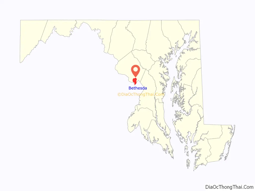
Bethesda location map. Where is Bethesda CDP?
History
Bethesda is located in a region that was populated by the Piscataway and Nacotchtank tribes at the time of European colonization. Fur trader Henry Fleet became the first European to visit the area, reaching it by sailing up the Potomac River. He stayed with the Piscataway tribe from 1623 to 1627, either as a guest or prisoner (historical accounts differ). Fleet eventually secured funding for another expedition to the region and was later granted proprietary rights to 2,000 acres of land in the nascent colony and became a member of Maryland’s colonial legislature. Raids from the Senecas and Susquehannock resulted in the creation of the Maryland division of Rangers in 1694 to patrol the frontier.
Most settlers in colonial Maryland were tenant farmers who paid their rent in tobacco, and colonists continued to expand farther north in search of fertile land. Henry Darnall (1645–1711) surveyed a 710-acre (290-hectare) area in 1694 which became the first land grant in Bethesda. Tobacco farming was the primary way of life in Bethesda throughout the 1700s. The city avoided seeing action during the Revolutionary War, although it became a supply region for the fledgling Continental Navy. The establishment of Washington, D.C. in 1790 deprived Montgomery County of its economic center at Georgetown, although the event had little effect on the small farmers throughout Bethesda.
Between 1805 and 1821, Bethesda became a rural way station after the development of the Washington and Rockville Turnpike, which carried tobacco and other products between Georgetown and Rockville, and north to Frederick. A small settlement grew around a store and tollhouse along the turnpike by 1862 known as “Darcy’s Store”, named after the store’s owner William E. Darcy. The settlement was renamed in 1871 by postmaster Robert Franck after the Bethesda Meeting House, a Presbyterian church built in 1820. The church burned in 1849 and was rebuilt the same year about 100 yards (91 m) south, and its former location became the Cemetery of the Bethesda Meeting House.
Bethesda did not develop beyond a small crossroads village through the 19th century. It consisted of a blacksmith shop, a church and school, and a few houses and stores. In 1852, the postmaster general established a post office in Bethesda and appointed Rev. A. R. Smith its first postmaster. A streetcar line was established in 1890 and suburbanization increased in the early 1900s, and Bethesda grew in population. Communities situated near railroad lines had grown the fastest during the 19th century. Still, mass production of the automobile ended that dependency and Bethesda planners grew the community with the transportation revolution in mind. This included becoming a key stopping point for the B & O railroad on their Georgetown Branch line completed around 1910 that ran from Silver Spring to Georgetown, passing through Bethesda on the way. The branch had a storage yard there and multiple sidings that served the industries in Bethesda in the early 20th century. B & O successor CSX ceased train service on the line in 1985, so the county transformed it into a trail in the rails-to-trails movement. The tracks were removed in 1994, and the first part of the trail was opened in 1998; it has become the most used rail-trail in the United States, averaging over one million users per year.
Subdivisions began to appear on old farmland in the late 19th century, becoming the neighborhoods of Drummond, Woodmont, Edgemoor, and Battery Park. Farther north, several wealthy men made Rockville Pike famous for its mansions. These included Brainard W. Parker (“Cedarcroft”, 1892), James Oyster (“Strathmore”, 1899), George E. Hamilton (“Hamilton House”, 1904; now the Stone Ridge School), Luke I. Wilson (“Tree Tops”, 1926), Gilbert Hovey Grosvenor (“Wild Acres”, 1928–29), and George Freeland Peter (“Stone House”, 1930). In 1930, Dr Armistead Peter’s pioneering manor house “Winona” (1873) became the clubhouse of the Woodmont Country Club on land that is now part of the National Institutes of Health (NIH) campus. Merle Thorpe’s mansion “Pook’s Hill” (1927, razed 1948) became the home-in-exile of the Norwegian Royal Family during World War II.
World War II and the subsequent expansion of government further fed the rapid growth of Bethesda. Both the National Naval Medical Center (1940–42) and the NIH complex (1948) were built just to the north of the developing downtown, and this drew government contractors, medical professionals, and other businesses to the area. In recent years, Bethesda has become the major urban core and employment center of southwestern Montgomery County. This recent vigorous growth has followed the 1984 expansion of Metrorail with a station in Bethesda. Alan Kay built the Bethesda Metro Center over the Red line metro rail, which opened up further commercial and residential development in the immediate vicinity. In the 2000s, the strict height limits on construction in the District of Columbia led to the development of mid-and high-rise office and residential towers around the Bethesda Metro stop, effectively creating a major urban center.
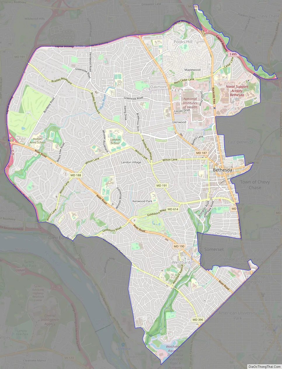
Bethesda Road Map
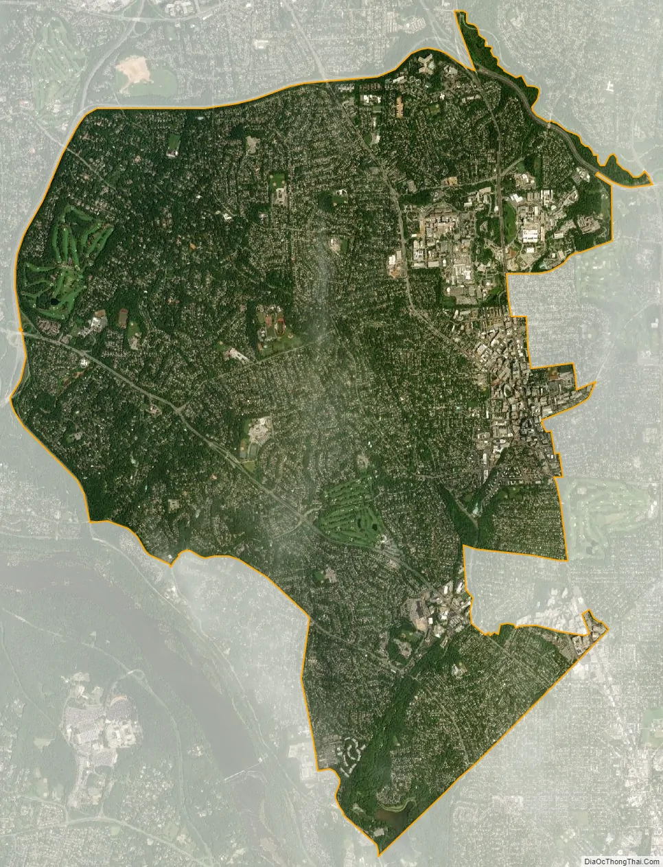
Bethesda city Satellite Map
Geography
According to the U.S. Census Bureau, the CDP has a total area of 13.2 square miles (34 km), of which 13.1 square miles (34 km) is land and 0.1 square miles (0.26 km) (0.38%) is water. The main commercial corridor that passes through Bethesda is Maryland Route 355 (known as Wisconsin Avenue in Bethesda and as Rockville Pike and Hungerford Drive in more northern communities), which, to the north, connects Bethesda with the communities of North Bethesda and Rockville, ending, after several name changes, in Frederick. Toward the South, Rockville Pike becomes Wisconsin Avenue near the NIH Campus and continues beyond Bethesda through Chevy Chase, Friendship Heights and into Washington, D.C., ending in Georgetown.
The area commonly known as Downtown Bethesda is centered at the intersection of Wisconsin Avenue, Old Georgetown Road and East-West Highway. This intersection is approximately two and one-half miles from Washington, DC’s western boundary, making Bethesda a close-in suburb of Washington. Other focal points of downtown Bethesda include the Woodmont Triangle, bordered by Old Georgetown Road (Maryland Route 187), Woodmont and Rugby Avenues, and the Bethesda Row, centered at the intersection of Woodmont Avenue and Bethesda Avenue. Much of the dense construction in that area followed the opening of the Bethesda station on the Red Line of the Washington Metro rapid transit system, also located at this intersection and the centerpiece of the Bethesda Metro Center development. The Medical Center Metro stop lies approximately 0.7 miles north of the Bethesda stop, Medical Center, which serves the NIH Campus, the Walter Reed National Military Medical Center, and the Uniformed Services University of the Health Sciences.
See also
Map of Maryland State and its subdivision: Map of other states:- Alabama
- Alaska
- Arizona
- Arkansas
- California
- Colorado
- Connecticut
- Delaware
- District of Columbia
- Florida
- Georgia
- Hawaii
- Idaho
- Illinois
- Indiana
- Iowa
- Kansas
- Kentucky
- Louisiana
- Maine
- Maryland
- Massachusetts
- Michigan
- Minnesota
- Mississippi
- Missouri
- Montana
- Nebraska
- Nevada
- New Hampshire
- New Jersey
- New Mexico
- New York
- North Carolina
- North Dakota
- Ohio
- Oklahoma
- Oregon
- Pennsylvania
- Rhode Island
- South Carolina
- South Dakota
- Tennessee
- Texas
- Utah
- Vermont
- Virginia
- Washington
- West Virginia
- Wisconsin
- Wyoming


