Aspen Hill is a census-designated place and an unincorporated area in Montgomery County, Maryland, United States. It is located 6 miles north of Washington D.C. Its population as of the 2020 census was 51,063.
| Name: | Aspen Hill CDP |
|---|---|
| LSAD Code: | 57 |
| LSAD Description: | CDP (suffix) |
| State: | Maryland |
| County: | Montgomery County |
| Elevation: | 328 ft (100 m) |
| Total Area: | 9.58 sq mi (24.81 km²) |
| Land Area: | 9.50 sq mi (24.60 km²) |
| Water Area: | 0.08 sq mi (0.21 km²) |
| Total Population: | 51,063 |
| Population Density: | 5,376.18/sq mi (2,075.79/km²) |
| ZIP code: | 20853, 20906, 20916 |
| FIPS code: | 2402825 |
| GNISfeature ID: | 0589663 |
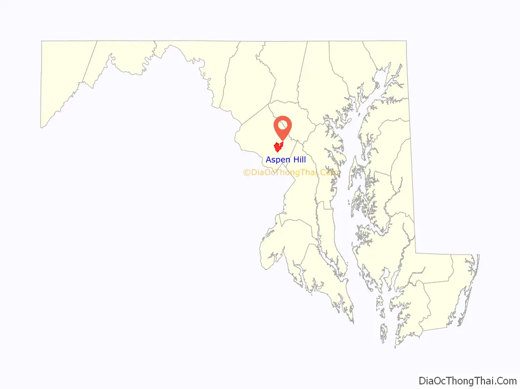
Online Interactive Map
Click on ![]() to view map in "full screen" mode.
to view map in "full screen" mode.
Aspen Hill location map. Where is Aspen Hill CDP?

History
In the 1920s and 1930s, Aspen Hill was known as being the location of Aspin Hill Memorial Park, one of three pet cemeteries then operating on the East Coast of the United States. Burials at Aspen Hill Cemetery included dogs that had served the during World War I as well as the pets of area residents. Memorial ceremonies honoring pets were often held there on World Day for Animals.
In July 1950, Louis M. Denit sold 517 acres (2.1 km) of land in Aspen Hill to Gelman Construction Company for approximately $300,000. Denit was a well-known attorney who specialized in banking and trust law. Gelman Construction Company bought the land in order to build 2,450 three-bedroom ramblers, a shopping center, schools, playgrounds, and churches. The homes were priced at less $10,000 each.
In January 1955, Minnie Goodman sold 268 acres (1.1 km) of land in Aspen Hill to Metropolitan Homes, Inc. At the time, the land was the last vacant tract of land of its size between Rockville and Wheaton. Metropolitan Homes planned to build 12,000 homes, schools, shopping centers, and churches on the land. Prices for the homes started at $15,000 each.
Aspen Hill was one of the locations in which a fatal shooting took place in October 2002 as part of the Beltway sniper attacks.
Aspen Hill Road Map
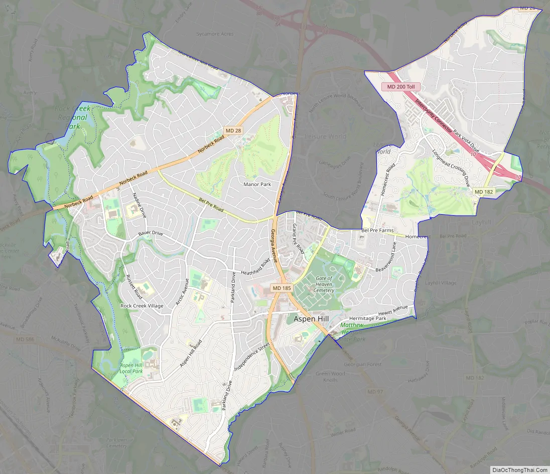
Aspen Hill city Satellite Map

Geography
As a census-designated place, Aspen Hill’s boundaries are defined by the U.S. Census Bureau. The United States Postal Service does not accept “Aspen Hill” as a place name; addresses in the community must use the place names Rockville, Silver Spring, or Wheaton.
Some addresses use Wheaton (20906), notably in the Aspen Hill Shopping Center, while immediately across Aspen Hill Road at the Northgate Plaza Shopping Center, the addresses use Silver Spring (20906). Immediately to the west across Connecticut Avenue, addresses use Rockville (20853). As a result, crime statistics which are reasonably considered as belonging to Aspen Hill are buried in the statistics of three different areas. Aspen Hill straddles a corner where three statistical areas meet in what locals consider the commercial heart of Aspen Hill.
The United States Census Bureau, defines Aspen Hill as a census-designated place located at 39°6′ North, 77°5′ West. In the 2000 Census Bureau Gazetteer, Aspen Hill was located at 39°5′19″N 77°4′49″W / 39.08861°N 77.08028°W / 39.08861; -77.08028 (39.088525, −77.080267).
The United States Geological Survey definition of Aspen Hill is centered at 39°4′46″N 77°4′24″W / 39.07944°N 77.07333°W / 39.07944; -77.07333, somewhat different from either of the Census Bureau’s definitions.
Other organizations, such as the Aspen Hill Civic Association, Inc. (AHCA) (2021), have their own definitions. For the most accurate boundaries and geographical map of the AHCA visit Aspen Hill Civic Association, Inc., Boundaries & Map (AHCA) (2021). This an archived website from the early 2000’s Aspen Hill Civic Association, Inc.. The Aspen Hill Civic Association, Inc. has been serving the community since 1985 for over 35 years in Aspen Hill, Montgomery County, Maryland.
Other local resources such as the Montgomery Gazette and the Washington Post use a more broad definition. Generally speaking, if it is not a part of Manor Country Club or Leisure World, and is south of Norbeck Road and north of Veirs Mill Road, east of Rock Creek and west of Bel Pre Creek or Matthew Henson State Park or Matthew Henson Greenway, the local media consider it to be Aspen Hill.
According to the United States Census Bureau, the community has a total area of 10.5 square miles (27 km), of which 10.5 square miles (27 km) is land and 0.1 square miles (0.26 km) (0.57%) is water.
See also
Map of Maryland State and its subdivision: Map of other states:- Alabama
- Alaska
- Arizona
- Arkansas
- California
- Colorado
- Connecticut
- Delaware
- District of Columbia
- Florida
- Georgia
- Hawaii
- Idaho
- Illinois
- Indiana
- Iowa
- Kansas
- Kentucky
- Louisiana
- Maine
- Maryland
- Massachusetts
- Michigan
- Minnesota
- Mississippi
- Missouri
- Montana
- Nebraska
- Nevada
- New Hampshire
- New Jersey
- New Mexico
- New York
- North Carolina
- North Dakota
- Ohio
- Oklahoma
- Oregon
- Pennsylvania
- Rhode Island
- South Carolina
- South Dakota
- Tennessee
- Texas
- Utah
- Vermont
- Virginia
- Washington
- West Virginia
- Wisconsin
- Wyoming


