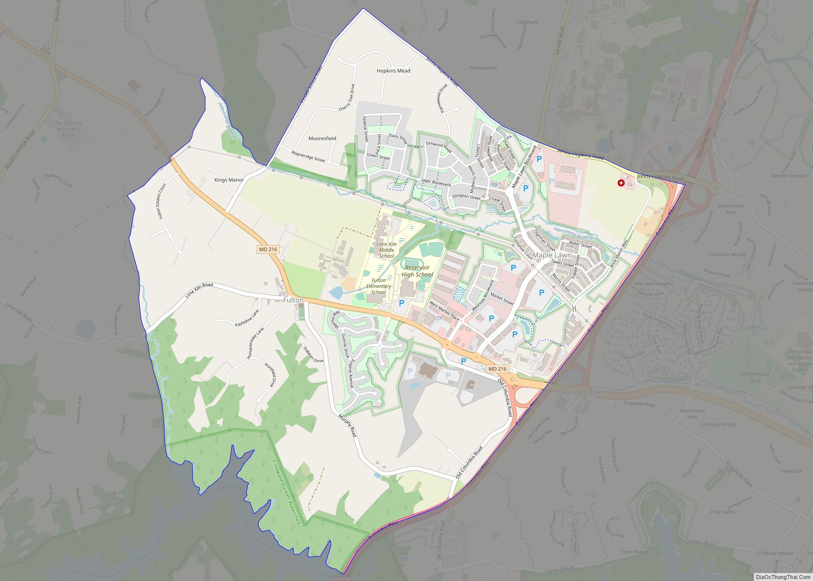
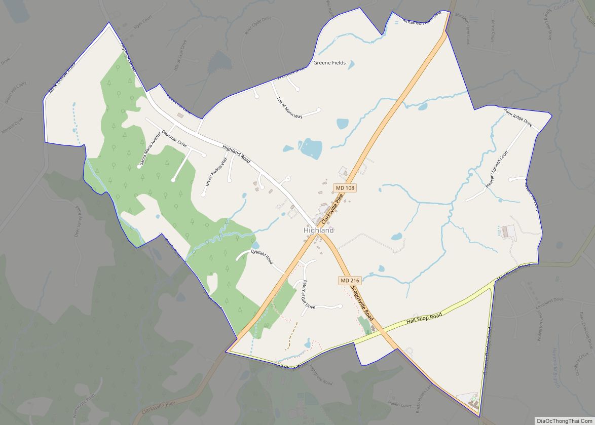
Highland is an unincorporated community and census-designated place in Howard County, Maryland, United States. As of the 2020 census it had a population of 1,133. It uses the 20777 zip code.
| Name: | Highland CDP |
|---|---|
| LSAD Code: | 57 |
| LSAD Description: | CDP (suffix) |
| State: | Maryland |
| County: | Howard County |
| Elevation: | 520 ft (160 m) |
| Total Area: | 2.42 sq mi (6.27 km²) |
| Land Area: | 2.41 sq mi (6.23 km²) |
| Water Area: | 0.01 sq mi (0.04 km²) |
| Total Population: | 1,133 |
| Population Density: | 470.91/sq mi (181.80/km²) |
| ZIP code: | 20777 |
| FIPS code: | 2438475 |
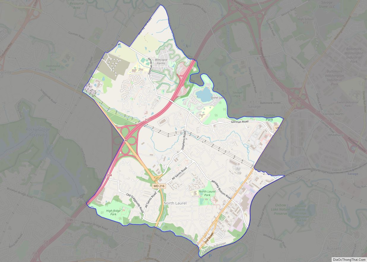
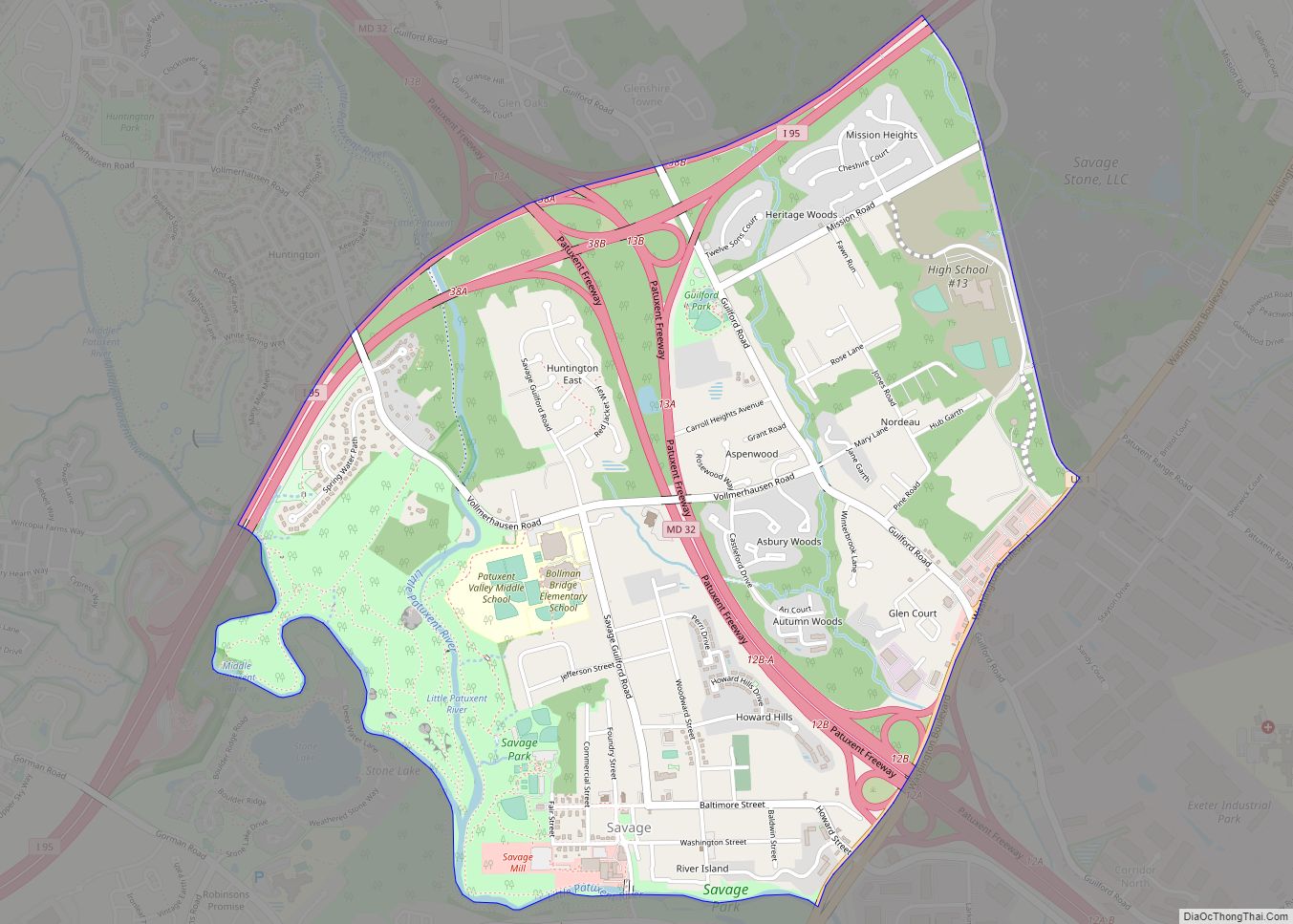
Online Interactive Map
Click on ![]() to view map in "full screen" mode.
to view map in "full screen" mode.
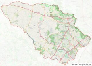
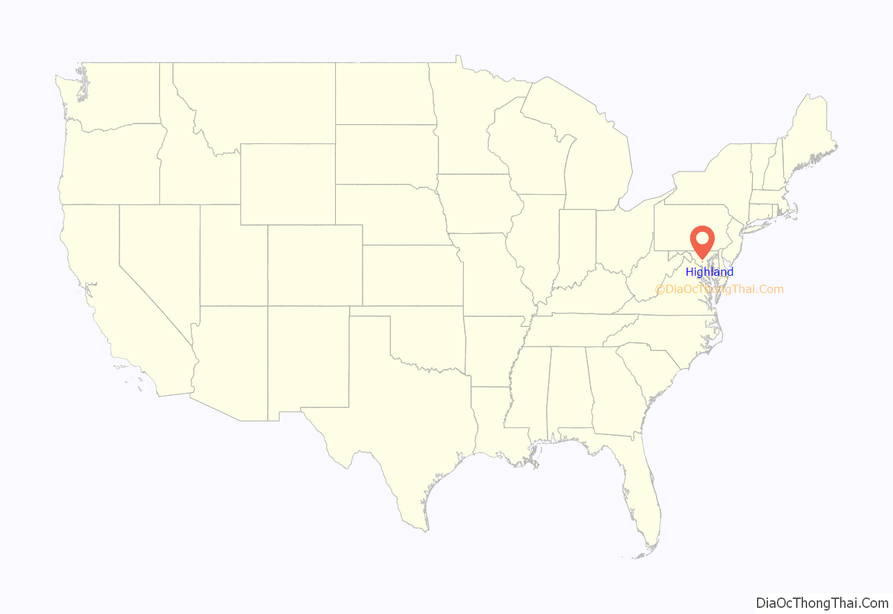
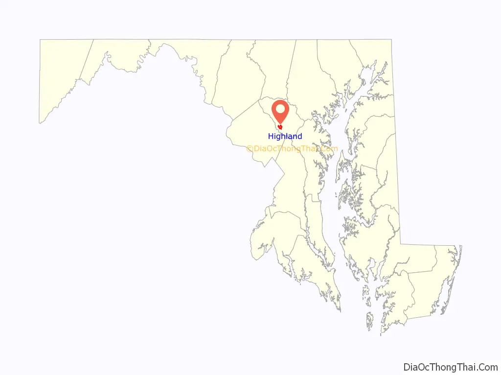
Highland location map. Where is Highland CDP?
History
The majority of the downtown Highland district is situated within the 418-acre (169 ha) land grant named “Hickory Ridge”. The Rouse Company borrowed the land grant name for one of its nearby villages of Columbia, built in 1974. The historic “White Hall” or “Hickory Ridge” estate (1749) was owned by the Ridgely, Hopkins and Disney families. One of the earliest businesses at the crossroads was Well’s tavern, founded by Richard Wells in 1759. This was replaced with a wheelwright’s shop by Joshua B. Disney in 1842. The same year, William Wall opened a general store and post office, giving the crossroads the short-lived name of “Walls Crossroads” before another name change of the post office on December 2, 1878, to “Highland” to reflect the town’s elevation in Howard County. The County Commissioners added Hall Shop Road on the southern side of the community in 1877. The town did not receive direct rail service, but was only nine miles away from the B&O railroad in Laurel, Maryland using the rolling road now known as Route 216.
A literary club formed in Highland in the late 19th century; J. B. Warfield in describing the Highland of 1904 refers to it as the “literary center of the county”.
Highland played several important roles in U.S. history. The town housed meetings that affected the events of the Boston Tea Party. Well’s Tavern (now the Kitty Bed and Breakfast) was the primary meeting place of a group of Northern sympathizers in the Civil War.
The Virginia Hardy Boarding School provided classes for students during the turn of the century.
In 2015, the group Preservation Howard County placed the crossroads on its top 10 most endangered site list.
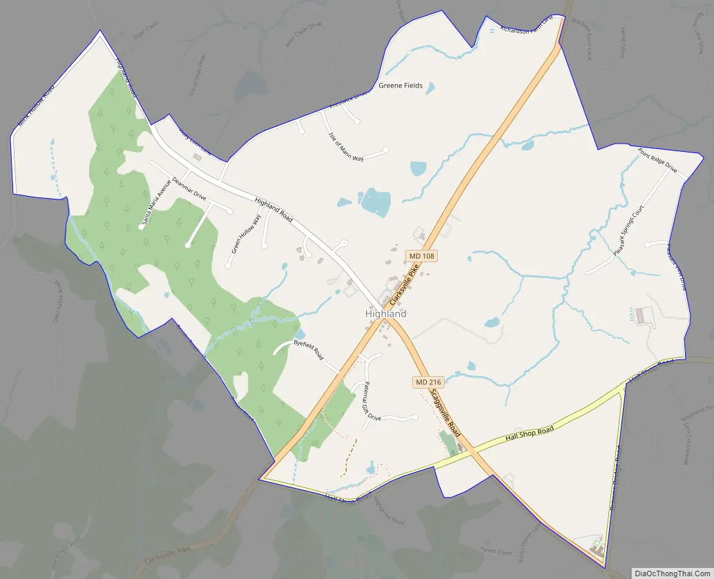
Highland Road Map
Highland city Satellite Map

Geography
The community is located in southern Howard County at the junction of Highland Road, Maryland Route 216 and Maryland Route 108, and is still heavily influenced by its agrarian history; farms and horse fields are common in the area. The crossroads itself has a small-town feel, with various shops including some that share in the town history. Clarksville is 2 miles (3 km) to the north on MD 108, Laurel is 9 miles (14 km) to the southeast on MD 216, and Olney is 7 miles (11 km) to the west on MD 108. The center of Columbia is 8 miles (13 km) to the northeast.
See also
Map of Maryland State and its subdivision: Map of other states:- Alabama
- Alaska
- Arizona
- Arkansas
- California
- Colorado
- Connecticut
- Delaware
- District of Columbia
- Florida
- Georgia
- Hawaii
- Idaho
- Illinois
- Indiana
- Iowa
- Kansas
- Kentucky
- Louisiana
- Maine
- Maryland
- Massachusetts
- Michigan
- Minnesota
- Mississippi
- Missouri
- Montana
- Nebraska
- Nevada
- New Hampshire
- New Jersey
- New Mexico
- New York
- North Carolina
- North Dakota
- Ohio
- Oklahoma
- Oregon
- Pennsylvania
- Rhode Island
- South Carolina
- South Dakota
- Tennessee
- Texas
- Utah
- Vermont
- Virginia
- Washington
- West Virginia
- Wisconsin
- Wyoming