Laytonsville is a town in Montgomery County, Maryland, United States. The population was 353 at the 2010 census. Laytonsville was incorporated in 1892.
| Name: | Laytonsville town |
|---|---|
| LSAD Code: | 43 |
| LSAD Description: | town (suffix) |
| State: | Maryland |
| County: | Montgomery County |
| Incorporated: | 1892 |
| Elevation: | 614 ft (187 m) |
| Total Area: | 1.05 sq mi (2.72 km²) |
| Land Area: | 1.05 sq mi (2.71 km²) |
| Water Area: | 0.00 sq mi (0.01 km²) |
| Total Population: | 572 |
| Population Density: | 546.32/sq mi (211.02/km²) |
| ZIP code: | 20879, 20882 |
| Area code: | 301, 240 |
| FIPS code: | 2446250 |
| GNISfeature ID: | 0585383 |
| Website: | www.laytonsville.md.us |
Online Interactive Map
Click on ![]() to view map in "full screen" mode.
to view map in "full screen" mode.
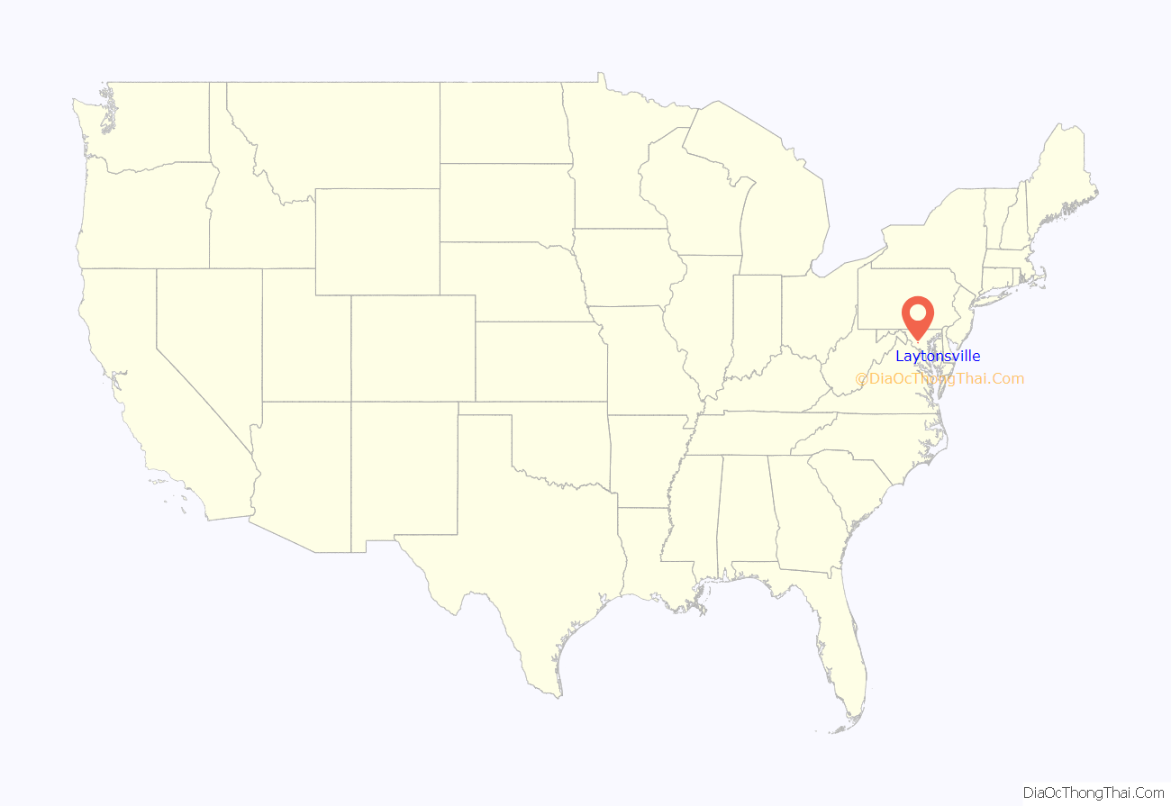
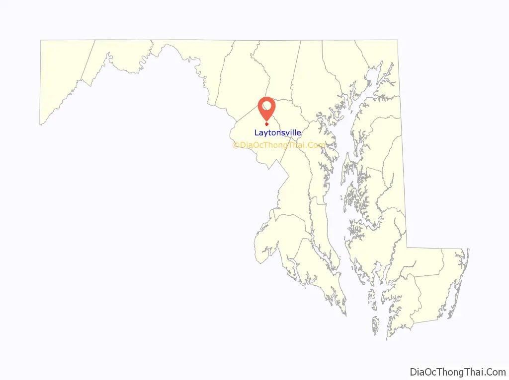
Laytonsville location map. Where is Laytonsville town?
History
Laytonsville has stood as a crossroad to the history of Maryland for over two centuries. The intersection of the northern district of the town provides a route to the major metropolitan areas of the state—Damascus and Frederick County, to the east to Baltimore, to the south toward Washington, and to the west, the Potomac River. Although Laytonsville is still a cozy town, its small size, 614 acres and a population of 295, belie its long and interesting history.
Laytonsville was originally known as Cracklintown. This name originated from the popular cracklin bread, which was baked in the locale. This recipe, essentially a bacon corn bread, also lent the entire area the name of Cracklin District. The original town extended beyond Laytonsville’s current boundaries, along Sundown Road toward the Hawlings River. The earliest church, school, and store were in this area. The first major transit road through Cracklintown was built in the early 1800s. This was the Brink-Sundown Road, referred to in documents from the early 1800s as the “road from the mouth of the Monocacy to Ellicotts Mills.”
The road which would become Route 108 appears in the historical record to have been added in the very early 1800s. This crossroads provided a major artery for cattle and pigs headed for the bustling markets of Baltimore, and established the town as a comfortable stopover for the drovers. By the early nineteenth century, substantial brick buildings were being constructed, such as the Layton House and a tavern across the road. By 1850, the southeast corner of the crossroads was developed. Much of the rest of the town along Rt. 108 was not developed until the 1870s.
A second reason for the development of the town was the successful farming in the area. Laytonsville farmers were blessed by the quality of the soil, a Manor loam or Chester loam, very fertile and well drained, but a soil which does not dry out too quickly. Under the loam lies a subsoil of red clay which assists in holding the moisture for roots even during hot, dry summers.
Laytonsville was incorporated in 1892.
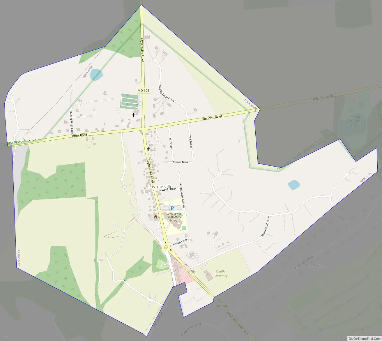
Laytonsville Road Map
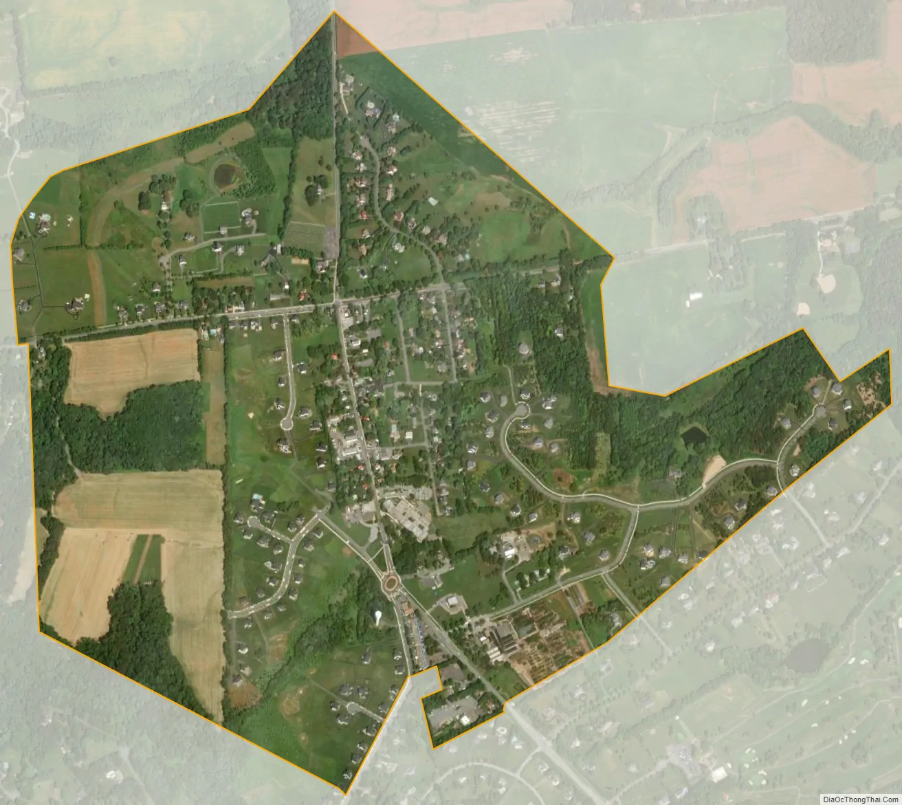
Laytonsville city Satellite Map
Geography
Laytonsville is located at 39°12′41″N 77°8′24″W / 39.21139°N 77.14000°W / 39.21139; -77.14000 (39.211256, -77.140134). According to the United States Census Bureau, the town has a total area of 1.04 square miles (2.69 km), all land. The town has more of a small town, rural character than nearby Olney. There are a number of tracts of farmland on the outskirts, as well as numerous homes on large plots of land.
See also
Map of Maryland State and its subdivision: Map of other states:- Alabama
- Alaska
- Arizona
- Arkansas
- California
- Colorado
- Connecticut
- Delaware
- District of Columbia
- Florida
- Georgia
- Hawaii
- Idaho
- Illinois
- Indiana
- Iowa
- Kansas
- Kentucky
- Louisiana
- Maine
- Maryland
- Massachusetts
- Michigan
- Minnesota
- Mississippi
- Missouri
- Montana
- Nebraska
- Nevada
- New Hampshire
- New Jersey
- New Mexico
- New York
- North Carolina
- North Dakota
- Ohio
- Oklahoma
- Oregon
- Pennsylvania
- Rhode Island
- South Carolina
- South Dakota
- Tennessee
- Texas
- Utah
- Vermont
- Virginia
- Washington
- West Virginia
- Wisconsin
- Wyoming


