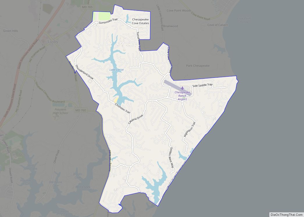
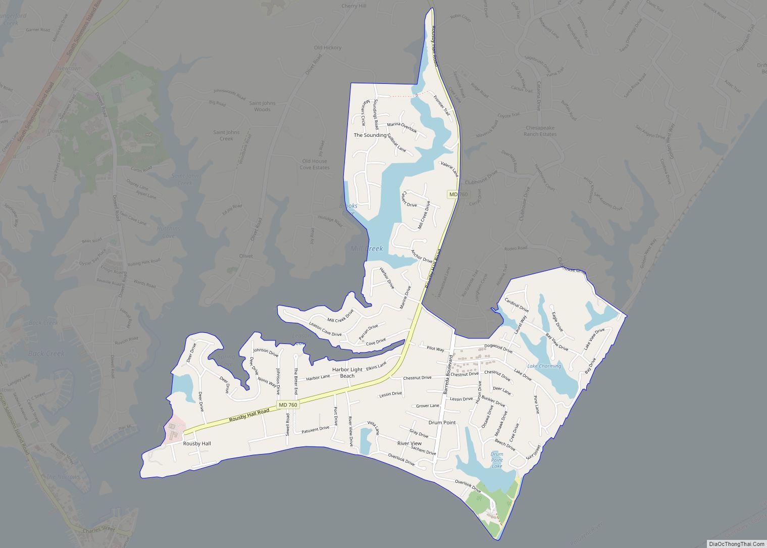
Lusby is an unincorporated community and census-designated place (CDP) in Calvert County, Maryland, United States. The population of the CDP was 1,835 at the 2010 census. Residents of the Chesapeake Ranch Estates and Drum Point communities also use the Lusby ZIP code designation.
| Name: | Lusby CDP |
|---|---|
| LSAD Code: | 57 |
| LSAD Description: | CDP (suffix) |
| State: | Maryland |
| County: | Calvert County |
| Elevation: | 105 ft (32 m) |
| Total Area: | 3.68 sq mi (9.53 km²) |
| Land Area: | 3.51 sq mi (9.10 km²) |
| Water Area: | 0.17 sq mi (0.43 km²) |
| Total Population: | 2,072 |
| Population Density: | 589.81/sq mi (227.72/km²) |
| ZIP code: | 20657 |
| Area code: | 410 |
| FIPS code: | 2448800 |
| GNISfeature ID: | 0590708 |
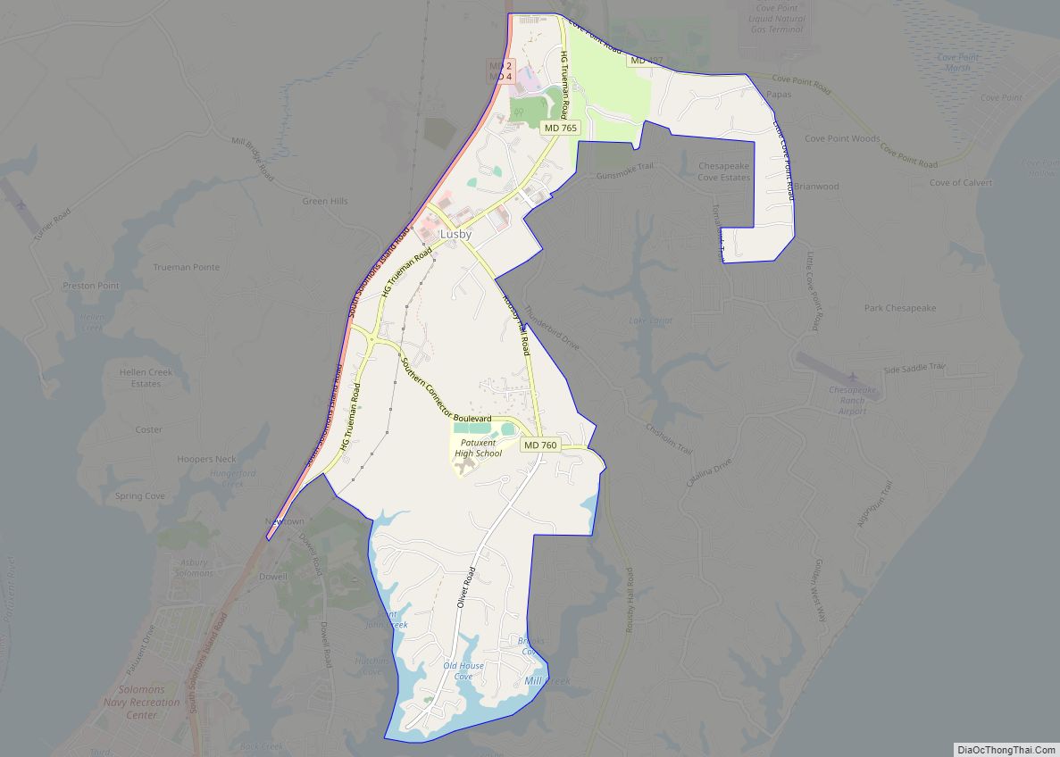
Online Interactive Map
Click on ![]() to view map in "full screen" mode.
to view map in "full screen" mode.
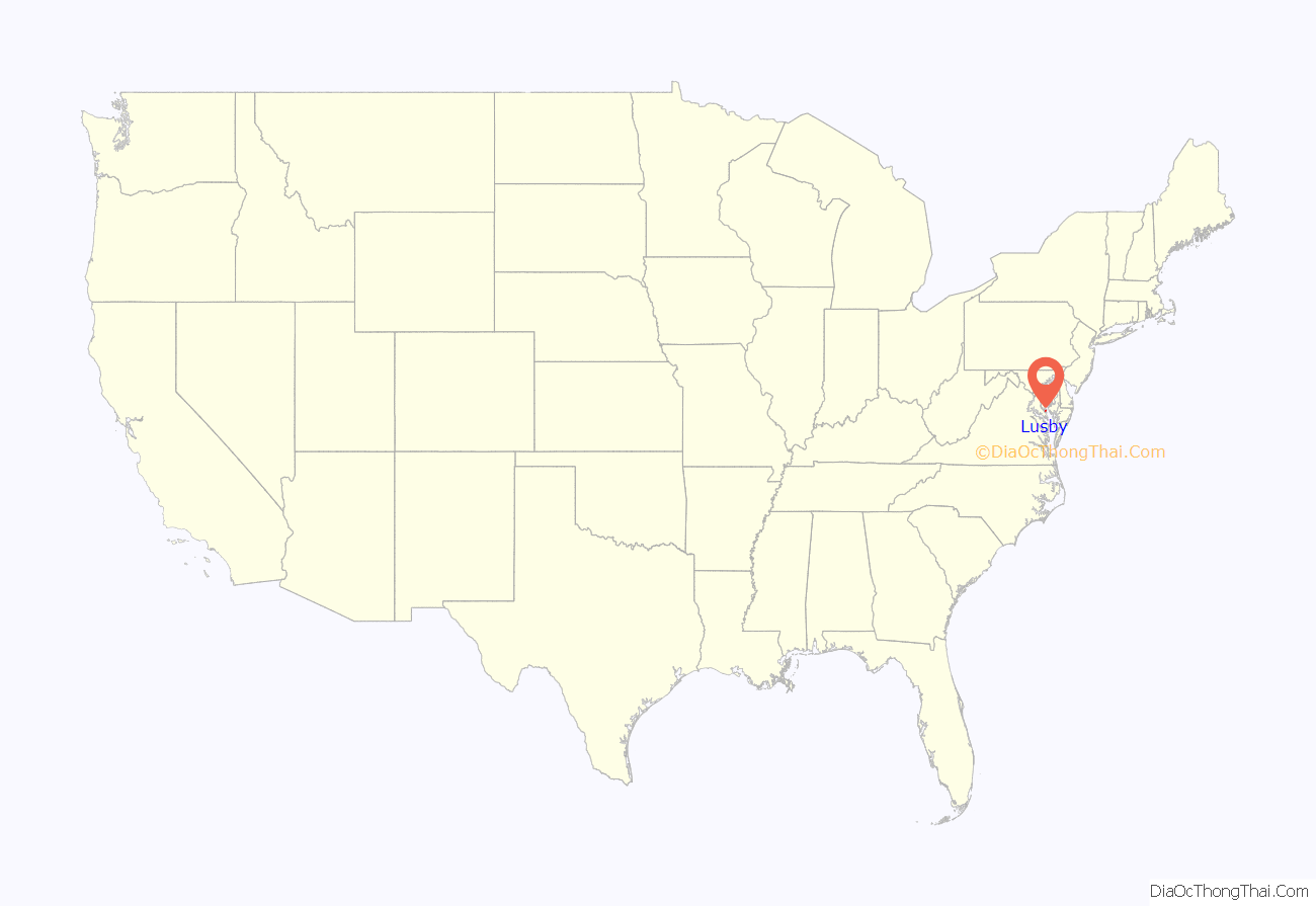
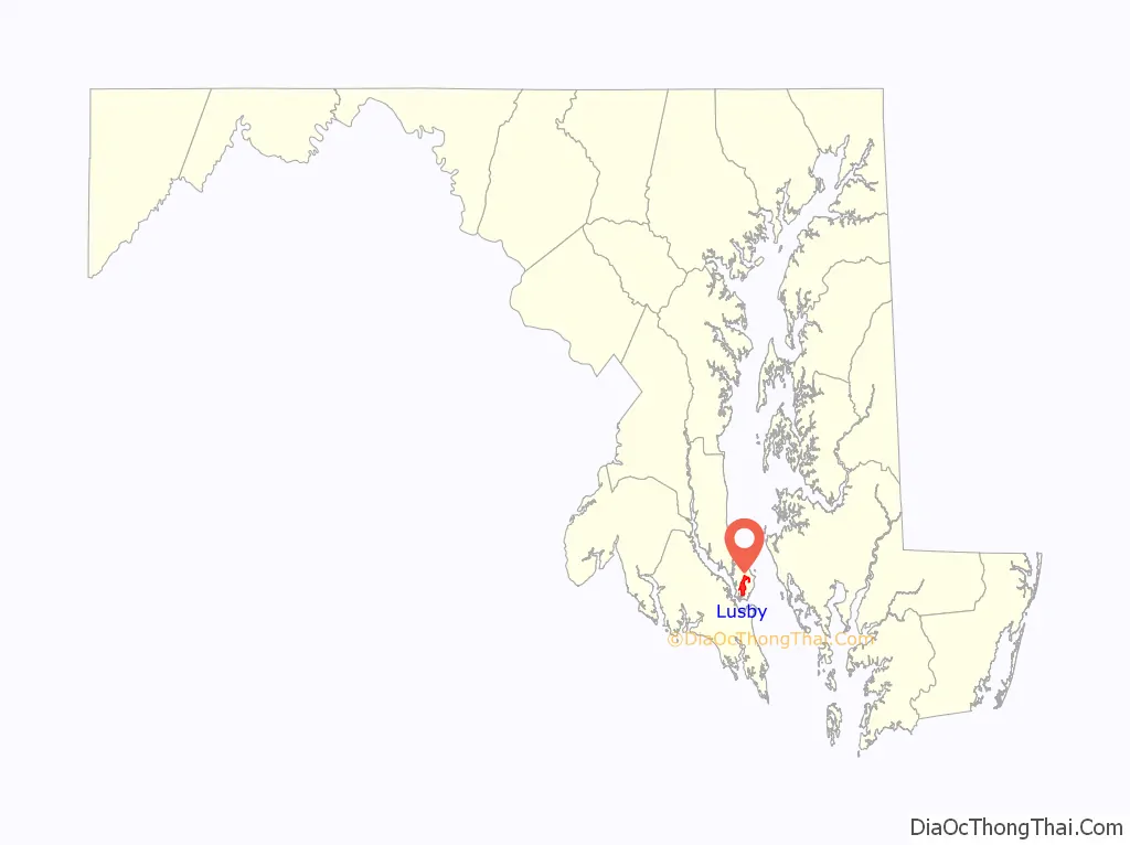
Lusby location map. Where is Lusby CDP?
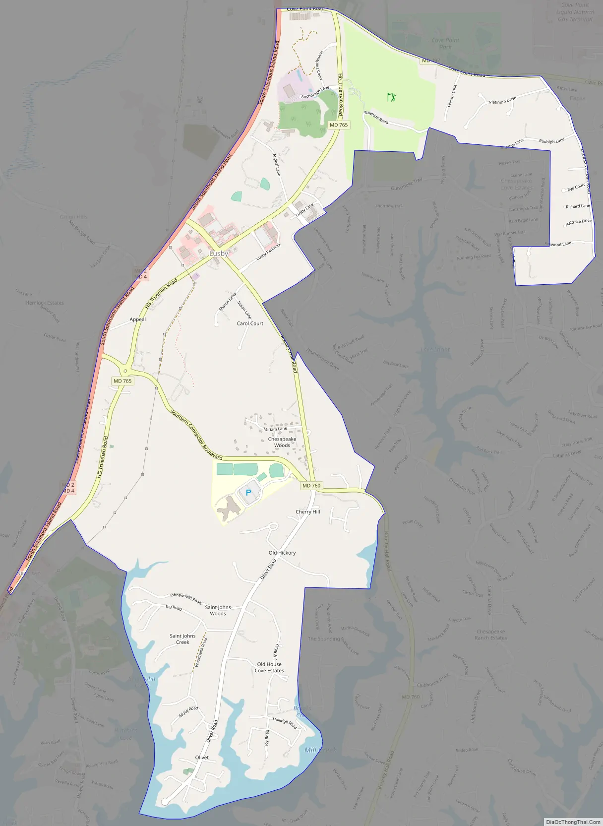
Lusby Road Map
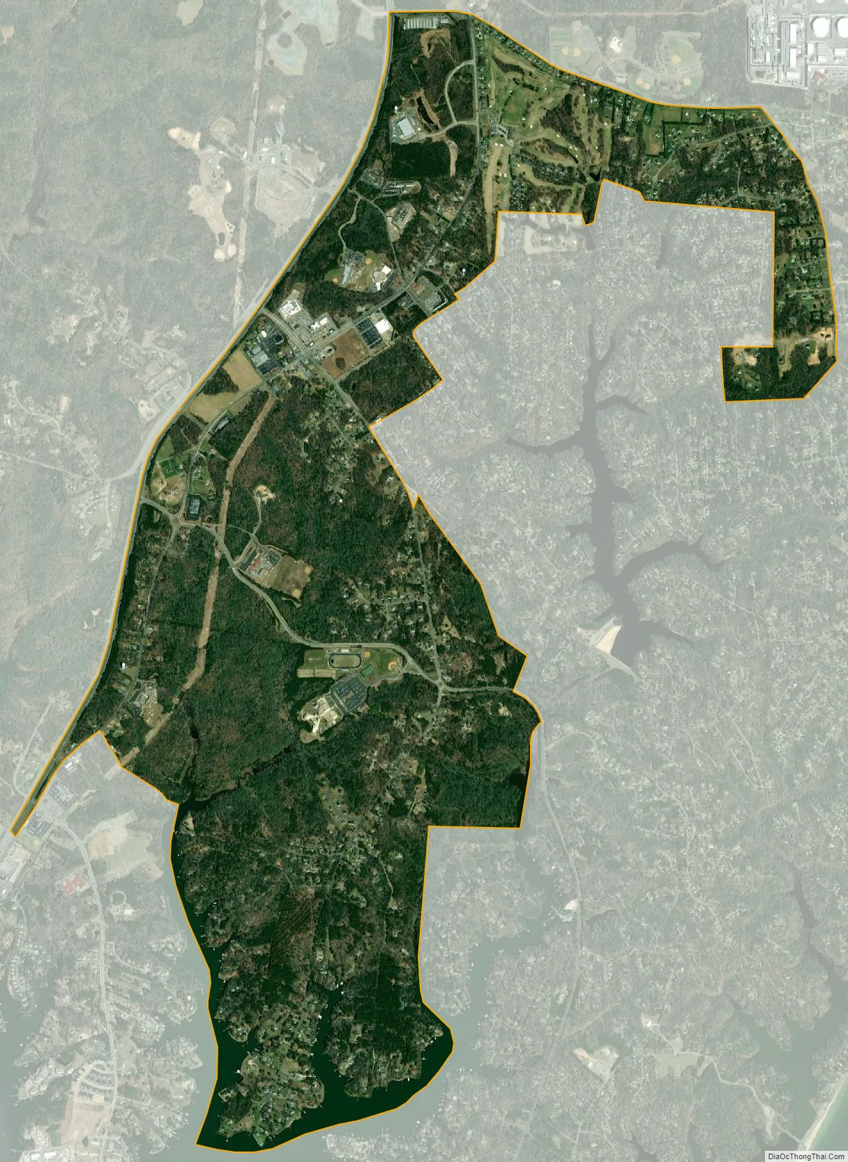
Lusby city Satellite Map
Geography
Lusby is located near the southern end of Calvert County at 38°21′13″N 76°26′12″W / 38.35361°N 76.43667°W / 38.35361; -76.43667 (38.353555, −76.436615). It is bordered to the southwest by Solomons, a tourist resort town, to the south by Drum Point (across tidal Mill Creek), and to the southeast by Chesapeake Ranch Estates, a large community governed by a homeowners’ association.
Dominion Cove Point LNG, one of the nation’s largest liquefied natural gas import facilities, is located just northeast of Lusby, and the Calvert Cliffs Nuclear Power Plant is 5 miles (8 km) to the north. Maryland Routes 2 and 4 run along the western edge of Lusby, leading south to the Patuxent River Naval Air Station and north to Andrews Air Force Base and the Washington, D.C., and Annapolis areas.
There is one public high school in Lusby, Patuxent High School, with the mascot being the Panthers. In 2015 the Panthers won states in football. In 2016, the Panthers won states in marching band and got third place at nationals. In 2002 and 2013, the Panthers won Maryland high school volleyball championships, with multiple other teams reaching the state finals such as the football team in 2013 and 2001, the baseball team in 2012, and the field hockey team in 2008. Lusby also has a public middle school and three public elementary schools, Patuxent Elementary (Pre-K through 2nd grade), Appeal (3rd-5th grade), and Dowell (Pre-K through 5th grade). While there are no private schools in Lusby, there is one in Solomon’s Island at Our Lady Star of the Sea Church that serves the area and has Pre-K through 8th grade.
Lusby’s central business district has been growing rapidly in recent years. Three shopping centers have recently been built, bringing in new grocery stores, restaurants, and other businesses. Several new roads have either been built or are in planning stages in order to ease traffic congestion to and from the Chesapeake Ranch Estates-Drum Point communities. Lusby also features Cove Point Park, which has numerous baseball, soccer, and lacrosse fields as well as a public swimming pool. There is a public golf course, Chesapeake Hills Golf Course, near Cove Point Park. There is also a private air field owned and operated by the Chesapeake Ranch Estates and Drum Point communities.
Places of note in the Lusby area include the Cove Point Lighthouse on the Chesapeake Bay and Calvert Cliffs State Park. The lighthouse was listed on the National Register of Historic Places in 1973. Also on the National Register are Middleham Chapel and Morgan Hill Farm.
According to the United States Census Bureau, the Lusby CDP has a total area of 3.7 square miles (9.5 km), of which 3.5 square miles (9.1 km) is land and 0.15 square miles (0.4 km), or 4.51%, is water.
See also
Map of Maryland State and its subdivision: Map of other states:- Alabama
- Alaska
- Arizona
- Arkansas
- California
- Colorado
- Connecticut
- Delaware
- District of Columbia
- Florida
- Georgia
- Hawaii
- Idaho
- Illinois
- Indiana
- Iowa
- Kansas
- Kentucky
- Louisiana
- Maine
- Maryland
- Massachusetts
- Michigan
- Minnesota
- Mississippi
- Missouri
- Montana
- Nebraska
- Nevada
- New Hampshire
- New Jersey
- New Mexico
- New York
- North Carolina
- North Dakota
- Ohio
- Oklahoma
- Oregon
- Pennsylvania
- Rhode Island
- South Carolina
- South Dakota
- Tennessee
- Texas
- Utah
- Vermont
- Virginia
- Washington
- West Virginia
- Wisconsin
- Wyoming