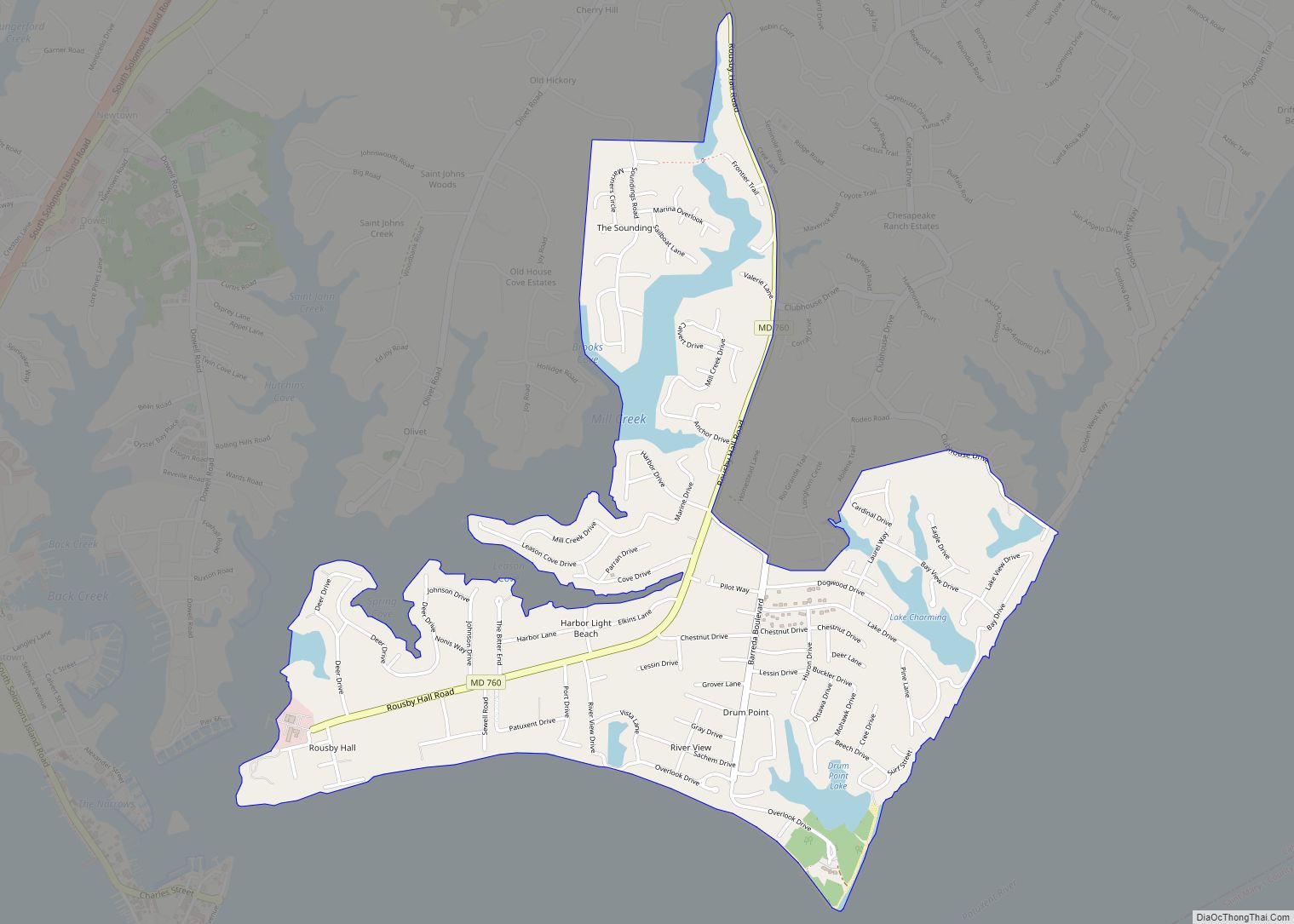
Solomons, also known as Solomons Island, is an unincorporated community and census-designated place (CDP) in Calvert County, Maryland, United States. The population was 2,368 at the 2010 census, up from 1,536 in 2000. Solomons is a popular weekend destination spot in the Baltimore–Washington metropolitan area.
| Name: | Solomons CDP |
|---|---|
| LSAD Code: | 57 |
| LSAD Description: | CDP (suffix) |
| State: | Maryland |
| County: | Calvert County |
| Elevation: | 0 ft (0 m) |
| Total Area: | 2.34 sq mi (6.05 km²) |
| Land Area: | 1.99 sq mi (5.16 km²) |
| Water Area: | 0.34 sq mi (0.89 km²) |
| Total Population: | 2,650 |
| Population Density: | 1,330.99/sq mi (514.02/km²) |
| ZIP code: | 20688 |
| Area code: | 410, 443, and 667 |
| FIPS code: | 2473325 |
| GNISfeature ID: | 1676619 |
Online Interactive Map
Click on ![]() to view map in "full screen" mode.
to view map in "full screen" mode.
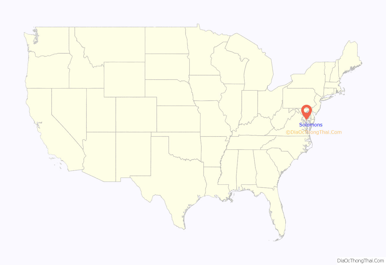
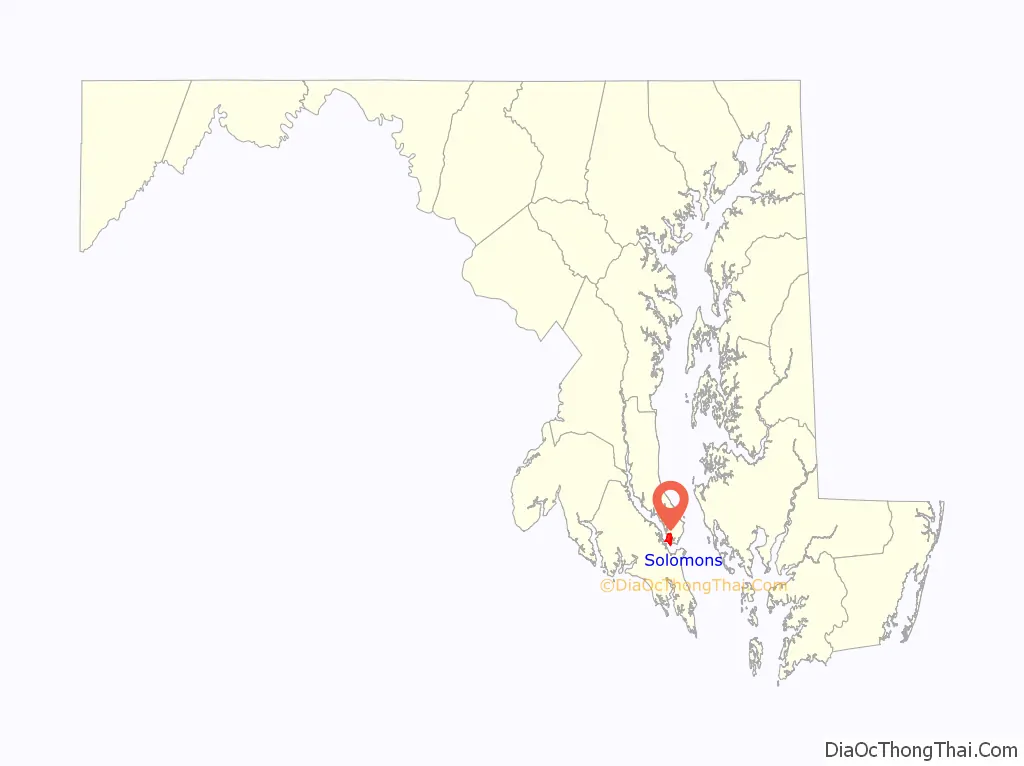
Solomons location map. Where is Solomons CDP?
History
Early settlers
Originally called Bourne’s Island (1680), then Somervell’s Island (1740), Solomons takes its name from 19th century Baltimore businessman Isaac Solomon, who established a cannery there shortly after the Civil War. Solomon’s home still stands on the front of the island.
The area has been inhabited since colonial times.
Shipbuilding and Maritime Activity
In the 19th century, shipyards developed to support the island’s fishing fleet. The Marsh Shipyard built schooners and sloops but became famous for its bugeyes, the forerunner of the skipjack. In the War of 1812, Commodore Joshua Barney’s flotilla sailed from here to attack British vessels on Chesapeake Bay. The deep, protected harbor has been a busy marine center ever since. Kronprinzessin Cecilie, a 1906-built German ocean liner which during World War I was commandeered (and renamed Mount Vernon (ID-4508) by the US, was laid up at Solomons in 1920.
During World War II, the island was chosen by the Allied command as the site for training amphibious invasion forces. The lessons learned at Solomons proved invaluable on D-Day, at Tarawa, at Guadalcanal, and in numerous other military operations. Three naval bases were established at the mouth of the Patuxent River. These three facilities made a major contribution to the war effort and brought new jobs to local residents. Between 1942 and 1945, the population of Solomons increased from 263 to more than 2,600. Over 60,000 troops trained at Solomons during the war.
Coincidentally, many of the servicemen who trained at the Solomons base in Maryland were sent to fight in the Solomon Islands in the Pacific Ocean.
Solomons was the site of the following U.S. Navy activities during the war:
- Naval Mine Warfare Test Station
- Naval Amphibious Training Base
- Mine Warfare Experimental Station
- Naval Dispensary, Naval Amphibious Training Base
Governor Thomas Johnson Bridge
Solomons was a rather isolated boat-building town housing the University of Maryland Chesapeake Biological Laboratory, until 1977 when the Governor Thomas Johnson Bridge was built. The bridge leads from just off Solomons Island proper to St. Mary’s County and the Patuxent Naval Air Station.
Solomons Road Map
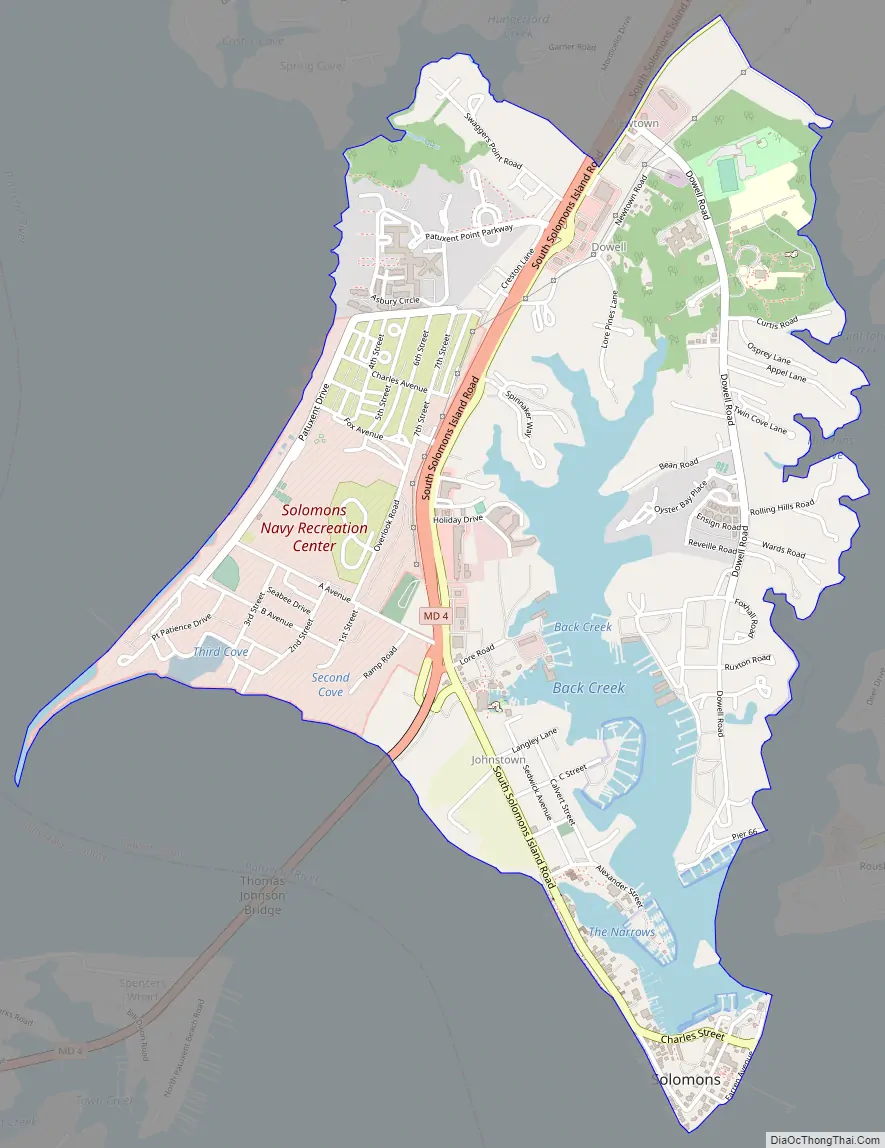
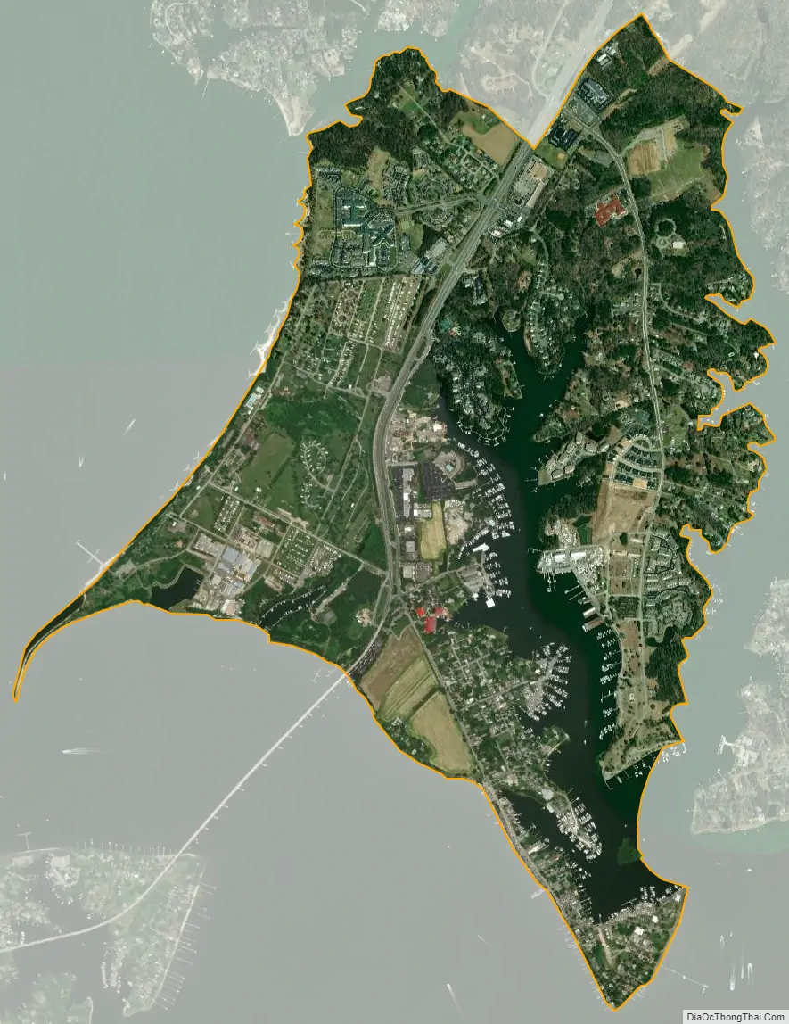
Solomons city Satellite Map
Geography
Solomons is located at the southern tip of Calvert County at 38°20′11″N 76°27′51″W / 38.33639°N 76.46417°W / 38.33639; -76.46417 (38.336431, −76.464102). It includes Solomons Island and mainland on the north side of the mouth of Patuxent River, where it meets the Chesapeake Bay. It is just across from the U.S. Naval Air Station Patuxent River (on the south side of the mouth of the Patuxent River).
According to the United States Census Bureau, the Solomons CDP has a total area of 2.3 square miles (6.0 km), of which 2.0 square miles (5.2 km) is land and 0.35 square miles (0.9 km), or 14.76%, is water, consisting mainly of Back Creek, a tidal inlet that extends north from the Patuxent River.
Climate
The climate in this area is characterized by hot, humid summers and generally mild to cool winters. According to the Köppen Climate Classification system, Solomons has a humid subtropical climate, abbreviated “Cfa” on climate maps. Monthly average temperatures on Solomons Island range from 36.7°F in January to 78.7°F in July. [6]
See also
Map of Maryland State and its subdivision: Map of other states:- Alabama
- Alaska
- Arizona
- Arkansas
- California
- Colorado
- Connecticut
- Delaware
- District of Columbia
- Florida
- Georgia
- Hawaii
- Idaho
- Illinois
- Indiana
- Iowa
- Kansas
- Kentucky
- Louisiana
- Maine
- Maryland
- Massachusetts
- Michigan
- Minnesota
- Mississippi
- Missouri
- Montana
- Nebraska
- Nevada
- New Hampshire
- New Jersey
- New Mexico
- New York
- North Carolina
- North Dakota
- Ohio
- Oklahoma
- Oregon
- Pennsylvania
- Rhode Island
- South Carolina
- South Dakota
- Tennessee
- Texas
- Utah
- Vermont
- Virginia
- Washington
- West Virginia
- Wisconsin
- Wyoming