Montgomery Village is a census-designated place (CDP) in Montgomery County, Maryland, United States, and a northern suburb of Washington, D.C. It is a large, planned suburban community, developed in the late 1960s and 1970s just outside Gaithersburg‘s city limits. Montgomery Village’s population was 34,893 at the time of the 2020 U.S. Census, and it is a part of the Washington metropolitan area.
| Name: | Montgomery Village CDP |
|---|---|
| LSAD Code: | 57 |
| LSAD Description: | CDP (suffix) |
| State: | Maryland |
| County: | Montgomery County |
| Elevation: | 371 ft (113 m) |
| Total Area: | 3.96 sq mi (10.26 km²) |
| Land Area: | 3.88 sq mi (10.05 km²) |
| Water Area: | 0.08 sq mi (0.21 km²) |
| Total Population: | 34,893 |
| Population Density: | 8,988.41/sq mi (3,470.42/km²) |
| ZIP code: | 20877, 20879, 20886 |
| Area code: | 301, 240 |
| FIPS code: | 2453325 |
| GNISfeature ID: | 1712797 |
| Website: | www.montgomeryvillage.com |
Online Interactive Map
Click on ![]() to view map in "full screen" mode.
to view map in "full screen" mode.
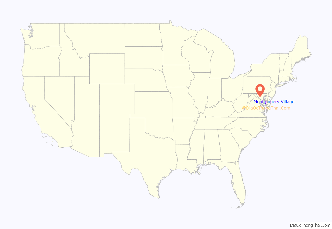
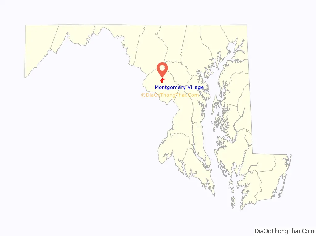
Montgomery Village location map. Where is Montgomery Village CDP?
History
1960s
Montgomery Village was created in 1962 by Kettler Brothers, Inc. The vision for a planned community in Gaithersburg is credited to architect Charles Kettler, who incorporated Kettler Brothers with his brothers Milton and Clarence in 1952. The first land purchase was the Walker Farm in 1962. Subsequent purchases were the Thomas Farm, The Mills Farm, The French Farm, The Patton Farm, The Fulks Farm, The Wilson Farm, and The James Walter Deppa property. The Walker Farm was the largest of all the properties the Kettlers bought. It was 412 acres (1.67 km) and now is Walkers Choice, Cider Mill, Horizon Run, Christopher Court, Dockside, Nathan’s Hill, Millrace, the Montgomery Village Library, Montgomery Village Day-Care Center, the Off-Price Centers, Bayberry, the Verandahs, Grover’s Forge, Lake Whetstone, South Valley Park, and part of Lakeforest Mall.
On February 28, 1966, the Kettler brothers broke ground for the first house in Montgomery Village. The first model homes were opened in Lakeside of Whetstone in August 1967. In September, more opened in the Clusters of Stedwick. The Montgomery Village Golf Club also opened in September of that year. The first residents of Montgomery Village moved in on September 25, 1967, in Goshenside. They were the Bartik family. Also on the same day, the Crosby family moved into a home on Whetstone Drive.
The Montgomery Village Foundation was incorporated in 1966. In 1968, the Whetstone Community Center opened, as did Whetstone Elementary and Montgomery Village Junior High schools.
1970s
In 1970, The Village Mall opened, which is now the Village Shopping Center on Montgomery Village Avenue. Then in 1971, a Holiday Inn was opened. In 1973, bus service to Washington, D.C., began.
1990s
In 1998, Montgomery Village began using its own ZIP code, 20886.
2000s
In 2007, Montgomery Village’s YMCA swimming pool closed.
2010s
The Montgomery Village Golf Club closed November 30, 2014 and will be turned into a neighborhood.
2020s
Montgomery Village is seeing a surge in redevelopment. The Montgomery Village Center is being refaced and updated. Atlantic Realty is adding additional green space, a new Aldi grocery store, redefined retail (Big Lots) and restaurant (Ledos, Subway) space and an extension of Centerway Rd through the mall which will make access to both sides more convenient. There are planned condos and townhomes being added to the property. The “Professional Center” property was purchased by Lidl, the German Grocery Store chain. The existing buildings were demolished in 2020 and replaced by a new grocery store, with the addition of a pad site to the property. Monument Realty has purchased the golf course and is approved to move forward with the Bloom Montgomery Village neighborhood featuring an 80-acre park and dog park, new single-family and townhomes. The groundbreaking is scheduled for March 2020 with the first model homes opening in fall 2020
Montgomery Village ‘The Village” currently has a farmers market on Saturdays from May through October, free summer concerts selling beer & wine, 3 summer youth swim teams, All Comers Swim Meet, 3 Community Centers (2 are rentable), annual art show, 4 July parade and carnival and 5k, A great Pumpkin race and fall festival, Brunch with a Bunny, flashlight Easter Egg Hunt, seasonal indoor/outdoor flea markets, Holiday craft bazaar, Annual Thanksgiving morning workout, Community Christmas Tree lighting, Breakfast with Santa, Holiday Toys for Tots Concert, a full year-round recreation program, summer youth camp program, an Active Seniors group with weekly activities, daddy-daughter Valentines Day Dance, wine & paint nights, Bingo nights, September annual dog swim (in one of the many pools) several tennis courts, 7 seasonal swimming pools, a heated pool (extends summer swimming season) paved bike and walking trails, ponds for non-motorized boating and fishing, pedestrian tunnels located under busy roads throughout for pedestrian safety, several parks and tot lots, protected natural streams, public transportation, a new renovated County Library, 2 exits to I-270 (Montgomery Village Ave & Watkins Mill Rd/2020)
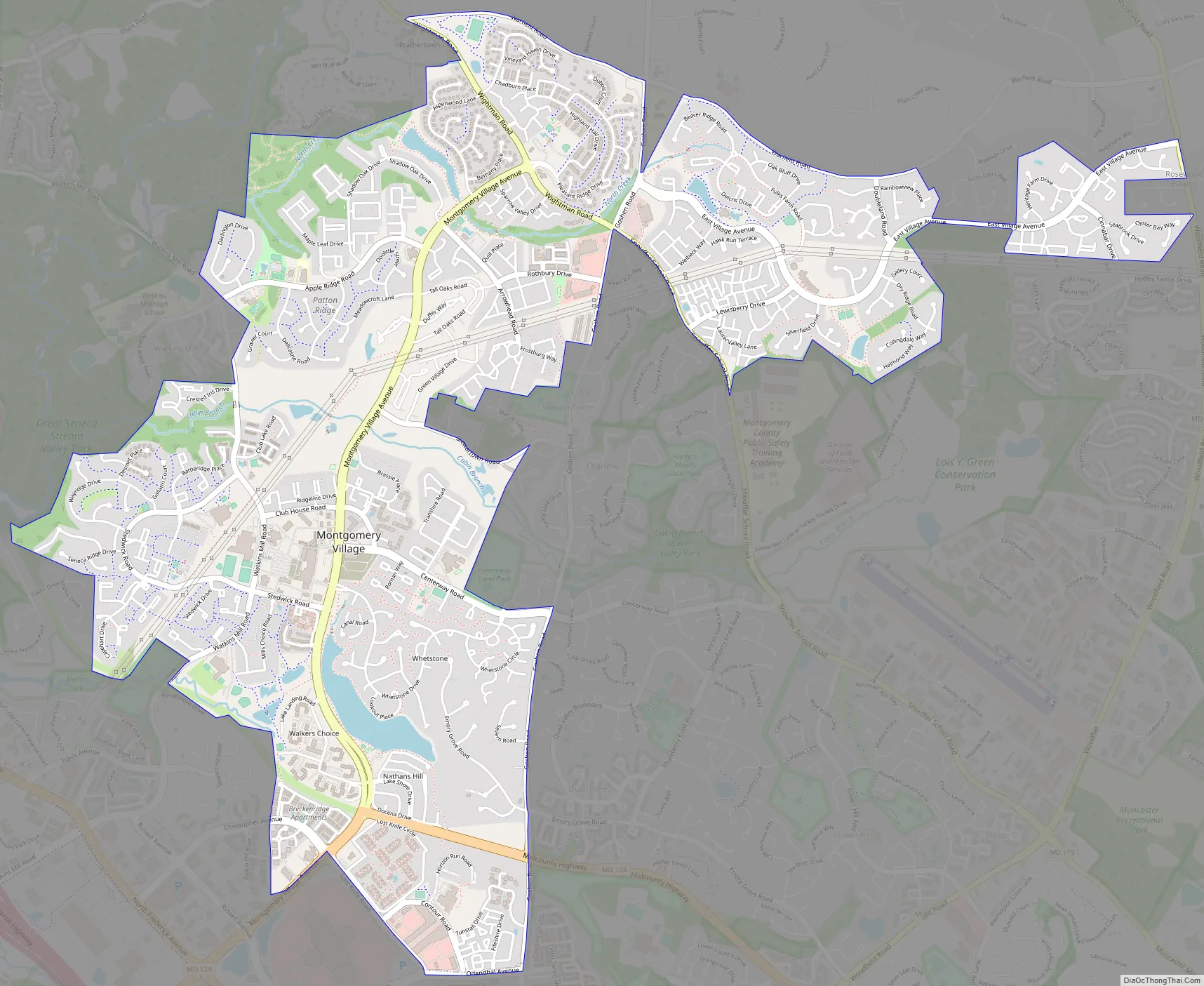
Montgomery Village Road Map
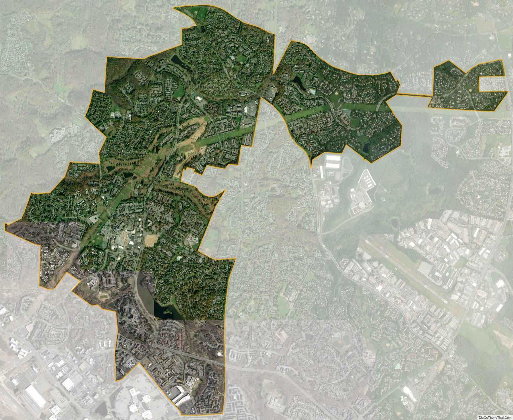
Montgomery Village city Satellite Map
Geography
Although Montgomery Village is an unincorporated area, its boundaries are defined according to Montgomery County zoning rules and by its own unique ZIP code. Montgomery Village can use Gaithersburg addresses even though the village is outside city limits. Montgomery Village is recognized by the U.S. Census Bureau as a census-designated place, and by the U.S. Geological Survey as a populated place located at 39°10′35″N 77°11′34″W / 39.17639°N 77.19278°W / 39.17639; -77.19278 (39.176469, -77.192654).
According to the U.S. Census Bureau, the place has a total area of 4.055 square miles (10.50 km), of which 3.974 square miles (10.29 km) is land and 0.081 square miles (0.21 km) (1.99%) is water.
See also
Map of Maryland State and its subdivision: Map of other states:- Alabama
- Alaska
- Arizona
- Arkansas
- California
- Colorado
- Connecticut
- Delaware
- District of Columbia
- Florida
- Georgia
- Hawaii
- Idaho
- Illinois
- Indiana
- Iowa
- Kansas
- Kentucky
- Louisiana
- Maine
- Maryland
- Massachusetts
- Michigan
- Minnesota
- Mississippi
- Missouri
- Montana
- Nebraska
- Nevada
- New Hampshire
- New Jersey
- New Mexico
- New York
- North Carolina
- North Dakota
- Ohio
- Oklahoma
- Oregon
- Pennsylvania
- Rhode Island
- South Carolina
- South Dakota
- Tennessee
- Texas
- Utah
- Vermont
- Virginia
- Washington
- West Virginia
- Wisconsin
- Wyoming


