Mount Savage is an unincorporated community and census-designated place (CDP) in Allegany County, Maryland, United States. As of the 2010 census it had a population of 873.
A small blue-collar community, Mount Savage lies at the base of Big Savage Mountain in the Allegheny Mountains, between the cities of Frostburg and Cumberland. It began as a small farming settlement in the mid-19th century, but it was not until 1844 that the region was put on the nation’s map with the pressing of the first iron rail in the United States. After this claim to fame, Mount Savage became the fifth largest city in Maryland. Named as the headquarters for the Mount Savage Railroad and later the Cumberland and Pennsylvania Railroad (C&P), the area was deemed an industrial center. In addition to the rail businesses, Mount Savage attracted a foundry, two brick refractories, and several local merchants. In this company town, the industries shaped the economy and topography of Mount Savage, building housing for workers and donating land for schools, churches, and other public buildings. It was a cultural melting pot attracting English businessmen and Irish, Scottish, Welsh, Italian, and German workers. With this diverse mix of cultures, the identity of Mount Savage was molded into a close-knit community. Despite the loss of the industries to the region, Mount Savage continues to celebrate its hard-working traditions. The Mount Savage Historic District was listed on the National Register of Historic Places in 1983.
| Name: | Mount Savage CDP |
|---|---|
| LSAD Code: | 57 |
| LSAD Description: | CDP (suffix) |
| State: | Maryland |
| County: | Allegany County |
| Elevation: | 1,234 ft (376 m) |
| Total Area: | 0.96 sq mi (2.48 km²) |
| Land Area: | 0.96 sq mi (2.48 km²) |
| Water Area: | 0.00 sq mi (0.00 km²) |
| Total Population: | 733 |
| Population Density: | 765.14/sq mi (295.36/km²) |
| ZIP code: | 21545 |
| Area code: | 301, 240 |
| FIPS code: | 2454325 |
| GNISfeature ID: | 2583661 |
Online Interactive Map
Click on ![]() to view map in "full screen" mode.
to view map in "full screen" mode.
Mount Savage location map. Where is Mount Savage CDP?


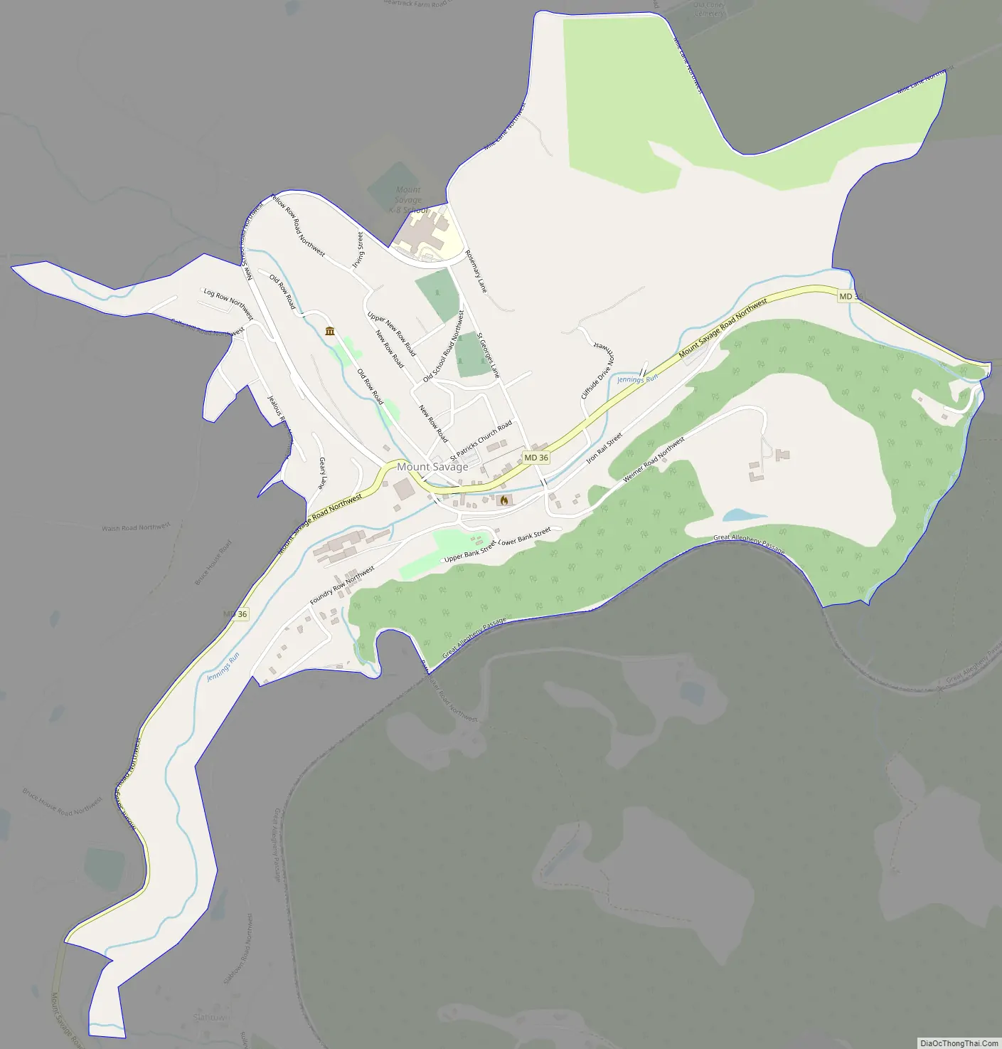
Mount Savage Road Map
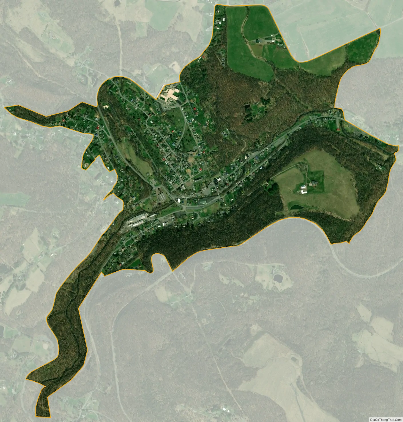
Mount Savage city Satellite Map
Geography
Mount Savage is located at an elevation of 1,234 feet (376 m) in the valley of Jennings Run in western Allegany County. Mount Savage Run flows into Jennings Run in Mount Savage. Maryland Route 36 runs through the community, leading southwest 5 miles (8 km) to Frostburg and 10 miles (16 km) east to Cumberland. Sampson Rock, the 2,934-foot (894 m) summit of Big Savage Mountain, rises 2 miles (3 km) to the west of the village.
See also
Map of Maryland State and its subdivision: Map of other states:- Alabama
- Alaska
- Arizona
- Arkansas
- California
- Colorado
- Connecticut
- Delaware
- District of Columbia
- Florida
- Georgia
- Hawaii
- Idaho
- Illinois
- Indiana
- Iowa
- Kansas
- Kentucky
- Louisiana
- Maine
- Maryland
- Massachusetts
- Michigan
- Minnesota
- Mississippi
- Missouri
- Montana
- Nebraska
- Nevada
- New Hampshire
- New Jersey
- New Mexico
- New York
- North Carolina
- North Dakota
- Ohio
- Oklahoma
- Oregon
- Pennsylvania
- Rhode Island
- South Carolina
- South Dakota
- Tennessee
- Texas
- Utah
- Vermont
- Virginia
- Washington
- West Virginia
- Wisconsin
- Wyoming


