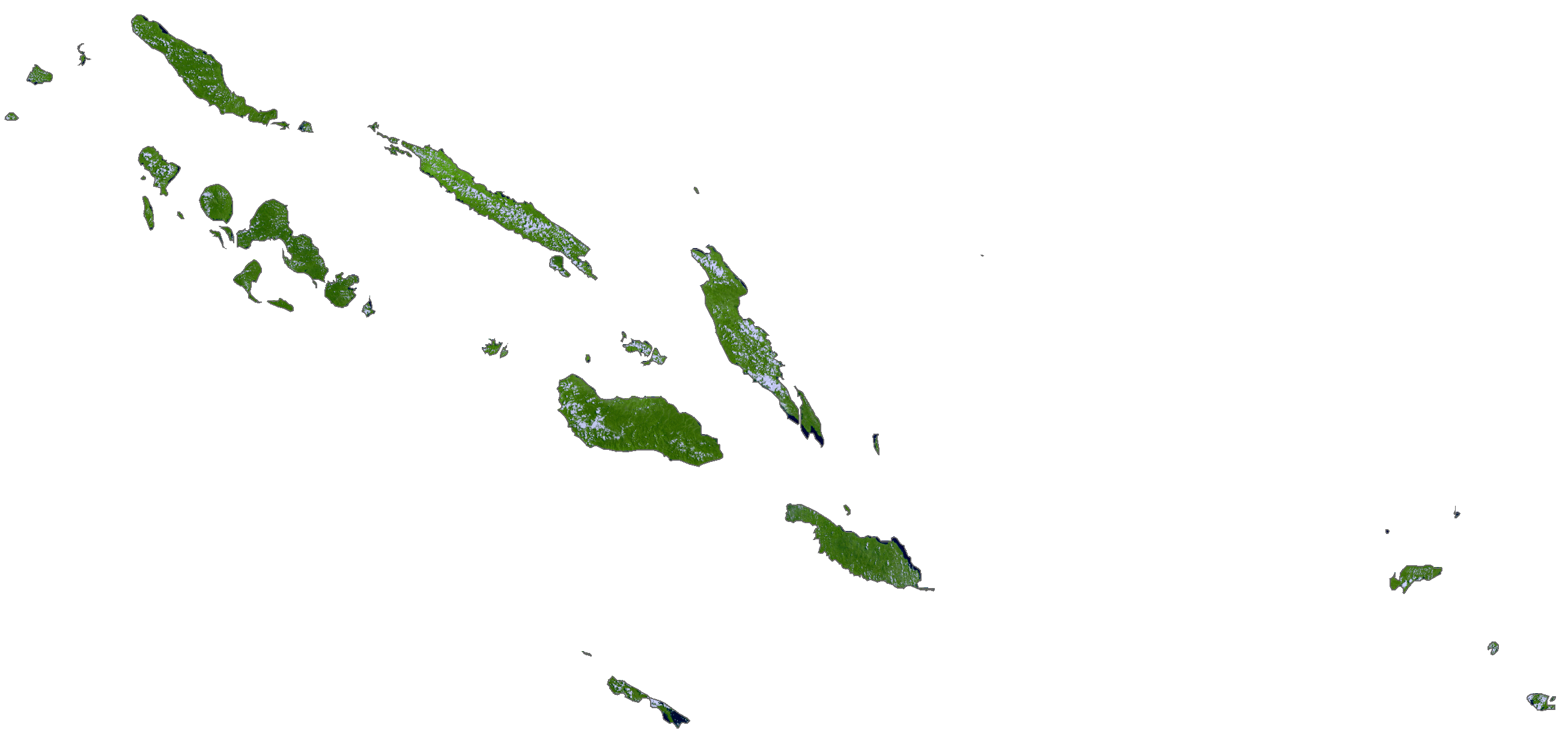
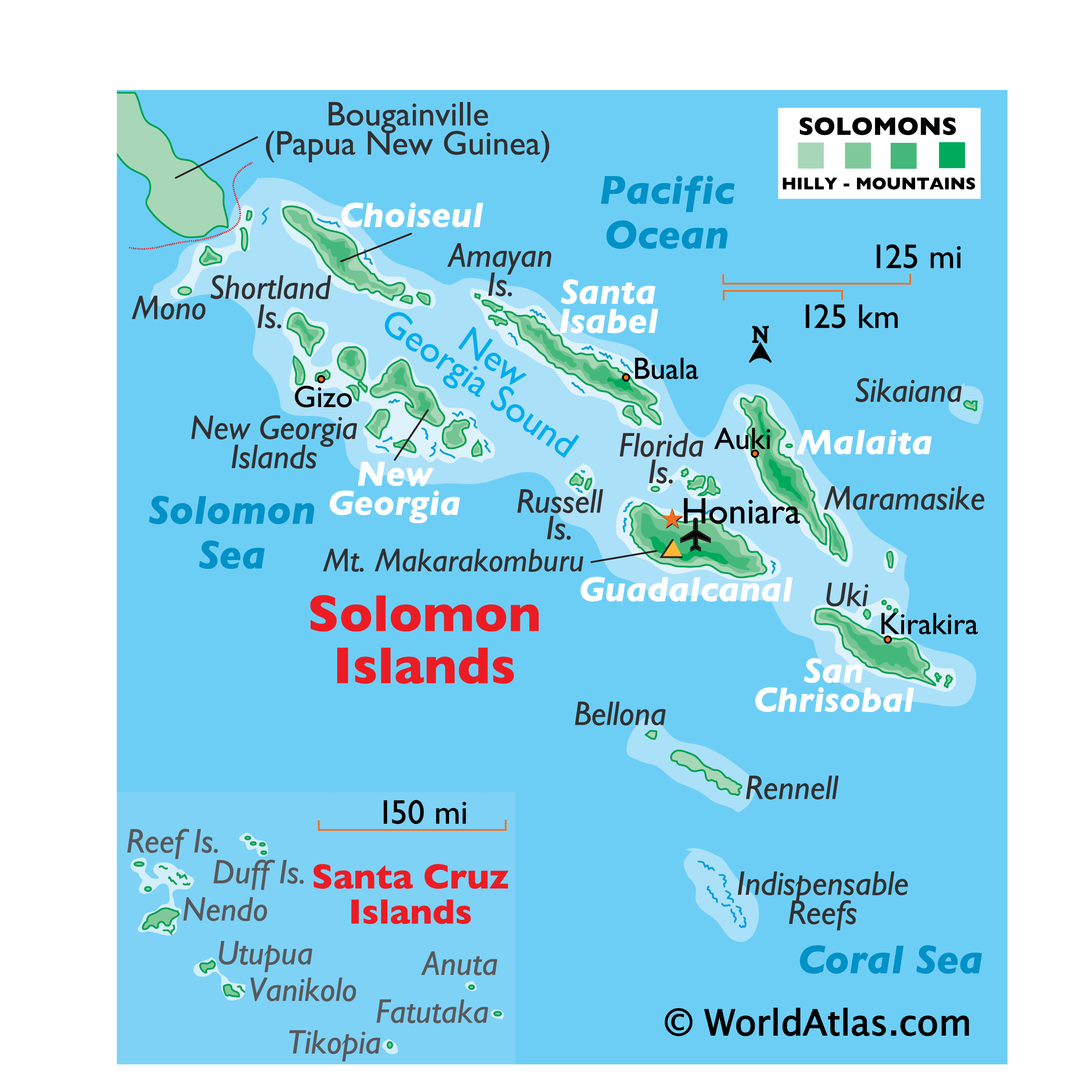
Covering an area of 28,400 sq.km (11,000 sq mi), Solomon Islands are an archipelagic state comprising of a double chain of 992 volcanic islands and coral atolls in Melanesia, located in southwest Pacific Ocean. Extending about 900 miles (1,448km) in total length, the Solomon Islands are a wide-spread archipelago of mountainous, heavily forested volcanic islands (some active) and a few low-lying coral atolls.
Included in the mix are 6 major islands (marked on the map above) and approximately 1,000 smaller islands, all ending in the Santa Cruz Islands of the far southeast. The highest point in the Solomon Islands is Mount Popomanaseu located on Guadalcanal, which peaks at 7,578ft (2,310m). The lowest point is the Pacific Ocean (0m).
| Flag: | 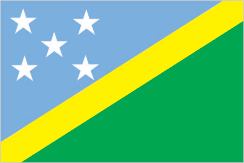 |
|---|---|
| Legal Name: | Solomon Islands |
| Capital Value: | Honiara |
| Official languages: | English |
| Demonym(s): | Solomon Islander |
| Government: | Unitary parliamentary constitutional monarchy |
| Legislature: | National Parliament |
| Total Area: | 28,896 km² |
| Land Area: | 27,986 km² |
| Water Area: | 910 km² |
| Population: | 669,823 |
| Density: | 18.1/km (46.9/sq mi) (200th) |
| GDP: | $1.43 Billion |
| GDP Per Capita: | $2,127.54 |
| Currency Value: | Solomon Islands dollars (SBD) |
| Driving side: | left |
| Calling code: | +677 |
| Internet TLD: | .sb |
Explore the Solomon Islands with these helpful maps. Discover the beauty of its islands, atolls and settlements with a reference map, satellite imagery and an elevation map. Learn more about the Solomon Islands and its geography with these informative maps.
Online Interactive Political Map
Click on ![]() to view map in "full screen" mode.
to view map in "full screen" mode.
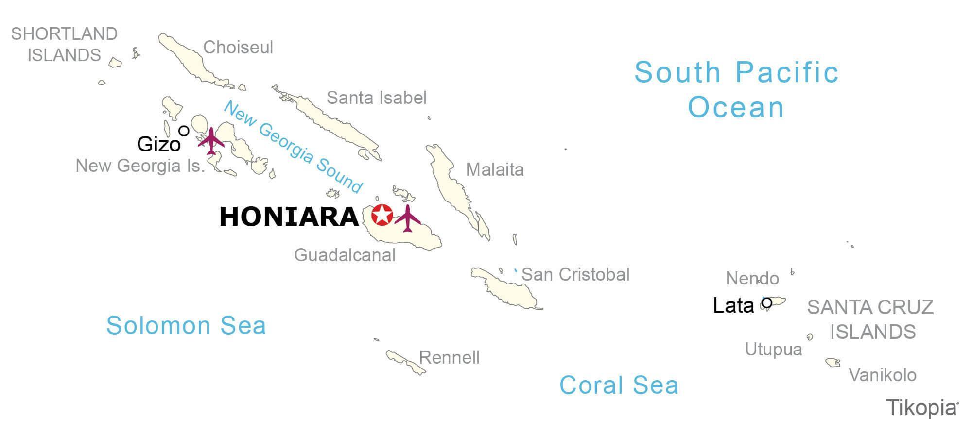
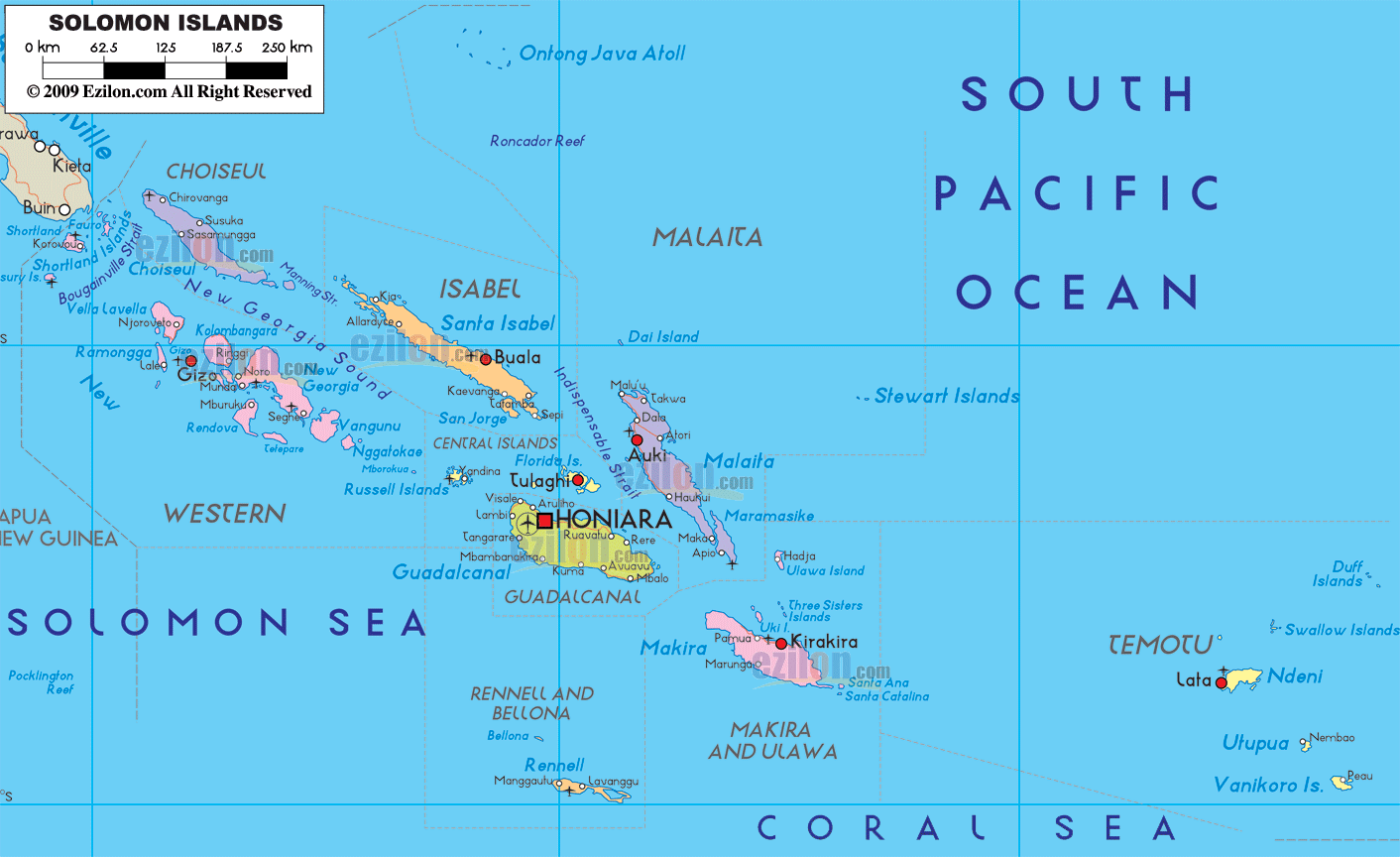
Solomon Islands is divided into 9 provinces and 1 capital city – Honiara. In alphabetical order, the 9 provinces are: Central, Choiseul, Guadalcanal, Isabel, Makira and Ulawa, Malaita, Renneu and Bellona, Temotu and Western.
Covering an area of 28,400 sq.km, Solomon Islands consists of 6 principal islands and approximately 1000 smaller islands. Located on the northwestern coast of Guadalcanal is, Honiara – the capital and the largest city of Solomon Islands.
Location Maps
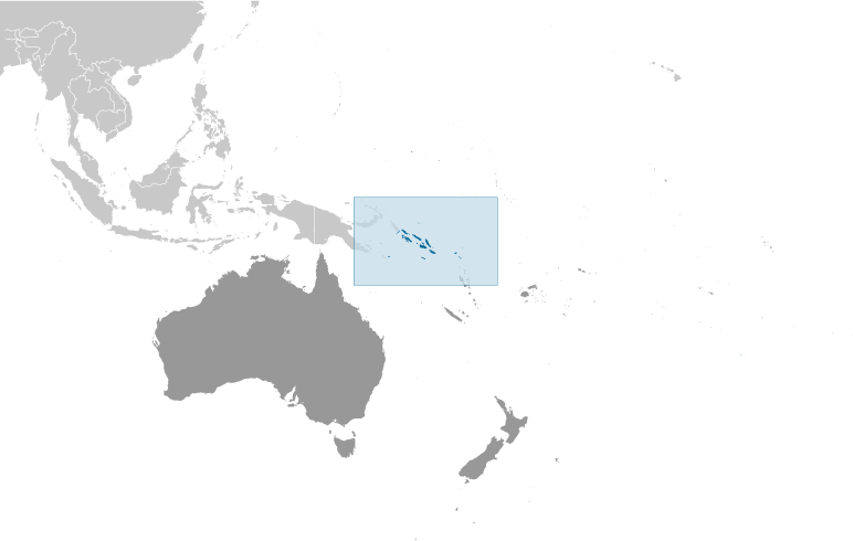
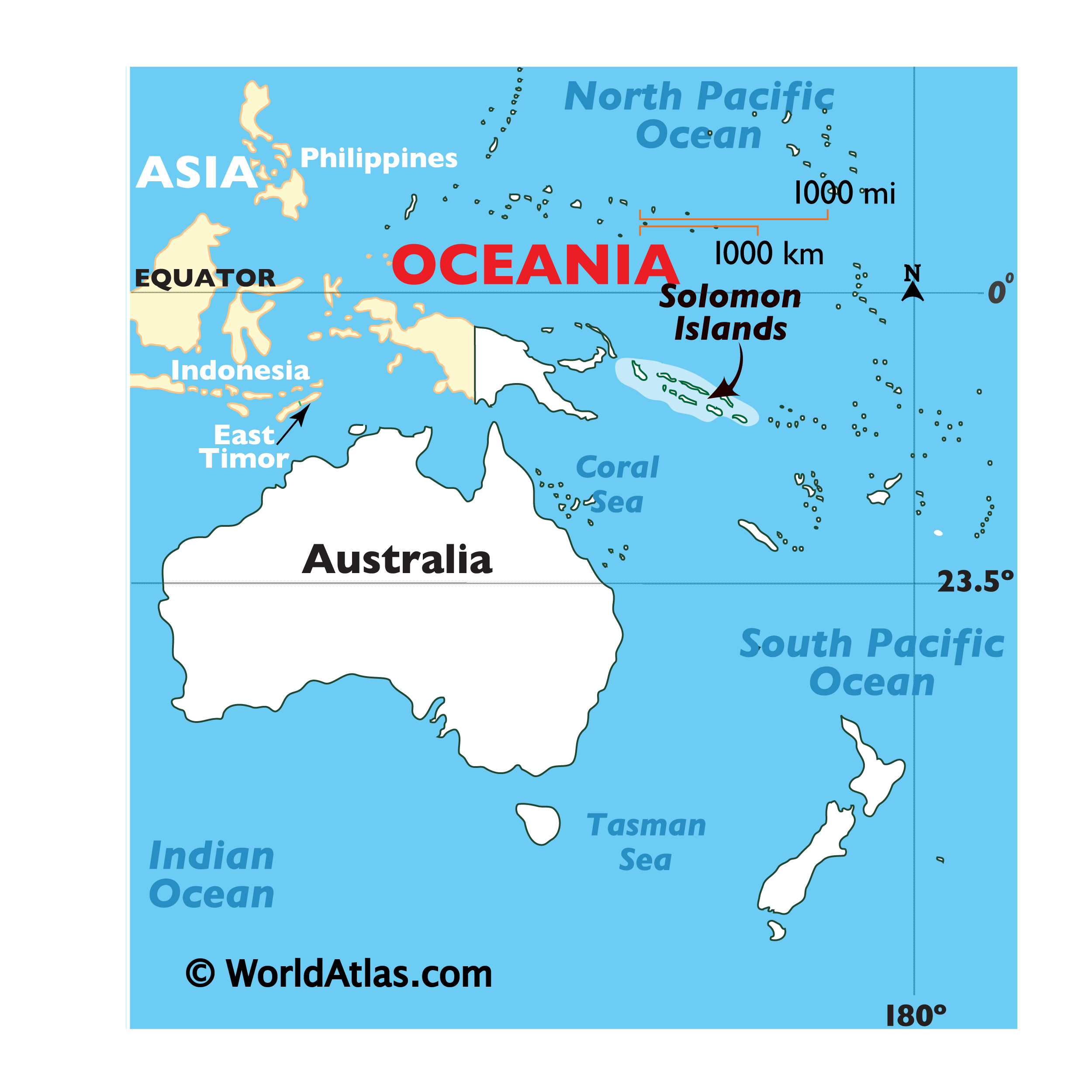
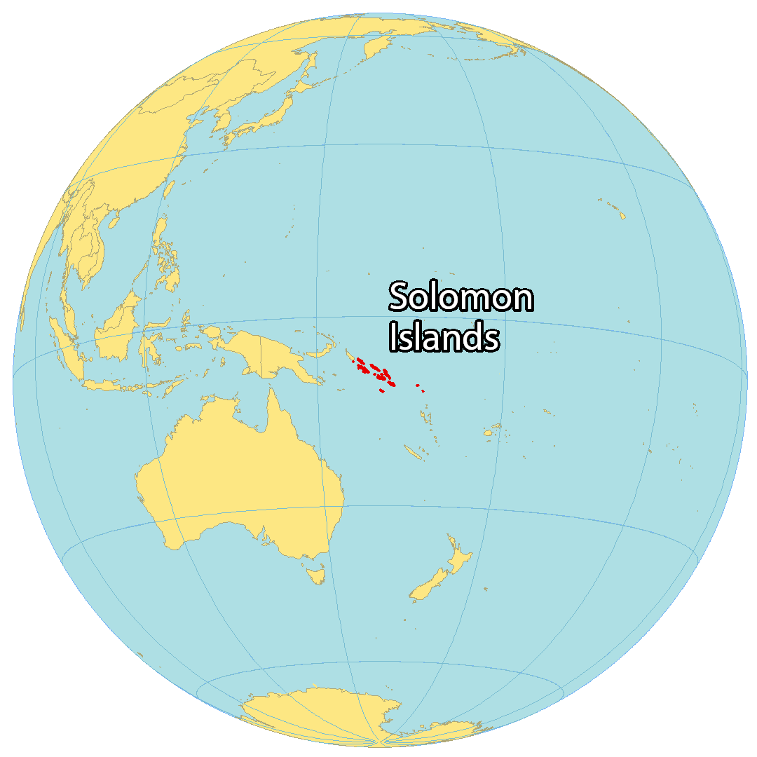
Where is Solomon Islands?
The Solomon Islands are an archipelago of six major islands and over 900 smaller uninhabited islands and coral atolls located in Oceania, in the South Atlantic Ocean. The Solomon Sea lies to the southwest of the islands, while the closest land border is 3.2 kilometers (2 mi) away, at the west island of Bougainville. Vanuatu is 153 kilometers (94.5 mi) to the south.
The Solomon Islands are renowned for their World War II sites, U.S. War Memorials, shipwrecks, biodiversity, and marine life. Honiara is the largest city and capital of the islands, situated on the main island of Guadalcanal.
High Definition Political Map of Solomon Islands
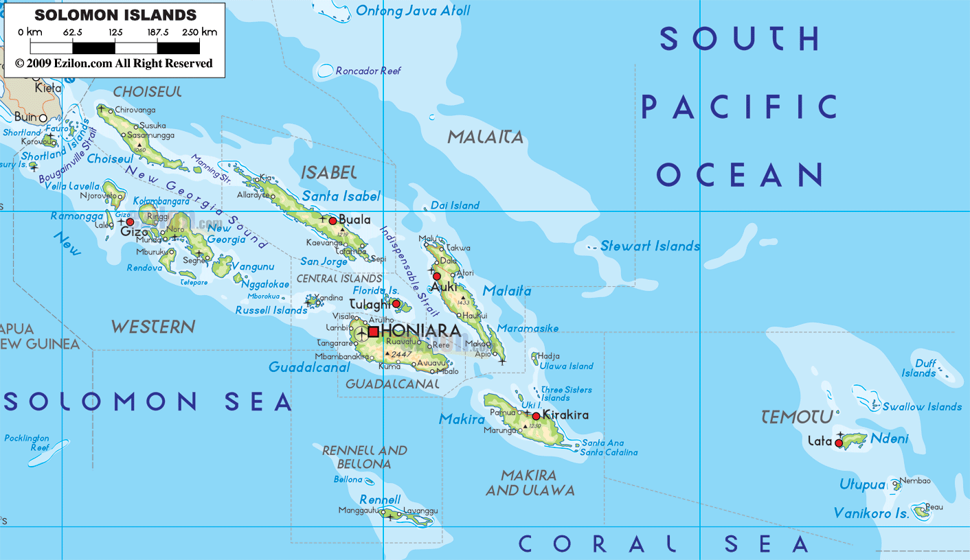
Physical Map of Solomon Islands
Solomon Islands Satellite Map