Tilghman Island is an island in the Chesapeake Bay. It is part of Talbot County, Maryland, United States.
| Name: | Tilghman Island CDP |
|---|---|
| LSAD Code: | 57 |
| LSAD Description: | CDP (suffix) |
| State: | Maryland |
| County: | Talbot County |
| Elevation: | 7 ft (2 m) |
| Total Area: | 2.54 sq mi (6.57 km²) |
| Land Area: | 2.40 sq mi (6.21 km²) |
| Water Area: | 0.14 sq mi (0.36 km²) |
| Total Population: | 807 |
| Population Density: | 336.67/sq mi (130.00/km²) |
| ZIP code: | 21671 |
| Area code: | 410, 443, and 667 |
| FIPS code: | 2477912 |
| GNISfeature ID: | 1852602 |
| Website: | www.tilghmanisland.com |
Online Interactive Map
Click on ![]() to view map in "full screen" mode.
to view map in "full screen" mode.
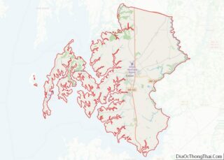
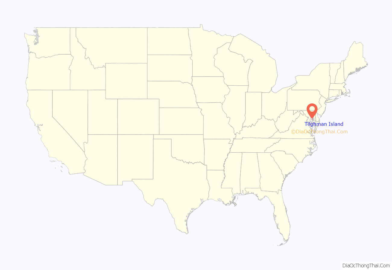
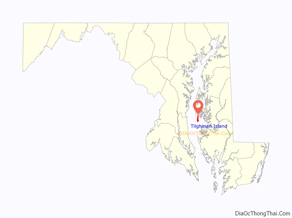
Tilghman Island location map. Where is Tilghman Island CDP?
History
Initially known as Great Choptank Island, the island became identified with a series of local families. It was owned by Matthew Tilghman’s family from 1752 and has been known as Tilghman Island ever since. During the War of 1812 the island was briefly occupied by the British, who obtained provisions for their military forces. The community of Tilghman appeared in the 1840s. The economy shifted from farming to greater reliance on oystering and fishing as markets developed in Baltimore and Washington, aided by steamboat service in the 1890s.
Historic places
The E.C. Collier, the Elsworth, the Hilda M. Willing, the Kathryn, the Maggie Lee, the Minnie V, the Nellie L. Byrd, the Paw Paw Cove Site, the Ralph T. Webster, the Rebecca T. Ruark, the Reliance, the Ruby G. Ford, Sharps Island Light, the Sigsbee, and the Virginia W are listed on the National Register of Historic Places.
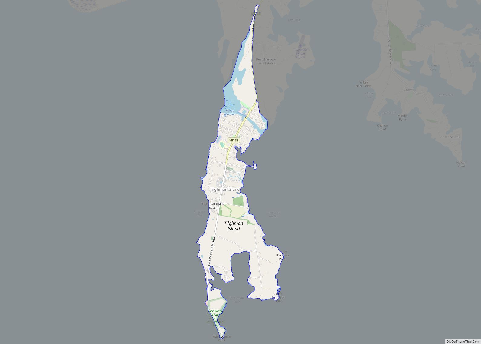
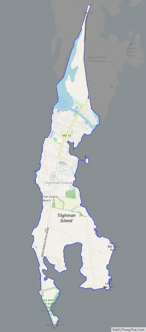
Tilghman Island Road Map
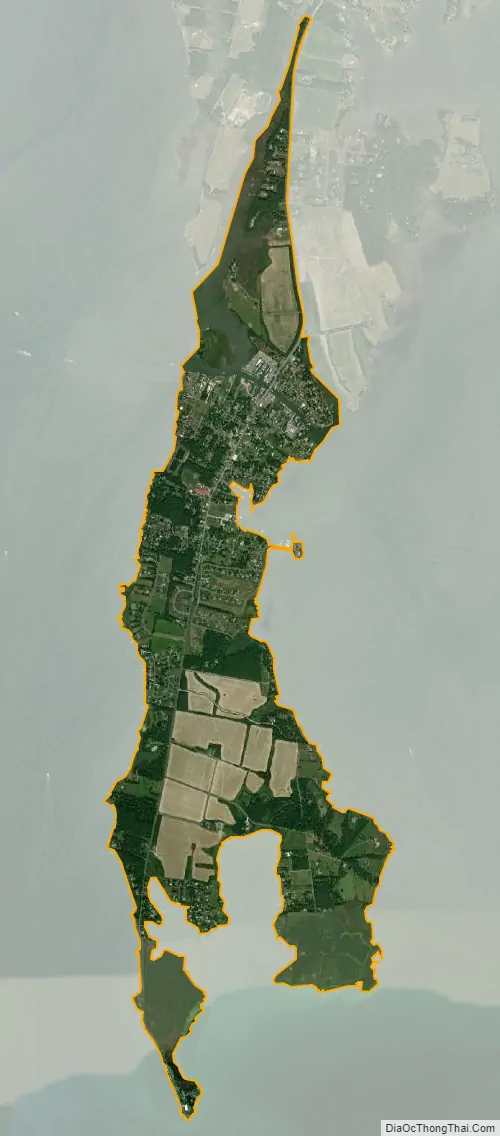
Tilghman Island city Satellite Map
Geography
Tilghman Island is located at 38°42′32″N 76°20′6″W / 38.70889°N 76.33500°W / 38.70889; -76.33500 (38.708795, −76.335016).
According to the United States Census Bureau, the CDP has a total area of 2.8 square miles (7.3 km), of which 2.7 square miles (7.0 km) is land and 0.1 square miles (0.26 km) (4.91%) is water.
See also
Map of Maryland State and its subdivision: Map of other states:- Alabama
- Alaska
- Arizona
- Arkansas
- California
- Colorado
- Connecticut
- Delaware
- District of Columbia
- Florida
- Georgia
- Hawaii
- Idaho
- Illinois
- Indiana
- Iowa
- Kansas
- Kentucky
- Louisiana
- Maine
- Maryland
- Massachusetts
- Michigan
- Minnesota
- Mississippi
- Missouri
- Montana
- Nebraska
- Nevada
- New Hampshire
- New Jersey
- New Mexico
- New York
- North Carolina
- North Dakota
- Ohio
- Oklahoma
- Oregon
- Pennsylvania
- Rhode Island
- South Carolina
- South Dakota
- Tennessee
- Texas
- Utah
- Vermont
- Virginia
- Washington
- West Virginia
- Wisconsin
- Wyoming