Washington Grove is a town in Montgomery County, Maryland, United States. The population was 555 at the 2010 United States Census. The Washington Grove Historic District was listed on the National Register of Historic Places in 1980.
| Name: | Washington Grove town |
|---|---|
| LSAD Code: | 43 |
| LSAD Description: | town (suffix) |
| State: | Maryland |
| County: | Montgomery County |
| Founded: | July 29, 1874 (1874-07-29) |
| Incorporated: | March 26, 1937 (1937-03-26) |
| Elevation: | 509 ft (155 m) |
| Total Area: | 0.34 sq mi (0.88 km²) |
| Land Area: | 0.34 sq mi (0.87 km²) |
| Water Area: | 0.00 sq mi (0.00 km²) |
| Total Population: | 505 |
| Population Density: | 1,502.98/sq mi (579.69/km²) |
| ZIP code: | 20880 |
| Area code: | 301, 240 |
| FIPS code: | 2481675 |
| GNISfeature ID: | 0591497 |
| Website: | http://www.washingtongrovemd.org/ |
Online Interactive Map
Click on ![]() to view map in "full screen" mode.
to view map in "full screen" mode.
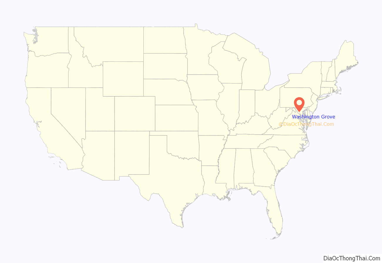
Washington Grove location map. Where is Washington Grove town?
History
Indigenous people of Washington Grove environs
The land where the residential community of Washington Grove now stands, and all of Montgomery County, was traveled and inhabited by indigenous people from around 10,000 BCE. Members of the Massawomeck, Susquehannock, Senaca (Iroquois), and Piscataway-Conoy tribes lived in the area through the 17th century, at which time the tribes had contact with Europeans, primarily using the land as crossover territory toward rock shelters, encampments and sizable villages near the Potomac River. Tribal boundaries were fluid.
12,000 years ago, an era colder than today’s climate, Paleo-Indian people moved together over the evergreen-covered landscape in small groups, adapting to changing seasons as they hunted bison, giant beavers, and mammoth using poles tipped with fluted points made from worked stone. Points have been found in the area where Seneca Creek flows into the Potomac River.
About 9,000 years ago, the climate warmed and plants and animals similar to today’s species spread along the Potomac. Signs of human occupation can be found along the Potomac River near Dickerson and other areas.
Around 3,500 years ago, tribes settled more permanently, although they still moved seasonally across woodlands, streams, and rivers. Seed collecting led to agriculture, and pottery making began. A settlement near Potomac, Maryland, dated from this period included burial sites for both humans and their dogs.
In the environs of Washington Grove is a steatite (soapstone) quarry site listed on the Maryland Inventory of Historic Properties, possibly dating from this late archaic time period. The presence of flaked stone tools suggests that Native Americans conducted quarrying here prior to the site’s use by local farmers and Washington Grove residents.
By 1300, indigenous people began to establish large settlements along the Potomac River, its islands, and uplands. They named the area Cohongoroota, “The Land Above the Falls”. The Piscataway people built longhouses 10 feet high and 20 feet long, with barrel-shaped roofs covered with bark or woven mats. Villages were surrounded by palisades for protection, and outside were fields of maize, beans, squash, and leaf vegetables such as Chenopodium (goosefoot) and Amaranthus. The bow and arrow were commonly used in hunting and warfare. A rock shelter in Gaithersburg near Seneca Creek (the Hargatt-King Rockshelter) contained a blue bead, suggesting contact with Europeans.
In 1608, John Smith identified 166 tribes, including the Algonquian-speaking tribes of the Powhatan group in Virginia, the Piscataway in Southern Maryland, and the Nachotank (Anacostia) near the Anacostia River. Montgomery County was ringed by non-Algonquian-speaking groups who were often hostile but were also trading partners: the Iroquoian-speaking Susquehannock’s near the mouth of the Chesapeake Bay (Susquehanna River), and the Siouan-speaking Monocans and Mannohoac west of the fall-line below the Potomac River. The Potomac River Valley was a major corridor in and out of the region. The tribes most prevalent in the area of Montgomery County just prior to European arrival were the Piscataway Conoy and the Susquehannock.
In the late 1600s, on Conoy Island near Point of Rocks, 150 Piscataway-Conoy people retreating from colonists’ discrimination built houses in a palisaded village, speaking an Algonquian language now extinct. By 1700, most indigenous tribes had suffered rapid population decline due to infectious diseases and wars, and had been forced out by English colonists. By 1722 the tribe had lost two-thirds of their population.
Fearing further encroachment and hostility, the Piscataway-Conoy people left the area, some moving into Pennsylvania and farther north. Today, descendants of the northern migrants live on the Six Nations of the Grand River First Nation reserve in Ontario. Some members moved to Virginia and a few families stayed in their traditional homeland in Maryland. The three groups are identified as the Piscataway Indian Nation and Tayca Territory, the Piscataway Conoy Confederacy and Sub-Tribes, and the Cedarville Band of Piscataway Indians.
As of December 2017, three tribes are recognized by the State of Maryland, namely the Piscataway Indian Nation, the Piscataway Conoy Tribe, and the Accohannock Indian Tribe. None of the three tribes are federally recognized.
As of the 2020 census, 40,000 Maryland residents self-identify as Native American.
Founding
A group of Methodists began the tradition of having camp meetings in the area circa 1800. Camp meetings were a tradition where a group of Methodists would gather in a forest clearing to worship and socialize. Benches were arranged in a circle or oval with an elevated preachers’ stand in the middle. Tents surrounded the area, along with carriages and wagons behind them. Services lasted well into the night. The camp meetings provided cultural and spiritual improvement to those who attended.
In 1873, a committee from the Foundry Methodist Church, located at 14th and G streets NW in Washington, D.C., began a search for a permanent location to hold annual camp meetings. They wanted a location with sufficient space for thousands of attendees, a supply of clean water, and a shaded location to provide relief from the summer sun. They wanted the location to be less than a day’s trip from Washington, D.C., and protection from the sale of liquor, because Methodists did not believe in drinking alcohol.
In June 1873, John T. Mitchell, Richard Willett, F. Howard, W.R. Woodward, E.F. Simpson, Mr. Worthington, Thomas P. Morgan, B. Peyton Brown, and a few others purchased 267.5 acres (1.1 km) of land from the widow of farmer Nathan Cooke for $6,636.25. The land was given to the Washington Grove Meeting Association, which had been recently incorporated on March 30, 1874.
Nineteenth century
A person could build a cottage on the land by purchasing five shares of stock for twenty dollars per share. The first share had to be purchased with cash, while the other four could be financed at an annual interest rate of six percent. Alternatively, a tent could be rented for between $9 and $15. There were two dining courts, and a market would provided fresh meat and produce. The center of the camp was originally named The Plaza and later The Symbolic Circle, and there were six numbered avenues radiating from it. Tents were arranged in a grid along avenues named for participating churches. Families would stay over to attend a two-week-long meeting of the Methodist Episcopal churches of the District of Columbia. Named Washington Grove Camp, the first camp meeting began on August 5, 1874, with 240 tents.
In 1877, a tabernacle with a belfry for a bell was built in the center of the circle. The bell called people to prayer, and it was also rung at the end of the camp meeting. The tabernacle was a large open-air chapel that could seat 500 worshipers. In addition to religious services, lecturers spoke on such topics as women’s suffrage and the problem of poverty in cities.
The Maryland legislature gave camp-meeting managers control of all land within a two-mile radius of a meeting site in order to prohibit businesses from opening nearby. The camp-meeting managers used this power to prohibit the sale of alcoholic beverages anywhere on the grounds. While entertaining programs were allowed, card playing, theater going, and dancing were all banned. In 1879, they voted to prohibit the selling of anything at all on Sundays. The Barrett Brothers, who operated the camp store, asked for an exception to sell ice cream and sandwiches on Sundays, but their request was denied.
Reverend William Burns of Dumbarton Methodist Church built the first cottage in 1878. By 1879, seventeen cottages had been built, each with green and white exteriors and large porches, surrounding a large tabernacle. The cottages peaked roofs resembled that of the original tents, and the architectural style was Carpenter Gothic, which was fashionable at the time. The round-trip train fare between the District and Washington Grove was eighty cents in 1879.
In 1879, the trustees voted to borrow $4,000 in order to build a hotel on the western area of the grounds. Completed in 1881, the hotel was three stories in the center and two stories in the wings. It had 23 sleeping rooms, a parlor, a dining room, and a kitchen. The cost to build the hotel came in under the $4,000 budget. Building of a chapel to hold 800 people began in 1889.
In 1880, the Washington Grove Camp Meeting Association decided that a hotel was needed. To build the hotel, they chose Wash Williams, a furniture store owner. The Albany Hotel had big porches, a large dining room, a barber shop, and a small store. Rooms cost between $6 and $7 per week, and dinner cost fifty cents. During the same year, rules were established protecting existing trees when cottages and streets were built.
In order to accommodate larger groups of people, an auditorium with seating for 1,400 people was built in Woodward Park in 1905. The auditorium symbolically moved away from the Sacred Circle. Admission to the wholesome entertainment cost $2 per adult and $1 per child for the season. Some of the entertainment included musical programs, educational lectures, and spelling bees. Religious services were held at the auditorium as well. As the auditorium increasingly became the center of life at the camp, the old Tabernacle was torn down.
Because the land was owned by the Washington Grove Camp Meeting Association, it had complete control over who purchased and leased the plots. In the early 20th century, the Washington Grove Camp Association, and later the Town of Washington Grove, placed restrictive covenants in deeds and leases in order to prevent African Americans from buying, renting, or leasing land in Washington Grove. This is exemplified in one of many deeds, such as one dating from 1925 that reads,
A Black Methodist camp was founded in 1864 as Emory Grove, that predated Washington Grove. Less than a mile separated the two towns, and many of the residents of Emory Grove worked for the residents of Washington Grove. The superintendent of the Washington Grove grounds was a resident of Emory Grove named William A. Scott. Following an incident in 1892 where an Emory Grove native, Jessie Lancaster, ransacked homes in Washington Grove, William A. Scott was forced out. Subsequently, in 1897 the gates to Washington Grove were closed, thus preventing anyone from walking through Washington Grove. This closing severely hindered the ability of Emory Grove residents to reach the train stop on the other side of Washington Grove.
Twentieth century
Eventually, people began to live in the area year-round. In 1910, the church formed a year-round congregation. By the 1920s, the Washington Grove Camp Meeting Association began selling portions of land, slowly replacing the 99-year leases. By 1924, camp meetings were no longer held.
The Great Depression affected the area significantly. The Washington Grove Camp Meeting Association had a difficult time paying its bills, it cut back on its insurance, and at one point it needed a donation to pay the community’s electricity bill. Because some residents could no longer afford vacation homes, some of the homes were rented out while others stood vacant and neglected.
By 1934, the Washington Grove Camp Meeting Association recognized that the area had dramatically changed since its founding. Some residents wanted the area to be annexed to the town of Gaithersburg. Reorganization committees met for several years to determine a plan for the future of the community. In 1937, the Washington Grove Camp Meeting Association was dissolved; the Maryland Legislature incorporated the community as a town on March 26, 1937. Maryland Governor Harry Nice signed the town’s charter into law on May 18, 1937. On July 10, 1937, the town held an election where it chose its first mayor and six members of the town council. Irving L. McCathran was elected the town’s first mayor. He served as mayor for twenty years.
By the late 1940s, Washington Grove began to look run down. Assembly Hall was in poor condition, the parks were unkempt, and many cottages so dilapidated that they were torn down. There was too little money to maintain the Auditorium, and it was demolished. The surrounding farms in Gaithersburg were beginning to be sold to developers, changing the surrounding area and putting pressure on the town to change dramatically. In 1955, the Town of Washington Grove obtained zoning and planning powers in order to control future growth.
In 1975, a master plan was written in order to retain the existing historic nature of the town. The town applied for National Register of Historic Places status in 1979, and it was approved the following year.
Today
The original layout of small houses fronting grassy walkways was preserved in the center of town, with vehicular access via paved streets leading to the backs of the houses. Houses built more recently do not front the walkways, but preserve a Grove flavor by the variety of architectural styles resulting from their being constructed one at a time in various styles rather than in tracts.
More than half of the town is publicly owned. The East Woods and West Woods, designated as wildlife sanctuaries, are the only municipality-owned forests in Maryland. The many walkways and parks are popular not only with residents but also with people from neighboring communities. On a fine evening, the walkways hum with people and cats strolling, walking dogs, and chatting. Residents meet for musical picnics at the Gazebo, town meetings in McCathran Hall, and summer days swimming in Maple Lake, the Town’s swimming hole in the West Woods. Other town activities include the Summer in the Parks program for children, a book club, a movie club, and the Mousetrap series of concerts.
In 2013, Preservation Maryland placed Washington Grove on its list of threatened historic properties.
Washington Grove Road Map
Washington Grove city Satellite Map
Geography
Washington Grove is located at 39°8′22″N 77°10′33″W / 39.13944°N 77.17583°W / 39.13944; -77.17583 (39.139535, -77.175926).
According to the United States Census Bureau, the town has a total area of 0.35 square miles (0.91 km), all land.
See also
Map of Maryland State and its subdivision: Map of other states:- Alabama
- Alaska
- Arizona
- Arkansas
- California
- Colorado
- Connecticut
- Delaware
- District of Columbia
- Florida
- Georgia
- Hawaii
- Idaho
- Illinois
- Indiana
- Iowa
- Kansas
- Kentucky
- Louisiana
- Maine
- Maryland
- Massachusetts
- Michigan
- Minnesota
- Mississippi
- Missouri
- Montana
- Nebraska
- Nevada
- New Hampshire
- New Jersey
- New Mexico
- New York
- North Carolina
- North Dakota
- Ohio
- Oklahoma
- Oregon
- Pennsylvania
- Rhode Island
- South Carolina
- South Dakota
- Tennessee
- Texas
- Utah
- Vermont
- Virginia
- Washington
- West Virginia
- Wisconsin
- Wyoming
