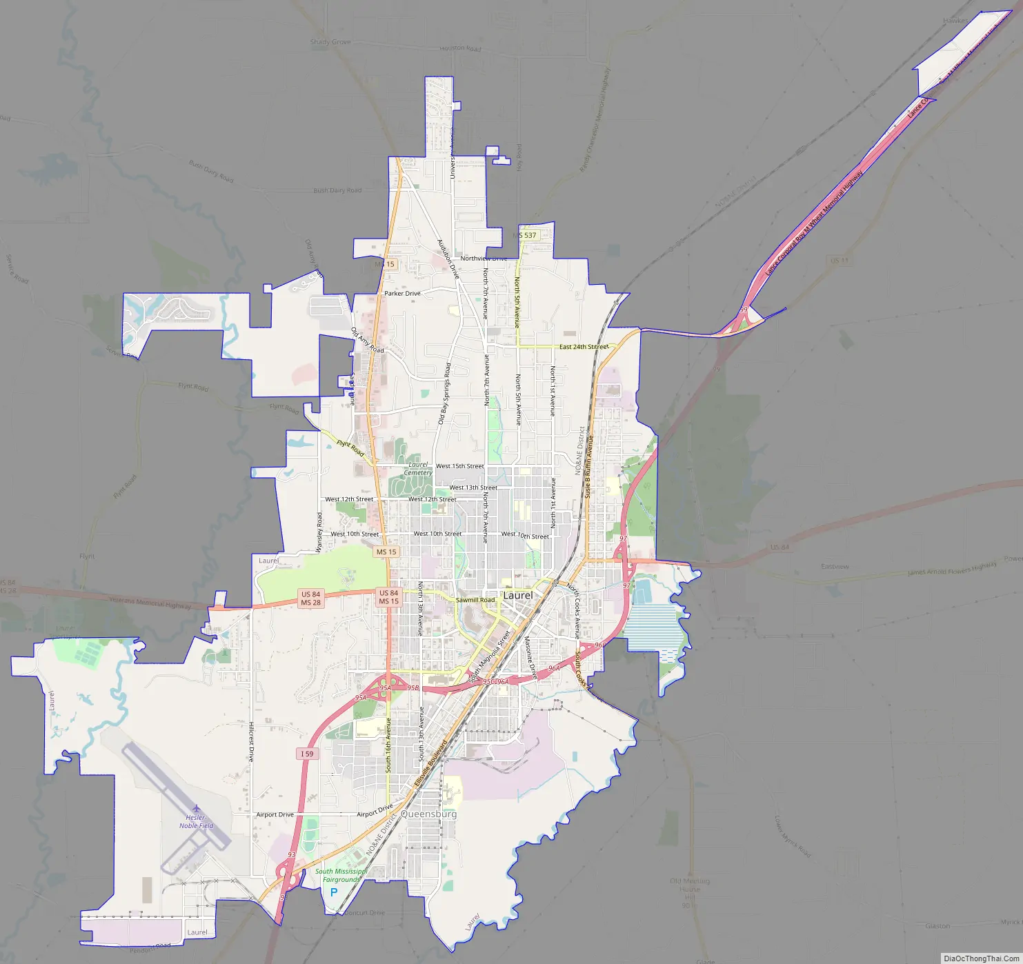
Laurel is a city in and the second county seat of Jones County, Mississippi, United States. As of the 2020 census, the city had a population of 17,161. Laurel is northeast of Ellisville, the first county seat, which contains the first county courthouse. It has the second county courthouse, as Jones County has two judicial districts. Laurel is the headquarters of the Jones County Sheriff’s Department, which administers in the county. Laurel is the principal city of a micropolitan statistical area named for it. Major employers include Howard Industries, Sanderson Farms, Masonite International, Family Health Center, Howse Implement, Thermo-Kool, and South Central Regional Medical Center. Laurel is home to the Lauren Rogers Museum of Art, Mississippi’s oldest art museum, established by the family of Lauren Eastman Rogers.
| Name: | Laurel city |
|---|---|
| LSAD Code: | 25 |
| LSAD Description: | city (suffix) |
| State: | Mississippi |
| County: | Jones County |
| Incorporated: | 1882 |
| Elevation: | 269 ft (82 m) |
| Total Area: | 16.54 sq mi (42.83 km²) |
| Land Area: | 16.24 sq mi (42.05 km²) |
| Water Area: | 0.30 sq mi (0.78 km²) |
| Total Population: | 17,161 |
| Population Density: | 1,056.97/sq mi (408.10/km²) |
| ZIP code: | 39440–39443 |
| Area code: | 601, 769 |
| FIPS code: | 2839640 |
| GNISfeature ID: | 0672321 |
| Website: | www.laurelms.com |
Online Interactive Map
Click on ![]() to view map in "full screen" mode.
to view map in "full screen" mode.
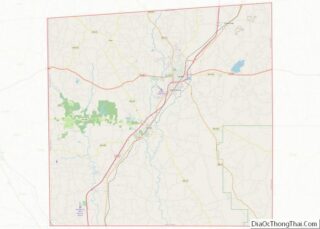
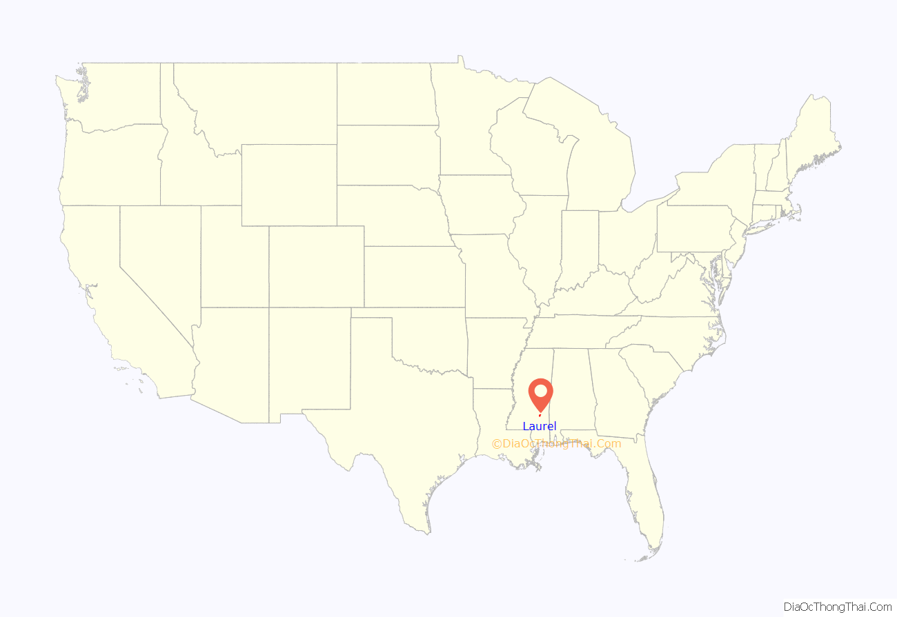
Laurel location map. Where is Laurel city?

History
Following the 1881 construction of the New Orleans and Northeastern Railroad through the area, economic development occurred rapidly. The city of Laurel was incorporated in 1882, with timber as the impetus. Yellow pine forests in the region fueled the industry. The city was named for thickets of mountain laurel (Kalmia latifolia) native to the original town site.
Located in the heart of the piney woods ecoregion of the southeastern United States, the land site that eventually became Laurel was densely covered with forests of virgin longleaf pine, making the area attractive to pioneering lumberjacks and sawmill operators in the late 19th century.
In 1881, business partners John Kamper and A.M. Lewin constructed a small lumber mill on the New Orleans and Northeastern Railroad. Kamper and Lewin’s mill was in an area that later became Laurel’s First Avenue. The next year, in response to a U.S. Postal Service request to provide a postal delivery name for their mill and its surrounding lumber camp, Kamper and Lewin submitted the name “Lawrell” as an homage to the area’s naturally growing mountain laurel bushes. Federal postal officials soon “corrected” the peculiar spelling, giving the town its current spelling.
During its first decade or so, Laurel was little more than a glorified lumber camp surrounding Kamper and Lewin’s primitive sawmill. By 1891, Kamper’s company was on the verge of bankruptcy, leading Kamper to sell the mill and extensive land holdings in the area (more than 15,000 acres), to Clinton, Iowa, lumber barons Lauren Chase Eastman and George and Silas Gardiner, founders of the Eastman-Gardiner Company.
After their purchase, Eastman and the Gardiner brothers decided to make substantial improvements to Laurel’s lumber operations by constructing a new, much larger, state-of-the-art lumber mill. In 1893, the new Eastman-Gardiner Company mill began operations, using the best technology and labor-saving devices of the day.
By the early 1900s, the success of Eastman-Gardner Company’s operations in Laurel and the region’s superabundance of timber began to attract other lumber industrialists’ attention. In 1906, the Gilchrist-Fordney Company, whose founders hailed from Alpena, Michigan, began construction on their own lumber mill in Laurel. The Wausau-Southern mill from Wausau, Wisconsin, followed in 1911, and the Marathon mill from Memphis, Tennessee, in 1914. By the end of World War I, Laurel’s mills produced and shipped more yellow pine lumber than those of any other location in the world. By the 1920s—the peak of Laurel’s lumber production—the area’s four mills were producing a total of one million board feet of lumber per day. Laid end to end, that amount of lumber would stretch 189 miles.
The economic prosperity of Laurel’s timber era (1893–1937) and “timber families” created the famed Laurel Central Historic District as a byproduct. The area is considered Mississippi’s largest, finest, and most intact collection of early-20th-century architecture and has been listed on the National Register of Historic Places since September 4, 1987, for both its historical value and its wide variety of architectural styles. Many of the district’s homes and buildings are featured on the HGTV series Home Town. In addition to influencing a diverse architectural district, Laurel’s “timber families” influenced the building of the town’s broad avenues, the design of numerous public parks, and the development of strong public schools.
The city’s population grew markedly during the early 20th century because rural people were attracted to manufacturing jobs and the economic takeoff of Masonite International. Mechanization of agriculture reduced the number of farming jobs. In 1942, Howard Wash, a 45-year-old African-American man who had been convicted of murder, was dragged from jail and lynched by a mob. The city reached its peak census population in 1960, and has declined about one third since then.
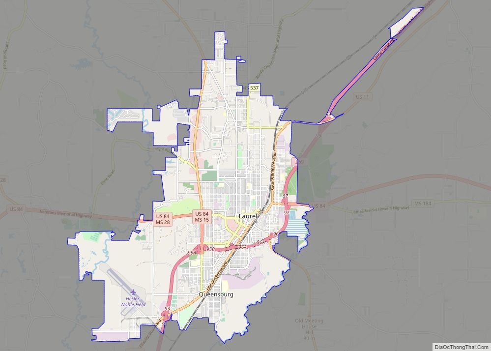
Laurel Road Map
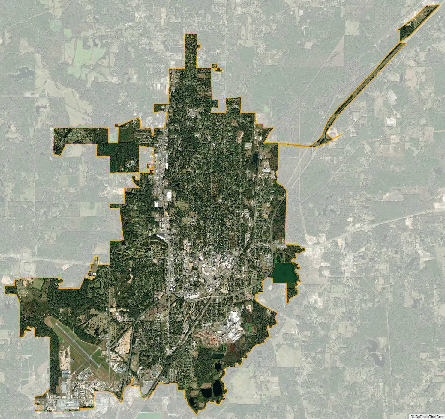
Laurel city Satellite Map
Geography
Laurel is in north-central Jones County, 8 miles (13 km) northeast of Ellisville, the first county seat. Interstate 59 and U.S. Route 11 pass through Laurel, both highways leading southwest 30 miles (48 km) to Hattiesburg and northeast 57 miles (92 km) to Meridian. U.S. Route 84 passes through the south side of the city, leading east 30 miles (48 km) to Waynesboro and west 27 miles (43 km) to Collins. Mississippi Highway 15 passes through the south and west sides of the city, leading northwest 24 miles (39 km) to Bay Springs and southeast 28 miles (45 km) to Richton.
According to the United States Census Bureau, Laurel has an area of 16.5 square miles (42.8 km), of which 15.8 square miles (40.8 km) is land and 0.3 square miles (0.8 km), or 1.81%, is water. The city lies on a low ridge between Tallahala Creek to the east and Tallahoma Creek to the west. Tallahoma Creek joins Tallahala Creek south of Laurel, and Tallahala Creek continues south to join the Leaf River, part of the Pascagoula River watershed.
Climate
The climate in this area is characterized by hot, humid summers and generally mild to cool winters. According to the Köppen Climate Classification system, Laurel has a humid subtropical climate, abbreviated “Cfa” on climate maps. The area is also prone to tornadoes. On December 28, 1954, an F3 tornado tore directly through the city, injuring 25 people.
See also
Map of Mississippi State and its subdivision:- Adams
- Alcorn
- Amite
- Attala
- Benton
- Bolivar
- Calhoun
- Carroll
- Chickasaw
- Choctaw
- Claiborne
- Clarke
- Clay
- Coahoma
- Copiah
- Covington
- Desoto
- Forrest
- Franklin
- George
- Greene
- Grenada
- Hancock
- Harrison
- Hinds
- Holmes
- Humphreys
- Issaquena
- Itawamba
- Jackson
- Jasper
- Jefferson
- Jefferson Davis
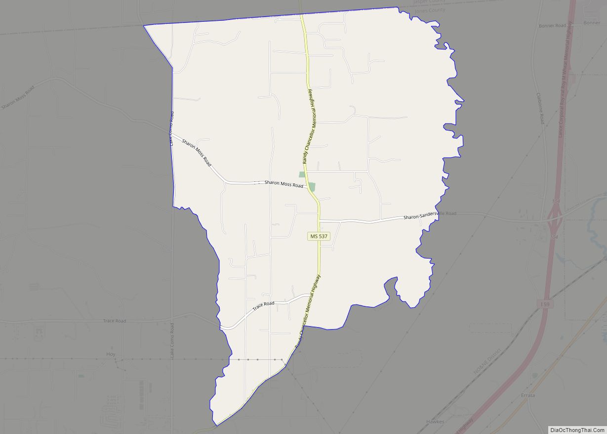
- Jones
- Kemper
- Lafayette
- Lamar
- Lauderdale
- Lawrence
- Leake
- Lee
- Leflore
- Lincoln
- Lowndes
- Madison
- Marion
- Marshall
- Monroe
- Montgomery
- Neshoba
- Newton
- Noxubee
- Oktibbeha
- Panola
- Pearl River
- Perry
- Pike
- Pontotoc
- Prentiss
- Quitman
- Rankin
- Scott
- Sharkey
- Simpson
- Smith
- Stone
- Sunflower
- Tallahatchie
- Tate
- Tippah
- Tishomingo
- Tunica
- Union
- Walthall
- Warren
- Washington
- Wayne
- Webster
- Wilkinson
- Winston
- Yalobusha
- Yazoo
- Alabama
- Alaska
- Arizona
- Arkansas
- California
- Colorado
- Connecticut
- Delaware
- District of Columbia
- Florida
- Georgia
- Hawaii
- Idaho
- Illinois
- Indiana
- Iowa
- Kansas
- Kentucky
- Louisiana
- Maine
- Maryland
- Massachusetts
- Michigan
- Minnesota
- Mississippi
- Missouri
- Montana
- Nebraska
- Nevada
- New Hampshire
- New Jersey
- New Mexico
- New York
- North Carolina
- North Dakota
- Ohio
- Oklahoma
- Oregon
- Pennsylvania
- Rhode Island
- South Carolina
- South Dakota
- Tennessee
- Texas
- Utah
- Vermont
- Virginia
- Washington
- West Virginia
- Wisconsin
- Wyoming