Meridian is the seventh largest city in the U.S. state of Mississippi, with a population of 41,148 at the 2010 census and an estimated population in 2018 of 36,347. It is the county seat of Lauderdale County and the principal city of the Meridian, Mississippi Micropolitan Statistical Area. Along major highways, the city is 93 mi (150 km) east of Jackson, Mississippi; 154 mi (248 km) southwest of Birmingham, Alabama; 202 mi (325 km) northeast of New Orleans, Louisiana; and 231 mi (372 km) southeast of Memphis, Tennessee.
Established in 1860, at the junction of the Mobile and Ohio Railroad and Southern Railway of Mississippi, Meridian built an economy based on the railways and goods transported on them, and it became a strategic trading center. During the American Civil War, General William Tecumseh Sherman burned much of the city to the ground in the Battle of Meridian (February 1864). Rebuilt after the war, the city entered a “Golden Age”. It became the largest city in Mississippi between 1890 and 1930, and a leading center for manufacturing in the South, with 44 trains arriving and departing daily. Union Station, built in 1906, is now a multi-modal center, with access to Amtrak and Greyhound Buses averaging 242,360 passengers per year. Although the economy slowed with the decline of the railroad industry, the city has diversified, with healthcare, military, and manufacturing employing the most people in 2010. The population within the city limits, according to 2008 census estimates, is 38,232, but a population of 232,900 in a 45-mile (72 km) radius and 526,500 in a 65-mile (105 km) radius, of which 104,600 and 234,200 people respectively are in the labor force, feeds the economy of the city.
The area is served by two military facilities, Naval Air Station Meridian and Key Field, which employ over 4,000 people. NAS Meridian is home to the Regional Counter-Drug Training Academy (RCTA) and the first local Department of Homeland Security in the state. Students in Training Air Wing ONE (Strike Flight Training) train in the T-45C Goshawk training jet. Key Field is named after brothers Fred and Al Key, who set a world endurance flight record in 1935. The field is now home to the 186th Air Refueling Wing of the Air National Guard and a support facility for the 185th Aviation Brigade of the Army National Guard. Rush Foundation Hospital is the largest non-military employer in the region, employing 2,610 people. Among the city’s many arts organizations and historic buildings are the Riley Center, the Meridian Museum of Art, Meridian Little Theatre, and the Meridian Symphony Orchestra. Meridian was home to two Carnegie libraries, one for whites and one for African Americans. The Carnegie Branch Library, now demolished, was one of a number of Carnegie libraries built for blacks in the Southern United States during the segregation era.
The Mississippi Arts and Entertainment Experience (the MAX) is located in downtown Meridian. Jimmie Rodgers, the “Father of Country Music”, was born in Meridian. Highland Park houses a museum which displays memorabilia of his life and career, as well as railroad equipment from the steam-engine era. The park is also home to the Highland Park Dentzel Carousel, a National Historic Landmark. It is the world’s only two-row stationary Dentzel menagerie in existence.
Other notable natives include Miss America 1986 Susan Akin; James Chaney, an activist who was one of three civil rights workers murdered in 1964; singer Paul Davis; and Hartley Peavey, founder of Peavey Electronics headquartered in Meridian. The federal courthouse was the site of the 1966–1967 trial of suspects in the murder of Chaney and two other activists. For the first time, an all-white jury convicted a white official of a civil rights killing.
| Name: | Meridian city |
|---|---|
| LSAD Code: | 25 |
| LSAD Description: | city (suffix) |
| State: | Mississippi |
| County: | Lauderdale County |
| Incorporated: | February 10, 1860 |
| Elevation: | 344 ft (105 m) |
| Land Area: | 53.74 sq mi (139.19 km²) |
| Water Area: | 0.76 sq mi (1.98 km²) |
| Population Density: | 652.24/sq mi (251.83/km²) |
| Area code: | 601 |
| FIPS code: | 2846640 |
| GNISfeature ID: | 0673491 |
| Website: | www.meridianms.org |
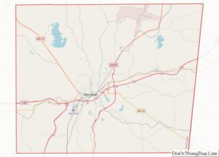
Online Interactive Map
Click on ![]() to view map in "full screen" mode.
to view map in "full screen" mode.
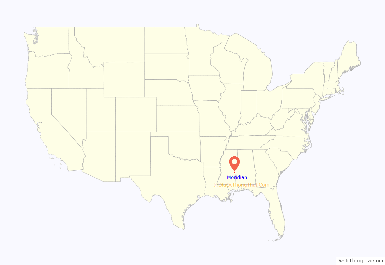
Meridian location map. Where is Meridian city?
History
Previously inhabited by the Choctaw Native Americans, the area now called Meridian was obtained by the United States under the terms of the Treaty of Dancing Rabbit Creek in 1830 during the period of Indian removal. After the treaty was ratified, European-American settlers began to move into the area.
After receiving a federal land grant of about 2,000 acres (810 ha), Richard McLemore, the first settler of Meridian, began offering free land to newcomers to attract more settlers to the region and develop the area. Most of McLemore’s land was bought in 1853 by Lewis A. Ragsdale, a lawyer from Alabama. John T. Ball, a merchant from Kemper County, bought the remaining 80 acres (0.32 km). Ragsdale and Ball, now known as the founders of the city, began laying out lots for new development on their respective land sections.
There was much competition over the proposed name of the settlement. Ball and the more industrial residents of the city supported the name “Meridian,” believing the term to be synonymous with “junction”; the more agrarian residents of the city preferred “Sowashee” (meaning “mad river” in Choctaw, from the name of a nearby creek); and Ragsdale proposed “Ragsdale City.” Ball erected a station house on the Mobile and Ohio Railroad – the sign on which would alternate between “Meridian” and “Sowashee” each day. Eventually the continued development of the railroads led to an influx of railroad workers who overruled the others in the city and left “Meridian” on the station permanently. The town was officially incorporated as Meridian on February 10, 1860.
At the start of the American Civil War in 1861, Meridian was still a small village. But the Confederates made use of its strategic position at the railroad junction and constructed several military installations there to support the war. During the Battle of Meridian in 1864, Union General William Tecumseh Sherman led troops into the city, destroying the railroads in every direction, as well as an arsenal and immense storehouses; his forces burned many of the buildings to the ground. Sherman is reported to have said afterwards, “Meridian, with its depots, store-houses, arsenal, hospitals, offices, hotels, and cantonments no longer exists.” Despite the destruction, workers rapidly repaired the railroad lines and they were back in operation 26 working days after the battle.
Race relations were tense during the Reconstruction era, as whites resisted freedmen being allowed to choose their labor, vote, and have freedom of movement. Following a fire that damaged many businesses, the riot of 1871 erupted, with whites attacking blacks in the community. The black community had expanded after the war, as people moved to the city for more opportunity and to create community away from white supervision.
The town boomed in the aftermath of the Civil War, and experienced its “Golden Age” from 1880 to 1910. The railroads in the area provided for both passenger transportation and industrial needs, stimulating industry, businesses and a population boom. Related commercial activity increased in the downtown area. Between 1890 and 1930, Meridian was the largest city in Mississippi and a leading center for manufacturing in the South.
The wealth generated by this strong economy resulted in residents constructing many fine buildings, now preserved as historic structures, including the Grand Opera House in 1890, the Wechsler School in 1894, two Carnegie libraries in 1913, and the Threefoot Building, Meridian’s tallest skyscraper, in 1929.
The city continued to grow thanks to a commission government’s efforts to bring in 90 new industrial plants in 1913 and a booming automobile industry in the 1920s. Even through the stock market crash of 1929 and the following Great Depression, the city continued to attract new businesses. With escapism becoming popular in the culture during the depth of the Depression, the S. H. Kress & Co. building, built to “provide luxury to the common man,” opened in downtown Meridian, as did the Temple Theater, which was first used as a movie house. The federal courthouse was built in 1933 as a WPA project.
After a brief slowdown of the economy at the end of the Depression, the country entered World War II, which renewed the importance of railroads. The rails were essential to transport gasoline and scrap metal to build military vehicles, so Meridian became the region’s rail center again. This renewed prosperity continued until the 1950s, when the affordability of automobiles and the subsidized Interstate Highway System drew off passengers from the trains. The decline of the railroad industry, which went through considerable restructuring among freight lines as well, caused significant job losses. The city’s population declined as workers left for other areas.
During the American Civil Rights Movement in the 1960s, Meridian was home to a Council of Federated Organizations (COFO) office and several other activist organizations. James Chaney and other local residents, along with Michael Schwerner, his wife Rita, and Andrew Goodman, volunteers from New York City, worked to create a community center. They held classes during Freedom Summer to help prepare African Americans in the area to prepare to regain their constitutional franchise, after having been excluded from politics since disenfranchisement in 1890. Whites in the area resented the activism, and physically attacked civil rights workers. In June 1964, Chaney, Schwerner, and Goodman went to Neshoba County, Mississippi, to meet with members of a black church that had been bombed and burned. The three disappeared that night on their way back to Meridian. Following a massive FBI investigation, their murdered bodies were found two months later, buried in an earthen dam.
Seven Klansmen, including a deputy sheriff, were convicted by an all-white jury in the federal courthouse in Meridian of “depriving the victims of their civil rights”. Three defendants were acquitted in the trial for the murders of Chaney, Goodman, and Schwerner. This was the first time that a white jury had convicted “a white official in a civil rights killing.”
In 2005, the state brought charges in the case for the first time. Edgar Ray Killen was convicted of manslaughter and sentenced to 60 years in prison. Meridian later honored Chaney by renaming a portion of 49th Avenue after him and holding an annual memorial service.
Starting in the 1960s and following the construction of highways that made commuting easier, residents began to move away from downtown in favor of new housing subdivisions to the north. After strip commercial interests began to move downtown, the city worked to designate several areas as historic districts in the 1970s and 80s to preserve the architectural character of the city. The Meridian Historic Districts and Landmarks Commission was created in 1979, and the Meridian Main Street program was founded in 1985.
Meridian Main Street organized several projects to revitalize downtown. This included construction of a new Amtrak Station in 1997, based on the design of the historic train station used during Meridian’s Golden Age; it had been demolished. Other projects included renovation of the Rosenbaum Building in 2001 and Weidmann’s Restaurant in 2002, as well as support for integrated urban design. Meridian Main Street, along with The Riley Foundation, helped renovate and adapt the historic Grand Opera House in 2006 for use as the “Mississippi State University Riley Center for Education and the Performing Arts.”
After ownership of the Meridian Main Street was transferred to the Alliance for Downtown Meridian in late 2007, the two organizations, along with the Meridian Downtown Association, spearheaded the downtown revitalization effort. The Alliance serves as an umbrella organization, allowing the other two organizations to use its support staff and housing, and in turn the Alliance serves as a liaison between the organizations. Plans were underway to renovate the Threefoot Building, but newly elected Mayor Cheri Barry killed the plans in early 2010. Today, the Alliance helps to promote further development and restoration downtown; its goal is to assist businesses such as specialty shops, restaurants, and bars because these help downtown become more active during the day and at night. The Meridian Downtown Association is primarily focused on increasing foot traffic downtown by organizing special events, and the Meridian Main Street program supports existing businesses downtown.
Hotels
Given Meridian’s site as a railroad junction, its travelers have attracted the development of many hotels. Even before Meridian reached its “Golden Age,” several large hotels, including the Great Southern and the Grand Avenue hotels, were built before the start of the 20th century. With the growth of the railroads and the construction of the original Union Station in 1906, many hotels were constructed for passengers and workers. The Elmira Hotel was constructed in 1905, and the Terminal Hotel was constructed in 1910. Hotel Meridian was constructed in 1907, and Union Hotel was built in 1908. Union Hotel was listed on the National Register of Historic Places in 1979, and both Hotel Meridian and Grand Avenue Hotel were listed as contributing properties to the Meridian Urban Center Historic District.
As the city grew, the hotels reflected ambitions of the strong economy, as evidenced by the 11-story skyscraper Lamar Hotel built in 1927. Listed on the National Register of Historic Places in 1979, the Lamar Hotel was adapted for use as a county annex building. In 1988 it was listed as a Mississippi Landmark. The E.F. Young Hotel was built in 1931. A staple in the African-American business district that developed west of the city’s core, the hotel was one of the only places in the city during the years of segregation where a traveling African American could find a room.
As the city suburbs developed in the 1960s and ’70s, most hotels moved outside of downtown. Rehabilitation of the Riley Center in 2006 has increased demand and a push for a new downtown hotel. The Threefoot Building has been proposed for redevelopment for this purpose, but restoration efforts stalled with a change in city administrations. The Threefoot Preservation Society was formed in 2013 to raise public awareness and support for the building’s renovation, featuring tours of the first floor and anniversary events.
Historic districts
Meridian has nine historic districts that are listed on the National Register of Historic Places. The Meridian Downtown Historic District is a combination of two older districts, the Meridian Urban Center Historic District and the Union Station Historic District. Many architectural styles are present in the districts, most from the late 19th and early 20th centuries, including Queen Anne, Colonial Revival, Italianate, Art Deco, Late Victorian, and bungalow. The districts are:
1 East End Historic District – roughly bounded by 18th St, 11th Ave, 14th St, 14th Ave, 5th St, and 17th Ave.
2 Highlands Historic District – roughly bounded by 15th St, 34th Ave, 19th St, and 36th Ave.
3 Meridian Downtown Historic District – runs from the former Gulf, Mobile and Ohio Railroad north to 6th St between 18th and 26th Ave, excluding Ragsdale Survey Block 71.
6 Merrehope Historic District – roughly bounded by 33rd Ave, 30th Ave, 14th St, and 8th St.
7 Mid-Town Historic District – roughly bounded by 23rd Ave, 15th St, 28th Ave, and 22nd St.
8 Poplar Springs Road Historic District – roughly bounded by 29th St, 23rd Ave, 22nd St, and 29th Ave.
9 West End Historic District – roughly bounded by 7th St, 28th Ave, Shearer’s Branch, and 5th St.
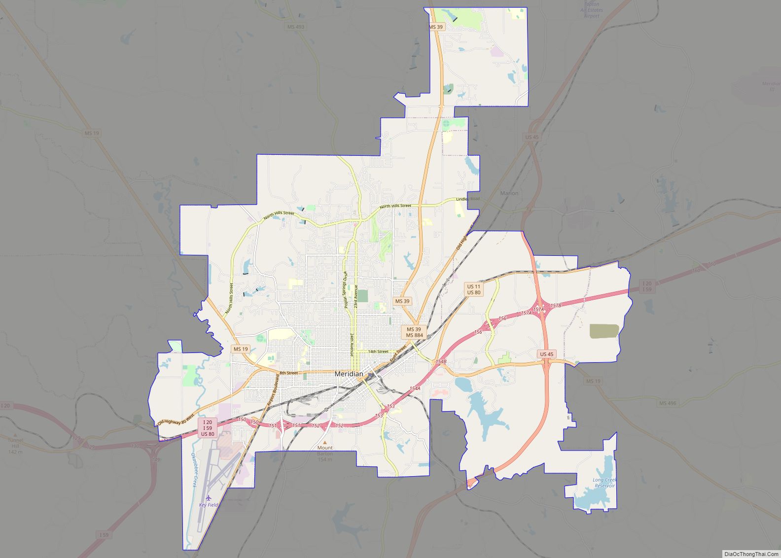
Meridian Road Map
Meridian city Satellite Map
Geography
Meridian is located in the East Central Hills region of Mississippi in Lauderdale County. According to the United States Census Bureau, the city has a total area of 54.50 square miles (141.2 km), of which 53.74 square miles (139.2 km) are land and 0.76 square miles (2.0 km), or 1.40%, are water. Along major highways, the city is 93 mi (150 km) east of Jackson, Mississippi; 154 mi (248 km) west of Birmingham, Alabama; 202 mi (325 km) northeast of New Orleans, Louisiana; 231 mi (372 km) southeast of Memphis, Tennessee; and 297 mi (478 km) west of Atlanta, Georgia. The area surrounding the city is covered with oak and pine forests, and its topography consists of clay hills and the bottom lands of the head waters of the Chickasawhay River.
The natural terrain of the area has been modified in the urban core of the city by grading, but maintains its gentle rolling character in the outlying areas. Numerous small creeks are found throughout the city, and small lakes and woodlands lie in the northern and southern portions of the city. Sowashee Creek runs through the southern portion of the city and is fed by Gallagher’s Creek, which flows through the center of the city. Loper’s Creek runs through the far-western part of the city, while smaller creeks including Shearer’s Branch, Magnolia Creek, and Robbins Creek are dispersed throughout the city.
Meridian is in the humid subtropical climate zone. The average high temperature during summer (June through August) is around 90 °F (32 °C) and the average low is around 70 °F (21 °C). In winter (December through February) the average maximum is around 60 °F (16 °C) and minimum 35 °F (2 °C). The warmest month is July, with an average high of 92.9 °F (33.8 °C), and the coldest month of the year is January with an average low of 34.7 °F (1.5 °C).
The average annual precipitation in the city is 58.65 in (1,490 mm). Rainfall is fairly evenly distributed throughout the year, and the wettest month of the year is March, in which an average of 6.93 in (176 mm) of rain falls. Much rainfall is delivered by thunderstorms which are common during the summer months but occur throughout the year. Severe thunderstorms – which can produce damaging winds and/or large hail in addition to the usual hazards of lightning and heavy rain – occasionally occur. These are most common during the spring months with a secondary peak during the fall months. These storms also bring the risk of tornadoes.
See also
Map of Mississippi State and its subdivision:- Adams
- Alcorn
- Amite
- Attala
- Benton
- Bolivar
- Calhoun
- Carroll
- Chickasaw
- Choctaw
- Claiborne
- Clarke
- Clay
- Coahoma
- Copiah
- Covington
- Desoto
- Forrest
- Franklin
- George
- Greene
- Grenada
- Hancock
- Harrison
- Hinds
- Holmes
- Humphreys
- Issaquena
- Itawamba
- Jackson
- Jasper
- Jefferson
- Jefferson Davis
- Jones
- Kemper
- Lafayette
- Lamar
- Lauderdale
- Lawrence
- Leake
- Lee
- Leflore
- Lincoln
- Lowndes
- Madison
- Marion
- Marshall
- Monroe
- Montgomery
- Neshoba
- Newton
- Noxubee
- Oktibbeha
- Panola
- Pearl River
- Perry
- Pike
- Pontotoc
- Prentiss
- Quitman
- Rankin
- Scott
- Sharkey
- Simpson
- Smith
- Stone
- Sunflower
- Tallahatchie
- Tate
- Tippah
- Tishomingo
- Tunica
- Union
- Walthall
- Warren
- Washington
- Wayne
- Webster
- Wilkinson
- Winston
- Yalobusha
- Yazoo
- Alabama
- Alaska
- Arizona
- Arkansas
- California
- Colorado
- Connecticut
- Delaware
- District of Columbia
- Florida
- Georgia
- Hawaii
- Idaho
- Illinois
- Indiana
- Iowa
- Kansas
- Kentucky
- Louisiana
- Maine
- Maryland
- Massachusetts
- Michigan
- Minnesota
- Mississippi
- Missouri
- Montana
- Nebraska
- Nevada
- New Hampshire
- New Jersey
- New Mexico
- New York
- North Carolina
- North Dakota
- Ohio
- Oklahoma
- Oregon
- Pennsylvania
- Rhode Island
- South Carolina
- South Dakota
- Tennessee
- Texas
- Utah
- Vermont
- Virginia
- Washington
- West Virginia
- Wisconsin
- Wyoming
