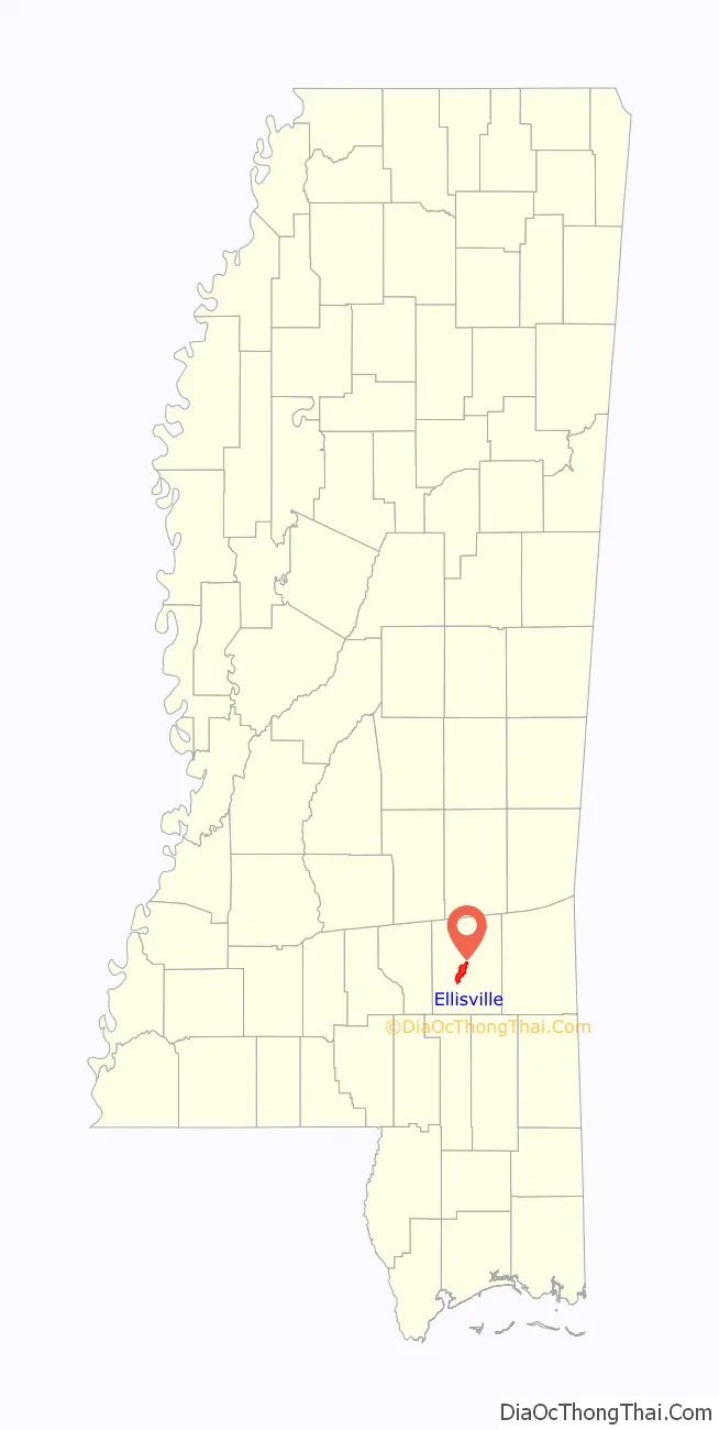
Ellisville is a town in and the first county seat of Jones County, Mississippi, United States. The population was 4,448 at the time of the 2010 census, up from 3,465 at the 2000 census. The Jones County Courthouse is located here, as is much of the county government.
The state legislature authorized a second county seat at Laurel, to the northeast, which developed as the center of lumber and textile mills, with a much larger population. Ellisville is part of the Laurel micropolitan statistical area.
| Name: | Ellisville city |
|---|---|
| LSAD Code: | 25 |
| LSAD Description: | city (suffix) |
| State: | Mississippi |
| County: | Jones County |
| Elevation: | 253 ft (77 m) |
| Total Area: | 10.55 sq mi (27.32 km²) |
| Land Area: | 10.44 sq mi (27.04 km²) |
| Water Area: | 0.11 sq mi (0.28 km²) |
| Total Population: | 4,652 |
| Population Density: | 445.59/sq mi (172.05/km²) |
| ZIP code: | 39437 |
| Area code: | 601, 769 |
| FIPS code: | 2822020 |
| GNISfeature ID: | 0669746 |
| Website: | cityofellisvillems.com |
Online Interactive Map
Click on ![]() to view map in "full screen" mode.
to view map in "full screen" mode.
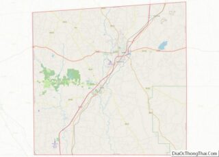
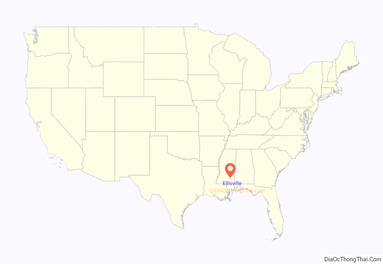
Ellisville location map. Where is Ellisville city?
History
The town is named for Powhatan Ellis, a former U.S. senator for Mississippi who identified as a descendant of Pocahontas and her father, Chief Powhatan in Virginia. Ellisville was designated as the county seat, and it became the major commercial and population center of Jones County through the early decades of development in the nineteenth century.
During the Civil War, Ellisville and Jones County were a center of pro-Union resistance. The county had mostly yeomen farmers and cattle herders, who were not slaveholders. Slaves constituted 12% of the county’s population in 1860, the lowest proportion of slaves of any county in the state in 1860, as conditions generally did not support cultivation of large cotton plantations. Many local men resented going to war to support slaveholders, and worried about the survival of their families, where women and children worked to keep subsistence farms going. They resented Confederate tax collectors who took the goods and stores their families needed to live.
Confederate deserters and refugee slaves formed a resistance group known as the Knight Company, led by Newton Knight, First Lieutenant Jasper Collins, and Second Lieutenant William Wesley Sumrall. They were known to take refuge in a swamp along the Leaf River. Along with as many as 100 other Southern men, they fought several skirmishes with Confederate tax men, then other Confederate units eventually sent to crush the resistance. In 1864 they took control in Ellisville, raising the United States flag over the courthouse in place of the Confederate flag.
In 1919, Ellisville hosted one of the most gruesome lynchings in history, when a black man, John Hartfield was found to have a white girlfriend. A story was concocted about a rape, and Hartfield was captured by law enforcement. The Jackson Daily News ran headlines that “John Hartfield will be lynched by Ellisville mob at 5:00 this afternoon”, and that a crowd of thousands was expected to attend. A crowd of around 10,000 came to watch Hartfield hanged from a tree, then shot repeatedly. When his body was cut down, pieces were cut off for souvenirs and what remained was burned. Commemorative postcards were printed.
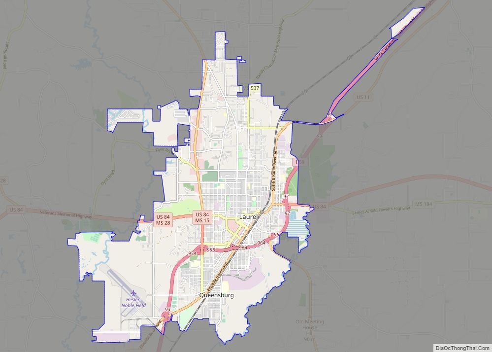
In the late 19th and early 20th centuries, Ellisville lost primacy to nearby Laurel, which became a center of the timber industry and cotton textile mills. Its population in the mid-20th century was nearly six times that of Ellisville. Laurel has attracted other industries and is the center of a micropolitan statistical area comprising all of Jones County and Jasper County. The Jones County Sheriff’s Department is based in Laurel, but the county government is still based in Ellisville, at the Jones County Courthouse.
Ellisville reflects the demographics of the county and is majority white. Laurel is majority African American in population, reflecting the migration of agricultural workers to the city for industrial and urban jobs.
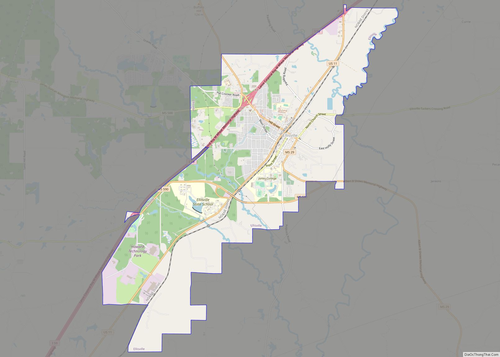
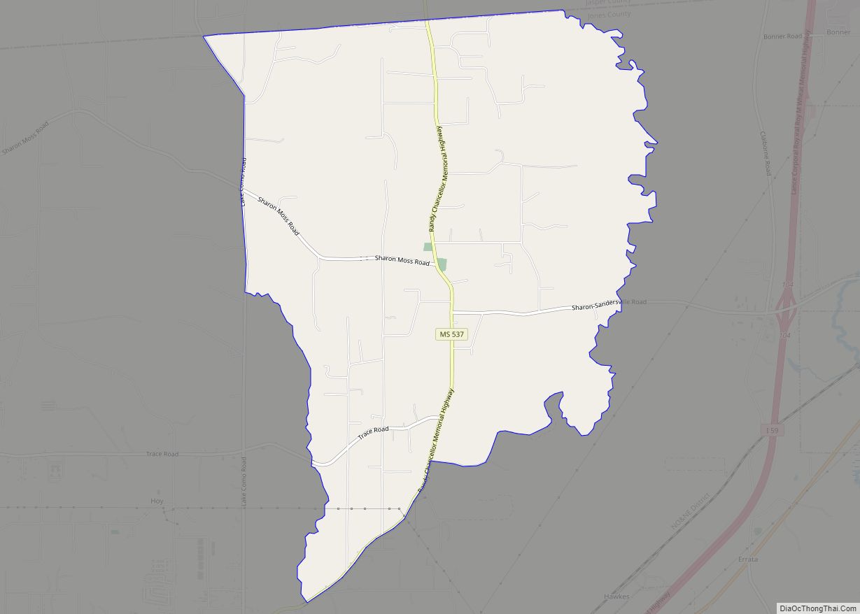
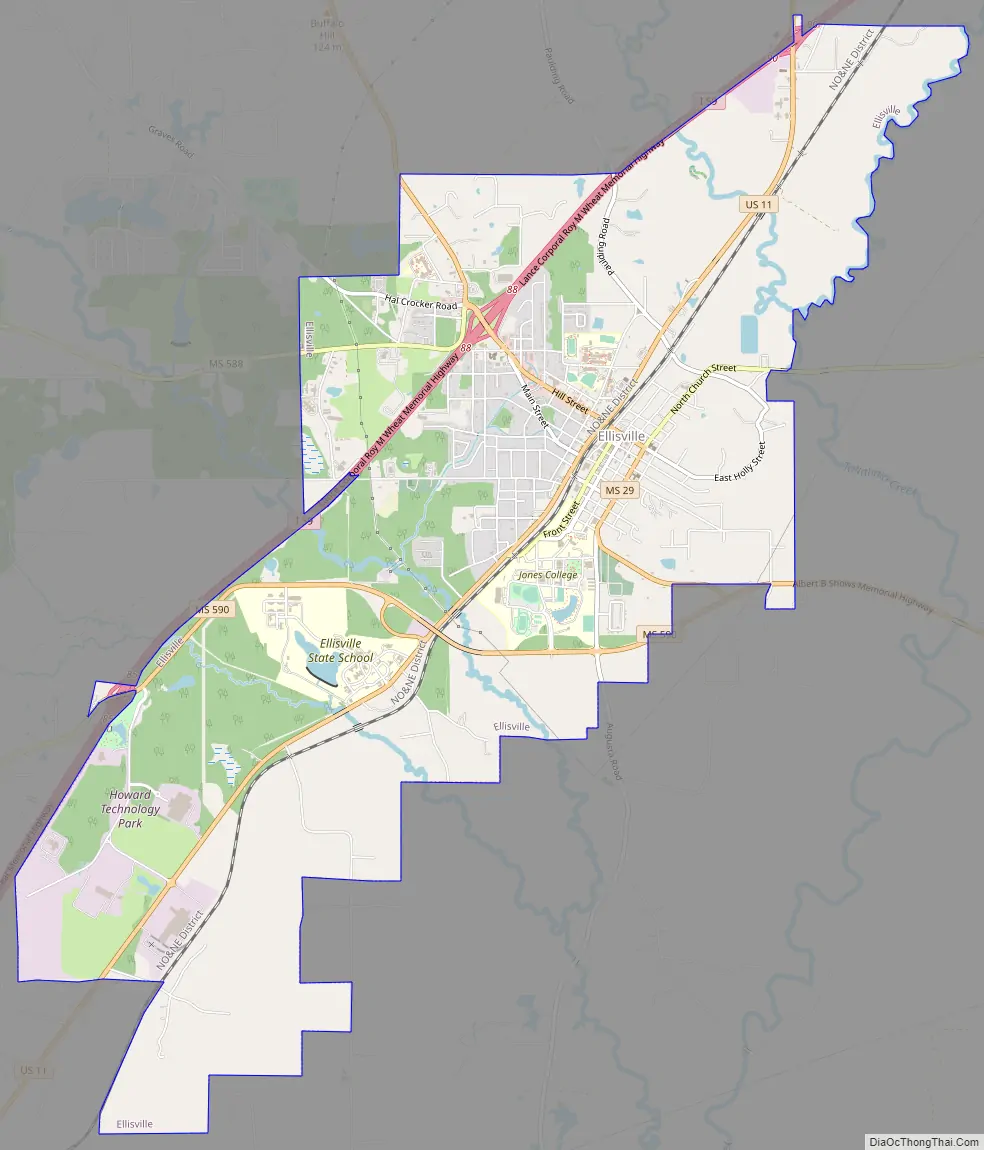
Ellisville Road Map
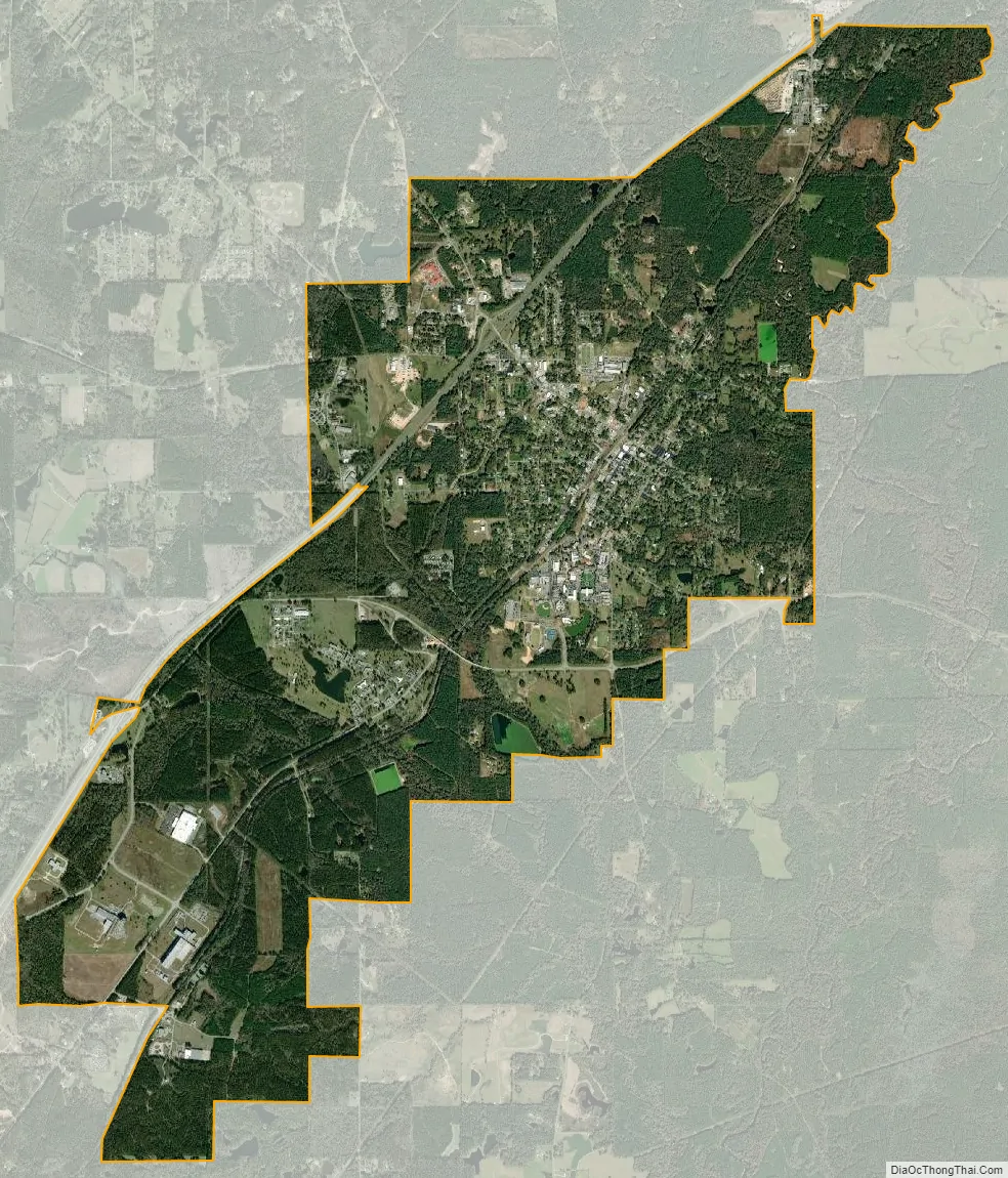
Ellisville city Satellite Map
Geography
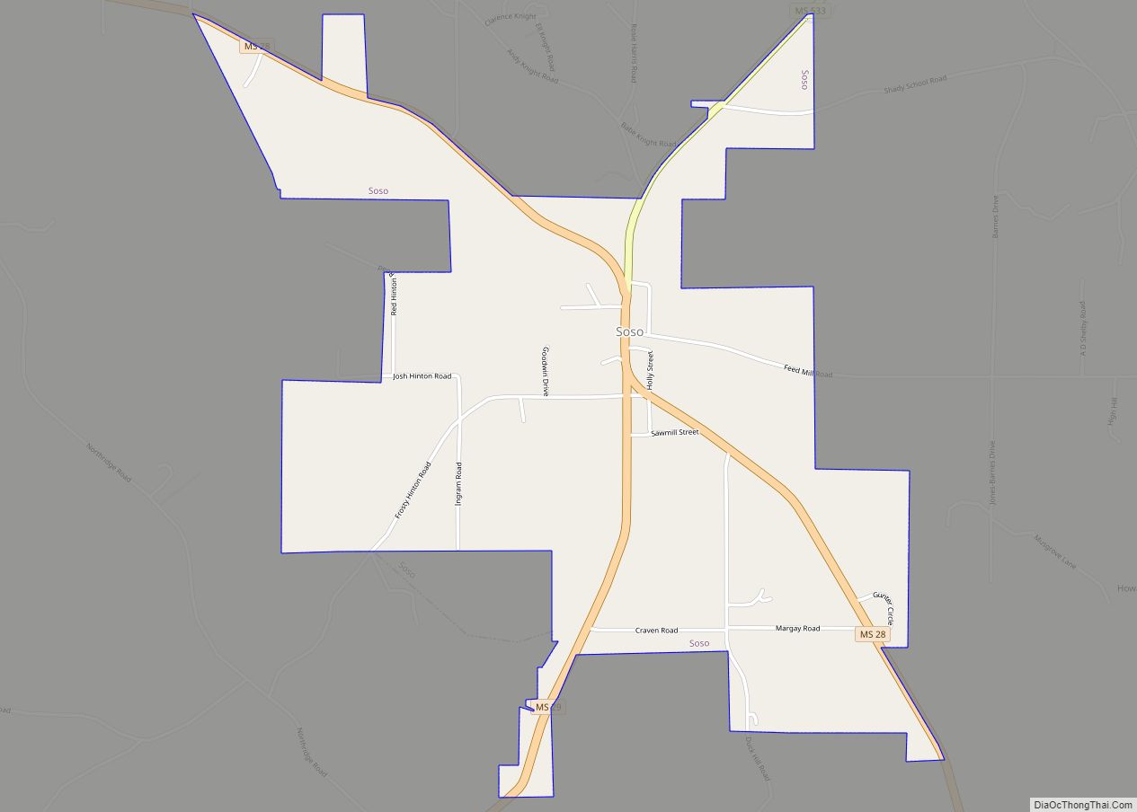
Ellisville is located in central Jones County at 31°36′4″N 89°12′8″W / 31.60111°N 89.20222°W / 31.60111; -89.20222 (31.601068, −89.202123). U.S. Route 11 runs through the center of town, while Interstate 59 runs through the northwest side, with access from Exits 85, 88, and 90. Both highways lead northeast 8 miles (13 km) to Laurel and southwest 22 miles (35 km) to Hattiesburg. Mississippi Highway 29 crosses US-11 near the center of town, leading northwest 12 miles (19 km) to Soso and southeast 20 miles (32 km) to Runnelstown.
According to the United States Census Bureau, Ellisville has a total area of 10.6 square miles (27.5 km), of which 0.12 square miles (0.3 km), or 1.01%, are water.
See also
Map of Mississippi State and its subdivision:- Adams
- Alcorn
- Amite
- Attala
- Benton
- Bolivar
- Calhoun
- Carroll
- Chickasaw
- Choctaw
- Claiborne
- Clarke
- Clay
- Coahoma
- Copiah
- Covington
- Desoto
- Forrest
- Franklin
- George
- Greene
- Grenada
- Hancock
- Harrison
- Hinds
- Holmes
- Humphreys
- Issaquena
- Itawamba
- Jackson
- Jasper
- Jefferson
- Jefferson Davis
- Jones
- Kemper
- Lafayette
- Lamar
- Lauderdale
- Lawrence
- Leake
- Lee
- Leflore
- Lincoln
- Lowndes
- Madison
- Marion
- Marshall
- Monroe
- Montgomery
- Neshoba
- Newton
- Noxubee
- Oktibbeha
- Panola
- Pearl River
- Perry
- Pike
- Pontotoc
- Prentiss
- Quitman
- Rankin
- Scott
- Sharkey
- Simpson
- Smith
- Stone
- Sunflower
- Tallahatchie
- Tate
- Tippah
- Tishomingo
- Tunica
- Union
- Walthall
- Warren
- Washington
- Wayne
- Webster
- Wilkinson
- Winston
- Yalobusha
- Yazoo
- Alabama
- Alaska
- Arizona
- Arkansas
- California
- Colorado
- Connecticut
- Delaware
- District of Columbia
- Florida
- Georgia
- Hawaii
- Idaho
- Illinois
- Indiana
- Iowa
- Kansas
- Kentucky
- Louisiana
- Maine
- Maryland
- Massachusetts
- Michigan
- Minnesota
- Mississippi
- Missouri
- Montana
- Nebraska
- Nevada
- New Hampshire
- New Jersey
- New Mexico
- New York
- North Carolina
- North Dakota
- Ohio
- Oklahoma
- Oregon
- Pennsylvania
- Rhode Island
- South Carolina
- South Dakota
- Tennessee
- Texas
- Utah
- Vermont
- Virginia
- Washington
- West Virginia
- Wisconsin
- Wyoming