Alpena (/ælˈpiːnə/ al-PEE-nə) is a city in the U.S. state of Michigan. It is the county seat of Alpena County, and is the only city within the county. The population was 10,197 at the 2020 census, making it the third most populated city in the Northern Michigan region, after Traverse City and Cadillac. The city is surrounded by Alpena Township, but the two are administered autonomously. It is the core city of the Alpena micropolitan statistical area, which encompasses all of Alpena County and had a total population of 28,907 at the 2020 census.
Alpena is located at the head of Thunder Bay, a bay of Lake Huron. Offshore of Alpena is the Thunder Bay National Marine Sanctuary, which protects an estimated 116 historically significant shipwrecks. Alpena is the third-largest American city on Lake Huron, behind Bay City and Port Huron.
| Name: | Alpena city |
|---|---|
| LSAD Code: | 25 |
| LSAD Description: | city (suffix) |
| State: | Michigan |
| County: | Alpena County |
| Founded: | 1840 |
| Incorporated: | 1871 |
| Elevation: | 591 ft (180 m) |
| Total Area: | 8.86 sq mi (22.94 km²) |
| Land Area: | 8.17 sq mi (21.17 km²) |
| Water Area: | 0.68 sq mi (1.77 km²) |
| Total Population: | 10,197 |
| Population Density: | 1,247.80/sq mi (481.78/km²) |
| Area code: | 989 |
| FIPS code: | 2601740 |
| GNISfeature ID: | 0620017 |
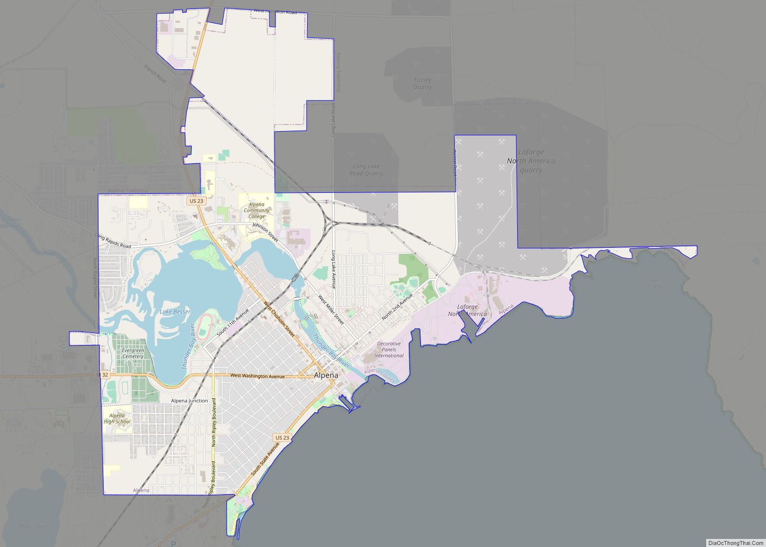
Online Interactive Map
Click on ![]() to view map in "full screen" mode.
to view map in "full screen" mode.
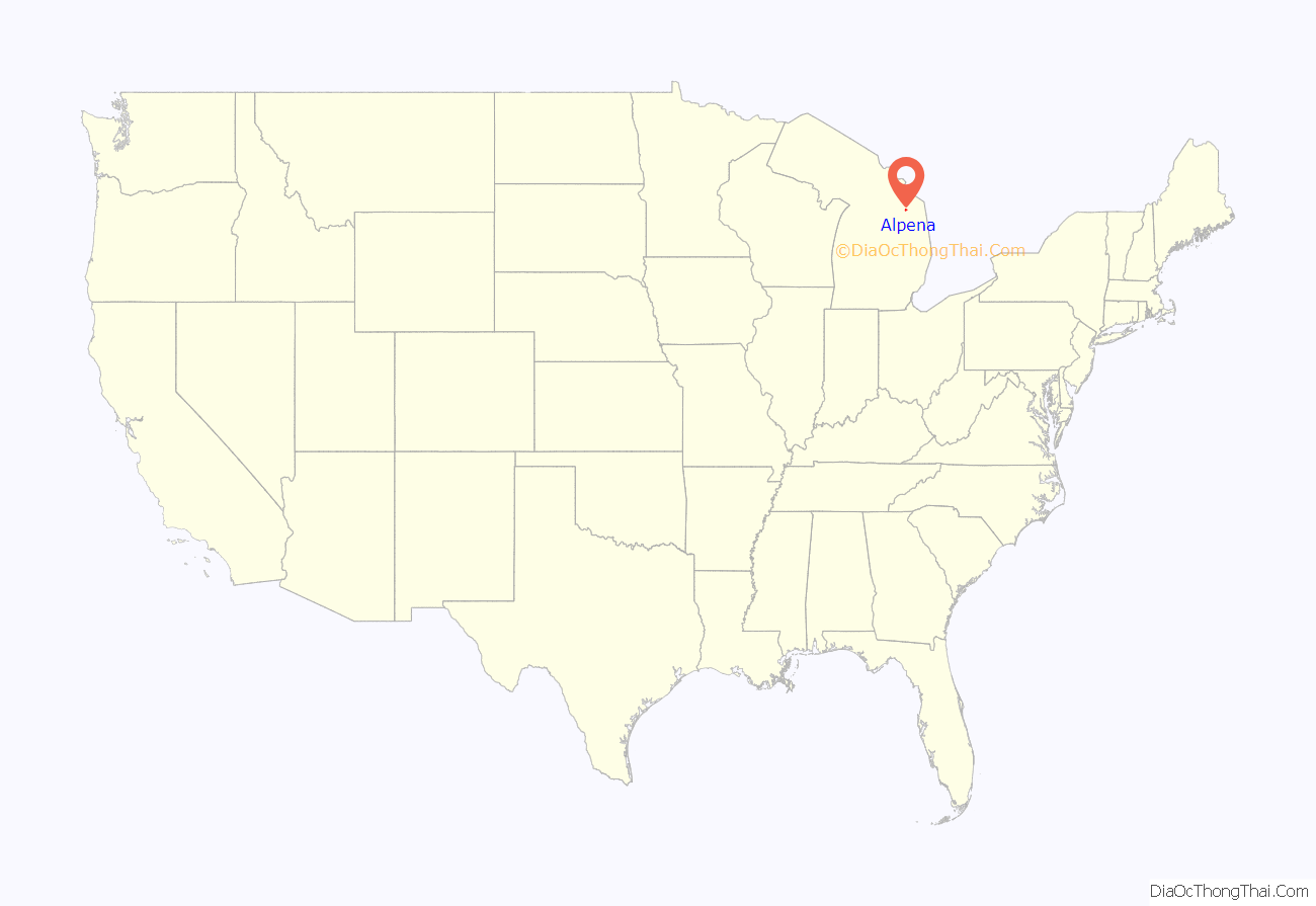
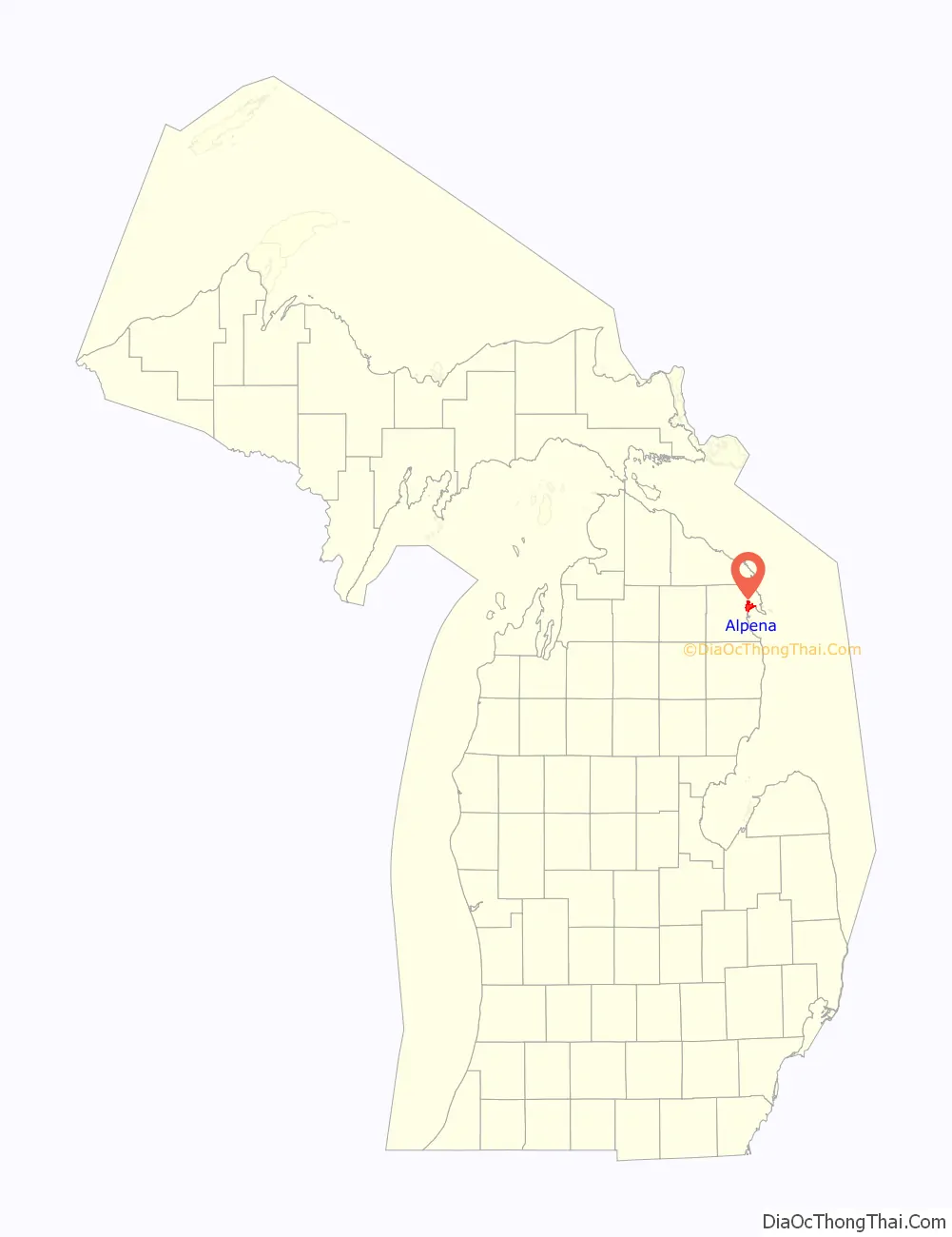
Alpena location map. Where is Alpena city?
History
The Alpena area is home to the Ojibwe, Ottawa, and Potawatomi people. These people groups inhabit the area surrounding the Great Lakes, including Michigan.
Alpena County was originally set off from Michilimackinac County as Anamickee County founded in 1840, which in 1843 was changed to Alpena, a pseudo-Native American word — a neologism coined by Henry Schoolcraft, meaning something like “a good partridge country.” This was part of a much larger effort to rename a great many of the Michigan counties at the time.
The first European settler at modern-day Alpena was W.F. Cullings, a fisherman in 1835. In 1856, George W. Fletcher and three others from Detroit platted a village by the name of Fremont, after John C. Frémont. The community was briefly renamed Thunder Bay in 1857 before being renamed again to Alpena in 1871. The city of Alpena was officially incorporated by Michigan State Legislature on March 29, 1871.
Most of the city was lost in the Great Michigan Fire of 1871. Less than one year later, on July 12, 1872, Alpena was hit by another fire, the largest in its history, which destroyed 15 acres (6.1 ha) of homes and businesses for a total amount of 65 buildings. The blaze started in a barn and lasted for two hours, killing at least four people and causing at least $180,000 (equivalent to $4,070,000 in 2021) in damages. Alpena was again hit by a disastrous fire on July 11, 1888. In the early 1910s a failed attempt was led by the Alpena Motor Car Company to turn the city into “Automobile City” and compete with Detroit.
The city has a number of notable buildings, including the Art deco Alpena County Courthouse, the I.O.O.F. Centennial Building, and Temple Beth El, one of the oldest synagogues in the United States.
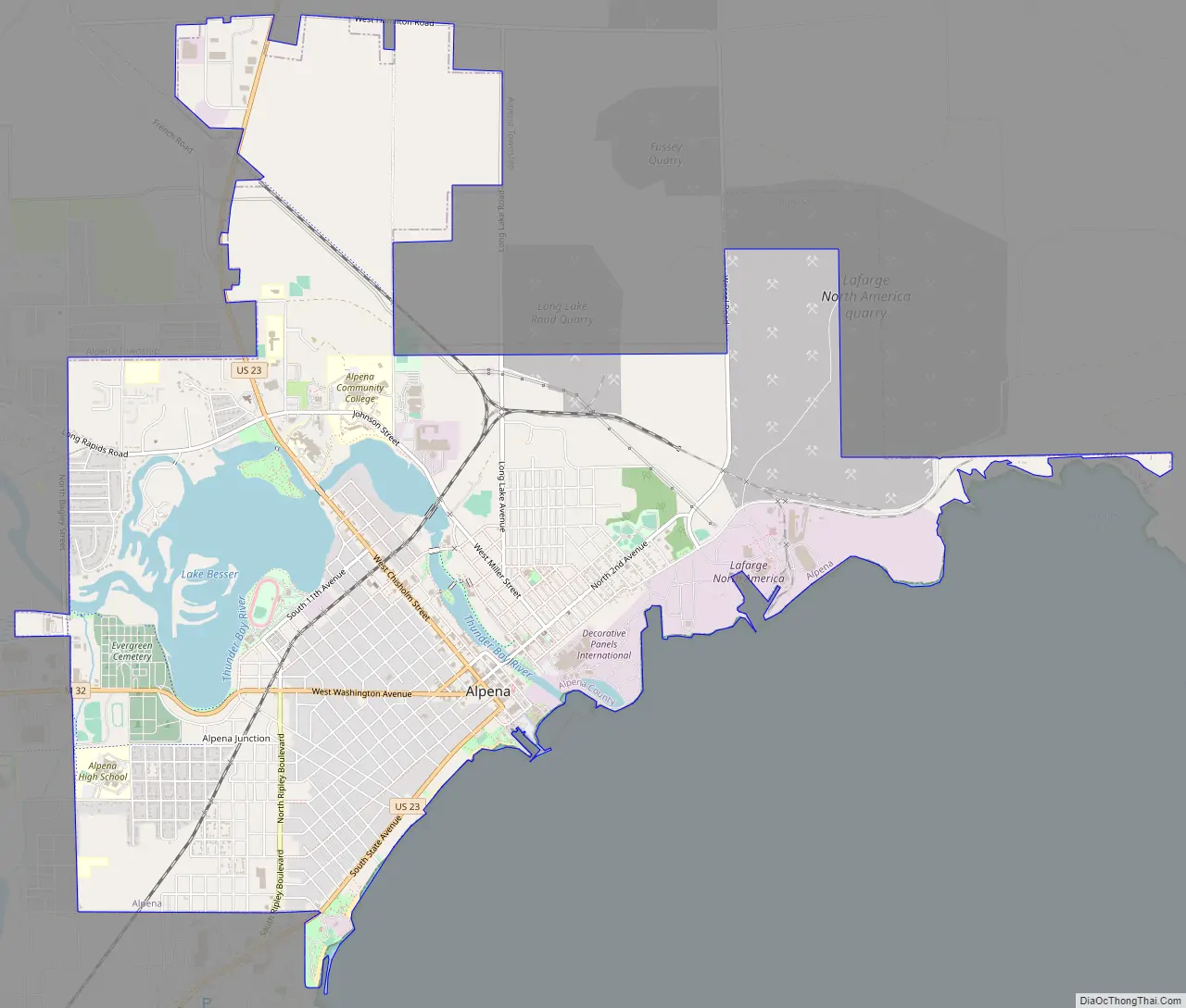
Alpena Road Map
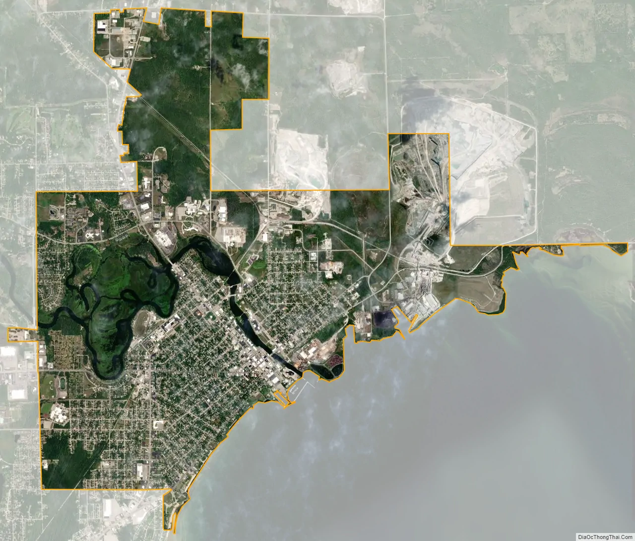
Alpena city Satellite Map
Geography
According to the United States Census Bureau, the city has a total area of 9.23 square miles (23.91 km), of which, 8.54 square miles (22.12 km) of it is land and 0.69 square miles (1.79 km) (7.48%) is water. The city is on the shore of Lake Huron’s Thunder Bay, with Alpena Township surrounding it on land.
Alpena has a humid continental climate (Dfb) with warm summers along with cool nights, moderated by nearby Lake Huron and cold, snowy winters with annual snowfall averaging 84 inches (210 cm).
See also
Map of Michigan State and its subdivision:- Alcona
- Alger
- Allegan
- Alpena
- Antrim
- Arenac
- Baraga
- Barry
- Bay
- Benzie
- Berrien
- Branch
- Calhoun
- Cass
- Charlevoix
- Cheboygan
- Chippewa
- Clare
- Clinton
- Crawford
- Delta
- Dickinson
- Eaton
- Emmet
- Genesee
- Gladwin
- Gogebic
- Grand Traverse
- Gratiot
- Hillsdale
- Houghton
- Huron
- Ingham
- Ionia
- Iosco
- Iron
- Isabella
- Jackson
- Kalamazoo
- Kalkaska
- Kent
- Keweenaw
- Lake
- Lake Hurron
- Lake Michigan
- Lake St. Clair
- Lake Superior
- Lapeer
- Leelanau
- Lenawee
- Livingston
- Luce
- Mackinac
- Macomb
- Manistee
- Marquette
- Mason
- Mecosta
- Menominee
- Midland
- Missaukee
- Monroe
- Montcalm
- Montmorency
- Muskegon
- Newaygo
- Oakland
- Oceana
- Ogemaw
- Ontonagon
- Osceola
- Oscoda
- Otsego
- Ottawa
- Presque Isle
- Roscommon
- Saginaw
- Saint Clair
- Saint Joseph
- Sanilac
- Schoolcraft
- Shiawassee
- Tuscola
- Van Buren
- Washtenaw
- Wayne
- Wexford
- Alabama
- Alaska
- Arizona
- Arkansas
- California
- Colorado
- Connecticut
- Delaware
- District of Columbia
- Florida
- Georgia
- Hawaii
- Idaho
- Illinois
- Indiana
- Iowa
- Kansas
- Kentucky
- Louisiana
- Maine
- Maryland
- Massachusetts
- Michigan
- Minnesota
- Mississippi
- Missouri
- Montana
- Nebraska
- Nevada
- New Hampshire
- New Jersey
- New Mexico
- New York
- North Carolina
- North Dakota
- Ohio
- Oklahoma
- Oregon
- Pennsylvania
- Rhode Island
- South Carolina
- South Dakota
- Tennessee
- Texas
- Utah
- Vermont
- Virginia
- Washington
- West Virginia
- Wisconsin
- Wyoming