Roselle Park is a borough in Union County, in the U.S. state of New Jersey. As of the 2020 United States census, the borough’s population was 13,967, an increase of 670 (+5.0%) from the 2010 census count of 13,297, which in turn reflected reflected an increase of 16 (+0.1%) from the 13,281 counted at the 2000 census.
Roselle Park was incorporated as a borough by an act of the New Jersey Legislature on March 22, 1901, from portions of Union Township. Roselle Park’s name is derived from the Roselle Land Improvement Company, which was created in 1866 to lay out a community around the Mulford Station on the Central Railroad of New Jersey. The name “Roselle” is said to have been based on the company’s founder, John Conklin Rose or from John Pierre Roselle, a friend of the railroad’s president.
| Name: | Roselle Park borough |
|---|---|
| LSAD Code: | 21 |
| LSAD Description: | borough (suffix) |
| State: | New Jersey |
| County: | Union County |
| Incorporated: | March 22, 1901 |
| Elevation: | 79 ft (24 m) |
| Total Area: | 1.23 sq mi (3.17 km²) |
| Land Area: | 1.23 sq mi (3.17 km²) |
| Water Area: | 0.00 sq mi (0.00 km²) 0.00% |
| Total Population: | 13,967 |
| Population Density: | 11,401.6/sq mi (4,402.2/km²) |
| ZIP code: | 07204 |
| Area code: | 908 exchanges: 241, 245, 259, 298, 620 |
| FIPS code: | 3464650 |
| GNISfeature ID: | 0885380 |
| Website: | www.rosellepark.net |
Online Interactive Map
Click on ![]() to view map in "full screen" mode.
to view map in "full screen" mode.
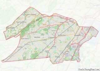
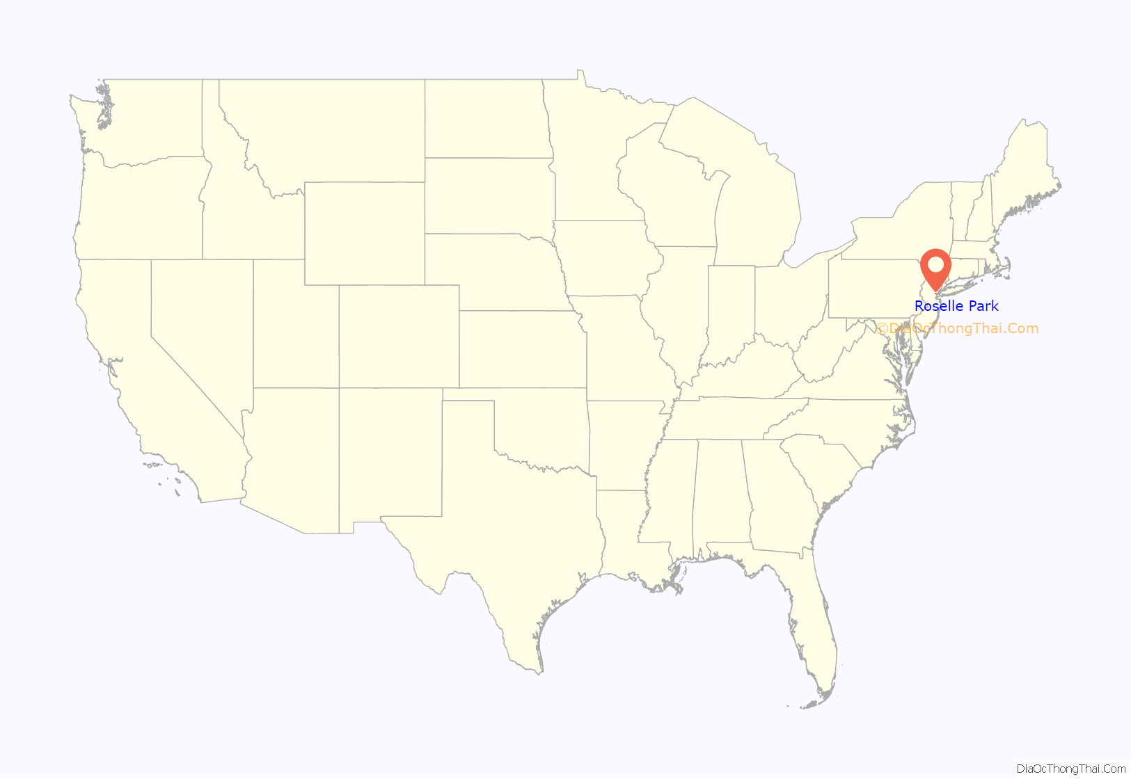
Roselle Park location map. Where is Roselle Park borough?

History
The first known settlement within what is now the borough was built by Samuel Williams in 1700. Galloping Hill Road was continually used by revolutionary war scouts, delivering messages to and from General George Washington and Governor Livingston. Galloping Hill Road also believed to be the route traveled by the British columns en route to the Battle of Connecticut Farms, battling the New Jersey militia the entire way. Son of American general William Crane, was bayoneted and killed by the British near what is now Galloping Hill Road and Colonial Road.
Elizabethtown & Somerville Railroad passed through in 1839, as the first railroad in Northern New Jersey. The first store in the world to be lit by electric light was Stone’s Store on Westfield Avenue, lit by Thomas Edison’s carbon filament prototype.
The formation of Roselle Park in 1901 occurred due to a number of grievances based on a lack of sufficient public services, including; lack of a modern sewage system, poor schools, neglected roads, and minimal public safety measures.
In 1907, the first poured concrete building in the world, now the Robert Gordon School, was built in Roselle Park using Edison’s revolutionary process. Roselle Park was home to the factory and lab of Marconi Wireless Telegraph, and in late 1921 became the site of WDY, the first radio broadcasting station licensed in the state of New Jersey.
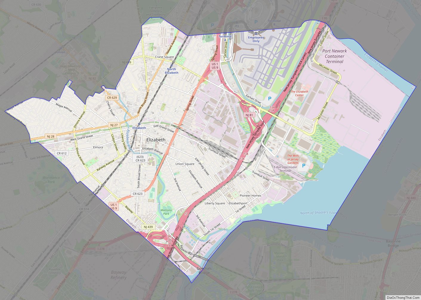
Roselle Park Road Map
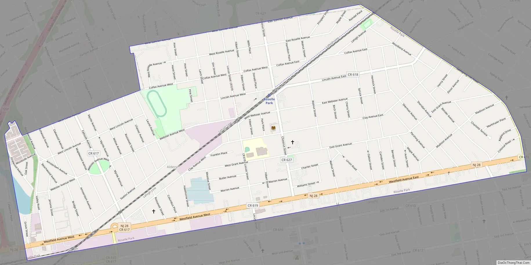
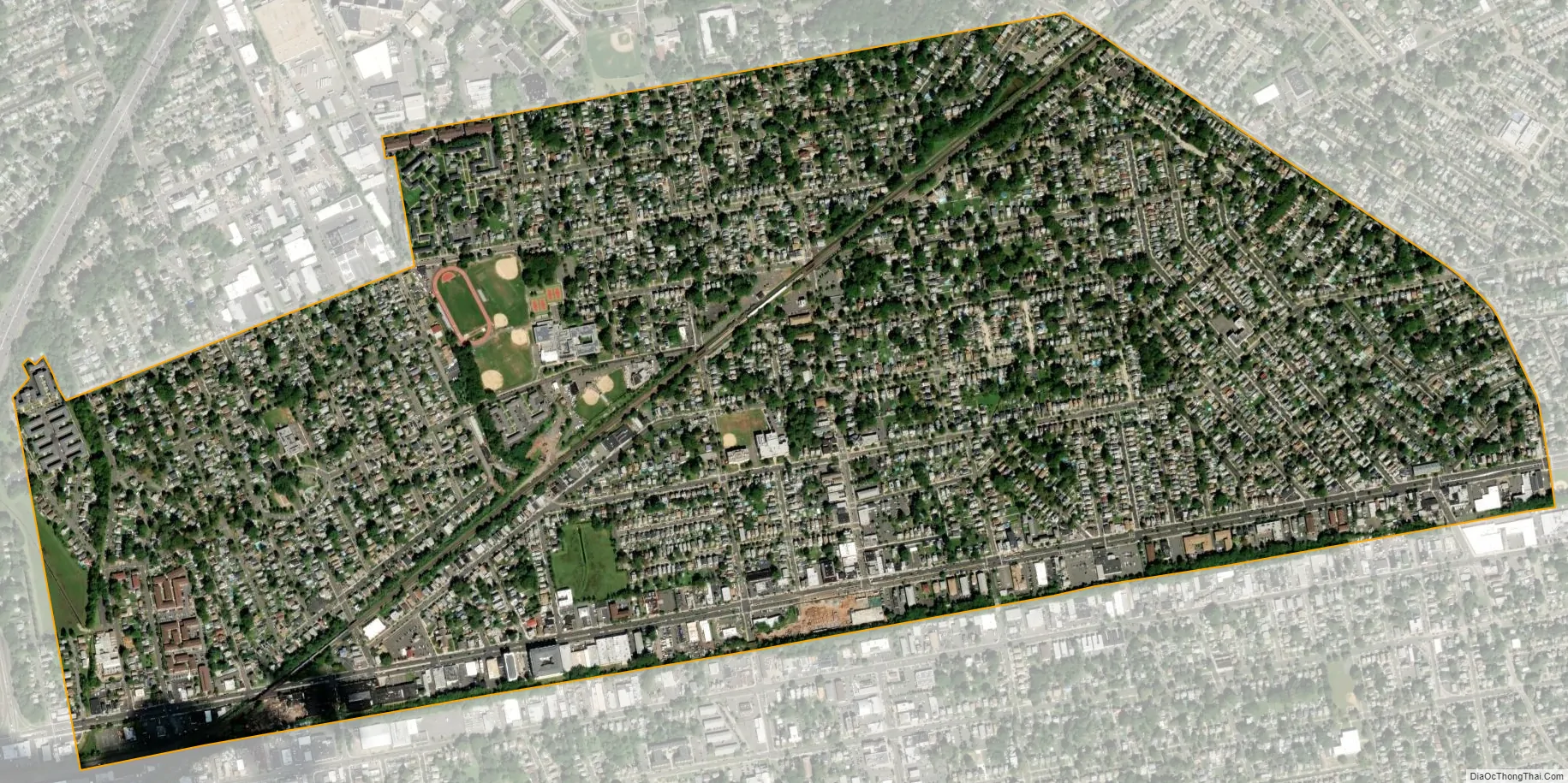
Roselle Park city Satellite Map
Geography
According to the United States Census Bureau, the borough had a total area of 1.23 square miles (3.17 km), all of which was land.
Unincorporated communities, localities and place names located partially or completely within the borough include Lorraine.
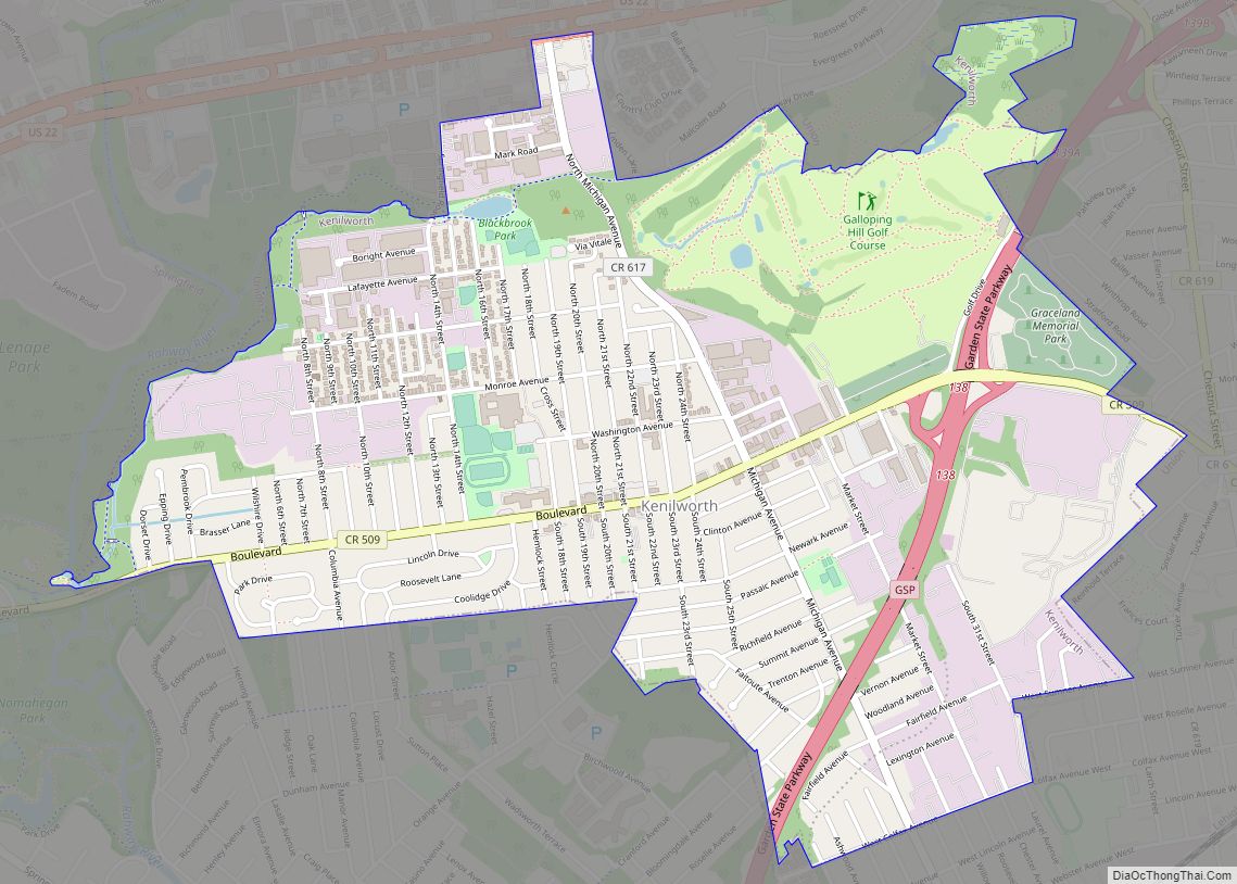
The borough is bordered to the northeast by Union Township, to the northwest by Kenilworth, to the east by Elizabeth, to the south by Roselle and to the west by Cranford.
See also
Map of New Jersey State and its subdivision: Map of other states:- Alabama
- Alaska
- Arizona
- Arkansas
- California
- Colorado
- Connecticut
- Delaware
- District of Columbia
- Florida
- Georgia
- Hawaii
- Idaho
- Illinois
- Indiana
- Iowa
- Kansas
- Kentucky
- Louisiana
- Maine
- Maryland
- Massachusetts
- Michigan
- Minnesota
- Mississippi
- Missouri
- Montana
- Nebraska
- Nevada
- New Hampshire
- New Jersey
- New Mexico
- New York
- North Carolina
- North Dakota
- Ohio
- Oklahoma
- Oregon
- Pennsylvania
- Rhode Island
- South Carolina
- South Dakota
- Tennessee
- Texas
- Utah
- Vermont
- Virginia
- Washington
- West Virginia
- Wisconsin
- Wyoming