Ship Bottom is a borough in Ocean County, in the U.S. state of New Jersey. As of the 2020 United States census, the borough’s population was 1,098, a decrease of 58 (−5.0%) from the 2010 census count of 1,156, which in turn reflected a decline of 228 (−16.5%) from the 1,384 counted in the 2000 census. The borough is located on Long Beach Island and borders the Atlantic Ocean. The summer population can be as much as 20,000.
The borough’s name derives from an incident in March 1817, in which a woman was saved from a wrecked ship that had flipped over, after her rescuers used axes to cut through the bottom of the hull.
What is now Ship Bottom was originally incorporated as the borough of Ship Bottom-Beach Arlington by an act of the New Jersey Legislature on March 3, 1925, from portions of Long Beach Township, based on the results of a referendum held on May 23, 1925. The borough name was shortened to Ship Bottom in 1947.
The borough is known as the “Gateway to Long Beach Island”, as Route 72 provides the sole road access from Manahawkin in Stafford Township, ending in Ship Bottom as it crosses Manahawkin Bay via the Manahawkin Bay Bridge (formally known as the Dorland J. Henderson Memorial Bridge).
| Name: | Ship Bottom borough |
|---|---|
| LSAD Code: | 21 |
| LSAD Description: | borough (suffix) |
| State: | New Jersey |
| County: | Ocean County |
| Incorporated: | March 3, 1925 as Ship Bottom-Beach Arlington |
| Elevation: | 3 ft (0.9 m) |
| Total Area: | 0.99 sq mi (2.58 km²) |
| Land Area: | 0.71 sq mi (1.84 km²) |
| Water Area: | 0.28 sq mi (0.73 km²) 28.48% |
| Total Population: | 1,098 |
| Population Density: | 1,541.8/sq mi (595.3/km²) |
| ZIP code: | 08008 – Beach Haven |
| Area code: | 609 exchanges: 207, 361, 492, 494 |
| FIPS code: | 3467110 |
| GNISfeature ID: | 0885394 |
| Website: | www.shipbottom.org |
Online Interactive Map
Click on ![]() to view map in "full screen" mode.
to view map in "full screen" mode.
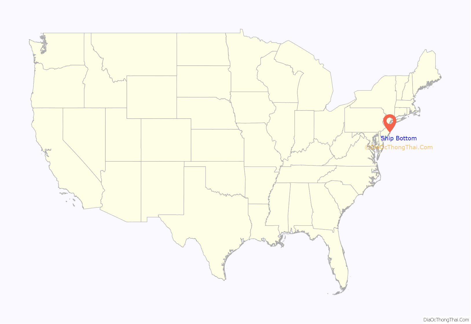
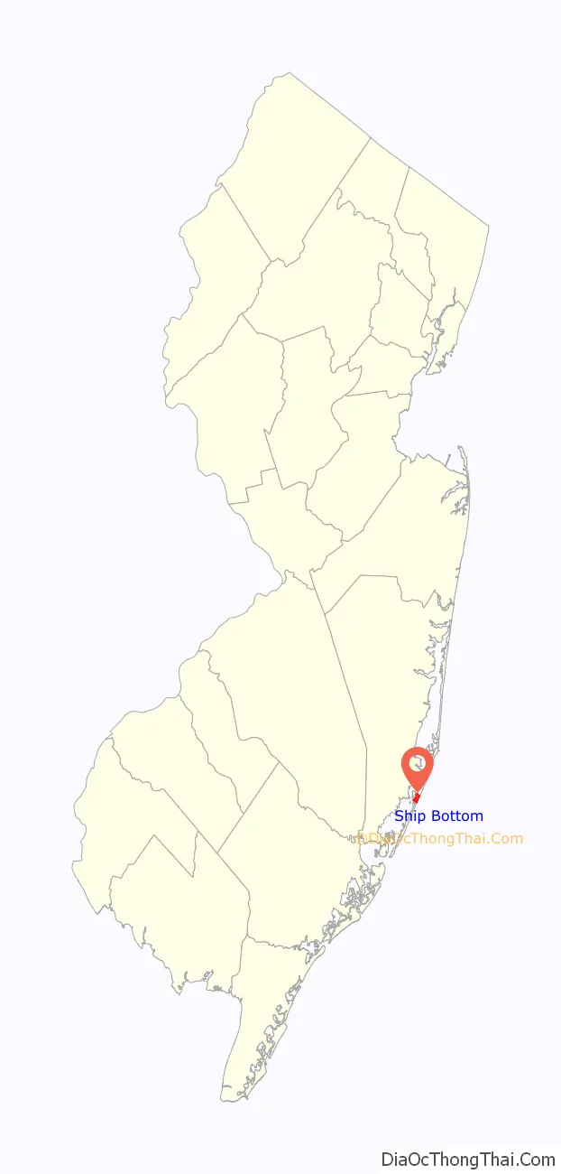
Ship Bottom location map. Where is Ship Bottom borough?
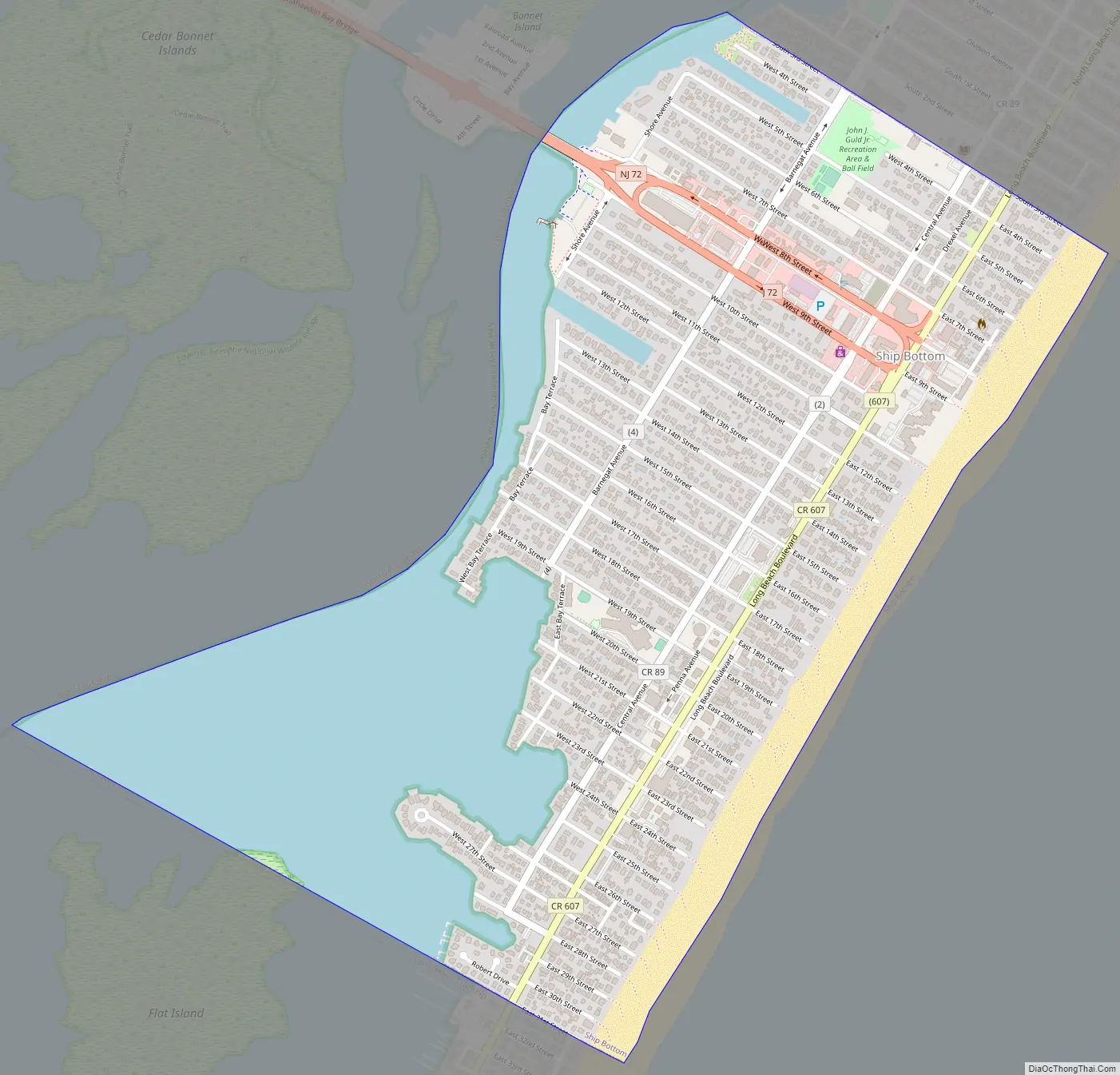
Ship Bottom Road Map
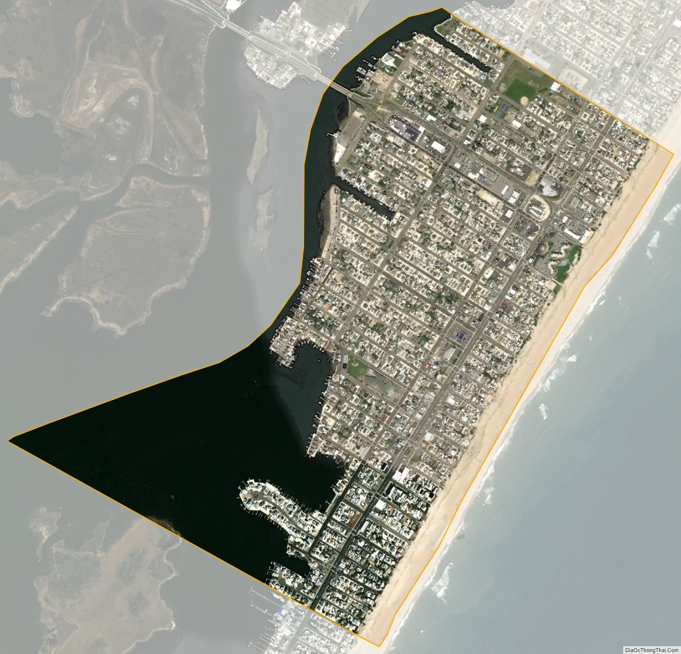
Ship Bottom city Satellite Map
Geography
According to the United States Census Bureau, the borough had a total area of 0.99 square miles (2.58 km), including 0.71 square miles (1.84 km) of land and 0.28 square miles (0.73 km) of water (28.48%).
Unincorporated communities, localities and place names located partially or completely within the borough include Beach Arlington.
The borough borders the Ocean County municipalities of Long Beach Township, Stafford Township and Surf City.
See also
Map of New Jersey State and its subdivision: Map of other states:- Alabama
- Alaska
- Arizona
- Arkansas
- California
- Colorado
- Connecticut
- Delaware
- District of Columbia
- Florida
- Georgia
- Hawaii
- Idaho
- Illinois
- Indiana
- Iowa
- Kansas
- Kentucky
- Louisiana
- Maine
- Maryland
- Massachusetts
- Michigan
- Minnesota
- Mississippi
- Missouri
- Montana
- Nebraska
- Nevada
- New Hampshire
- New Jersey
- New Mexico
- New York
- North Carolina
- North Dakota
- Ohio
- Oklahoma
- Oregon
- Pennsylvania
- Rhode Island
- South Carolina
- South Dakota
- Tennessee
- Texas
- Utah
- Vermont
- Virginia
- Washington
- West Virginia
- Wisconsin
- Wyoming


