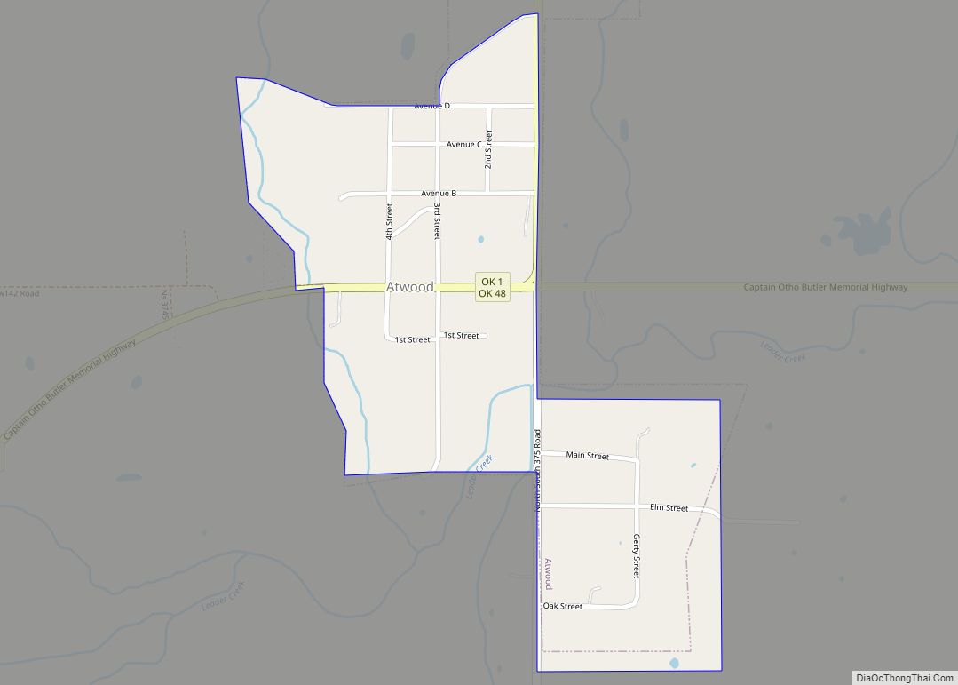
Atwood is a town in Hughes County, Oklahoma, United States. The population was 74 at the 2010 census.
| Name: | Atwood town |
|---|---|
| LSAD Code: | 43 |
| LSAD Description: | town (suffix) |
| State: | Oklahoma |
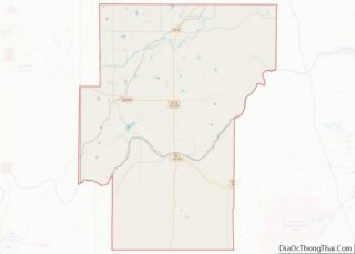
| County: | Hughes County |
| Elevation: | 801 ft (244 m) |
| Total Area: | 0.30 sq mi (0.78 km²) |
| Land Area: | 0.30 sq mi (0.78 km²) |
| Water Area: | 0.00 sq mi (0.00 km²) |
| Total Population: | 85 |
| Population Density: | 282.39/sq mi (108.95/km²) |
| ZIP code: | 74827 |
| Area code: | 580 |
| FIPS code: | 4003350 |
| GNISfeature ID: | 1089752 |
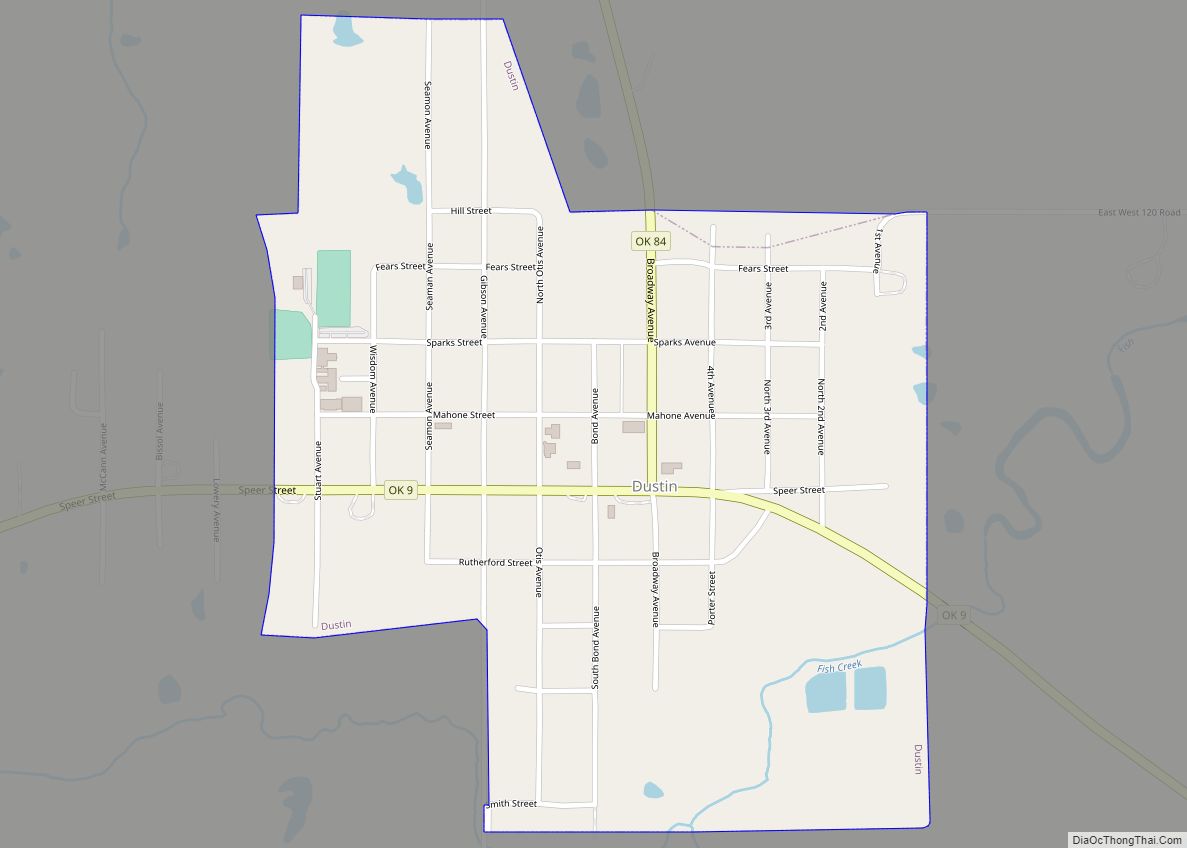
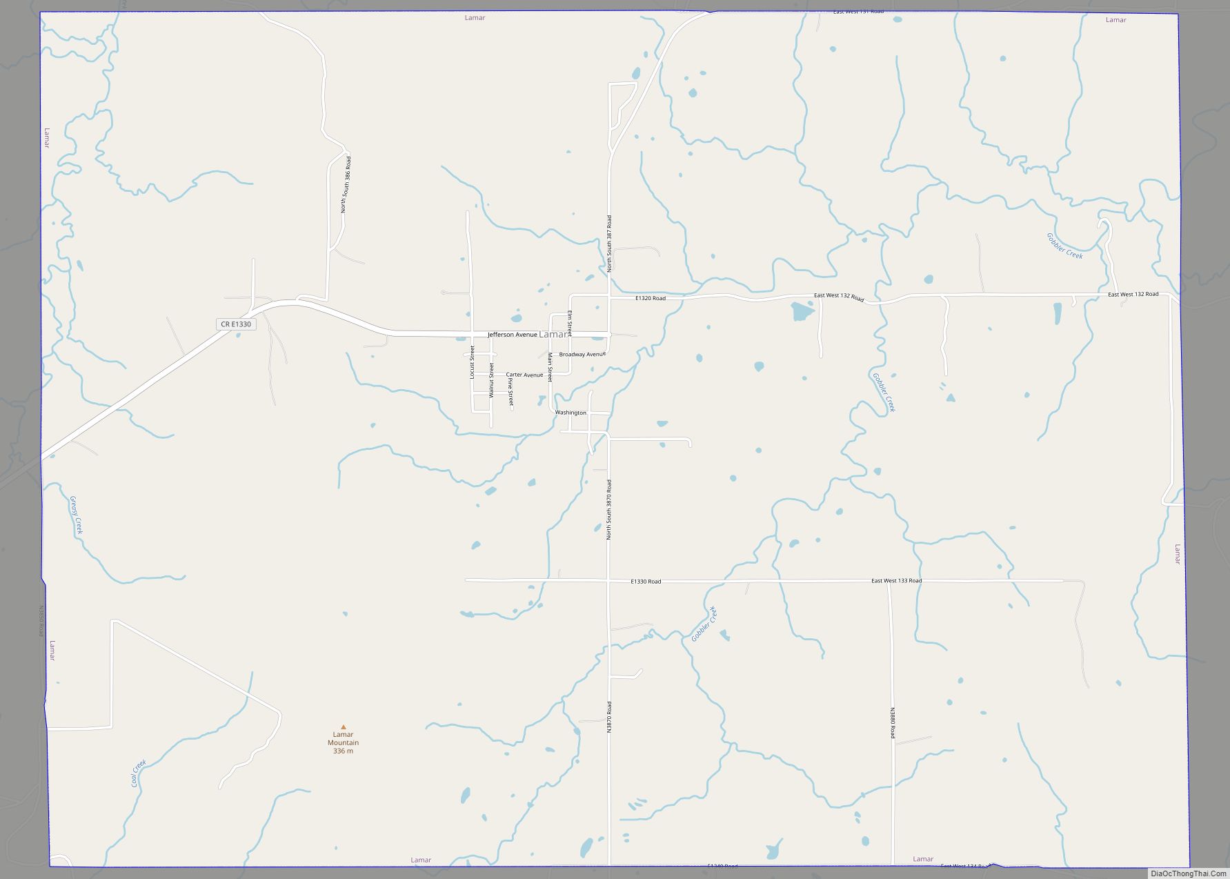
Online Interactive Map
Click on ![]() to view map in "full screen" mode.
to view map in "full screen" mode.
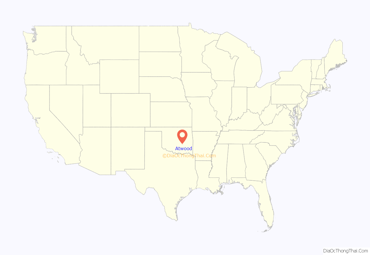
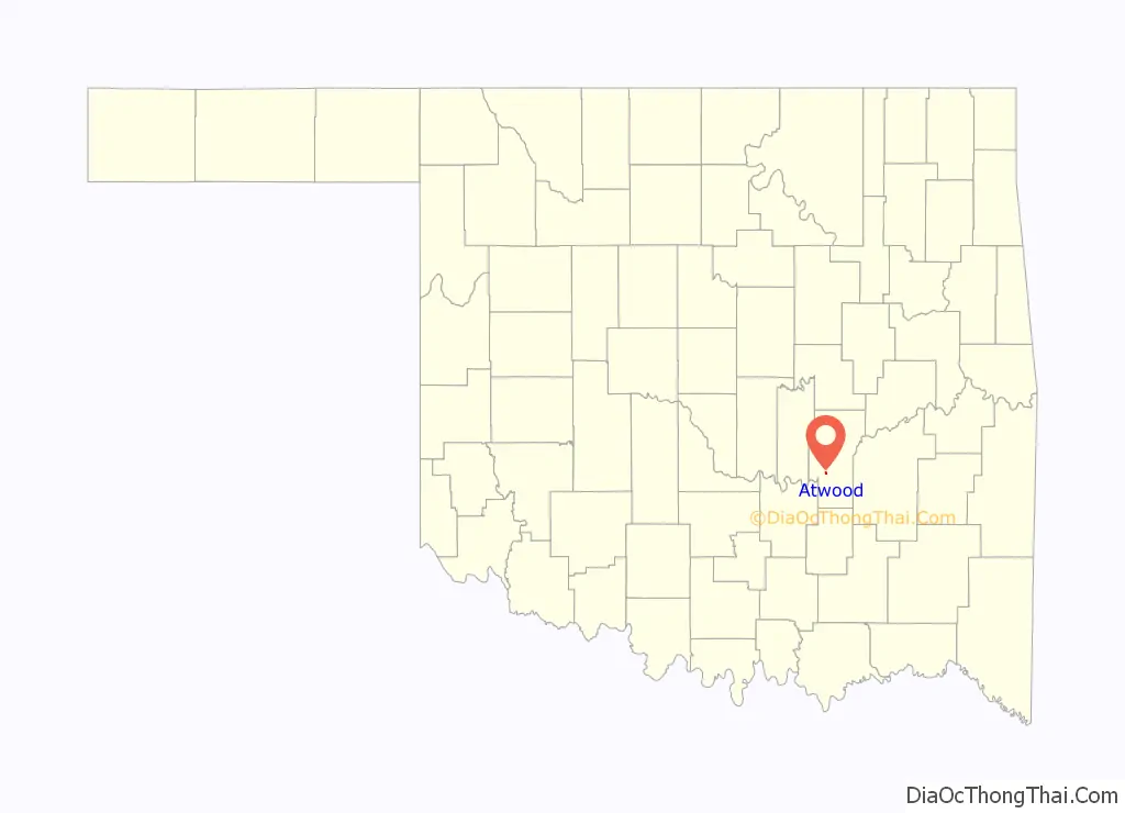
Atwood location map. Where is Atwood town?
History
The town is named for Chester C. Atwood, an early settler of what would later become Hughes County, Oklahoma. Atwood was an educated farmer, extensive area landowner, and elected commissioner of Hughes County. He was born in July 1862 in central Texas, to natives of Tennessee who had migrated to Texas before the Civil War. In 1881, Atwood left Texas for the Mushulatubbee District of the Choctaw Nation of Oklahoma. Settling in western Tobucksy County, some 28 miles (45 km) west of a pioneer general store owned by J.J. McAlester, Atwood married a young woman named Patsy Ann, of the Choctaw Nation, giving him settlement rights by marriage. By 1885, he was farming 25 acres (100,000 m) of what later would become eastern Hughes County, and was enumerated in the Choctaw Nation census of that year.
Population growth in the community near the Atwood farm brought a post office designation January 23, 1897, with “Newburg” as the assigned name and Henry S. Halloway established as postmaster.
A weekly newspaper, the Atwood Herald, kept citizens informed during the early 20th Century. The date when it ceased publication is unknown.
By 1900, Chester Atwood had increased his land holdings and his family included wife Patsy Ann (familiarly called Mattie), daughters Ottie (b. 1883) and Arrie (b. 1886), son Bennie (b. 1887), daughter Allie (b. 1889), son Coleman (b. 1891), and daughters Lizzie (b. 1893) and Ambrozia (b. 1895). Two other children born after 1900 died before reaching adulthood.
At statehood, counties created under the Choctaw Nation were redrawn and renamed. That portion of Tobucksy County in which Newburg lay, fell inside the new boundary of Hughes County, Oklahoma. On December 3, 1909, two years after Oklahoma statehood, the town of Newburg was renamed “Atwood”, honoring Chester C. Atwood as one of the significant pioneer members of the community.
Atwood served as an elected commissioner of Hughes County, and son Coleman Atwood worked as a local banker before moving to Holdenville during the Depression. Chester C. Atwood died after 1930.
The Missouri, Oklahoma and Gulf Railway built a line from Muskogee to the Red River, bypassing Newburg. Therefore, some of Newburg’s residents moved one mile south to take advantage of the rail system. In December 1909, they named their new settlement.
Atwood became a trading center for the agricultural trying center around it. A grist mill was built in 1910, followed by a bank, a livery, a drug store and five general stores. The population grew to 150 by 1913.
In 1993, Atwood received a $75,000 federal grant to modernize its fire protection system. Atwood incorporated as a town in 1994.
The post office in Atwood was slated for possible closure by the United States Postal Service in 2012.
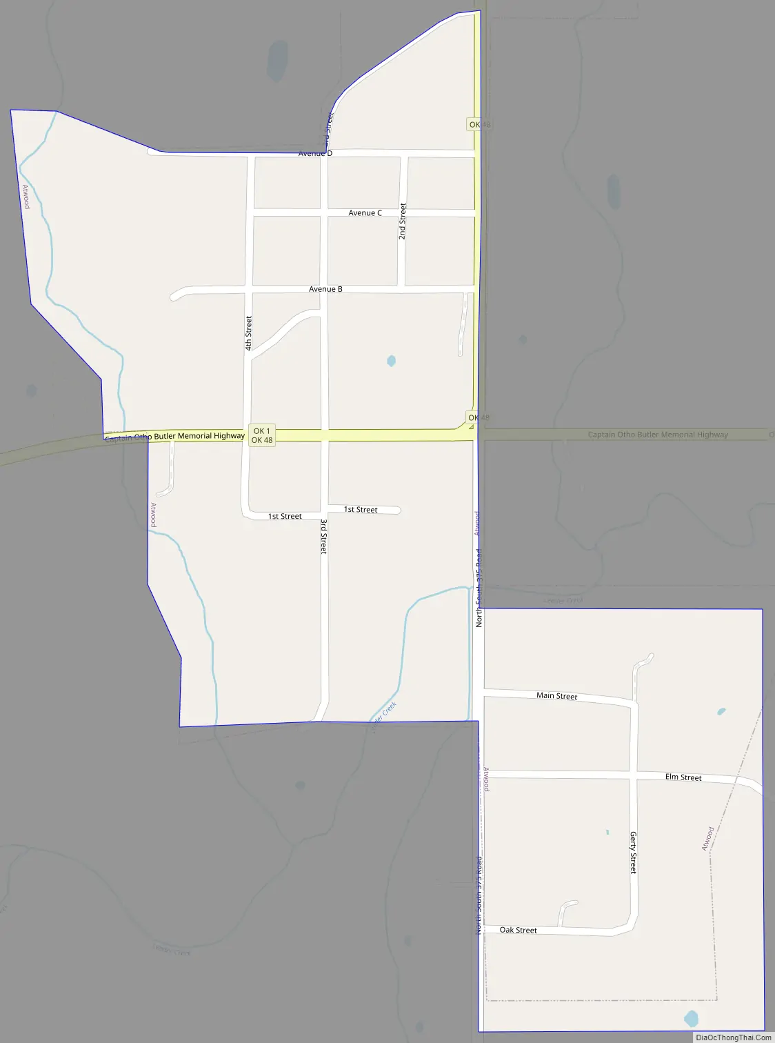
Atwood Road Map
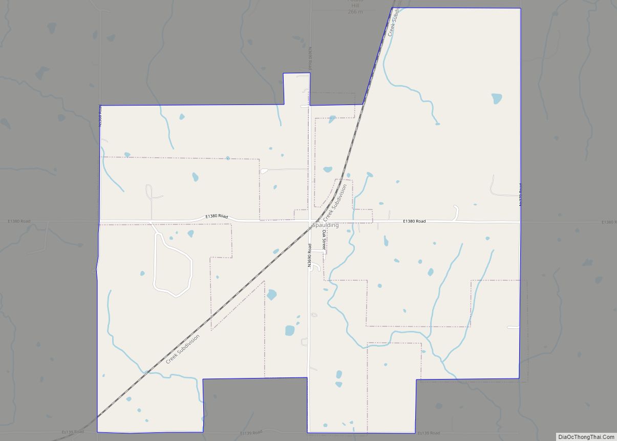
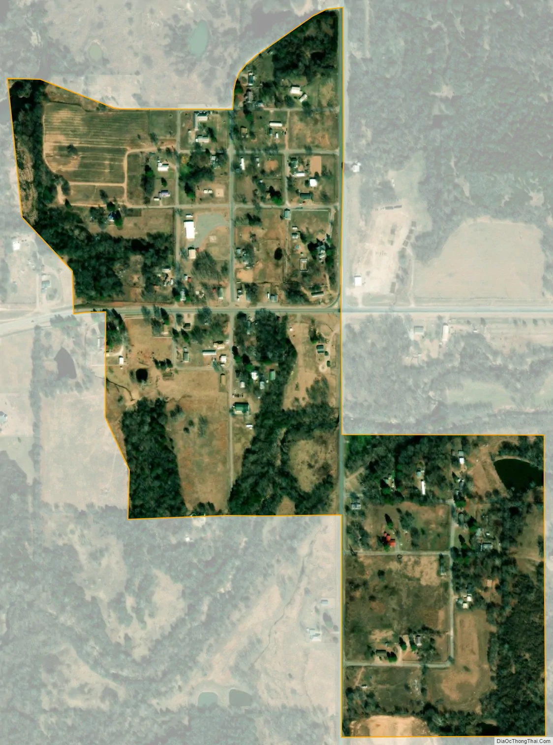
Atwood city Satellite Map
Geography
Atwood is located in west-central Hughes County at 34°57′25″N 96°20′13″W / 34.95694°N 96.33694°W / 34.95694; -96.33694 (34.956977, -96.336816). State Highways 1 and 48 intersect at the eastern edge of the town, Highway 1 leading east 5 miles (8 km) to Calvin and Highway 48 leading north 10 miles (16 km) to Holdenville, the Hughes county seat. The two highways together lead southwest 7 miles (11 km) to Allen.
According to the United States Census Bureau, Atwood has a total area of 0.3 square miles (0.7 km), all land.
Climate
See also
Map of Oklahoma State and its subdivision:- Adair
- Alfalfa
- Atoka
- Beaver
- Beckham
- Blaine
- Bryan
- Caddo
- Canadian
- Carter
- Cherokee
- Choctaw
- Cimarron
- Cleveland
- Coal
- Comanche
- Cotton
- Craig
- Creek
- Custer
- Delaware
- Dewey
- Ellis
- Garfield
- Garvin
- Grady
- Grant
- Greer
- Harmon
- Harper
- Haskell
- Hughes
- Jackson
- Jefferson
- Johnston
- Kay
- Kingfisher
- Kiowa
- Latimer
- Le Flore
- Lincoln
- Logan
- Love
- Major
- Marshall
- Mayes
- McClain
- McCurtain
- McIntosh
- Murray
- Muskogee
- Noble
- Nowata
- Okfuskee
- Oklahoma
- Okmulgee
- Osage
- Ottawa
- Pawnee
- Payne
- Pittsburg
- Pontotoc
- Pottawatomie
- Pushmataha
- Roger Mills
- Rogers
- Seminole
- Sequoyah
- Stephens
- Texas
- Tillman
- Tulsa
- Wagoner
- Washington
- Washita
- Woods
- Woodward
- Alabama
- Alaska
- Arizona
- Arkansas
- California
- Colorado
- Connecticut
- Delaware
- District of Columbia
- Florida
- Georgia
- Hawaii
- Idaho
- Illinois
- Indiana
- Iowa
- Kansas
- Kentucky
- Louisiana
- Maine
- Maryland
- Massachusetts
- Michigan
- Minnesota
- Mississippi
- Missouri
- Montana
- Nebraska
- Nevada
- New Hampshire
- New Jersey
- New Mexico
- New York
- North Carolina
- North Dakota
- Ohio
- Oklahoma
- Oregon
- Pennsylvania
- Rhode Island
- South Carolina
- South Dakota
- Tennessee
- Texas
- Utah
- Vermont
- Virginia
- Washington
- West Virginia
- Wisconsin
- Wyoming