Holdenville is a city in and county seat of Hughes County, Oklahoma, United States. The population was 5,771 at the 2010 census, an increase of 22 percent from 4,732 at the 2000 census.
It is home to The Pork Group, a subsidiary of Tyson Foods; the Holdenville State Fish Hatchery, one of four operated by the Oklahoma Department of Wildlife Conservation; the Davis Correctional Facility, a 1,600 bed medium security prison operated by the Corrections Corporation of America; and the Creek Nation Casino, one of many operated by the Muscogee (Creek) Nation.
| Name: | Holdenville city |
|---|---|
| LSAD Code: | 25 |
| LSAD Description: | city (suffix) |
| State: | Oklahoma |
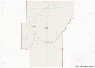
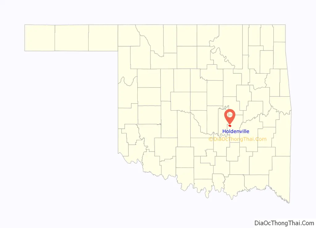
| County: | Hughes County |
| Founded: | 1895 |
| Incorporated: | 1898 |
| Elevation: | 866 ft (264 m) |
| Total Area: | 5.04 sq mi (13.05 km²) |
| Land Area: | 5.02 sq mi (13.00 km²) |
| Water Area: | 0.02 sq mi (0.04 km²) |
| Total Population: | 5,934 |
| Population Density: | 1,182.07/sq mi (456.44/km²) |
| ZIP code: | 74848 |
| FIPS code: | 4035400 |
| GNISfeature ID: | 1093837 |
| Website: | www.cityofholdenville.net |
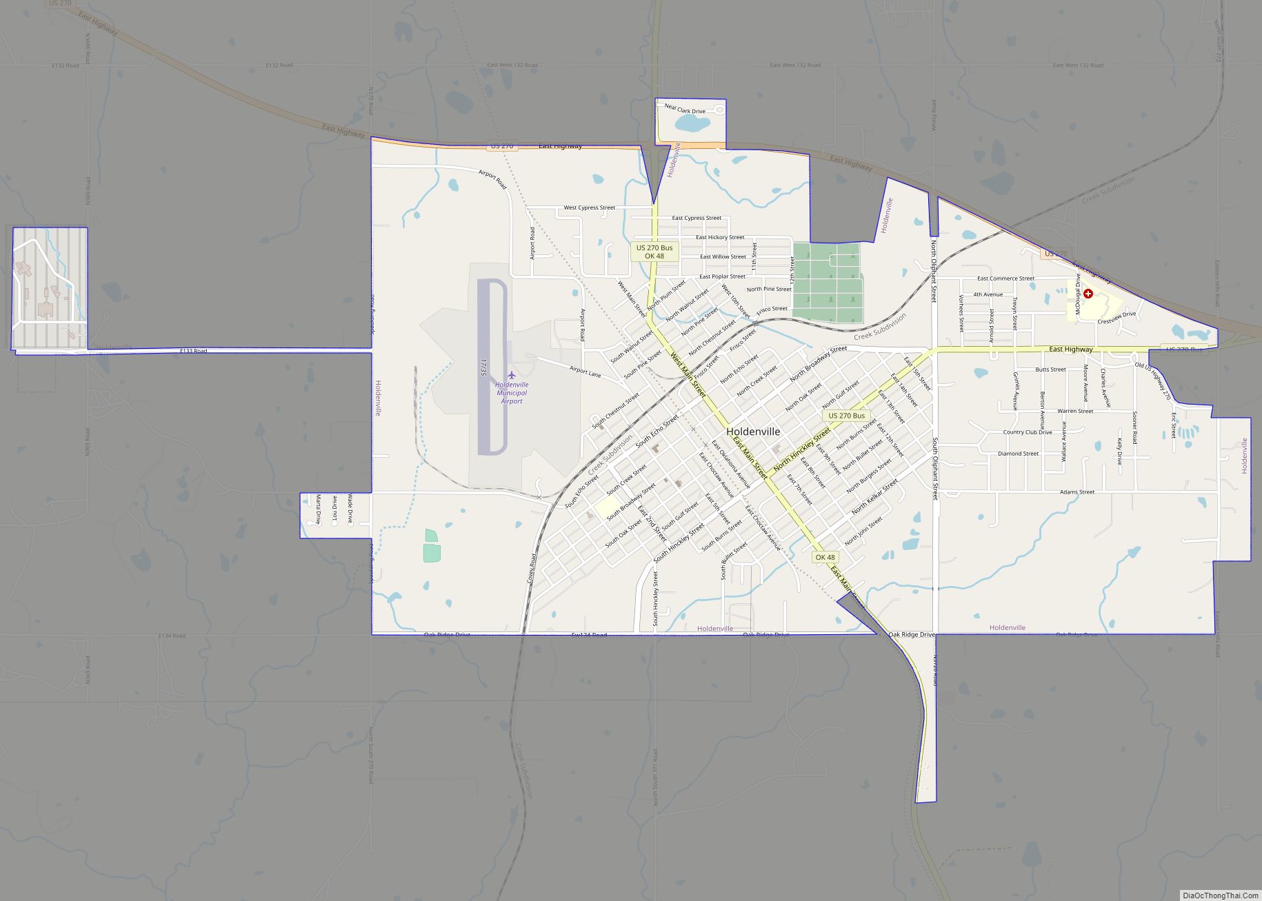
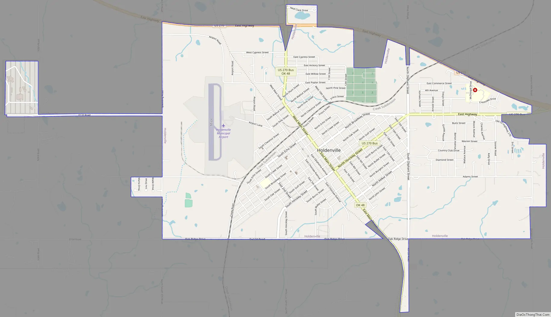
Online Interactive Map
Click on ![]() to view map in "full screen" mode.
to view map in "full screen" mode.
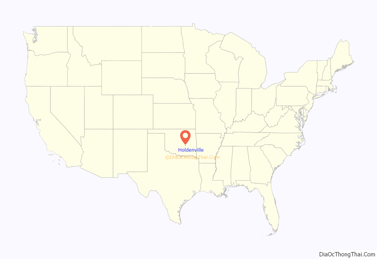
Holdenville location map. Where is Holdenville city?
History
Holdenville traces its origin to a Creek settlement called echo, which means “deer” in English. George B. Fentress operated a general store there. A post office called “Fentress” opened there on May 24, 1895. The Choctaw, Oklahoma and Gulf Railroad was constructed in the 1890s from Arkansas to Indian Territory. Between 1895 and 1897, the construction passed through the Creek Nation. During this period, a railroad camp was set up to service the railroad construction. The railroad workers called the camp “Holden” in honor of J.F. Holden, the Auditor and Traffic Manager of Choctaw, Oklahoma, and Gulf Railroad. In 1895, a request was delivered to the U.S. Congress to establish a post office in Holden. The request was rejected because the name was too similar to another post office called “Holder.” The proposed name was then altered to “Holdenville” and was accepted.
In 1898, settlers petitioned Indian Territory to incorporate Holdenville as a town. A hearing was granted and on November 14, 1898, Holdenville was incorporated as part of Indian Territory. D. J. Red was elected mayor at the first municipal election, held December 27, 1898. The first city council meeting was held January 4, 1899. The St. Louis, Oklahoma and Southern Railway (later the St. Louis and San Francisco Railway) constructed a line between 1900 and 1901 from Sapulpa to the Red River that passed through Holdenville. An election was held on June 27, 1908, to determine the permanent county seat. Contending communities were Holdenville, Wetumka, Calvin, and Lamar. None of the candidates won a majority, so a runoff election was held on September 10, 1908, between the two top vote-getters, Holdenville and Wetumka. This time, Holdenville won the election.
Until it was named in a grand jury investigation in 1904, Holdenville was a sundown town where African Americans were not allowed to live or even wait for a train.
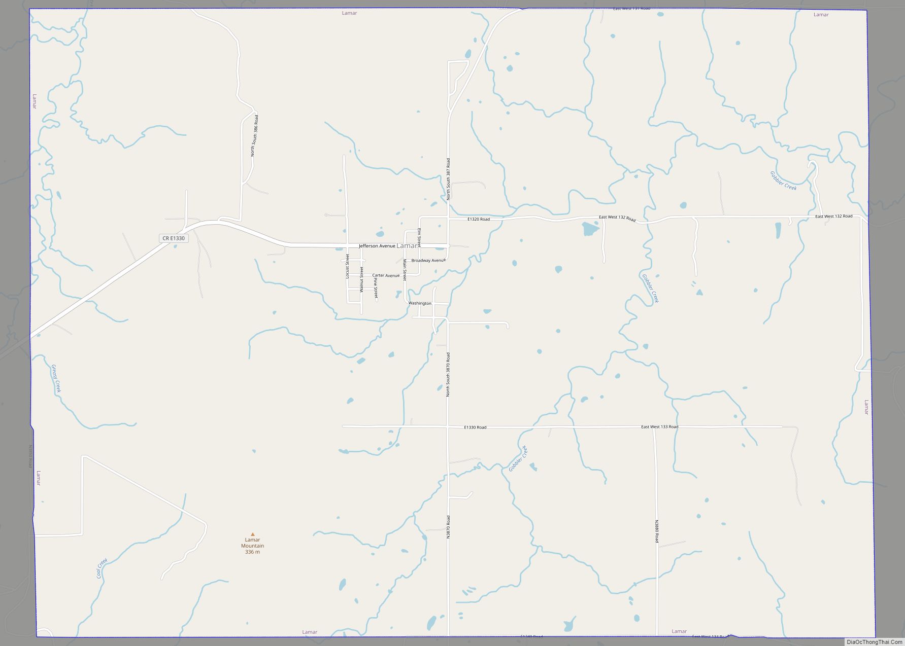
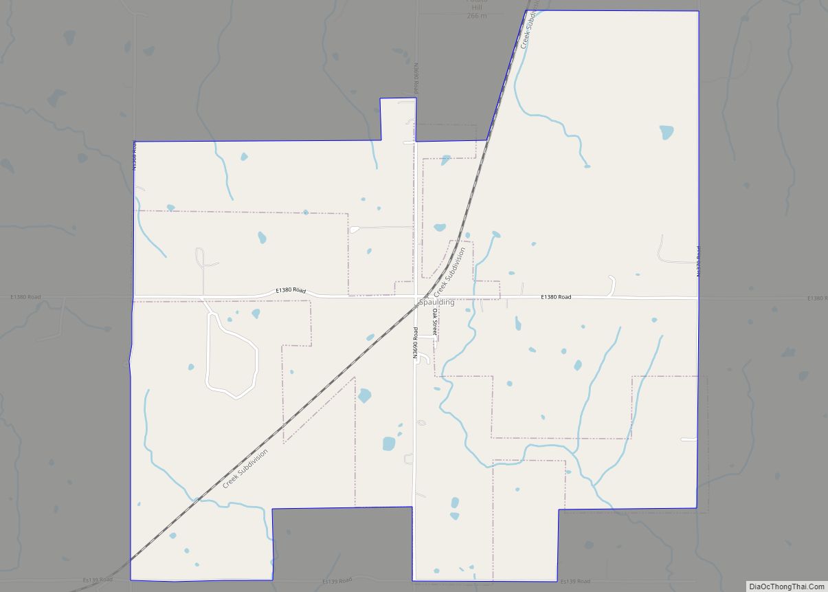
Holdenville Road Map
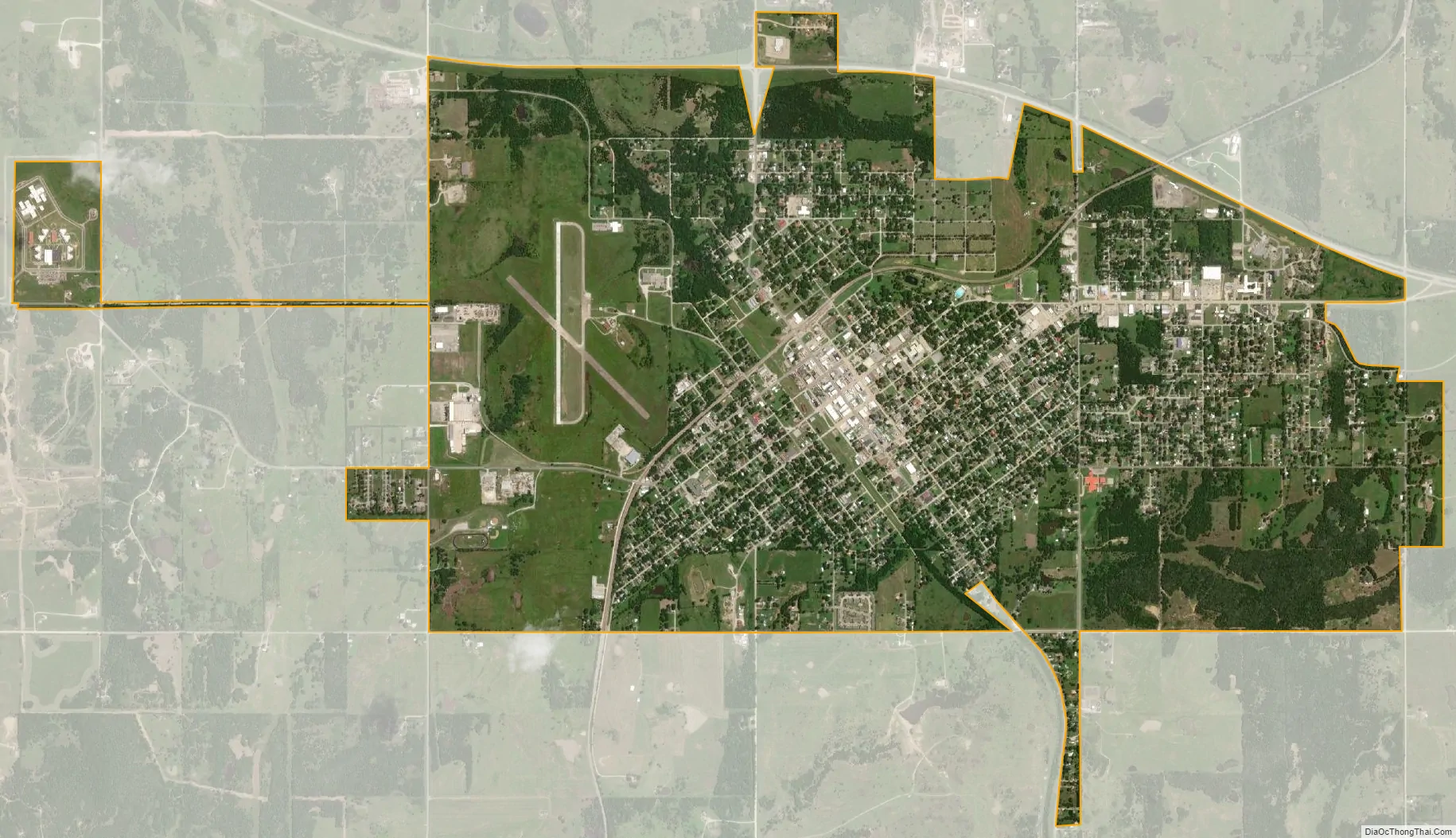
Holdenville city Satellite Map
Geography
Holdenville is located at 35°5′3″N 96°24′1″W / 35.08417°N 96.40028°W / 35.08417; -96.40028 (35.084199, -96.400305). It is about 75 miles (121 km) from Oklahoma City. According to the United States Census Bureau, the city has a total area of 4.8 square miles (12 km), all land.
Holdenville sits approximately five miles north of the Holdenville City Lake, eight miles north of the Canadian River, and six miles north of the Little River. The area is mostly wooded and flanked by gently rolling hills, interrupted occasionally by small creeks and streams.
See also
Map of Oklahoma State and its subdivision:- Adair
- Alfalfa
- Atoka
- Beaver
- Beckham
- Blaine
- Bryan
- Caddo
- Canadian
- Carter
- Cherokee
- Choctaw
- Cimarron
- Cleveland
- Coal
- Comanche
- Cotton
- Craig
- Creek
- Custer
- Delaware
- Dewey
- Ellis
- Garfield
- Garvin
- Grady
- Grant
- Greer
- Harmon
- Harper
- Haskell
- Hughes
- Jackson
- Jefferson
- Johnston
- Kay
- Kingfisher
- Kiowa
- Latimer
- Le Flore
- Lincoln
- Logan
- Love
- Major
- Marshall
- Mayes
- McClain
- McCurtain
- McIntosh
- Murray
- Muskogee
- Noble
- Nowata
- Okfuskee
- Oklahoma
- Okmulgee
- Osage
- Ottawa
- Pawnee
- Payne
- Pittsburg
- Pontotoc
- Pottawatomie
- Pushmataha
- Roger Mills
- Rogers
- Seminole
- Sequoyah
- Stephens
- Texas
- Tillman
- Tulsa
- Wagoner
- Washington
- Washita
- Woods
- Woodward
- Alabama
- Alaska
- Arizona
- Arkansas
- California
- Colorado
- Connecticut
- Delaware
- District of Columbia
- Florida
- Georgia
- Hawaii
- Idaho
- Illinois
- Indiana
- Iowa
- Kansas
- Kentucky
- Louisiana
- Maine
- Maryland
- Massachusetts
- Michigan
- Minnesota
- Mississippi
- Missouri
- Montana
- Nebraska
- Nevada
- New Hampshire
- New Jersey
- New Mexico
- New York
- North Carolina
- North Dakota
- Ohio
- Oklahoma
- Oregon
- Pennsylvania
- Rhode Island
- South Carolina
- South Dakota
- Tennessee
- Texas
- Utah
- Vermont
- Virginia
- Washington
- West Virginia
- Wisconsin
- Wyoming