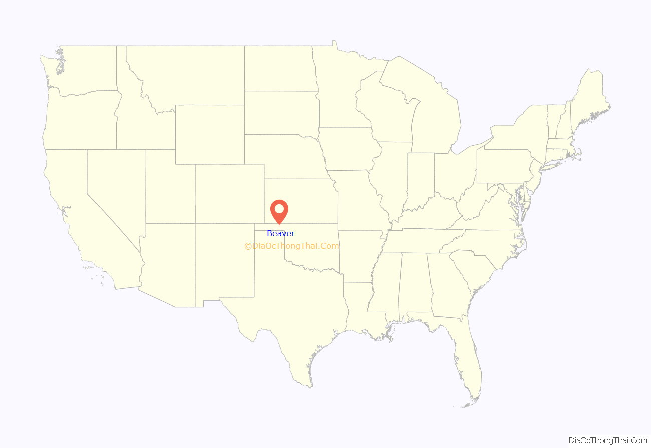
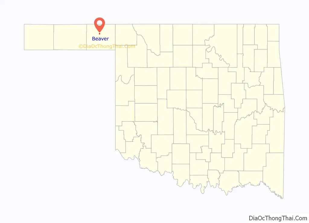
Beaver is a town and county seat in Beaver County, Oklahoma, United States. The community is in the Oklahoma Panhandle. As of the 2010 census, the town population was 1,515, a 3.5 percent decrease from 1,570 at the 2000 census. The city is host to the annual World Cow Chip Throwing Championship. Held in April, “Cow Chip” brings attention from nearby cities with a parade, carnival, and cowchip throwing.
| Name: | Beaver town |
|---|---|
| LSAD Code: | 43 |
| LSAD Description: | town (suffix) |
| State: | Oklahoma |
| County: | Beaver County |
| Elevation: | 2,395 ft (730 m) |
| Total Area: | 1.15 sq mi (2.97 km²) |
| Land Area: | 1.15 sq mi (2.97 km²) |
| Water Area: | 0.00 sq mi (0.00 km²) |
| Total Population: | 1,280 |
| Population Density: | 1,114.98/sq mi (430.34/km²) |
| ZIP code: | 73932 |
| Area code: | 580 |
| FIPS code: | 4004750 |
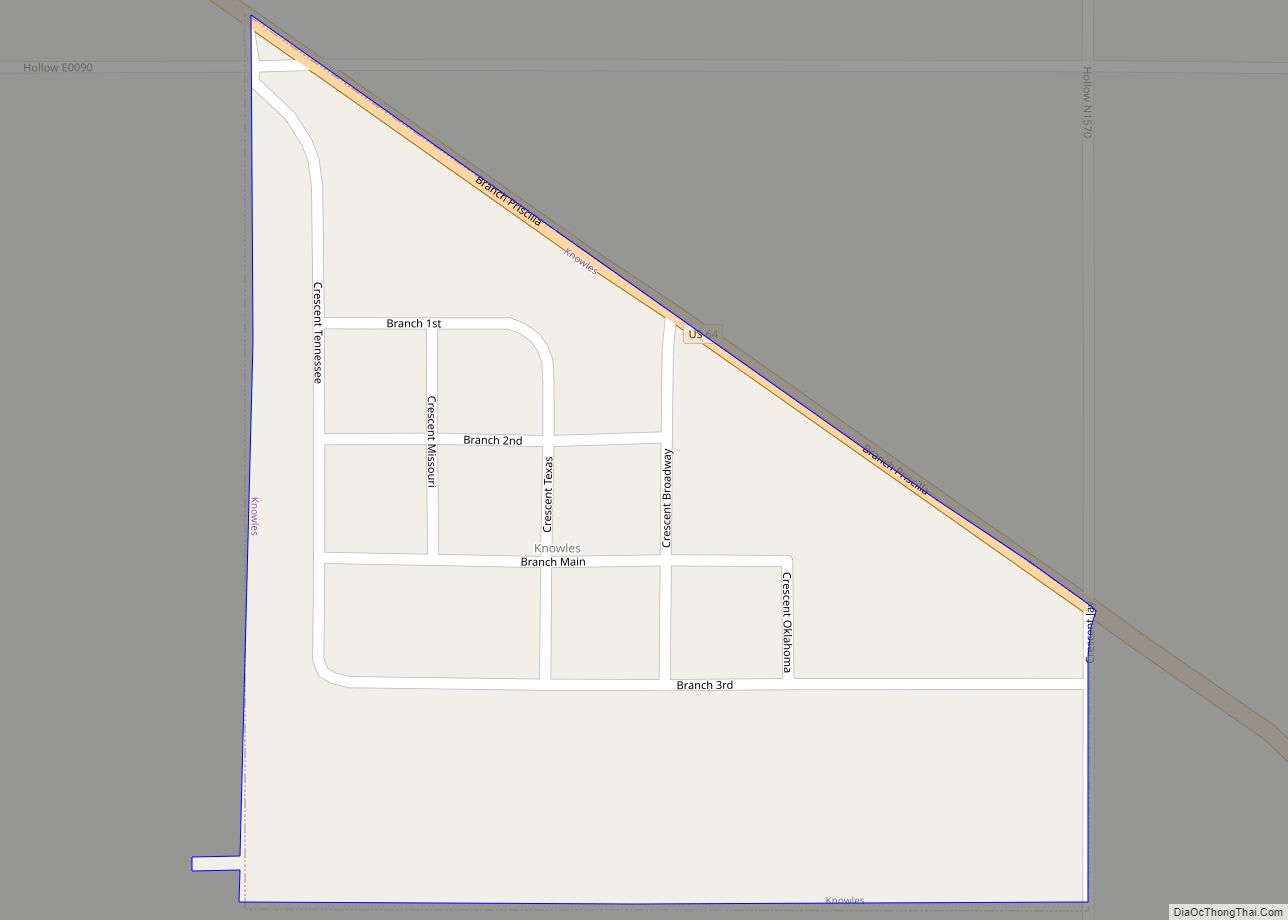
Online Interactive Map
Click on ![]() to view map in "full screen" mode.
to view map in "full screen" mode.
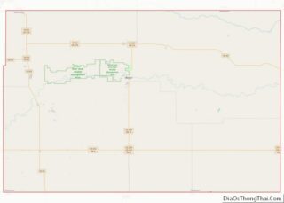
Beaver location map. Where is Beaver town?
History
Beaver is located by Beaver River, also known as North Canadian River, and began as the location of a fur-trading post in 1879. Its original name was Beaver City, and was planned to be the capital of the short-lived Cimarron Territory. The Federal government never recognized the proposed Territory, but Beaver City remained the center of business and law enforcement for the area. In 1890, the territory was assigned to Oklahoma Territory, and Beaver City became the seat for the entire Oklahoma Panhandle, then known as Seventh County.
Beaver began as a stop on the Jones and Plummer Trail. In 1880, Jim Lane built a house on the south side of Beaver Creek, that also served as a general store, saloon, hotel, and restaurant. Beaver slowly sprouted along the banks of Beaver Creek. The first post office had been established on the north side of the river in 1883. In 1884 Lane moved the post office to his store and became the postmaster. He also added a corral and livery stable to accommodate freighters and cattle drivers. The Presbyterian Church was built in 1887. It is listed on the National Register of Historic Places as “the oldest church in Oklahoma Territory”. The Groves Hotel (later renamed the Thompson Hotel) was said to be the first business in town, when it was built in 1885. In 1891, Carter Tracy opened a general hardware and implement store. The first newspaper, the Territorial Advocate, began printing in 1887.
Although the Oklahoma Panhandle is noted for its lack of rainfall, it is occasionally subjected to flash floods. One such event occurred early in Beaver’s history, and flooded Main Street, where many of the businesses had been built. Another street, Douglas, had already been built, running south up a hill from the river, where the businesses relocated to prevent a recurrence.
The population grew to 112 in 1900, the main reason for its existence was to support cattle ranches located in the Panhandle area. In 1901–02, the Homestead Act encouraged farmers to move in to the area. Growth continued after the turn of 1900. A telephone exchange was built in 1905, and the Bank of Beaver City and the First National Bank, were established. The Beaver, Meade and Englewood Railroad (BME) was built to connect to the Missouri, Kansas and Texas Railway, a.k.a. M-K-T or “Katy” in Forgan, Oklahoma, 7 miles (11 km) to the north. The BME track to Forgan was not completed until 1915. Meanwhile, the BME was extended into Texas and Cimarron Counties. Soon, the M-K-T bought the BME system for $2 million.
During the Dust Bowl and the Great Depression most of the Panhandle and its communities suffered great economic hardships and lost population. The city of Beaver actually gained population. In 1920, it had 920 residents, which grew to 1028 in 1930 and 1146 in 1940.
Between Beaver and Guymon along Beaver Creek there are several plains Indians ruins. They are on private property and not accessible to the public. These ruins are associated with the Buried City Plains Indian Ruins near Perryton, Texas.
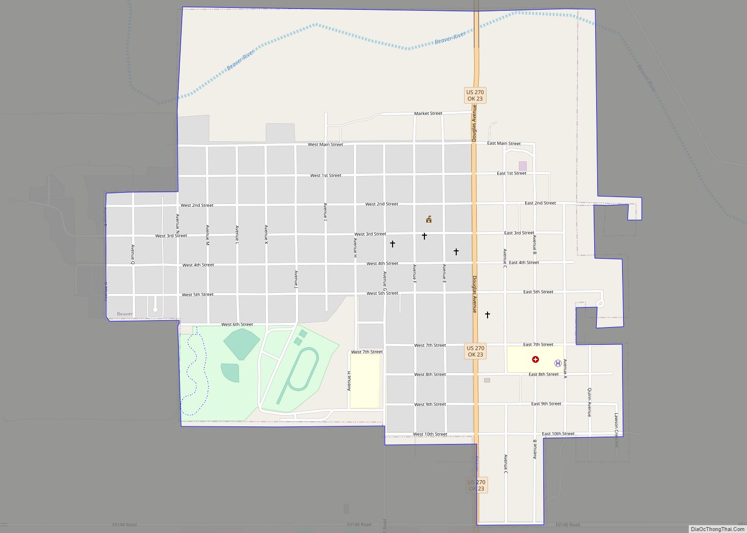
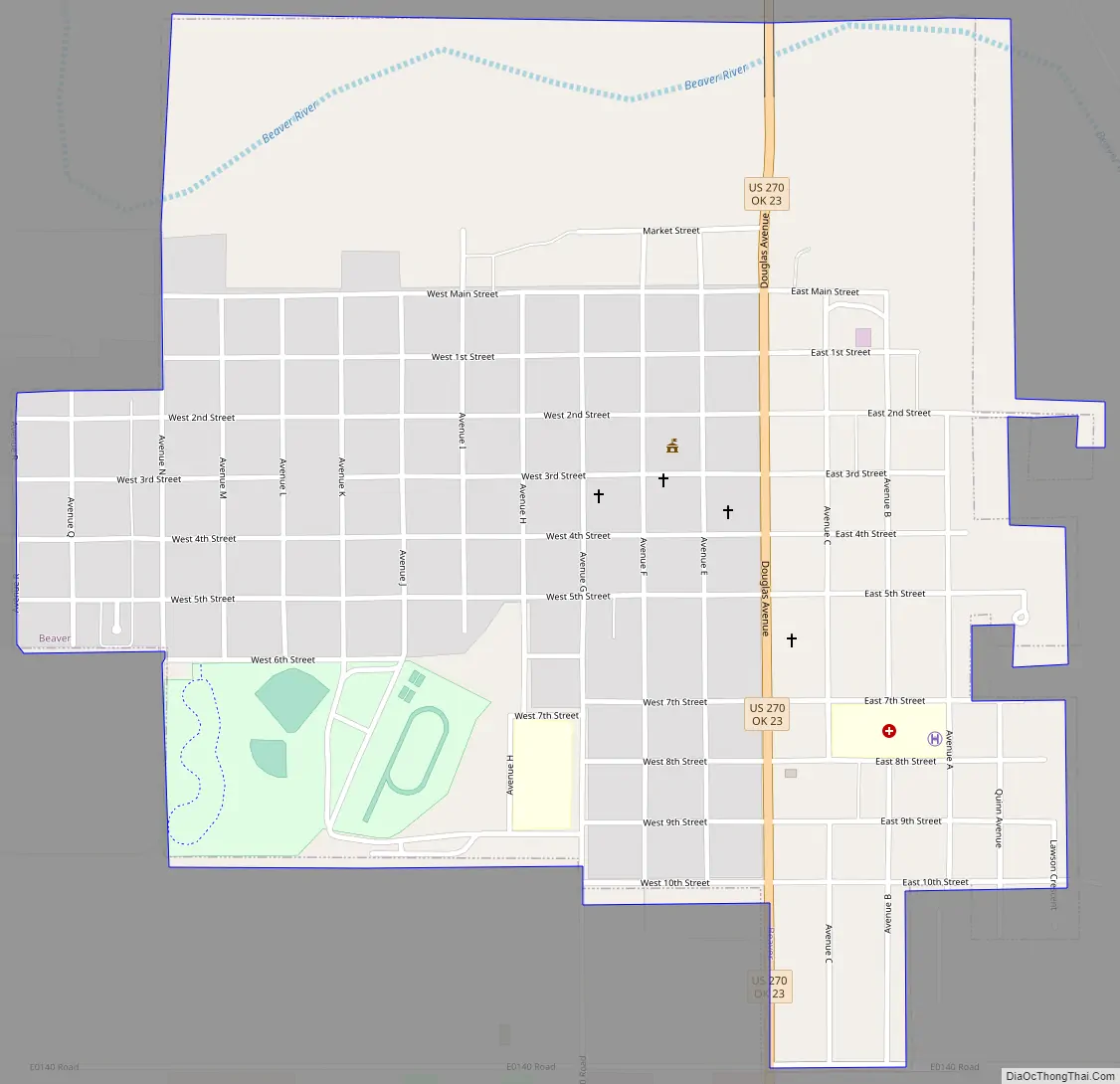
Beaver Road Map
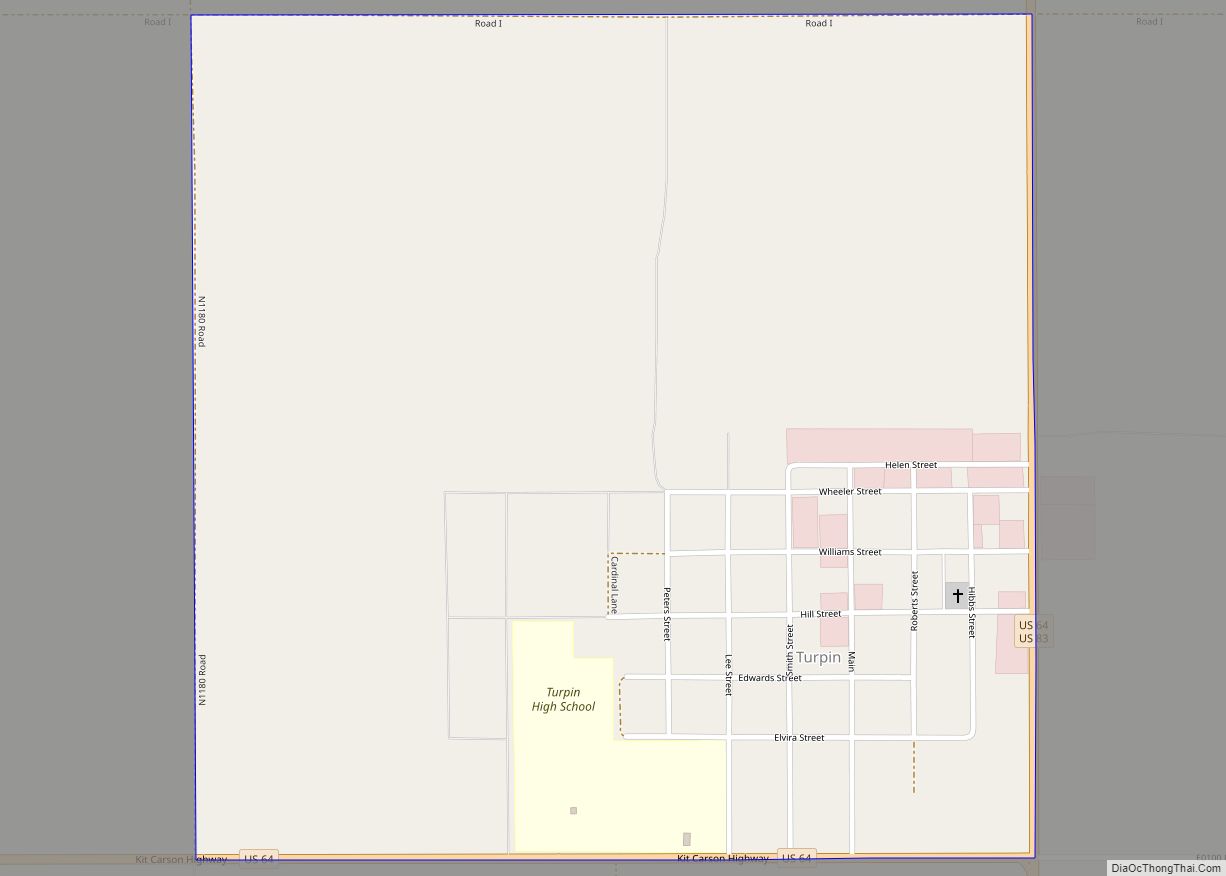
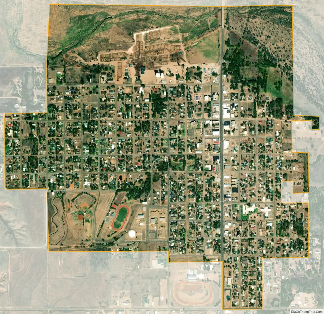
Beaver city Satellite Map
Geography
Beaver is located at 36°48′49″N 100°31′27″W / 36.81361°N 100.52417°W / 36.81361; -100.52417 (36.813486, −100.524298). According to the United States Census Bureau, the city had a total area of 1.1 square miles (2.8 km), all land.
A mile north of the town is Beaver Dunes Park, now owned by the City of Beaver, featuring sand dunes left by ancient seas that once covered the area.
Climate
Beaver experiences a semi-arid climate (Köppen BSk) with cool, dry winters and hot, much wetter summers.
While not the snowiest location in Oklahoma ranked by highest annual average snowfall, Beaver has the distinction of holding the State snowfall record for 1 season, being the 87.3″ which fell during 1911–1912.
See also
Map of Oklahoma State and its subdivision:- Adair
- Alfalfa
- Atoka
- Beaver
- Beckham
- Blaine
- Bryan
- Caddo
- Canadian
- Carter
- Cherokee
- Choctaw
- Cimarron
- Cleveland
- Coal
- Comanche
- Cotton
- Craig
- Creek
- Custer
- Delaware
- Dewey
- Ellis
- Garfield
- Garvin
- Grady
- Grant
- Greer
- Harmon
- Harper
- Haskell
- Hughes
- Jackson
- Jefferson
- Johnston
- Kay
- Kingfisher
- Kiowa
- Latimer
- Le Flore
- Lincoln
- Logan
- Love
- Major
- Marshall
- Mayes
- McClain
- McCurtain
- McIntosh
- Murray
- Muskogee
- Noble
- Nowata
- Okfuskee
- Oklahoma
- Okmulgee
- Osage
- Ottawa
- Pawnee
- Payne
- Pittsburg
- Pontotoc
- Pottawatomie
- Pushmataha
- Roger Mills
- Rogers
- Seminole
- Sequoyah
- Stephens
- Texas
- Tillman
- Tulsa
- Wagoner
- Washington
- Washita
- Woods
- Woodward
- Alabama
- Alaska
- Arizona
- Arkansas
- California
- Colorado
- Connecticut
- Delaware
- District of Columbia
- Florida
- Georgia
- Hawaii
- Idaho
- Illinois
- Indiana
- Iowa
- Kansas
- Kentucky
- Louisiana
- Maine
- Maryland
- Massachusetts
- Michigan
- Minnesota
- Mississippi
- Missouri
- Montana
- Nebraska
- Nevada
- New Hampshire
- New Jersey
- New Mexico
- New York
- North Carolina
- North Dakota
- Ohio
- Oklahoma
- Oregon
- Pennsylvania
- Rhode Island
- South Carolina
- South Dakota
- Tennessee
- Texas
- Utah
- Vermont
- Virginia
- Washington
- West Virginia
- Wisconsin
- Wyoming