Big Cabin is a town in Craig County, Oklahoma, United States. The population was 265 at the 2010 census, a decrease of 9.6 percent from the figure of 293 recorded in 2000.
| Name: | Big Cabin town |
|---|---|
| LSAD Code: | 43 |
| LSAD Description: | town (suffix) |
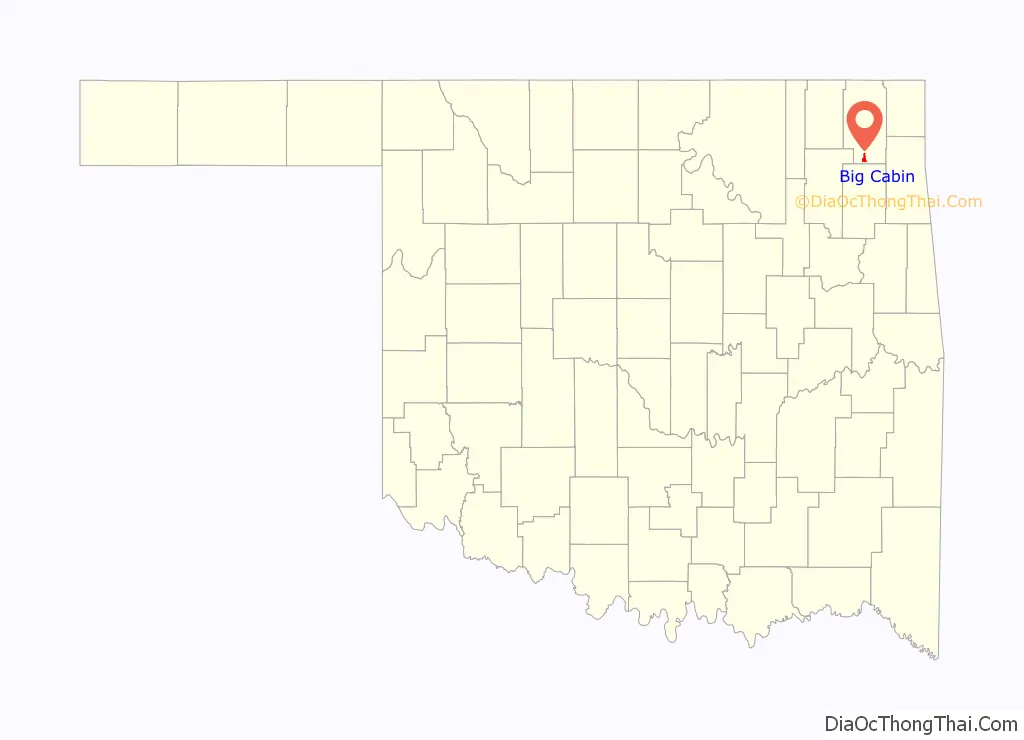
| State: | Oklahoma |
| County: | Craig County |
| Elevation: | 722 ft (220 m) |
| Total Area: | 2.34 sq mi (6.05 km²) |
| Land Area: | 2.34 sq mi (6.05 km²) |
| Water Area: | 0.00 sq mi (0.00 km²) |
| Total Population: | 174 |
| Population Density: | 74.45/sq mi (28.74/km²) |
| ZIP code: | 74332 |
| FIPS code: | 4005900 |
| GNISfeature ID: | 1090098 |
| Website: | http://www.cityofbigcabin.org/ |
Online Interactive Map
Click on ![]() to view map in "full screen" mode.
to view map in "full screen" mode.
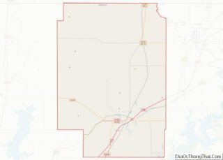
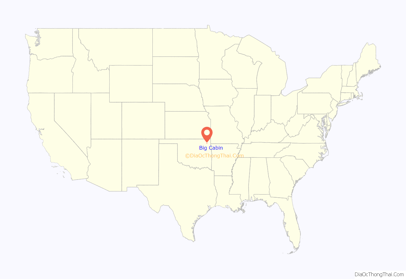
Big Cabin location map. Where is Big Cabin town?
History
The town was named for a local landmark, a plank cabin, that existed near the place where the Missouri, Kansas and Texas Railway built a switch in 1871–2. The first post office in this part of Indian Territory opened in 1872. (though it was not named Big Cabin until 1892). Some entrepreneurs built a stockyard in the town in 1888. The first two-story frame building was constructed in 1892. In 1892 the Post Office Department assigned a postal designation to Big Cabin. A school for non-Indian children began in 1895. The railroad built a depot in 1903.
Big Cabin was platted as a town in 1904. It began the process to incorporate in 1926, but did not finish the task until 1958. Meanwhile, the area around Big Cabin became noted for producing hay. A local resident claimed that the town had shipped out more hay between 1893 and 1910 than any other town in the U.S. He claimed that Big Cabin was “the Hay Capital of the World.”
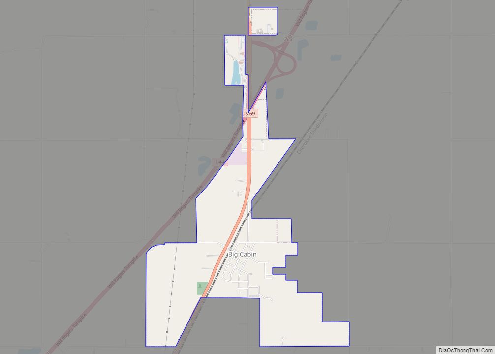
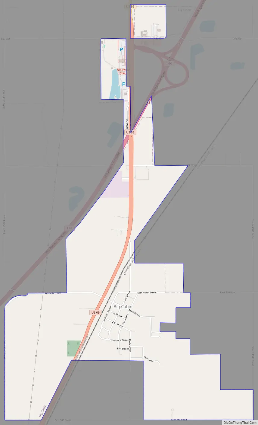
Big Cabin Road Map
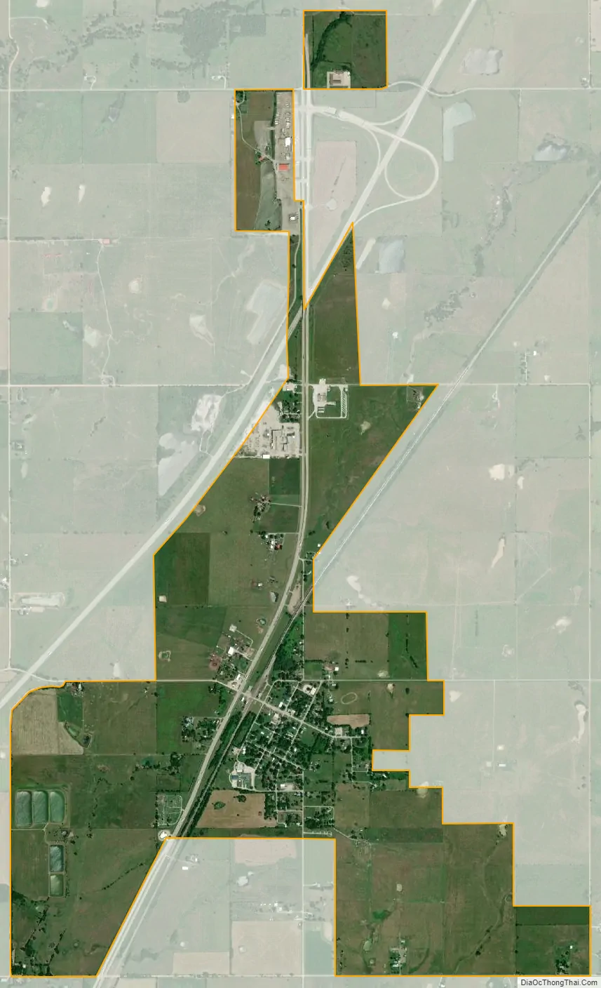
Big Cabin city Satellite Map
Geography
Big Cabin is located near the southern border of Craig County at 36°32′39″N 95°13′14″W / 36.54417°N 95.22056°W / 36.54417; -95.22056 (36.544031, -95.220496). U.S. Route 69 passes through the town, leading north 10 miles (16 km) to Vinita, the county seat, and south 8 miles (13 km) to Adair. Interstate 44, the Will Rogers Turnpike, passes just north of the town, with access from Exit 283. Via I-44, it is 56 miles (90 km) southwest to Tulsa and 32 miles (51 km) northeast to Miami.
According to the United States Census Bureau, Big Cabin has a total area of 2.2 square miles (5.7 km), all land.
See also
Map of Oklahoma State and its subdivision:- Adair
- Alfalfa
- Atoka
- Beaver
- Beckham
- Blaine
- Bryan
- Caddo
- Canadian
- Carter
- Cherokee
- Choctaw
- Cimarron
- Cleveland
- Coal
- Comanche
- Cotton
- Craig
- Creek
- Custer
- Delaware
- Dewey
- Ellis
- Garfield
- Garvin
- Grady
- Grant
- Greer
- Harmon
- Harper
- Haskell
- Hughes
- Jackson
- Jefferson
- Johnston
- Kay
- Kingfisher
- Kiowa
- Latimer
- Le Flore
- Lincoln
- Logan
- Love
- Major
- Marshall
- Mayes
- McClain
- McCurtain
- McIntosh
- Murray
- Muskogee
- Noble
- Nowata
- Okfuskee
- Oklahoma
- Okmulgee
- Osage
- Ottawa
- Pawnee
- Payne
- Pittsburg
- Pontotoc
- Pottawatomie
- Pushmataha
- Roger Mills
- Rogers
- Seminole
- Sequoyah
- Stephens
- Texas
- Tillman
- Tulsa
- Wagoner
- Washington
- Washita
- Woods
- Woodward
- Alabama
- Alaska
- Arizona
- Arkansas
- California
- Colorado
- Connecticut
- Delaware
- District of Columbia
- Florida
- Georgia
- Hawaii
- Idaho
- Illinois
- Indiana
- Iowa
- Kansas
- Kentucky
- Louisiana
- Maine
- Maryland
- Massachusetts
- Michigan
- Minnesota
- Mississippi
- Missouri
- Montana
- Nebraska
- Nevada
- New Hampshire
- New Jersey
- New Mexico
- New York
- North Carolina
- North Dakota
- Ohio
- Oklahoma
- Oregon
- Pennsylvania
- Rhode Island
- South Carolina
- South Dakota
- Tennessee
- Texas
- Utah
- Vermont
- Virginia
- Washington
- West Virginia
- Wisconsin
- Wyoming