Burbank is a town in western Osage County, Oklahoma, United States. The population was 141 at the 2010 census, a 9 percent decrease from the figure of 155 recorded in 2000.
| Name: | Burbank town |
|---|---|
| LSAD Code: | 43 |
| LSAD Description: | town (suffix) |
| State: | Oklahoma |
| County: | Osage County |
| Elevation: | 1,030 ft (310 m) |
| Total Area: | 0.34 sq mi (0.87 km²) |
| Land Area: | 0.33 sq mi (0.86 km²) |
| Water Area: | 0.00 sq mi (0.01 km²) |
| Total Population: | 123 |
| Population Density: | 370.48/sq mi (142.87/km²) |
| ZIP code: | 74633 |
| Area code: | 539/918 |
| FIPS code: | 4009950 |
| GNISfeature ID: | 1090702 |
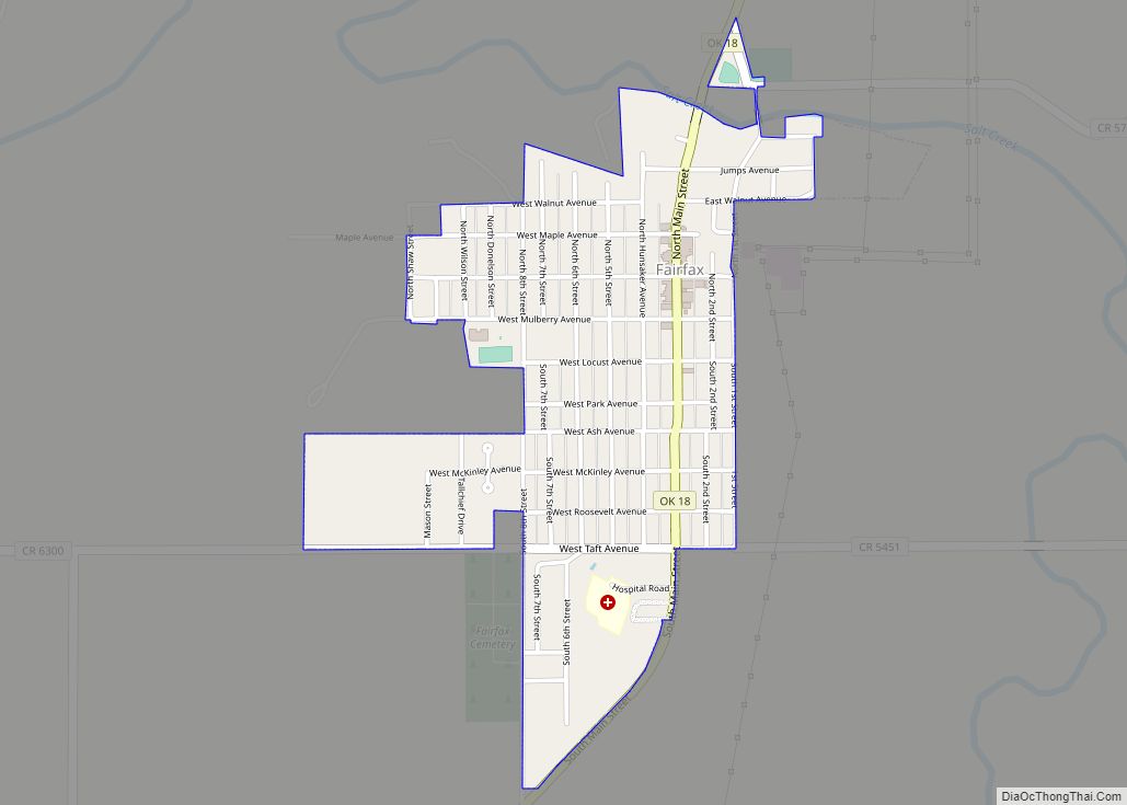
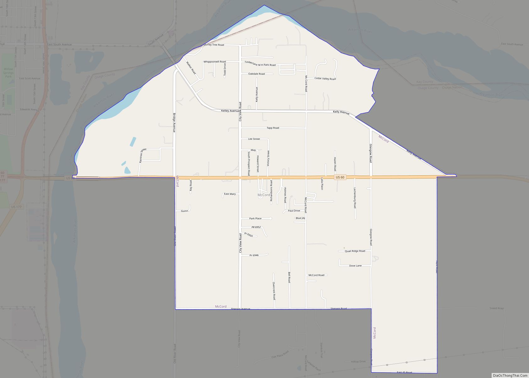
Online Interactive Map
Click on ![]() to view map in "full screen" mode.
to view map in "full screen" mode.
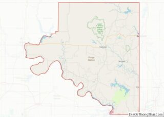
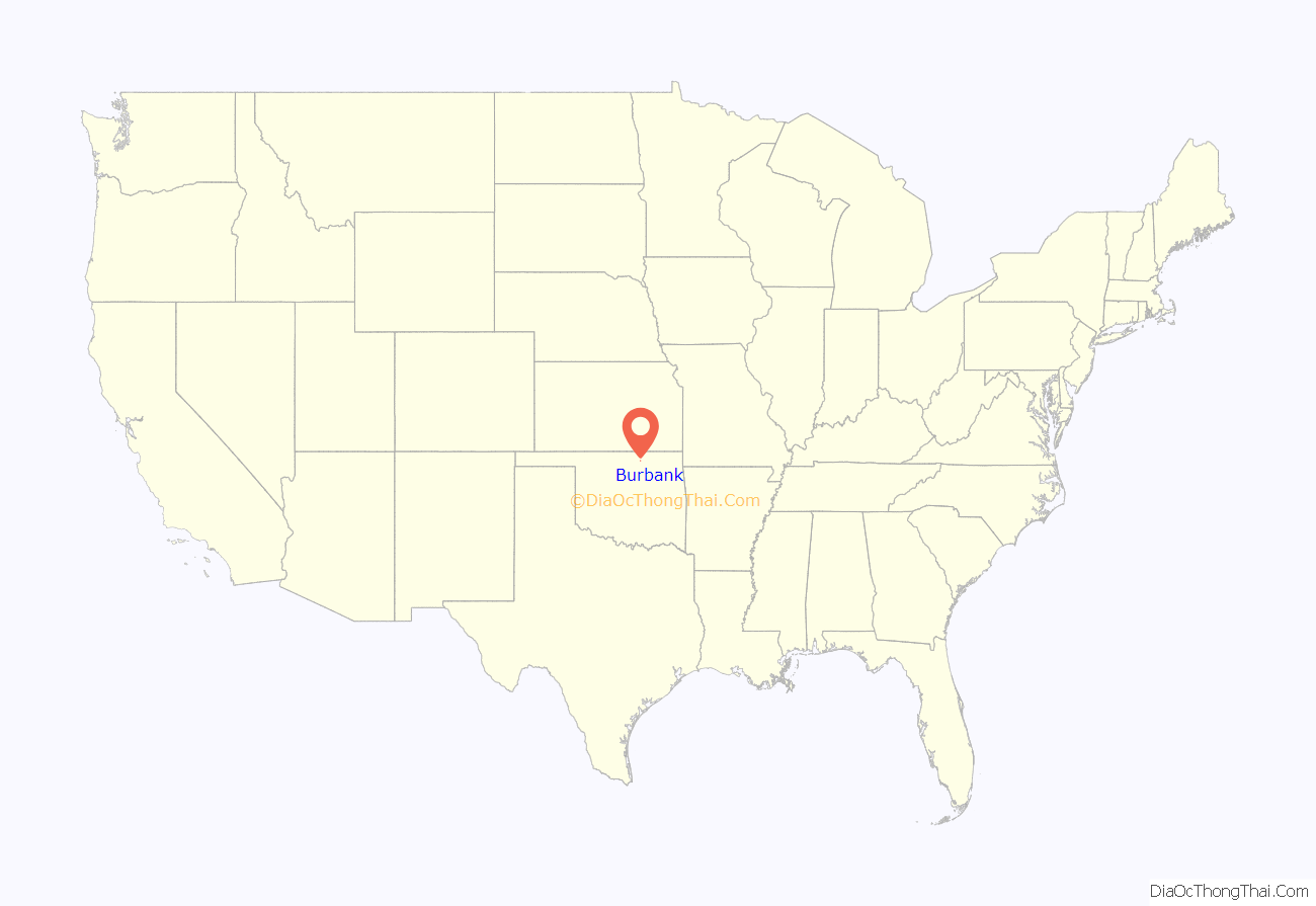
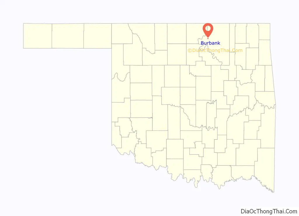
Burbank location map. Where is Burbank town?
History
Burbank was founded in 1903 on the Osage Reservation. The founder was Anthony “Gabe” Carlton, a mixed-blood Osage and a Chouteau family descendant, who owned the townsite and named it after the artist Elbridge Ayer Burbank (1858-1949) who spent his life painting the Indians of over 125 tribes.
Burbank had about 200 residents and an economy based on farming and ranching until May 1920 when E.W. Marland discovered petroleum northeast of the town. Burbank became a boom town, and other towns in the area such as Whizbang sprang up overnight to exploit the rich petroleum resources. The Burbank field was mostly located in Osage County but extended into Kay County. The Burbank field extended over an area about 20 miles (32 km) long and 10 miles (16 km) wide. Burbank quickly grew into a town of 3,000 people.
Several major petroleum companies participated in the exploitation of the Burbank Field. Leases of oil land were obtained from the Osage Indians, usually by auction under the “Million Dollar Elm” tree in Pawhuska, the county seat and capital of the Osage Indians. Colonel Ellsworth Walters was the auctioner and more than a million dollars was often bid for the mineral rights to 160 acre (65 ha) tracts in the Burbank Field. Rich and famous oilmen such as Marland, Frank Phillips, L. E. Phillips, Waite Phillips, and William G. Skelly stood in the shade of the Elm tree and bid in the auctions. Oil production in the Burbank field expanded from 134,408 barrels in 1920 to a peak production of 26,206,741 barrels in 1923. Production dropped by one-half in 1926 and by 1930 the boom period was over. Burbank’s population dropped to 372 in 1930. The value of the 160 million barrels the Burbank field produced during its heyday was almost 286 million dollars.
The Osage tribe and its members received $45 million in royalties from the Burbank field in the 1920s. The Osage, unlike many tribes, had retained collective ownership of mineral rights on their former reservation. Osage with a full headright (those on the 1906 tribal roll) received up to $15,000 each annually in oil royalties, the equivalent of more than $150,000 in 2010 dollars. The Osage were the “richest people in the world.”
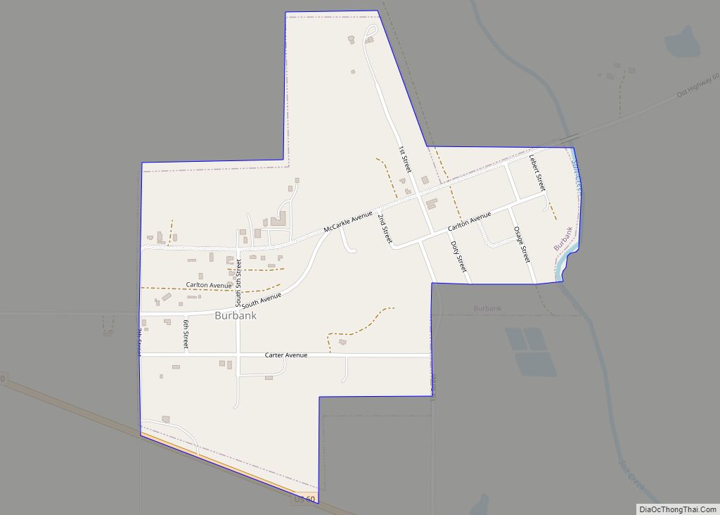
Burbank Road Map
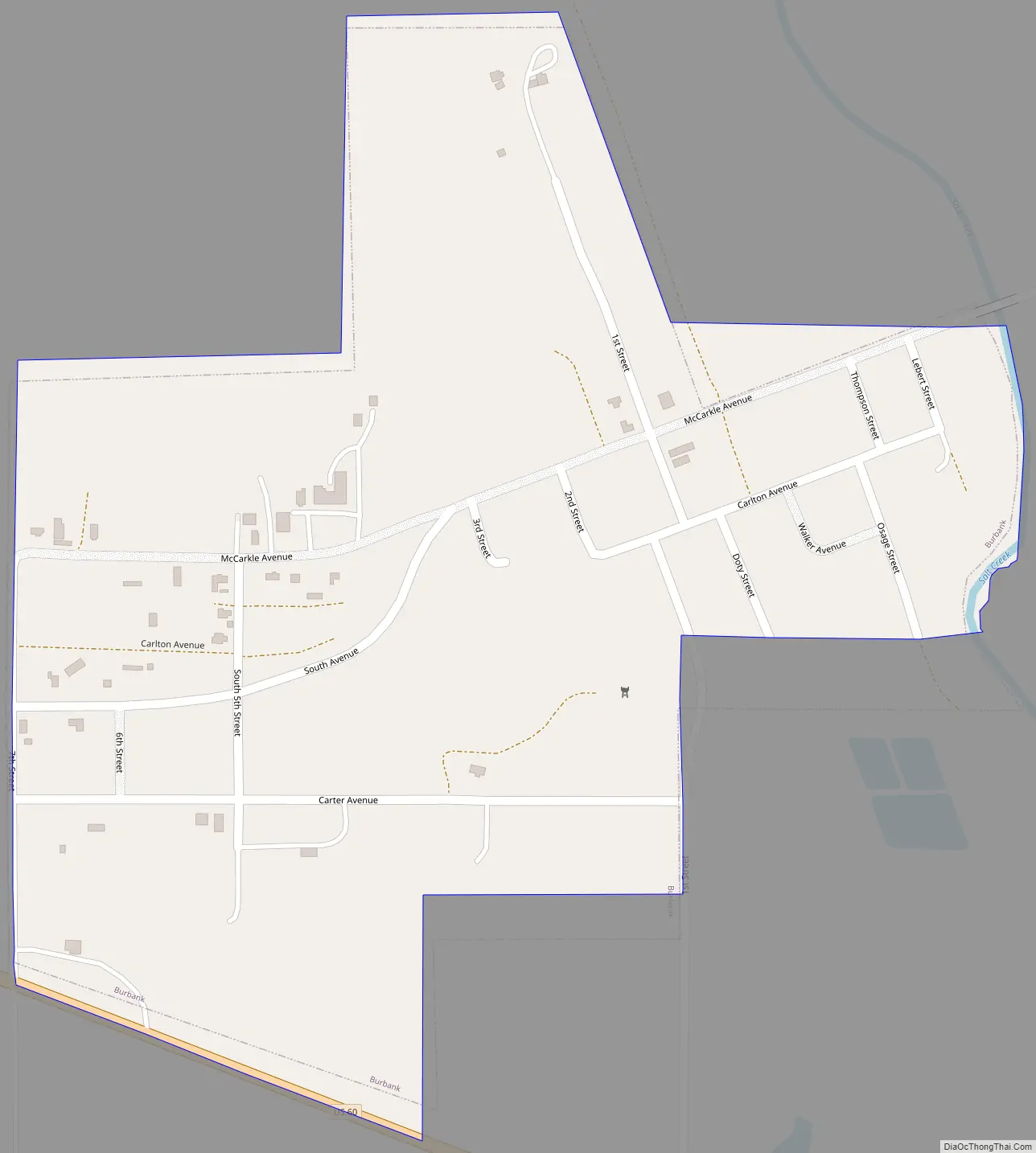
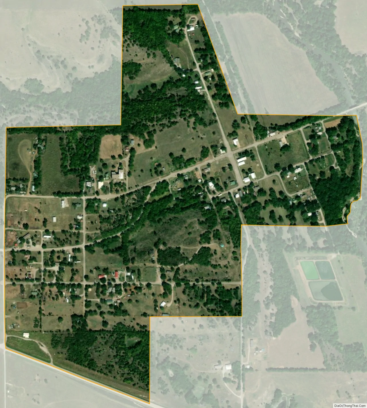
Burbank city Satellite Map
Geography
Burbank is located at 36°41′46″N 96°43′41″W / 36.69611°N 96.72806°W / 36.69611; -96.72806 (36.695983, -96.727978). It is 22 miles (35 km) west of Pawhuska and 122 miles (196 km) northeast of Oklahoma City.
According to the United States Census Bureau, the town has a total area of 0.3 square miles (0.78 km), all land.
See also
Map of Oklahoma State and its subdivision:- Adair
- Alfalfa
- Atoka
- Beaver
- Beckham
- Blaine
- Bryan
- Caddo
- Canadian
- Carter
- Cherokee
- Choctaw
- Cimarron
- Cleveland
- Coal
- Comanche
- Cotton
- Craig
- Creek
- Custer
- Delaware
- Dewey
- Ellis
- Garfield
- Garvin
- Grady
- Grant
- Greer
- Harmon
- Harper
- Haskell
- Hughes
- Jackson
- Jefferson
- Johnston
- Kay
- Kingfisher
- Kiowa
- Latimer
- Le Flore
- Lincoln
- Logan
- Love
- Major
- Marshall
- Mayes
- McClain
- McCurtain
- McIntosh
- Murray
- Muskogee
- Noble
- Nowata
- Okfuskee
- Oklahoma
- Okmulgee
- Osage
- Ottawa
- Pawnee
- Payne
- Pittsburg
- Pontotoc
- Pottawatomie
- Pushmataha
- Roger Mills
- Rogers
- Seminole
- Sequoyah
- Stephens
- Texas
- Tillman
- Tulsa
- Wagoner
- Washington
- Washita
- Woods
- Woodward
- Alabama
- Alaska
- Arizona
- Arkansas
- California
- Colorado
- Connecticut
- Delaware
- District of Columbia
- Florida
- Georgia
- Hawaii
- Idaho
- Illinois
- Indiana
- Iowa
- Kansas
- Kentucky
- Louisiana
- Maine
- Maryland
- Massachusetts
- Michigan
- Minnesota
- Mississippi
- Missouri
- Montana
- Nebraska
- Nevada
- New Hampshire
- New Jersey
- New Mexico
- New York
- North Carolina
- North Dakota
- Ohio
- Oklahoma
- Oregon
- Pennsylvania
- Rhode Island
- South Carolina
- South Dakota
- Tennessee
- Texas
- Utah
- Vermont
- Virginia
- Washington
- West Virginia
- Wisconsin
- Wyoming