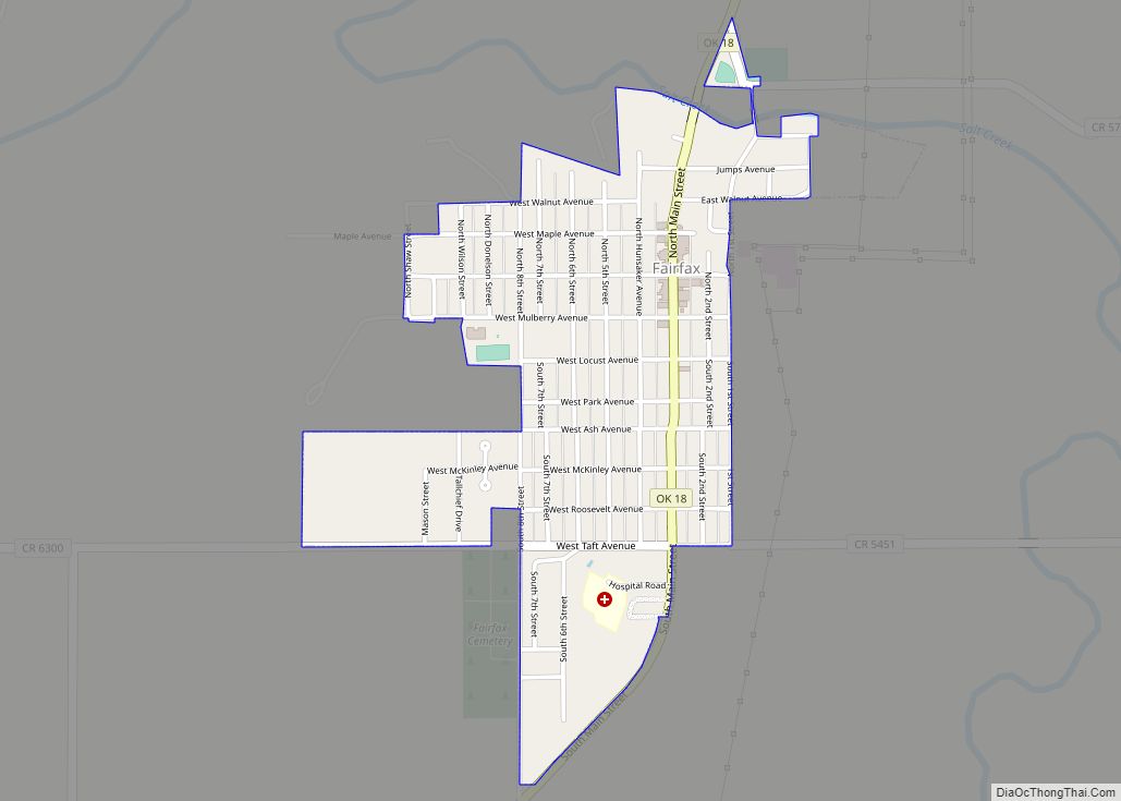
Fairfax is a town in Osage County, Oklahoma, United States. The Osage Nation reservation is coterminous with the county. The population was 1,380 at the 2010 census, down 11.3 percent from the figure of 1,555 recorded in 2000. It is notable as the home of world-famous ballerinas Maria and Marjorie Tallchief.
| Name: | Fairfax town |
|---|---|
| LSAD Code: | 43 |
| LSAD Description: | town (suffix) |
| State: | Oklahoma |
| County: | Osage County |
| Elevation: | 853 ft (260 m) |
| Total Area: | 0.77 sq mi (1.99 km²) |
| Land Area: | 0.77 sq mi (1.98 km²) |
| Water Area: | 0.00 sq mi (0.01 km²) |
| Total Population: | 1,136 |
| Population Density: | 1,483.03/sq mi (572.80/km²) |
| ZIP code: | 74637 |
| Area code: | 539/918 |
| FIPS code: | 4024850 |
| GNISfeature ID: | 1092690 |
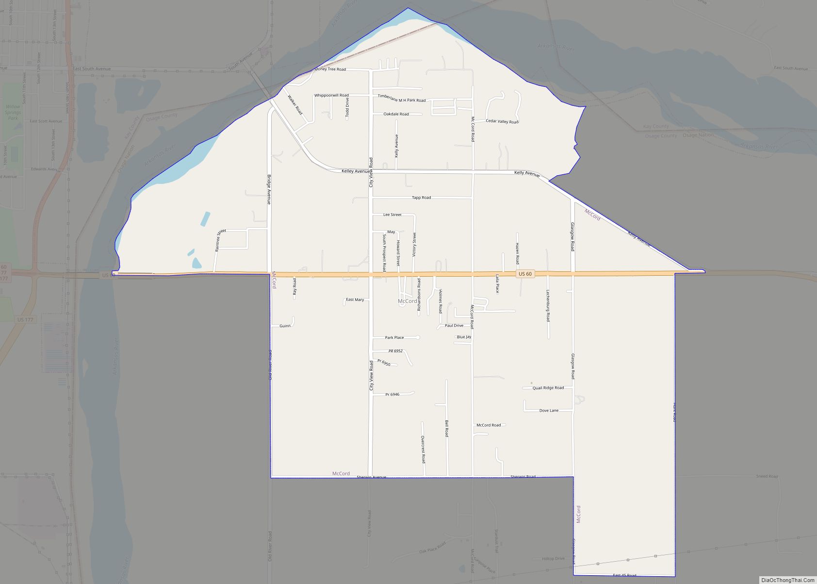
Online Interactive Map
Click on ![]() to view map in "full screen" mode.
to view map in "full screen" mode.
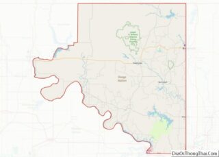
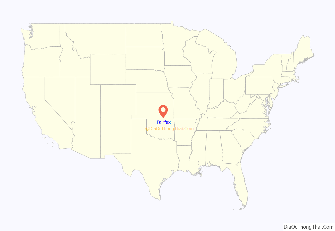
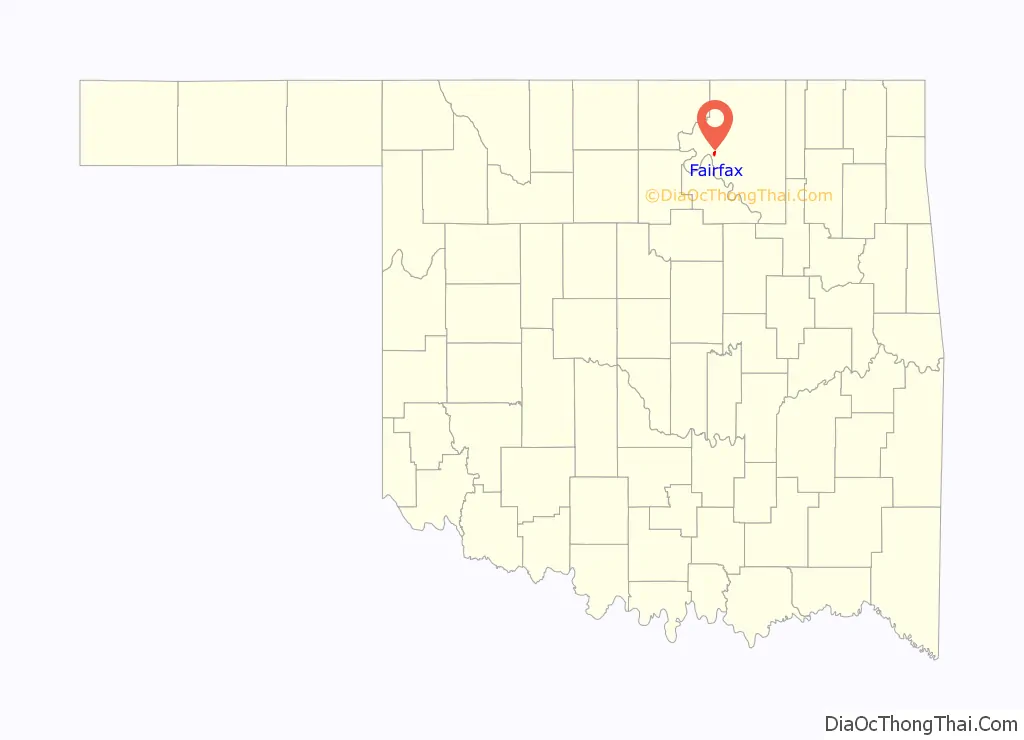
Fairfax location map. Where is Fairfax town?
History
When the Santa Fe Railway chose to go up Salt Creek valley and bypassed the village of Gray Horse (which continues to exist today as the home of one of the Osage tribe’s three major historic bands) the present day town of Fairfax was created. Local merchants, including Lew A. Wismeyer, moved buildings from Gray Horse and leased 40 acres (16 ha) acres for a townsite. Wismeyer rejected the name Coda proposed by the railroad and convinced them to call the depot Fairfax after a hotel he had stayed at in Washington, D.C. The Osage tribe retained title to the townsite until March 3, 1905, when Congress provided for the land to be sold at public auction, with the proceeds credited to the tribe. Fairfax had 470 residents at the time of statehood in 1907. Fairfax is also the site of the majority of the Osage Indian Murders that took place in the 1920s in Osage County, Oklahoma. The murders occurred because of the discovery of oil that was found on Osage Nation Reservation (Osage County). At least 24 Osages were murdered. The mastermind behind it all was William K. Hale. Author David Grann wrote Killers of the Flower Moon, a book about these murders and how they led to the creation of the FBI.
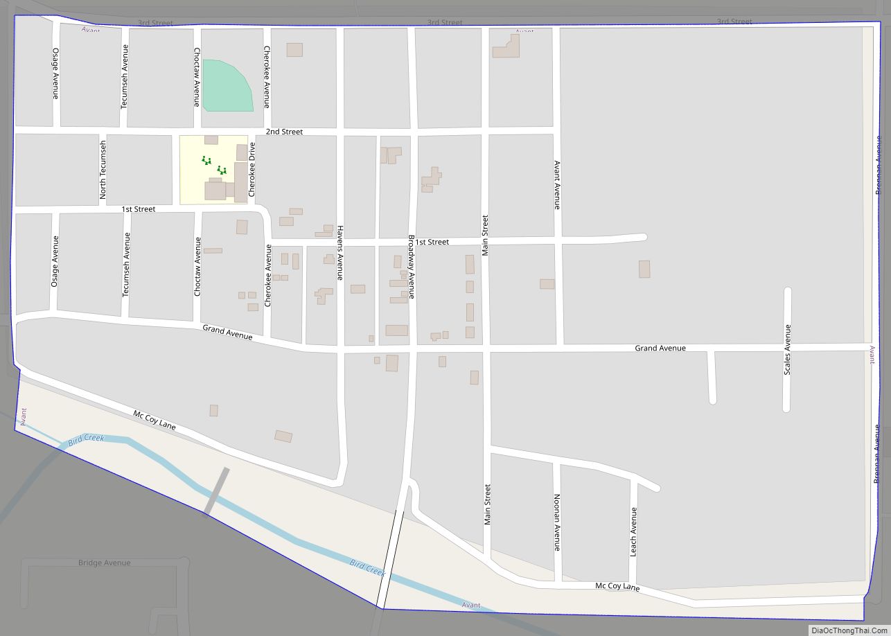
Fairfax Road Map
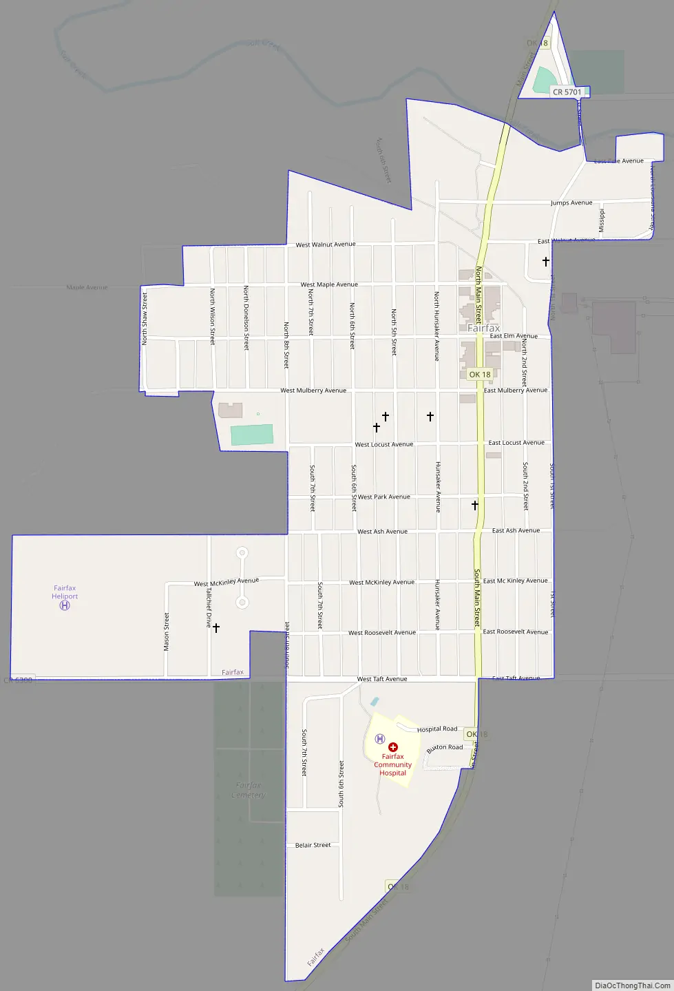
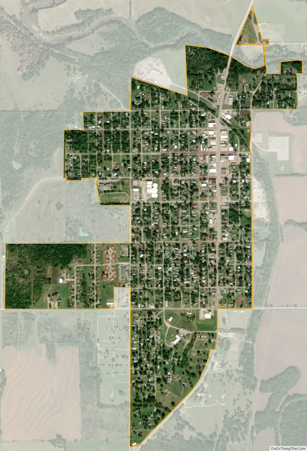
Fairfax city Satellite Map
Geography
Fairfax is located at 36°34′17″N 96°42′23″W / 36.57139°N 96.70639°W / 36.57139; -96.70639 (36.571386, -96.706259). It is 28 miles (45 km) southwest of Pawhuska and 32 miles (51 km) southeast of Ponca City.
According to the United States Census Bureau, the town has a total area of 0.8 square miles (2.1 km), all land.
Climate
See also
Map of Oklahoma State and its subdivision:- Adair
- Alfalfa
- Atoka
- Beaver
- Beckham
- Blaine
- Bryan
- Caddo
- Canadian
- Carter
- Cherokee
- Choctaw
- Cimarron
- Cleveland
- Coal
- Comanche
- Cotton
- Craig
- Creek
- Custer
- Delaware
- Dewey
- Ellis
- Garfield
- Garvin
- Grady
- Grant
- Greer
- Harmon
- Harper
- Haskell
- Hughes
- Jackson
- Jefferson
- Johnston
- Kay
- Kingfisher
- Kiowa
- Latimer
- Le Flore
- Lincoln
- Logan
- Love
- Major
- Marshall
- Mayes
- McClain
- McCurtain
- McIntosh
- Murray
- Muskogee
- Noble
- Nowata
- Okfuskee
- Oklahoma
- Okmulgee
- Osage
- Ottawa
- Pawnee
- Payne
- Pittsburg
- Pontotoc
- Pottawatomie
- Pushmataha
- Roger Mills
- Rogers
- Seminole
- Sequoyah
- Stephens
- Texas
- Tillman
- Tulsa
- Wagoner
- Washington
- Washita
- Woods
- Woodward
- Alabama
- Alaska
- Arizona
- Arkansas
- California
- Colorado
- Connecticut
- Delaware
- District of Columbia
- Florida
- Georgia
- Hawaii
- Idaho
- Illinois
- Indiana
- Iowa
- Kansas
- Kentucky
- Louisiana
- Maine
- Maryland
- Massachusetts
- Michigan
- Minnesota
- Mississippi
- Missouri
- Montana
- Nebraska
- Nevada
- New Hampshire
- New Jersey
- New Mexico
- New York
- North Carolina
- North Dakota
- Ohio
- Oklahoma
- Oregon
- Pennsylvania
- Rhode Island
- South Carolina
- South Dakota
- Tennessee
- Texas
- Utah
- Vermont
- Virginia
- Washington
- West Virginia
- Wisconsin
- Wyoming