Foraker is a town in Osage County, Oklahoma, United States. It was named for Ohio Senator Joseph B. Foraker. The Tallgrass Prairie Preserve is southeast of town. The official population peaked at 415 in 1910 and has declined steadily since 1930. The population was only 18 at the 2010 census, a 21.7 percent decline from 23 in 2000.
Foraker is now considered a ghost town. A historian quoted one long-time resident as saying: “Stores gone, post office gone, train gone, school gone, oil gone, boys and girls gone – only thing not gone is graveyard and it git bigger.”
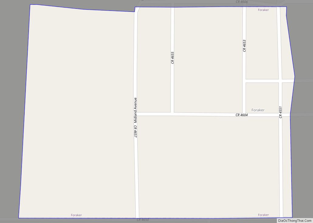
| Name: | Foraker town |
|---|---|
| LSAD Code: | 43 |
| LSAD Description: | town (suffix) |
| State: | Oklahoma |
| County: | Osage County |
| Elevation: | 1,280 ft (390 m) |
| Total Area: | 0.26 sq mi (0.67 km²) |
| Land Area: | 0.26 sq mi (0.67 km²) |
| Water Area: | 0.00 sq mi (0.00 km²) |
| Total Population: | 18 |
| Population Density: | 69.23/sq mi (26.73/km²) |
| ZIP code: | 74652 |
| Area code: | 539/918 |
| FIPS code: | 4026750 |
| GNISfeature ID: | 1092923 |
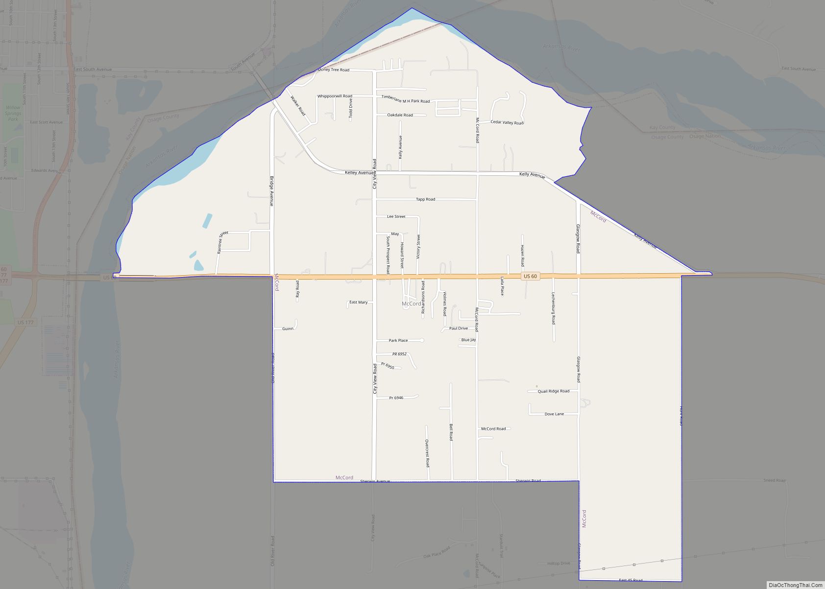
Online Interactive Map
Click on ![]() to view map in "full screen" mode.
to view map in "full screen" mode.
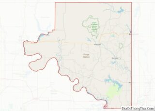
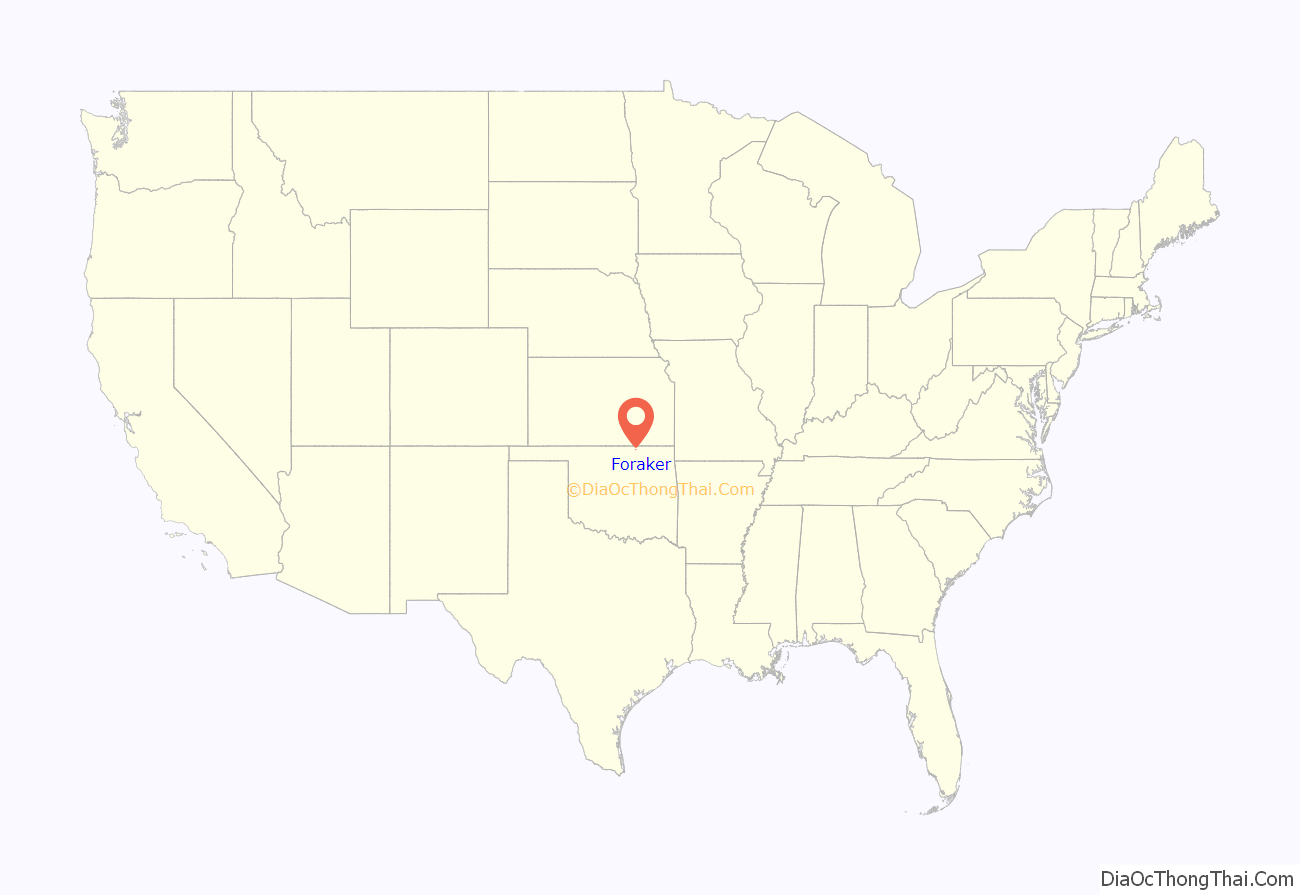
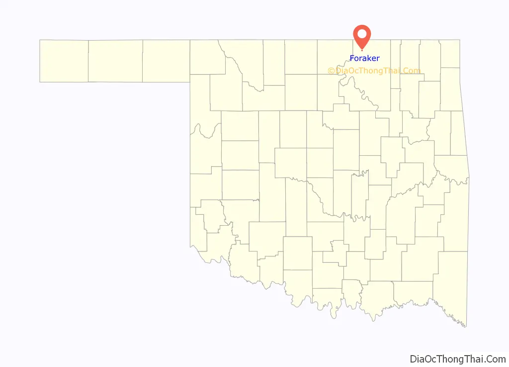
Foraker location map. Where is Foraker town?
History
Located in an area of rolling plains and tallgrass prairie, a post office was established at Foraker on February 13, 1903. The town began as a 160-acre tract platted by the U.S. Department of the Interior along the Midland Valley Railroad in 1905. By 1909, the town had a population of 500 as the area underwent a ranching and farming boom. Foraker had the amenities associated with older communities: sidewalks, a public park, and plans for an electric and water system and a substantial school building.
The agriculture boom subsided, but the town was briefly revitalized by discovery of the Burbank Oil Field in 1920, which made Foraker an oil industry equipment supply center. In 1922 the Osage Railway, one of the Muskogee Roads, was opened from Foraker to Shidler, ten miles away, making Foraker an oil shipping point. The population rose to about 2,000 in the early 1920s. The Osage County oil boom declined during the Great Depression, and with it Foraker’s fortunes. The population dropped. The Osage Valley railroad was abandoned in 1953 and the Midland Valley Railroad was abandoned in 1968. The town business district fell vacant. Foraker is now in a region dominated by large cattle ranches. A lonely and picturesque old cemetery in the prairie approximately one mile east of what remains of the town is the chief landmark. The nearest post office is at Shidler.
Foraker Road Map
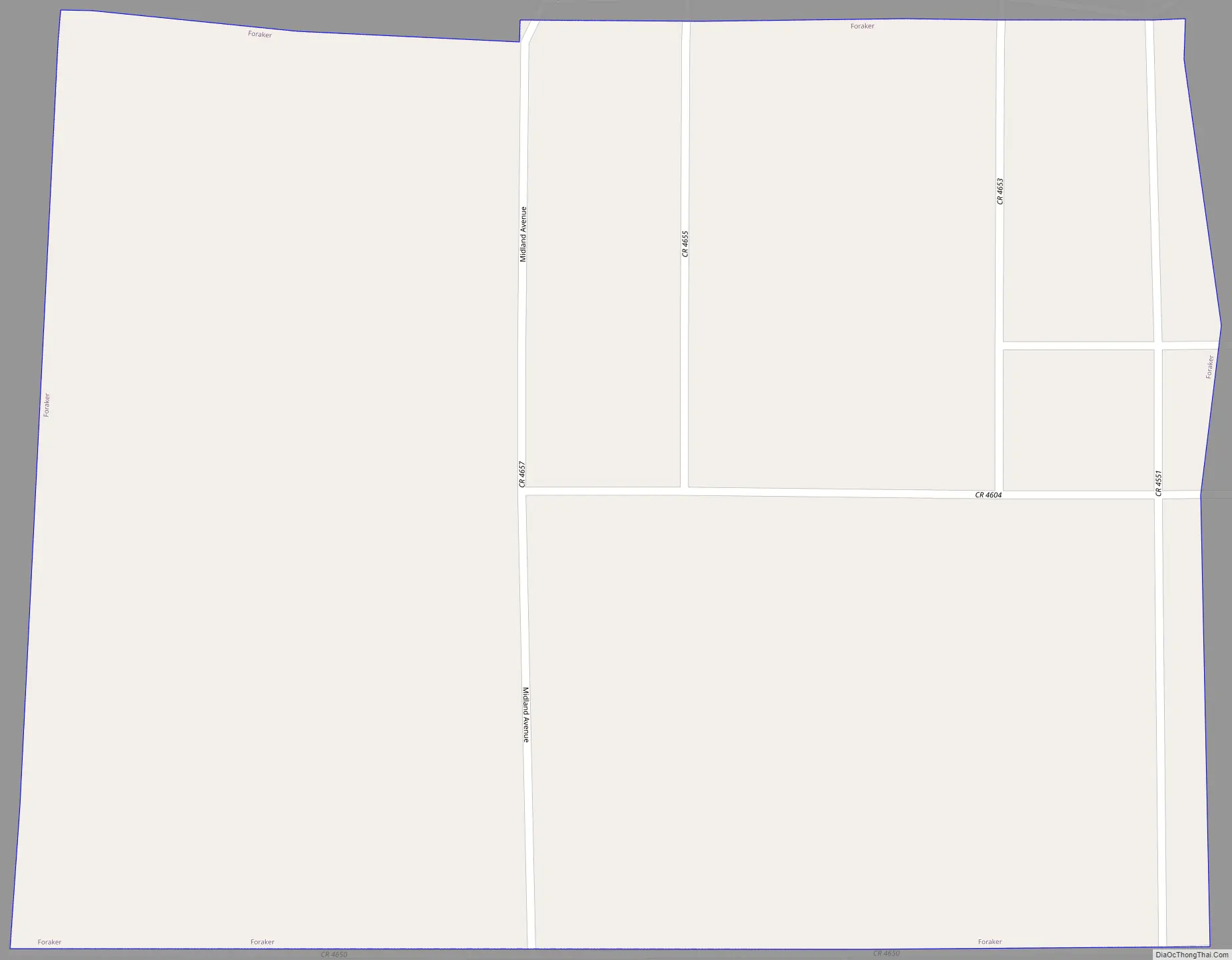
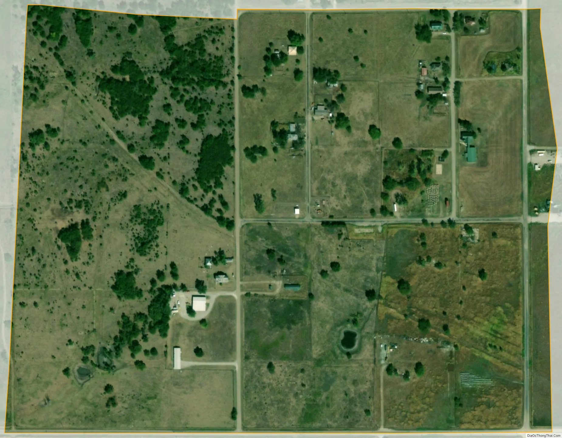
Foraker city Satellite Map
Geography
Foraker is 13 miles (21 km) north and 12 miles (19 km) west of Pawhuska and 6 miles (9.7 km) north and 3 miles (4.8 km) east of Shidler.
See also
Map of Oklahoma State and its subdivision:- Adair
- Alfalfa
- Atoka
- Beaver
- Beckham
- Blaine
- Bryan
- Caddo
- Canadian
- Carter
- Cherokee
- Choctaw
- Cimarron
- Cleveland
- Coal
- Comanche
- Cotton
- Craig
- Creek
- Custer
- Delaware
- Dewey
- Ellis
- Garfield
- Garvin
- Grady
- Grant
- Greer
- Harmon
- Harper
- Haskell
- Hughes
- Jackson
- Jefferson
- Johnston
- Kay
- Kingfisher
- Kiowa
- Latimer
- Le Flore
- Lincoln
- Logan
- Love
- Major
- Marshall
- Mayes
- McClain
- McCurtain
- McIntosh
- Murray
- Muskogee
- Noble
- Nowata
- Okfuskee
- Oklahoma
- Okmulgee
- Osage
- Ottawa
- Pawnee
- Payne
- Pittsburg
- Pontotoc
- Pottawatomie
- Pushmataha
- Roger Mills
- Rogers
- Seminole
- Sequoyah
- Stephens
- Texas
- Tillman
- Tulsa
- Wagoner
- Washington
- Washita
- Woods
- Woodward
- Alabama
- Alaska
- Arizona
- Arkansas
- California
- Colorado
- Connecticut
- Delaware
- District of Columbia
- Florida
- Georgia
- Hawaii
- Idaho
- Illinois
- Indiana
- Iowa
- Kansas
- Kentucky
- Louisiana
- Maine
- Maryland
- Massachusetts
- Michigan
- Minnesota
- Mississippi
- Missouri
- Montana
- Nebraska
- Nevada
- New Hampshire
- New Jersey
- New Mexico
- New York
- North Carolina
- North Dakota
- Ohio
- Oklahoma
- Oregon
- Pennsylvania
- Rhode Island
- South Carolina
- South Dakota
- Tennessee
- Texas
- Utah
- Vermont
- Virginia
- Washington
- West Virginia
- Wisconsin
- Wyoming