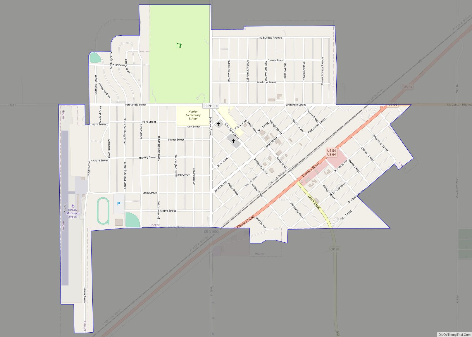
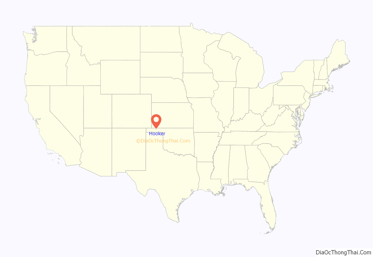
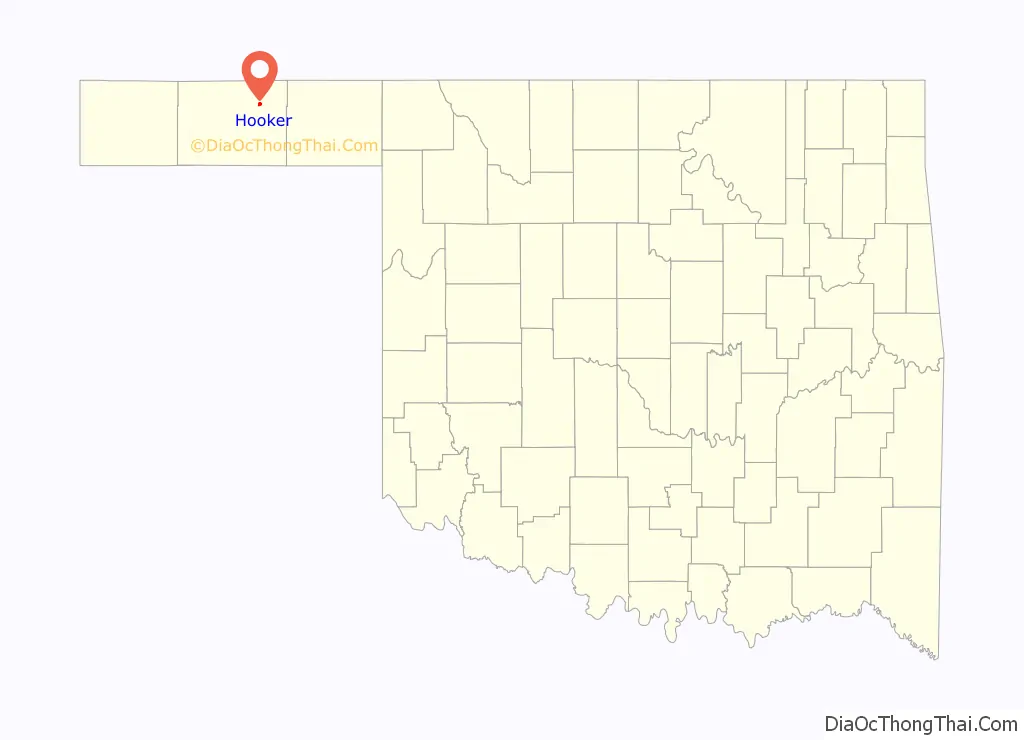
Hooker is a city in Texas County, Oklahoma, United States. As of the 2010 census, the city population was 1,918. It is located approximately 20 miles northeast of Guymon on US Route 54 highway.
| Name: | Hooker city |
|---|---|
| LSAD Code: | 25 |
| LSAD Description: | city (suffix) |
| State: | Oklahoma |
| County: | Texas County |
| Elevation: | 2,990 ft (910 m) |
| Total Area: | 1.11 sq mi (2.87 km²) |
| Land Area: | 1.11 sq mi (2.87 km²) |
| Water Area: | 0.00 sq mi (0.00 km²) |
| Total Population: | 1,802 |
| Population Density: | 1,629.29/sq mi (628.86/km²) |
| ZIP code: | 73945 |
| Area code: | 580 |
| FIPS code: | 4036000 |
| Website: | HookerOklahoma.net |
Online Interactive Map
Click on ![]() to view map in "full screen" mode.
to view map in "full screen" mode.
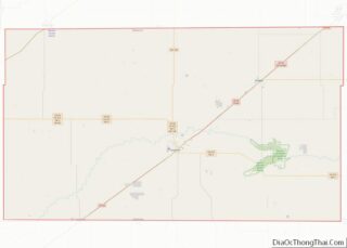
Hooker location map. Where is Hooker city?
History
In 1902, the Chicago, Rock Island and Pacific Railway laid tracks from Liberal, Kansas southwest through the Hooker area to Texhoma, Texas area. In 1904, the Chicago Townsite Company oversaw the organization and sale of town lots, and the city quickly grew. In 1927 the Beaver, Meade and Englewood Railroad (BM&E) built an east–west line to Hooker.
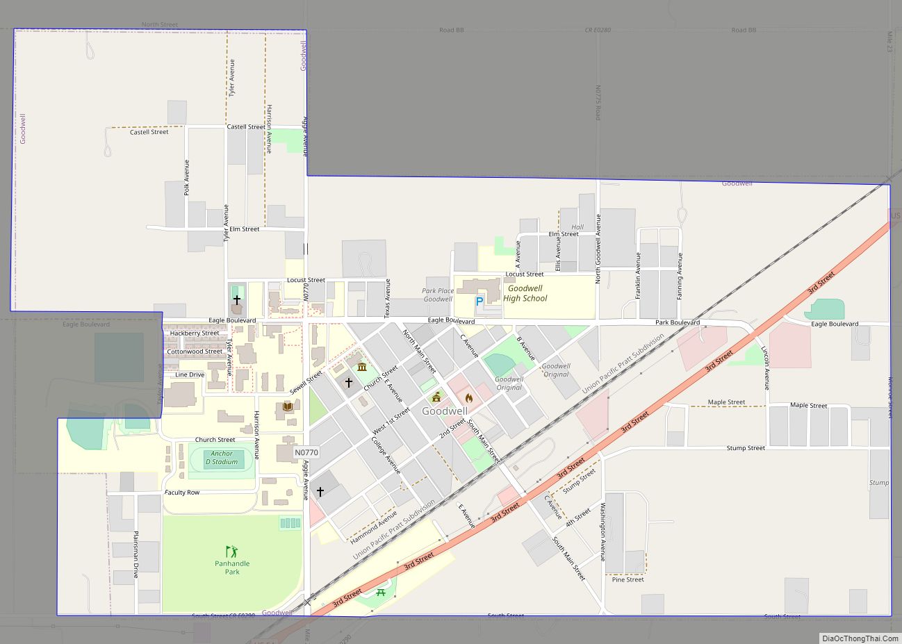
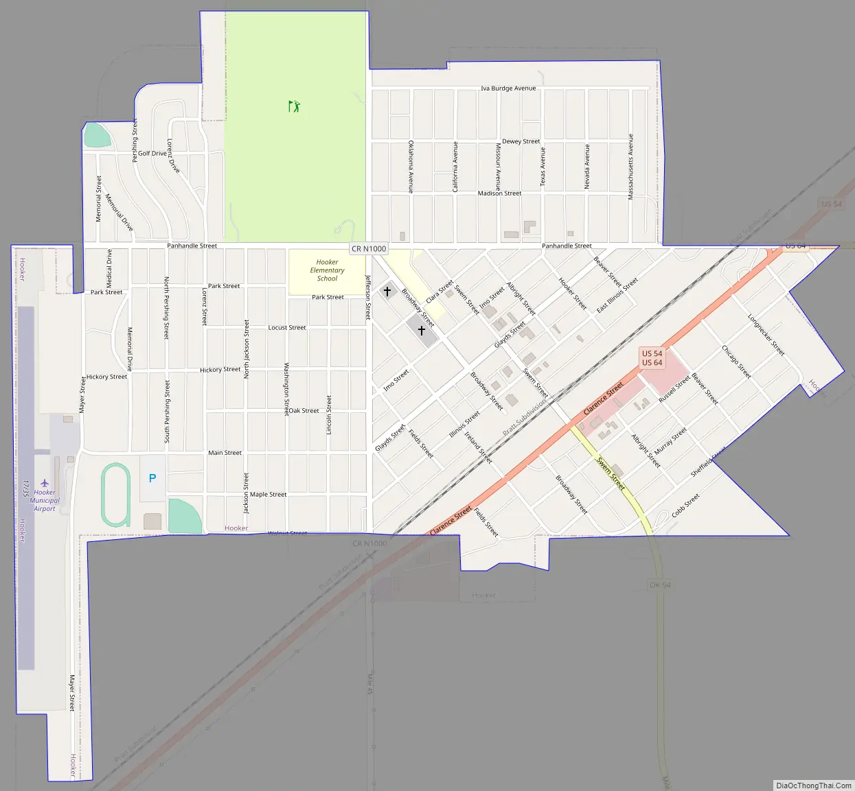
Hooker Road Map
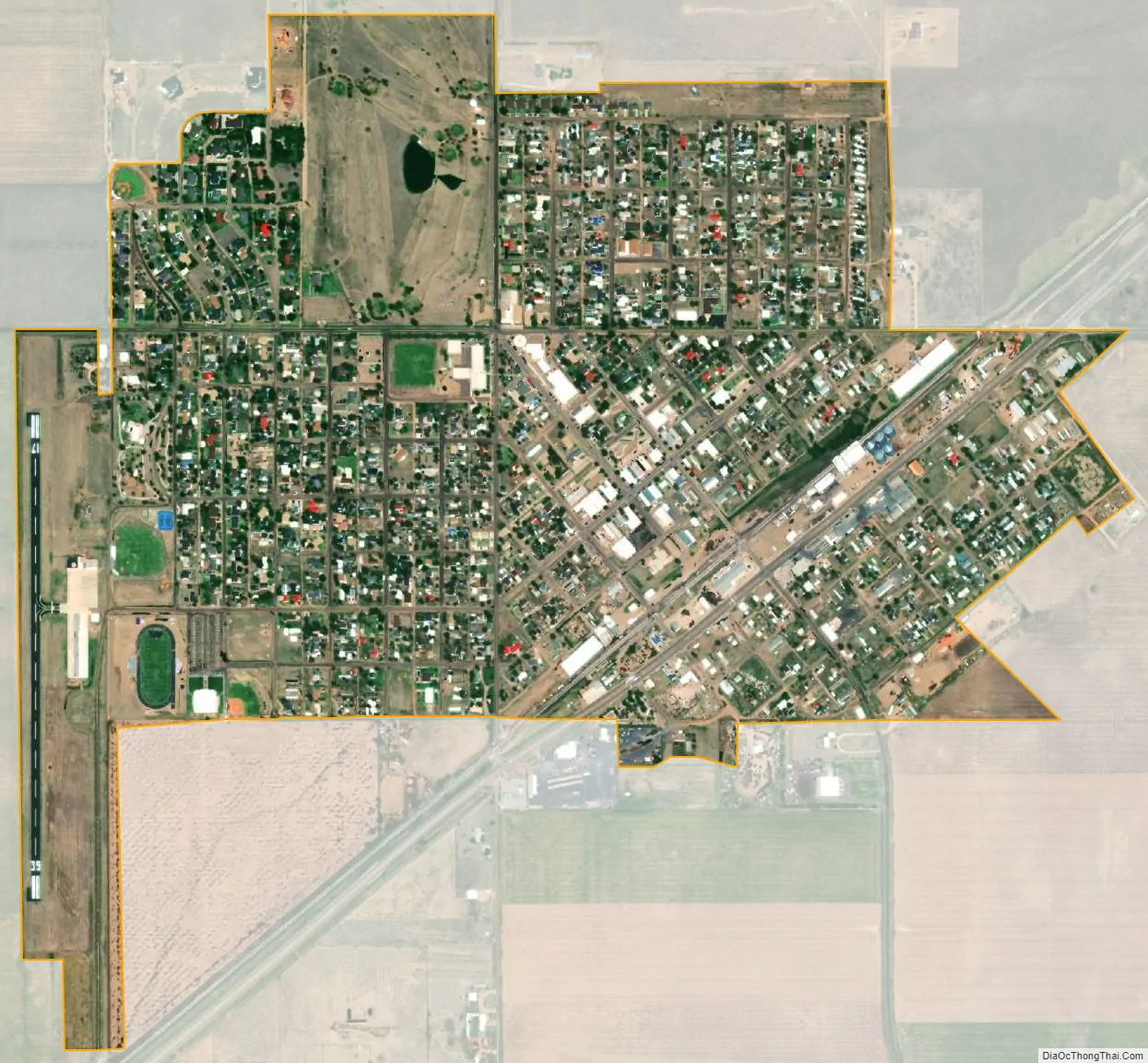
Hooker city Satellite Map
Geography
Hooker is located at 36°51′41″N 101°12′50″W / 36.86139°N 101.21389°W / 36.86139; -101.21389 (36.861425, −101.213915). According to the United States Census Bureau, the city has a total area of 0.9 square miles (2.3 km), all land.
Climate
See also
Map of Oklahoma State and its subdivision:- Adair
- Alfalfa
- Atoka
- Beaver
- Beckham
- Blaine
- Bryan
- Caddo
- Canadian
- Carter
- Cherokee
- Choctaw
- Cimarron
- Cleveland
- Coal
- Comanche
- Cotton
- Craig
- Creek
- Custer
- Delaware
- Dewey
- Ellis
- Garfield
- Garvin
- Grady
- Grant
- Greer
- Harmon
- Harper
- Haskell
- Hughes
- Jackson
- Jefferson
- Johnston
- Kay
- Kingfisher
- Kiowa
- Latimer
- Le Flore
- Lincoln
- Logan
- Love
- Major
- Marshall
- Mayes
- McClain
- McCurtain
- McIntosh
- Murray
- Muskogee
- Noble
- Nowata
- Okfuskee
- Oklahoma
- Okmulgee
- Osage
- Ottawa
- Pawnee
- Payne
- Pittsburg
- Pontotoc
- Pottawatomie
- Pushmataha
- Roger Mills
- Rogers
- Seminole
- Sequoyah
- Stephens
- Texas
- Tillman
- Tulsa
- Wagoner
- Washington
- Washita
- Woods
- Woodward
- Alabama
- Alaska
- Arizona
- Arkansas
- California
- Colorado
- Connecticut
- Delaware
- District of Columbia
- Florida
- Georgia
- Hawaii
- Idaho
- Illinois
- Indiana
- Iowa
- Kansas
- Kentucky
- Louisiana
- Maine
- Maryland
- Massachusetts
- Michigan
- Minnesota
- Mississippi
- Missouri
- Montana
- Nebraska
- Nevada
- New Hampshire
- New Jersey
- New Mexico
- New York
- North Carolina
- North Dakota
- Ohio
- Oklahoma
- Oregon
- Pennsylvania
- Rhode Island
- South Carolina
- South Dakota
- Tennessee
- Texas
- Utah
- Vermont
- Virginia
- Washington
- West Virginia
- Wisconsin
- Wyoming