Liberal is the county seat of Seward County, Kansas, United States. As of the 2020 census, the population of the city was 19,825. Liberal is home of Seward County Community College.
| Name: | Liberal city |
|---|---|
| LSAD Code: | 25 |
| LSAD Description: | city (suffix) |
| State: | Kansas |
| County: | Seward County |
| Founded: | 1888 |
| Incorporated: | 1888 |
| Elevation: | 2,835 ft (864 m) |
| Total Area: | 11.65 sq mi (30.18 km²) |
| Land Area: | 11.43 sq mi (29.60 km²) |
| Water Area: | 0.22 sq mi (0.57 km²) |
| Total Population: | 19,825 |
| Population Density: | 1,700/sq mi (660/km²) |
| ZIP code: | 67901, 67905 |
| Area code: | 620 |
| FIPS code: | 2039825 |
| Website: | cityofliberal.org |
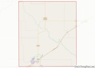
Online Interactive Map
Click on ![]() to view map in "full screen" mode.
to view map in "full screen" mode.
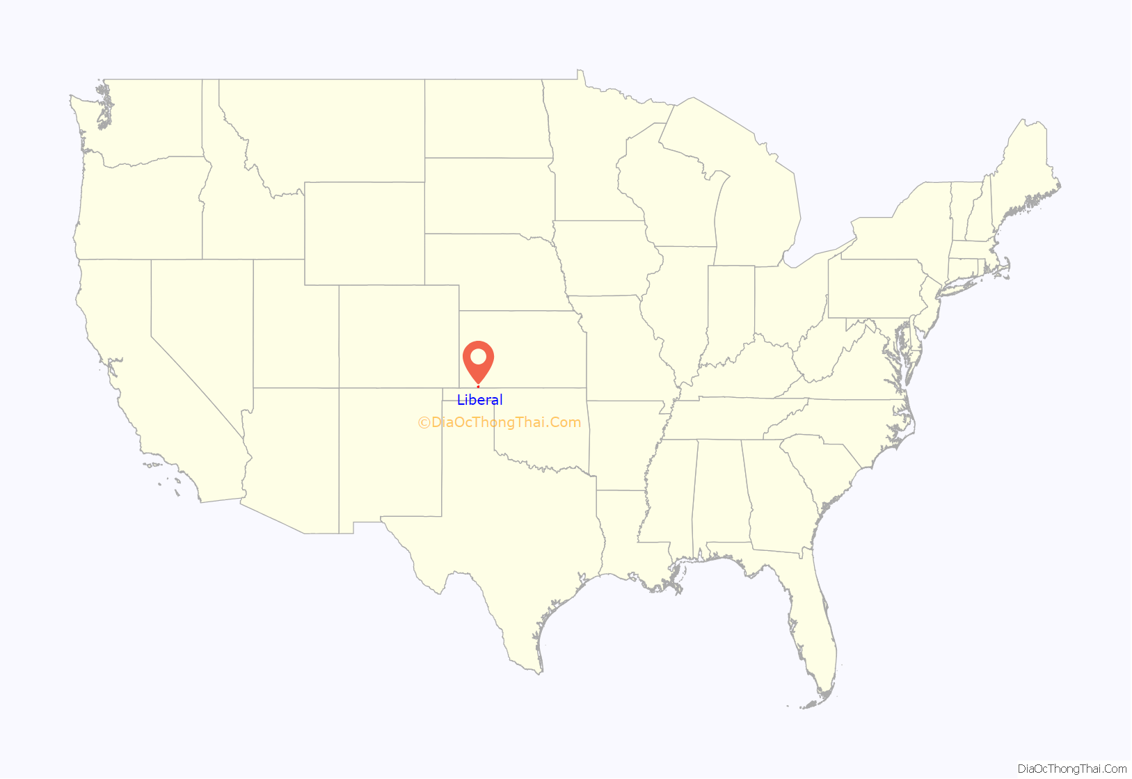
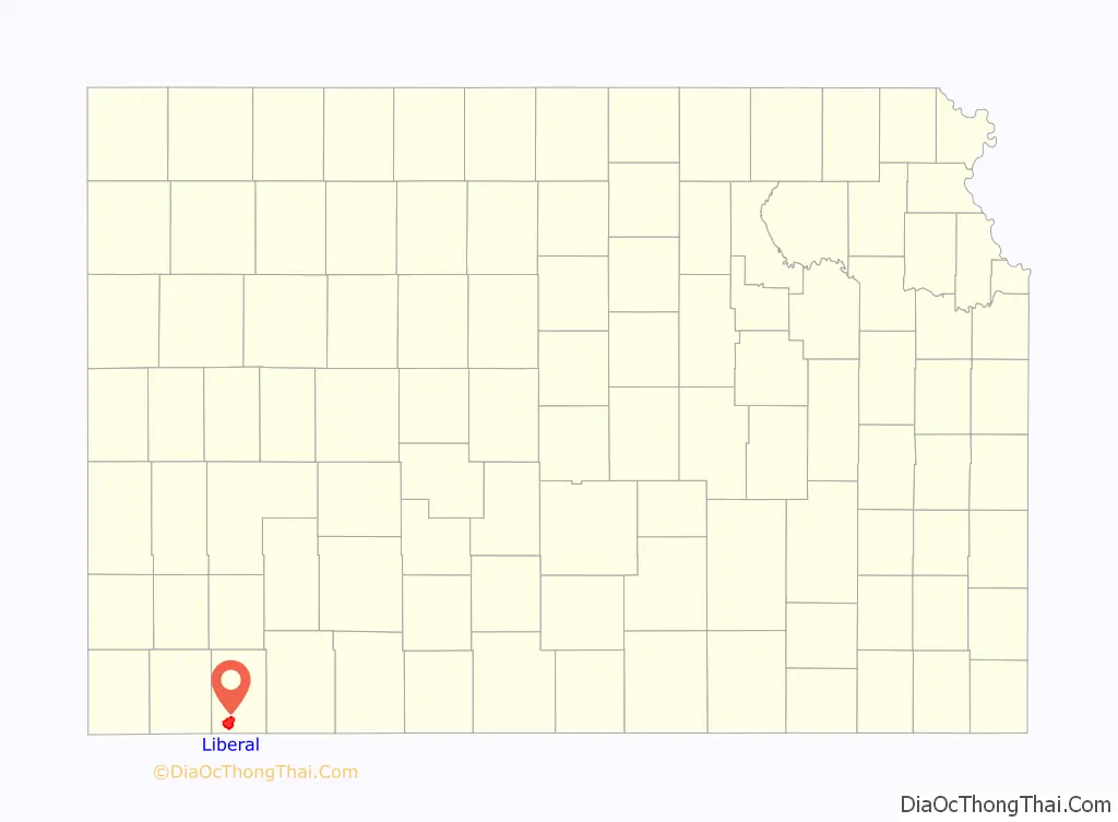
Liberal location map. Where is Liberal city?
History
Early settler Seymour S. Rogers built the first house in what would become Liberal in 1888. Rogers became famous in the region for giving free water to thirsty travelers. Reportedly, Liberal gained its name from the common response to his acts of kindness, “That’s very liberal of you.” In 1885 Rogers built a general store, and with it came an official U.S. Post Office. Rogers named the post office ‘Liberal’. After the railroad was built close by, a plan for the town site was created in 1888. A year later the population was around 800.
Drought caused some farmers to give up and look for more fertile territory; however, when the nearby Indian Territory was opened, more settlers headed to the cheap land that would become Oklahoma.
Natural gas was discovered west of town, in what would become part of the massive Panhandle-Hugoton Gas Field, in 1920. Oil was discovered southwest of town in 1951. In 1963 the largest helium plant in the world, National Helium, was opened.
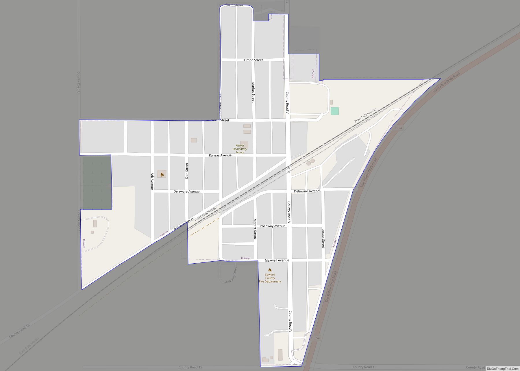
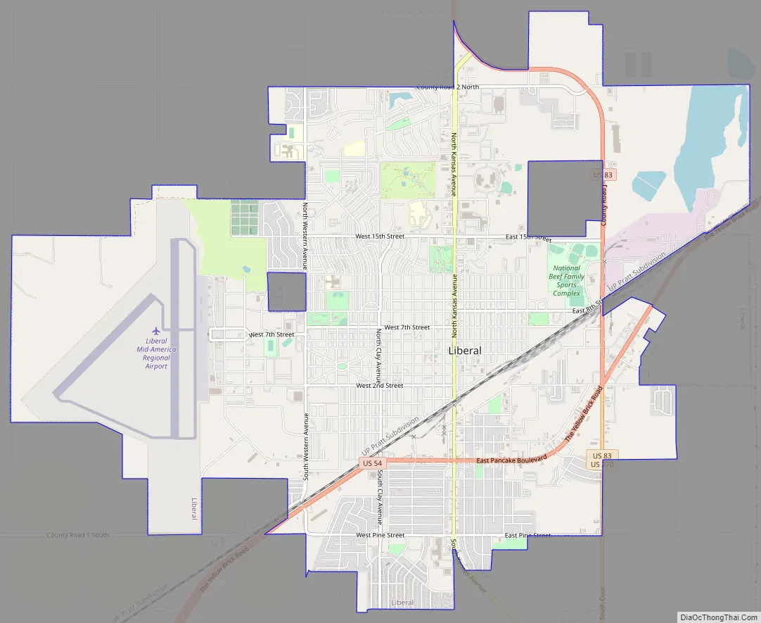
Liberal Road Map
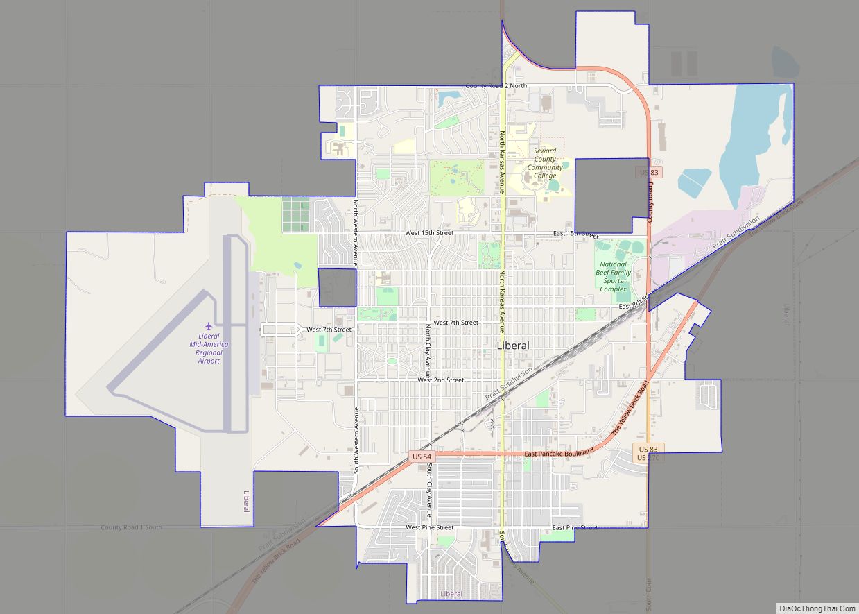
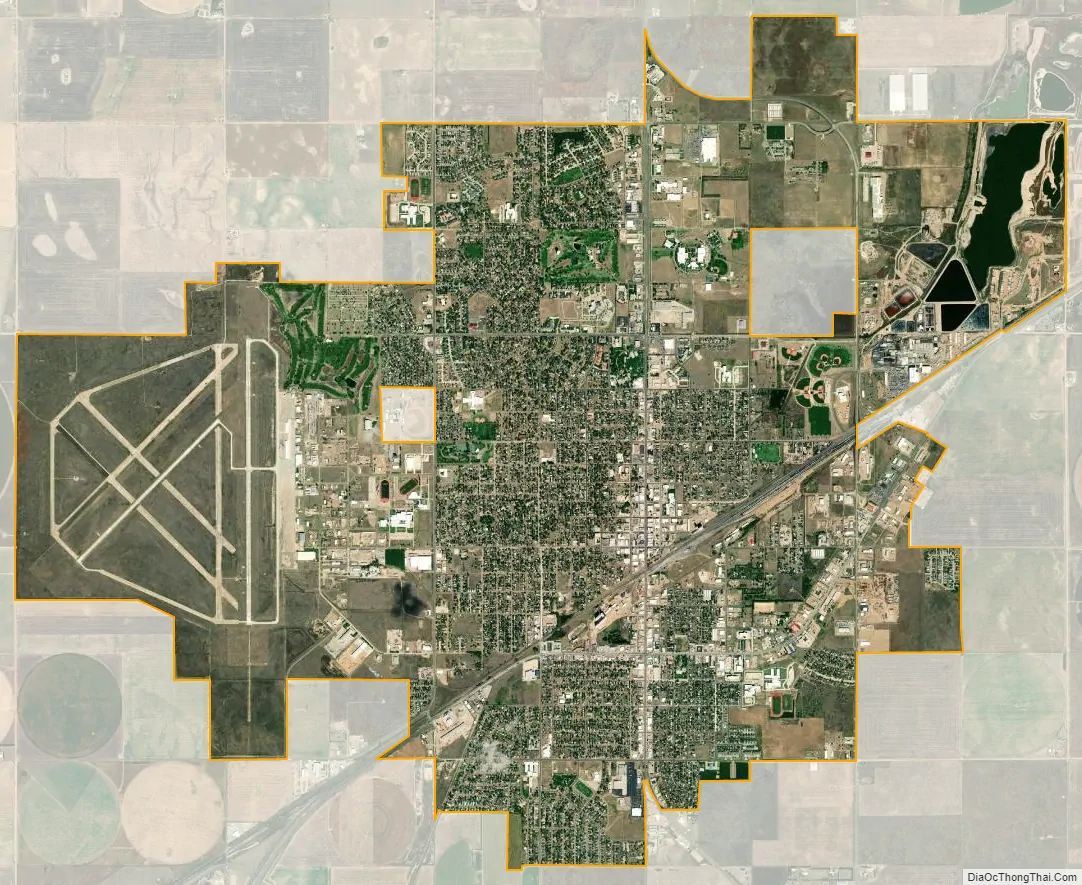
Liberal city Satellite Map
Geography
Liberal is located at 37°2′36″N 100°55′41″W / 37.04333°N 100.92806°W / 37.04333; -100.92806 (37.043418, −100.928133) at an elevation of 2,835 feet (864 m). Located in southwestern Kansas at the intersection of U.S. Route 83 and U.S. Route 54, Liberal is 140 miles (225 km) north-northeast of Amarillo, Texas, 202 mi (325 km) west-southwest of Wichita, and 288 mi (463 km) southeast of Denver, Colorado.
The city lies approximately 10 miles (16 km) southwest of the Cimarron River in the High Plains region of the Great Plains.
According to the United States Census Bureau, the city has a total area of 11.75 square miles (30.43 km), of which 11.61 square miles (30.07 km) is land and 0.14 square miles (0.36 km) is water.
Climate
Liberal has a semi-arid steppe climate (Köppen BSk) characterized by hot, dry summers, cool, dry winters, and large diurnal temperature variation year-round; relative humidity averages 63%. On average, January is the coldest month, July is the hottest month, and June is the wettest month.
The monthly daily average temperature ranges from 34.1 °F (1.2 °C) in January to 79.3 °F (26.3 °C) in July. The high temperature reaches or exceeds 90 °F (32 °C) an average of 80 days a year and 100 °F (38 °C) an average of 18 days. The minimum temperature falls to or below 0 °F (−17.8 °C) on an average 5.3 days a year. The highest temperature recorded in Liberal was 114 °F (45.6 °C) as recently as June 10, 1981; the coldest temperature recorded was −19 °F (−28.3 °C) on January 7, 1912.
On average, Liberal receives 20.15 inches (512 mm) of precipitation annually, a majority of which occurs from May to August, and records 58 days of measurable precipitation. Measurable snowfall occurs an average of 8.9 days per year with 6.1 days receiving at least 1.0 inch (2.5 cm). Snow depth of at least one inch occurs an average of 9.5 days a year. Typically, the average window for freezing temperatures is October 21 through April 14, and that for temperatures below 0 °F or −17.8 °C from January 5 to January 24. Liberal is located in USDA Plant Hardiness Zone 7.
See also
Map of Kansas State and its subdivision:- Allen
- Anderson
- Atchison
- Barber
- Barton
- Bourbon
- Brown
- Butler
- Chase
- Chautauqua
- Cherokee
- Cheyenne
- Clark
- Clay
- Cloud
- Coffey
- Comanche
- Cowley
- Crawford
- Decatur
- Dickinson
- Doniphan
- Douglas
- Edwards
- Elk
- Ellis
- Ellsworth
- Finney
- Ford
- Franklin
- Geary
- Gove
- Graham
- Grant
- Gray
- Greeley
- Greenwood
- Hamilton
- Harper
- Harvey
- Haskell
- Hodgeman
- Jackson
- Jefferson
- Jewell
- Johnson
- Kearny
- Kingman
- Kiowa
- Labette
- Lane
- Leavenworth
- Lincoln
- Linn
- Logan
- Lyon
- Marion
- Marshall
- McPherson
- Meade
- Miami
- Mitchell
- Montgomery
- Morris
- Morton
- Nemaha
- Neosho
- Ness
- Norton
- Osage
- Osborne
- Ottawa
- Pawnee
- Phillips
- Pottawatomie
- Pratt
- Rawlins
- Reno
- Republic
- Rice
- Riley
- Rooks
- Rush
- Russell
- Saline
- Scott
- Sedgwick
- Seward
- Shawnee
- Sheridan
- Sherman
- Smith
- Stafford
- Stanton
- Stevens
- Sumner
- Thomas
- Trego
- Wabaunsee
- Wallace
- Washington
- Wichita
- Wilson
- Woodson
- Wyandotte
- Alabama
- Alaska
- Arizona
- Arkansas
- California
- Colorado
- Connecticut
- Delaware
- District of Columbia
- Florida
- Georgia
- Hawaii
- Idaho
- Illinois
- Indiana
- Iowa
- Kansas
- Kentucky
- Louisiana
- Maine
- Maryland
- Massachusetts
- Michigan
- Minnesota
- Mississippi
- Missouri
- Montana
- Nebraska
- Nevada
- New Hampshire
- New Jersey
- New Mexico
- New York
- North Carolina
- North Dakota
- Ohio
- Oklahoma
- Oregon
- Pennsylvania
- Rhode Island
- South Carolina
- South Dakota
- Tennessee
- Texas
- Utah
- Vermont
- Virginia
- Washington
- West Virginia
- Wisconsin
- Wyoming