Mannsville is a town in Johnston County, Oklahoma, United States. The population was 863 at the 2010 census, up from 587 in 2000.
| Name: | Mannsville town |
|---|---|
| LSAD Code: | 43 |
| LSAD Description: | town (suffix) |
| State: | Oklahoma |
| County: | Johnston County |
| Elevation: | 748 ft (228 m) |
| Total Area: | 3.05 sq mi (7.91 km²) |
| Land Area: | 3.04 sq mi (7.86 km²) |
| Water Area: | 0.02 sq mi (0.05 km²) |
| Total Population: | 728 |
| Population Density: | 239.87/sq mi (92.62/km²) |
| ZIP code: | 73447 |
| Area code: | 580 |
| FIPS code: | 4046300 |
| GNISfeature ID: | 1095119 |
Online Interactive Map
Click on ![]() to view map in "full screen" mode.
to view map in "full screen" mode.
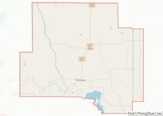
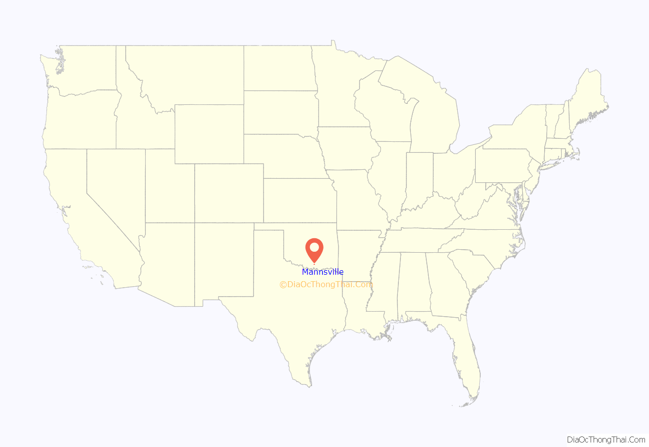
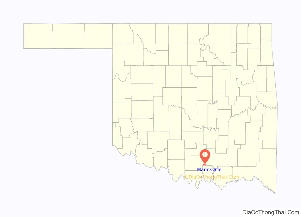
Mannsville location map. Where is Mannsville town?
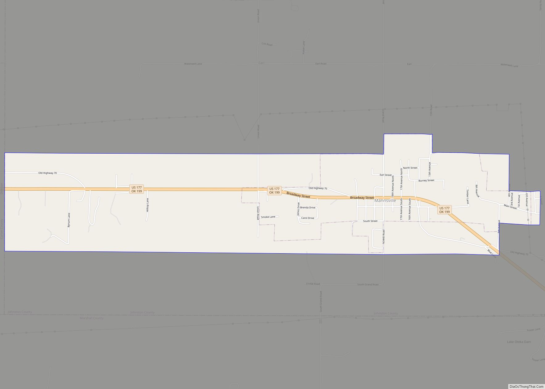
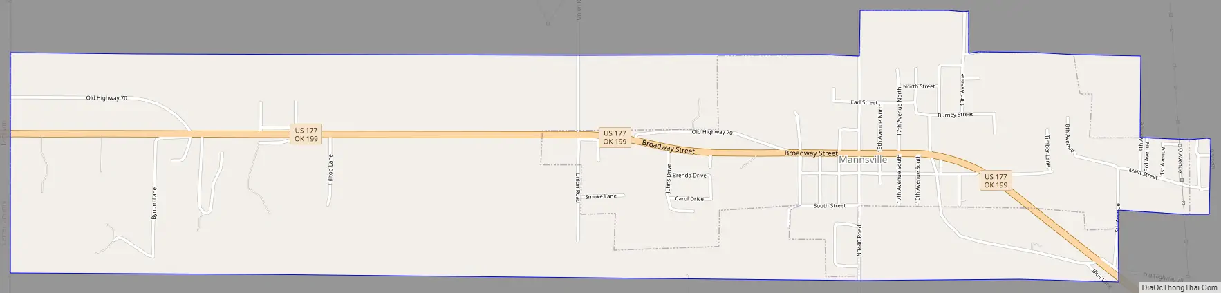
Mannsville Road Map
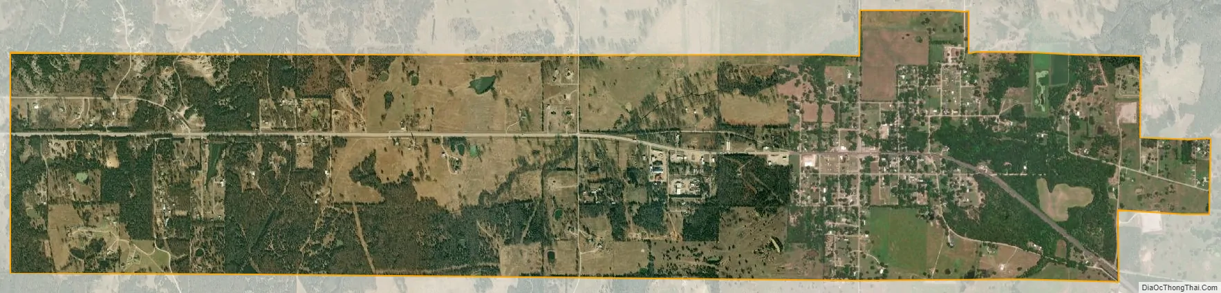
Mannsville city Satellite Map
Geography
Mannsville is located in southwestern Johnston County at 34°11′9″N 96°52′49″W / 34.18583°N 96.88028°W / 34.18583; -96.88028 (34.185707, -96.880271). It is bordered to the west by the town of Dickson in Carter County. As of 2010, the town had a total area of 3.3 square miles (8.5 km), more than triple its area in 2000. 0.02 square miles (0.06 km), or 0.73% of the town’s area, are water bodies.
U.S. Route 177 passes through the center of Mannsville, leading west 6 miles (10 km) to the center of Dickson and southeast 10 miles (16 km) to Madill. Ardmore is 16 miles (26 km) west of Mannsville via Routes 177 and 199.
Mannsville has an all-volunteer fire department three stations, two in town and one in the small community of Greasy Bend.
See also
Map of Oklahoma State and its subdivision:- Adair
- Alfalfa
- Atoka
- Beaver
- Beckham
- Blaine
- Bryan
- Caddo
- Canadian
- Carter
- Cherokee
- Choctaw
- Cimarron
- Cleveland
- Coal
- Comanche
- Cotton
- Craig
- Creek
- Custer
- Delaware
- Dewey
- Ellis
- Garfield
- Garvin
- Grady
- Grant
- Greer
- Harmon
- Harper
- Haskell
- Hughes
- Jackson
- Jefferson
- Johnston
- Kay
- Kingfisher
- Kiowa
- Latimer
- Le Flore
- Lincoln
- Logan
- Love
- Major
- Marshall
- Mayes
- McClain
- McCurtain
- McIntosh
- Murray
- Muskogee
- Noble
- Nowata
- Okfuskee
- Oklahoma
- Okmulgee
- Osage
- Ottawa
- Pawnee
- Payne
- Pittsburg
- Pontotoc
- Pottawatomie
- Pushmataha
- Roger Mills
- Rogers
- Seminole
- Sequoyah
- Stephens
- Texas
- Tillman
- Tulsa
- Wagoner
- Washington
- Washita
- Woods
- Woodward
- Alabama
- Alaska
- Arizona
- Arkansas
- California
- Colorado
- Connecticut
- Delaware
- District of Columbia
- Florida
- Georgia
- Hawaii
- Idaho
- Illinois
- Indiana
- Iowa
- Kansas
- Kentucky
- Louisiana
- Maine
- Maryland
- Massachusetts
- Michigan
- Minnesota
- Mississippi
- Missouri
- Montana
- Nebraska
- Nevada
- New Hampshire
- New Jersey
- New Mexico
- New York
- North Carolina
- North Dakota
- Ohio
- Oklahoma
- Oregon
- Pennsylvania
- Rhode Island
- South Carolina
- South Dakota
- Tennessee
- Texas
- Utah
- Vermont
- Virginia
- Washington
- West Virginia
- Wisconsin
- Wyoming