Slaughterville is a town in Cleveland County, Oklahoma, United States, and located in the Oklahoma City metropolitan area. As of the 2020 census, the city population was 4,163, a 0.6% increase from 2010.
The community is made up of mostly homes on acreages so it has retained a rural type of land use. Much of the area is wooded and has a natural scenic outdoor appeal to residents and visitors.
| Name: | Slaughterville town |
|---|---|
| LSAD Code: | 43 |
| LSAD Description: | town (suffix) |
| State: | Oklahoma |
| County: | Cleveland County |
| Elevation: | 1,119 ft (341 m) |
| Total Area: | 39.00 sq mi (101.01 km²) |
| Land Area: | 38.63 sq mi (100.05 km²) |
| Water Area: | 0.37 sq mi (0.96 km²) |
| Total Population: | 4,163 |
| Population Density: | 107.76/sq mi (41.61/km²) |
| FIPS code: | 4067950 |
| GNISfeature ID: | 1100833 |
| Website: | www.town.slaughterville.ok.us |
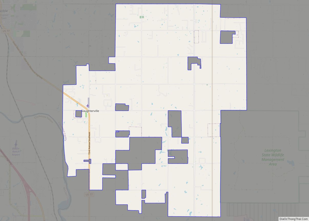
Online Interactive Map
Click on ![]() to view map in "full screen" mode.
to view map in "full screen" mode.
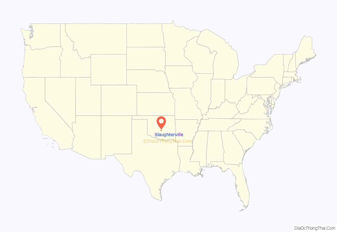
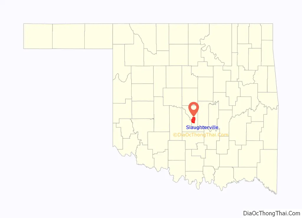
Slaughterville location map. Where is Slaughterville town?
History
Slaughterville was named after a grocery store run by James Slaughter in the early 20th century.
The site was located in the Unassigned Lands of Indian Territory. It was opened to settlement in the Land Run of 1889. The first building was erected in the same year. The town did not incorporate until 1970, to avoid annexation by either Norman, Noble, or Lexington.
Slaughterville encompassed 27 square miles (70 km) at incorporation. It deannexed about 40 percent of the area during the 1980s, but later annexed more land and by 2000 had an area of 38.108 square miles (98.70 km).
The town name was the subject of controversy in 2004 when People for the Ethical Treatment of Animals (PETA) asked Slaughterville to rename the town to Veggieville, offering a donation of $20,000 of veggie burgers as incentive. Slaughterville’s town council heard presentations by members of PETA and local citizens before voting against the suggestion.
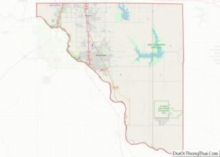
Slaughterville Road Map
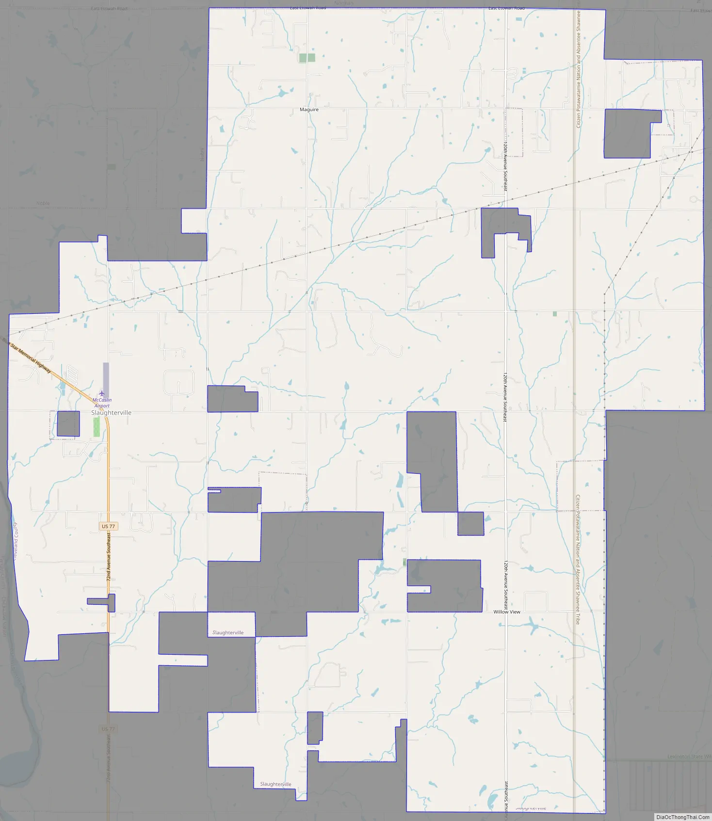
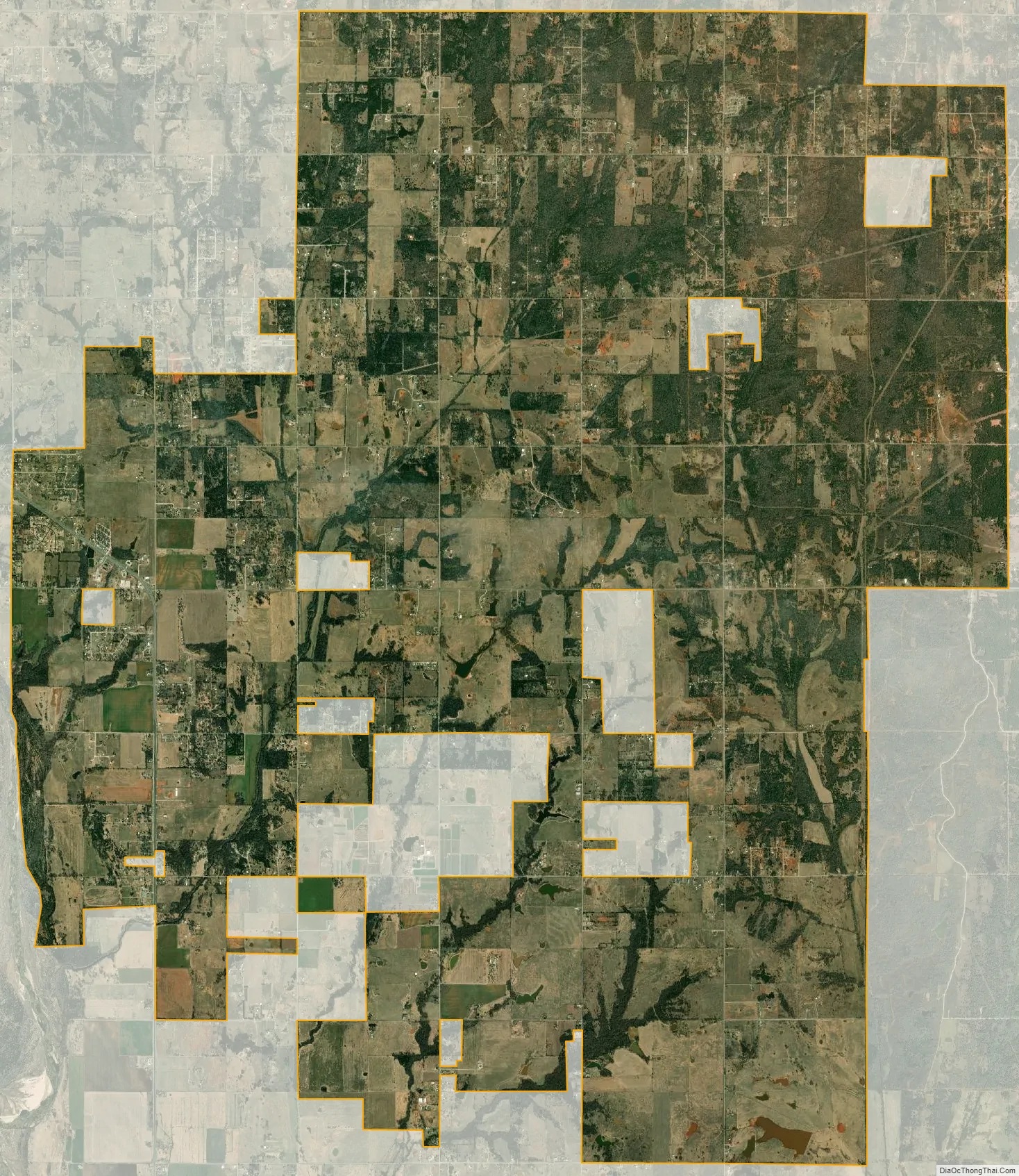
Slaughterville city Satellite Map
Geography
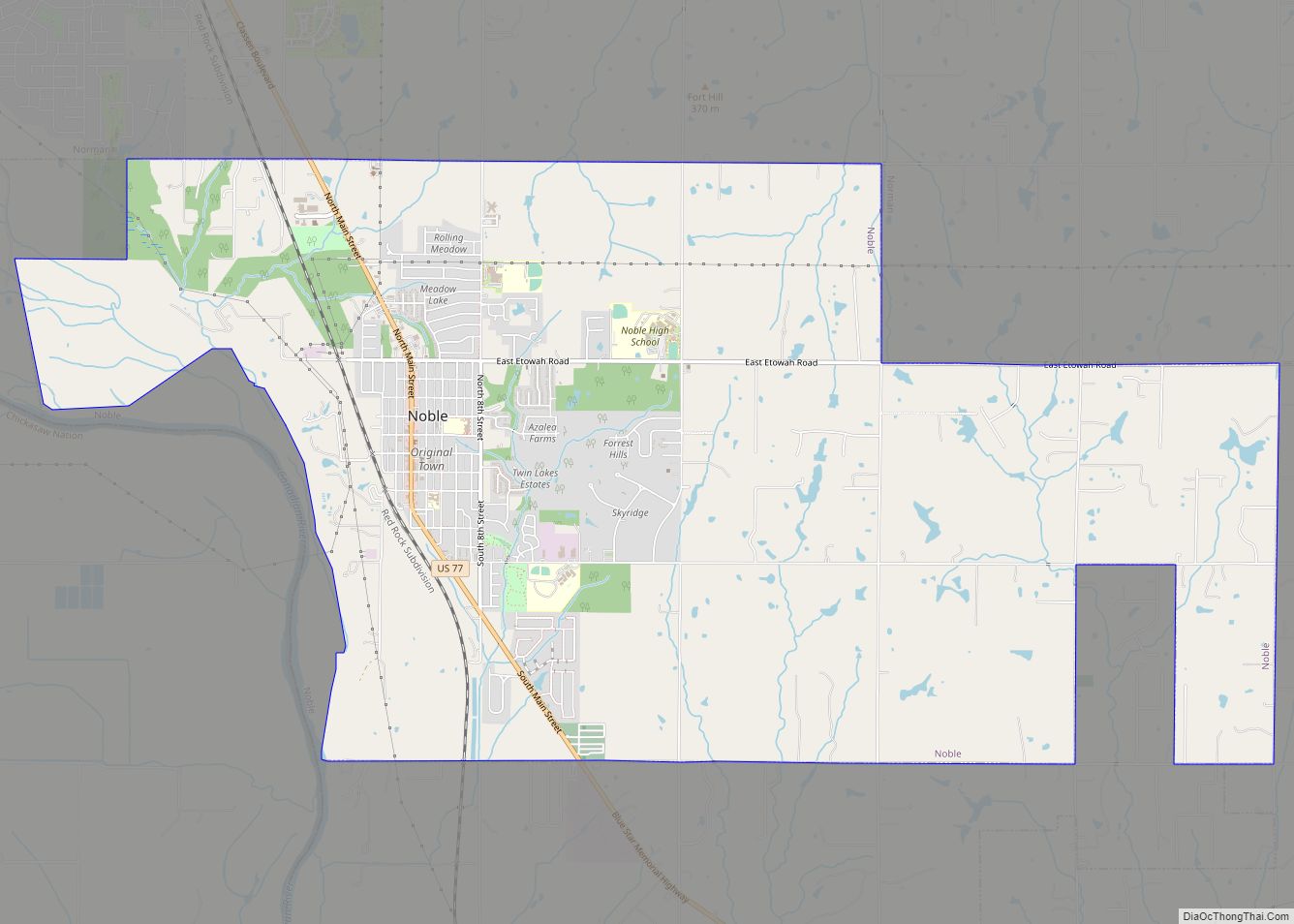
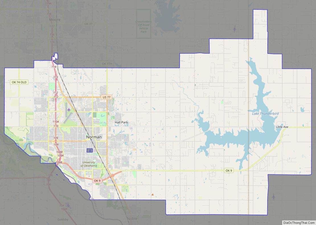
Slaughterville is located in southern Cleveland County at 35°5′1″N 97°17′13″W / 35.08361°N 97.28694°W / 35.08361; -97.28694 (35.083584, -97.286945). It is bordered to the north by the city of Norman and to the northwest by Noble. Part of its western border touches the Canadian River, across which is McClain County.
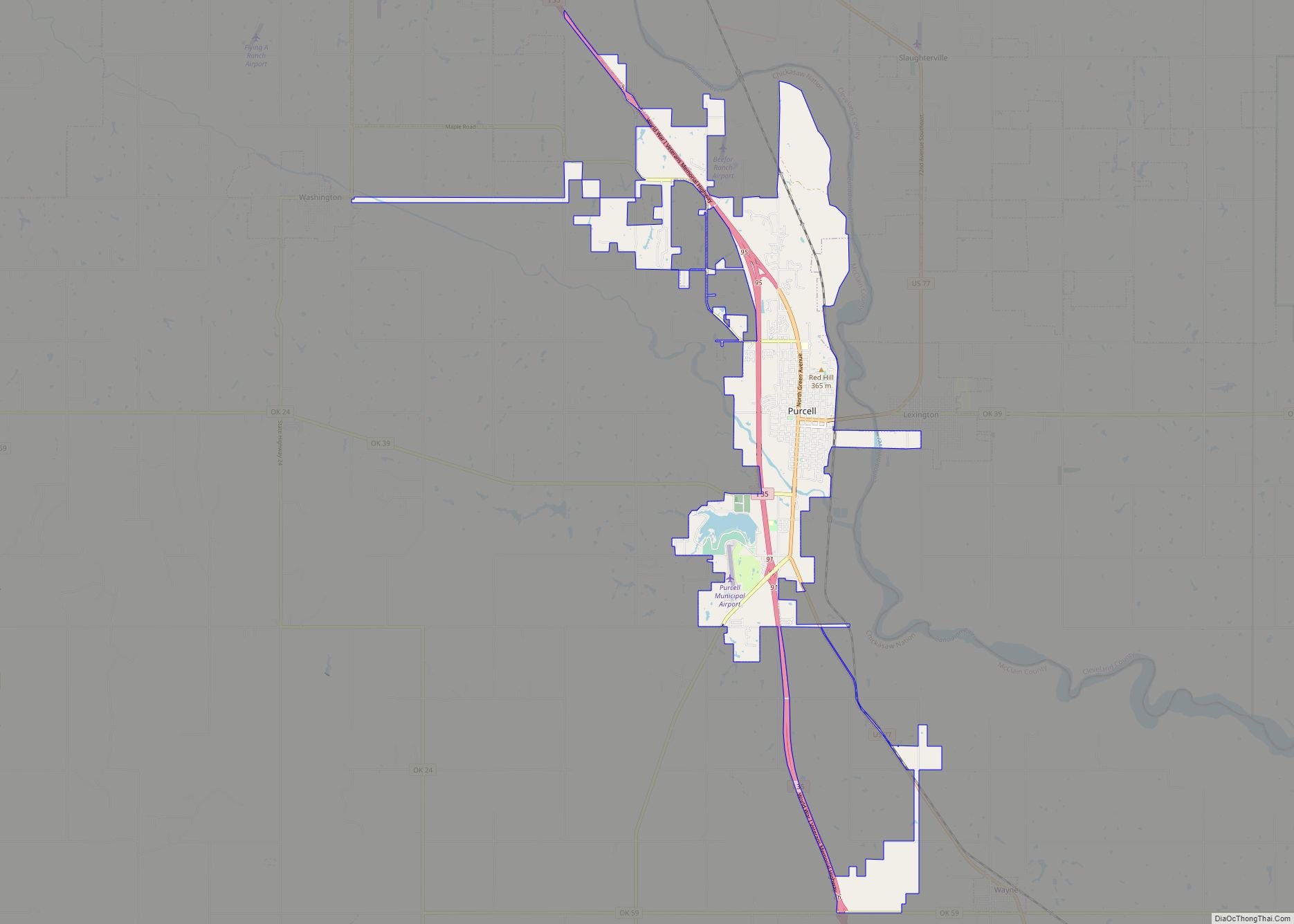
U.S. Route 77 passes through the town, leading north 33 miles (53 km) to the center of Oklahoma City and south 6 miles (9.7 km) to Purcell.
According to the United States Census Bureau, the town of Slaughterville has a total area of 38.5 square miles (99.6 km), of which 38.1 square miles (98.7 km) is land and 0.35 square miles (0.9 km), or 0.91%, is water.
See also
Map of Oklahoma State and its subdivision:- Adair
- Alfalfa
- Atoka
- Beaver
- Beckham
- Blaine
- Bryan
- Caddo
- Canadian
- Carter
- Cherokee
- Choctaw
- Cimarron
- Cleveland
- Coal
- Comanche
- Cotton
- Craig
- Creek
- Custer
- Delaware
- Dewey
- Ellis
- Garfield
- Garvin
- Grady
- Grant
- Greer
- Harmon
- Harper
- Haskell
- Hughes
- Jackson
- Jefferson
- Johnston
- Kay
- Kingfisher
- Kiowa
- Latimer
- Le Flore
- Lincoln
- Logan
- Love
- Major
- Marshall
- Mayes
- McClain
- McCurtain
- McIntosh
- Murray
- Muskogee
- Noble
- Nowata
- Okfuskee
- Oklahoma
- Okmulgee
- Osage
- Ottawa
- Pawnee
- Payne
- Pittsburg
- Pontotoc
- Pottawatomie
- Pushmataha
- Roger Mills
- Rogers
- Seminole
- Sequoyah
- Stephens
- Texas
- Tillman
- Tulsa
- Wagoner
- Washington
- Washita
- Woods
- Woodward
- Alabama
- Alaska
- Arizona
- Arkansas
- California
- Colorado
- Connecticut
- Delaware
- District of Columbia
- Florida
- Georgia
- Hawaii
- Idaho
- Illinois
- Indiana
- Iowa
- Kansas
- Kentucky
- Louisiana
- Maine
- Maryland
- Massachusetts
- Michigan
- Minnesota
- Mississippi
- Missouri
- Montana
- Nebraska
- Nevada
- New Hampshire
- New Jersey
- New Mexico
- New York
- North Carolina
- North Dakota
- Ohio
- Oklahoma
- Oregon
- Pennsylvania
- Rhode Island
- South Carolina
- South Dakota
- Tennessee
- Texas
- Utah
- Vermont
- Virginia
- Washington
- West Virginia
- Wisconsin
- Wyoming