Waynoka is a city in Woods County, Oklahoma, United States. It is located on U.S. Highway 281 and State Highway 14, seventy miles west of Enid. The population, which peaked at 2018 in 1950, stood at 927 according to the 2010 census.
| Name: | Waynoka city |
|---|---|
| LSAD Code: | 25 |
| LSAD Description: | city (suffix) |
| State: | Oklahoma |
| County: | Woods County |
| Elevation: | 1,493 ft (455 m) |
| Total Area: | 1.00 sq mi (2.60 km²) |
| Land Area: | 1.00 sq mi (2.60 km²) |
| Water Area: | 0.00 sq mi (0.00 km²) |
| Total Population: | 708 |
| Population Density: | 705.18/sq mi (272.37/km²) |
| ZIP code: | 73860 |
| Area code: | 580 |
| FIPS code: | 4079350 |
| GNISfeature ID: | 1099446 |
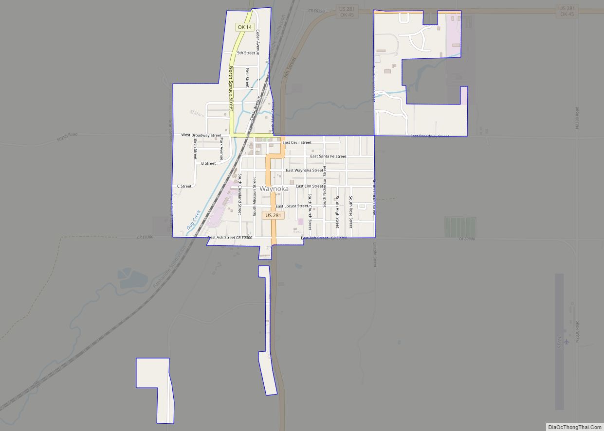
Online Interactive Map
Click on ![]() to view map in "full screen" mode.
to view map in "full screen" mode.
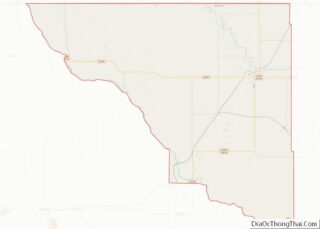
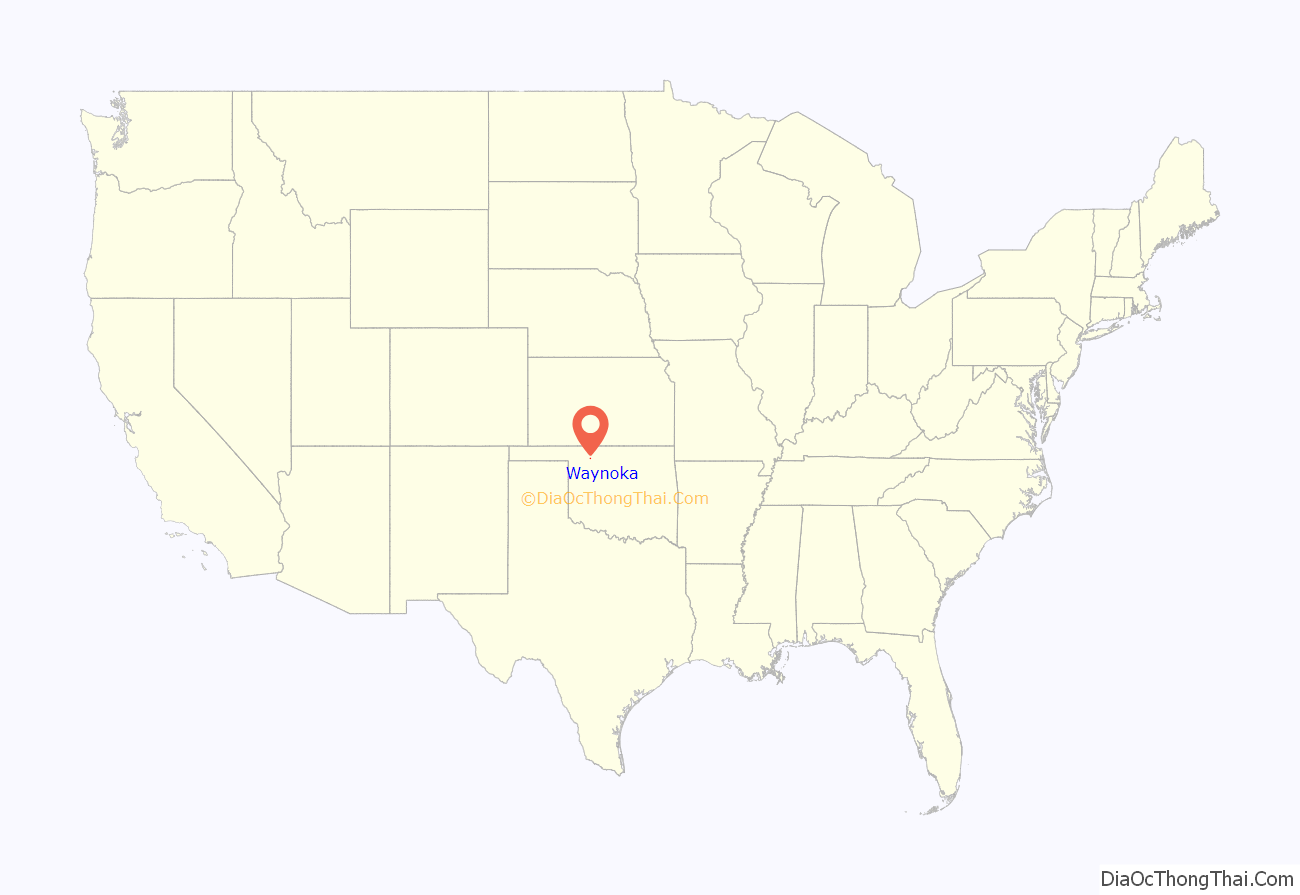
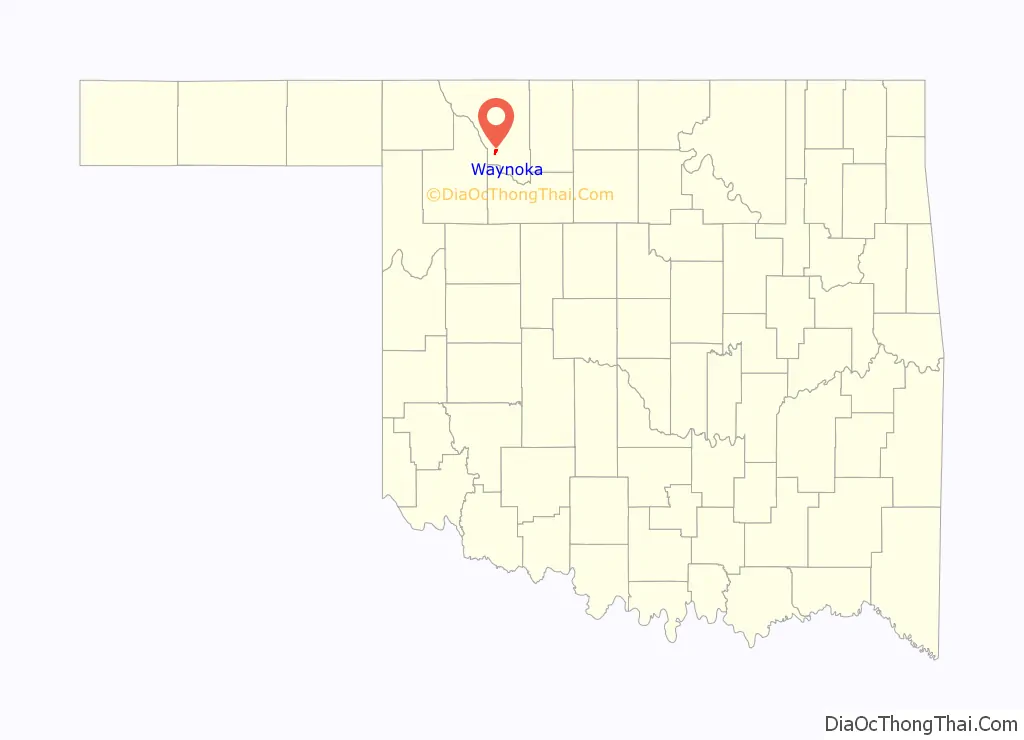
Waynoka location map. Where is Waynoka city?
History
Founding years
Founded in what was then known as Indian Territory, Waynoka was established in 1887 when the Southern Kansas Railroad, a subsidiary of the Atchison, Topeka and Santa Fe Railway, built a rail line through the area. Shortly thereafter, on April 10, 1888, a post office was established, having the distinction of being the first to be established in the Cherokee Outlet. Its economy was based on the railroad and the large ranches in the area. When the Cherokee Outlet opened up for non-Indian settlement in the land run of September 16, 1893, Waynoka became the area’s agricultural trade center.
Transportation Center
The Santa Fe Railway made the city a major railroad center when it built Oklahoma’s largest rail yard in Waynoka. Ultimately employing a thousand machinists, boilermakers, sheet metal mechanics, fire builders, car men, switchmen, and engineers, it operated twenty-four hours a day. One of the nation’s largest ice plants was built to supply ice for refrigerator cars hauling perishables on Santa Fe’s main line from Chicago to Los Angeles. In addition, a roundhouse, maintenance and repair shops, a reading room, a depot, and a Harvey House were built by the railroad. Although the railroad eventually moved its maintenance operations from Waynoka, it continued train crew changes there until 1986. At the turn of the twenty-first century, between fifty and one hundred trains still passed daily through Waynoka on Oklahoma’s fastest and busiest rail line.
Waynoka was also the starting point of the Buffalo and Northwestern Railroad, a 52-mile line linking to Buffalo, Oklahoma, the Harper County seat. The line was finished in 1920, and acquired by the Santa Fe the same year. However, the Santa Fe abandoned the line in 1982.
The predecessor company of TWA, Transcontinental Air Transport, known as “TAT”, built Oklahoma’s first transcontinental airport in 1929 in Waynoka, at a site five miles northeast of town selected by Charles Lindbergh himself. TAT offered passengers coast-to-coast travel in forty-eight hours, and Waynoka was an important stop on the pioneering route. For the service, TAT utilized not only its own Ford Trimotor aircraft, but also Pullman sleeper cars of the Pennsylvania Railroad and the Santa Fe Railroad for the two overnight segments of the long trip. It was at Waynoka that passengers would transfer from the TAT airplane to the Santa Fe train (going westbound), or conversely, from the Santa Fe train to the TAT plane (heading eastbound). Both Lindbergh and Amelia Earhart, as officers in the company, reportedly became familiar faces in town. After losing $2.7 million in its first eighteen months of operation, TAT in October 1930 merged with Western Air Express to become Transcontinental and Western Airlines, which announced a new route from Kansas City, Kansas, by way of Tulsa, Oklahoma. This ended operations at Waynoka.
Waynoka is linked by US Route 281.
The current Waynoka Municipal Airport (FAA Identifier: 1K5) is one mile southeast of town, and features a paved 3532’ x 60’ runway.
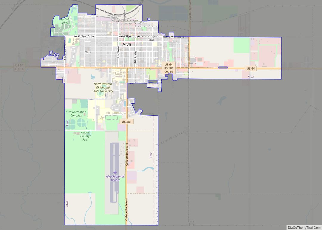
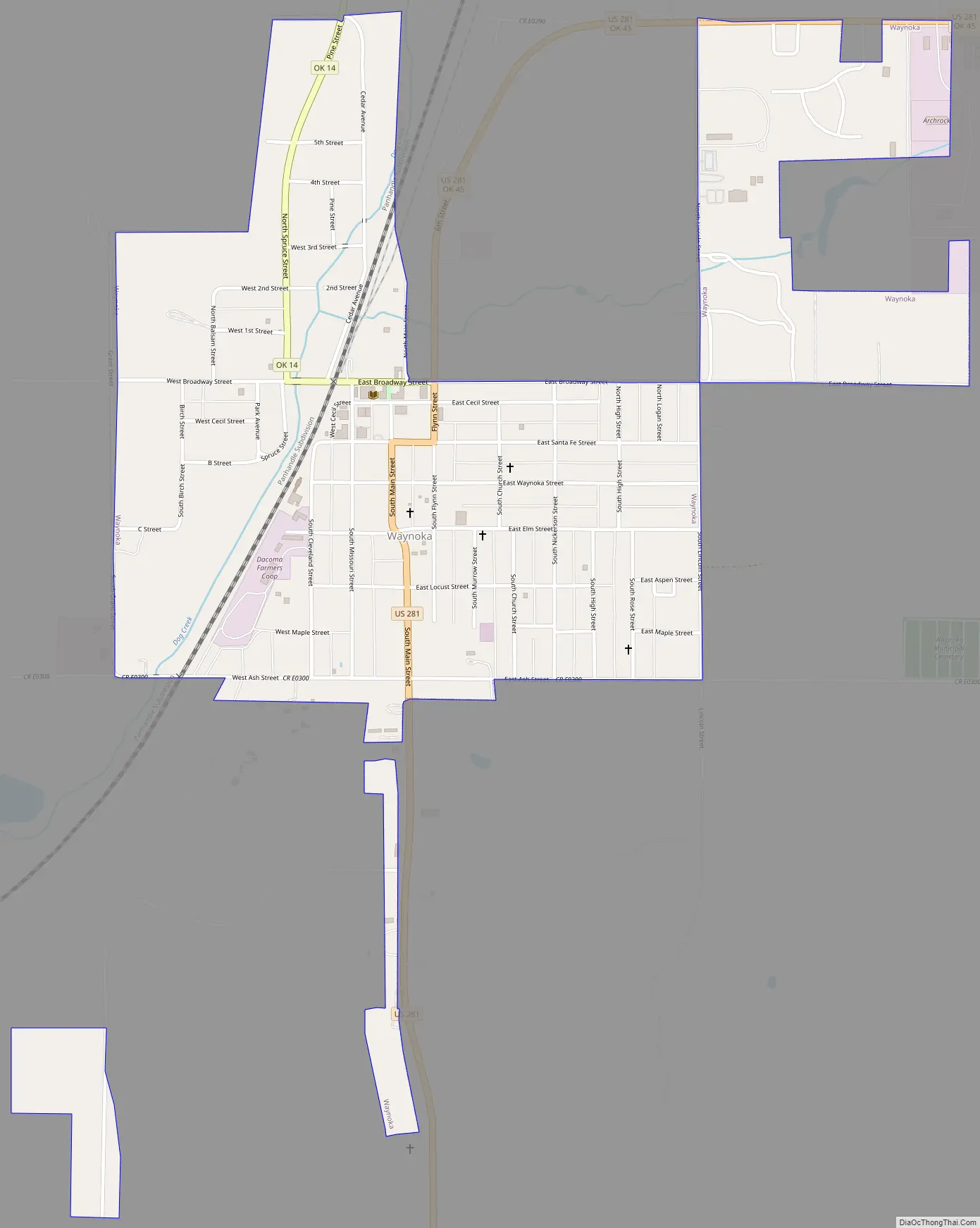
Waynoka Road Map
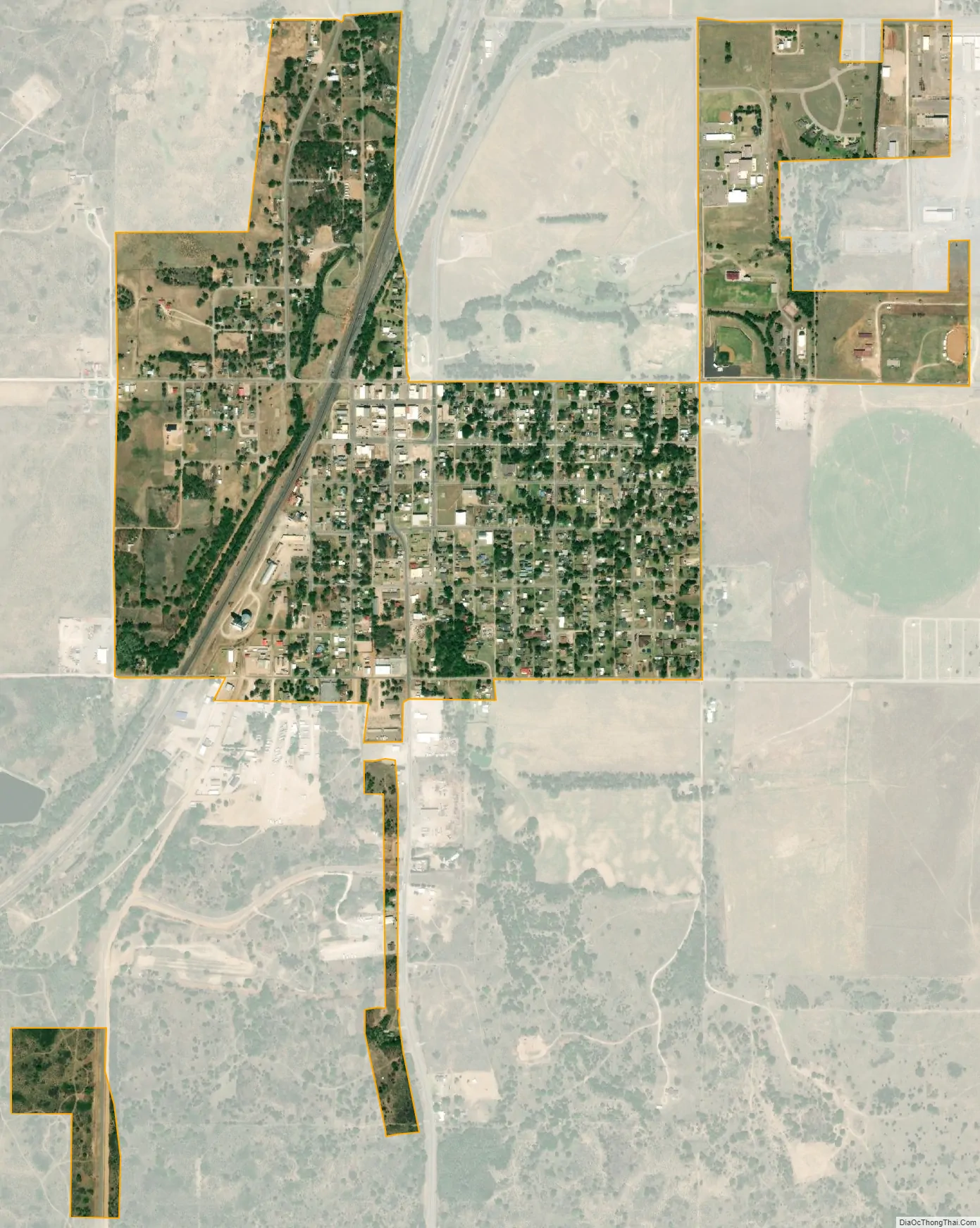
Waynoka city Satellite Map
Geography
Waynoka is located at 36°35′3″N 98°52′47″W / 36.58417°N 98.87972°W / 36.58417; -98.87972 (36.584060, -98.879714). According to the United States Census Bureau, the city has a total area of 1.0 square mile (2.6 km), all land.
Little Sahara State Park is 4 miles (6.4 km) south of the city. The park offers over 1,600 acres (6.5 km) of rideable sand dunes ranging in height from 25 to 75 feet (23 m).
See also
Map of Oklahoma State and its subdivision:- Adair
- Alfalfa
- Atoka
- Beaver
- Beckham
- Blaine
- Bryan
- Caddo
- Canadian
- Carter
- Cherokee
- Choctaw
- Cimarron
- Cleveland
- Coal
- Comanche
- Cotton
- Craig
- Creek
- Custer
- Delaware
- Dewey
- Ellis
- Garfield
- Garvin
- Grady
- Grant
- Greer
- Harmon
- Harper
- Haskell
- Hughes
- Jackson
- Jefferson
- Johnston
- Kay
- Kingfisher
- Kiowa
- Latimer
- Le Flore
- Lincoln
- Logan
- Love
- Major
- Marshall
- Mayes
- McClain
- McCurtain
- McIntosh
- Murray
- Muskogee
- Noble
- Nowata
- Okfuskee
- Oklahoma
- Okmulgee
- Osage
- Ottawa
- Pawnee
- Payne
- Pittsburg
- Pontotoc
- Pottawatomie
- Pushmataha
- Roger Mills
- Rogers
- Seminole
- Sequoyah
- Stephens
- Texas
- Tillman
- Tulsa
- Wagoner
- Washington
- Washita
- Woods
- Woodward
- Alabama
- Alaska
- Arizona
- Arkansas
- California
- Colorado
- Connecticut
- Delaware
- District of Columbia
- Florida
- Georgia
- Hawaii
- Idaho
- Illinois
- Indiana
- Iowa
- Kansas
- Kentucky
- Louisiana
- Maine
- Maryland
- Massachusetts
- Michigan
- Minnesota
- Mississippi
- Missouri
- Montana
- Nebraska
- Nevada
- New Hampshire
- New Jersey
- New Mexico
- New York
- North Carolina
- North Dakota
- Ohio
- Oklahoma
- Oregon
- Pennsylvania
- Rhode Island
- South Carolina
- South Dakota
- Tennessee
- Texas
- Utah
- Vermont
- Virginia
- Washington
- West Virginia
- Wisconsin
- Wyoming