Webb City is an unincorporated town in northwestern Osage County, Oklahoma, United States. The population was 62 at the 2010 census, a 34.7 percent decline from the figure of 95 recorded in 2000. It was named for its founder, Horace Webb, on whose land the town was founded. The Webb City post office opened December 16, 1922.
| Name: | Webb City town |
|---|---|
| LSAD Code: | 43 |
| LSAD Description: | town (suffix) |
| State: | Oklahoma |
| County: | Osage County |
| Elevation: | 1,099 ft (335 m) |
| Total Area: | 0.25 sq mi (0.65 km²) |
| Land Area: | 0.25 sq mi (0.65 km²) |
| Water Area: | 0.00 sq mi (0.00 km²) |
| Total Population: | 58 |
| Population Density: | 230.16/sq mi (88.97/km²) |
| FIPS code: | 4079600 |
| GNISfeature ID: | 1099455 |
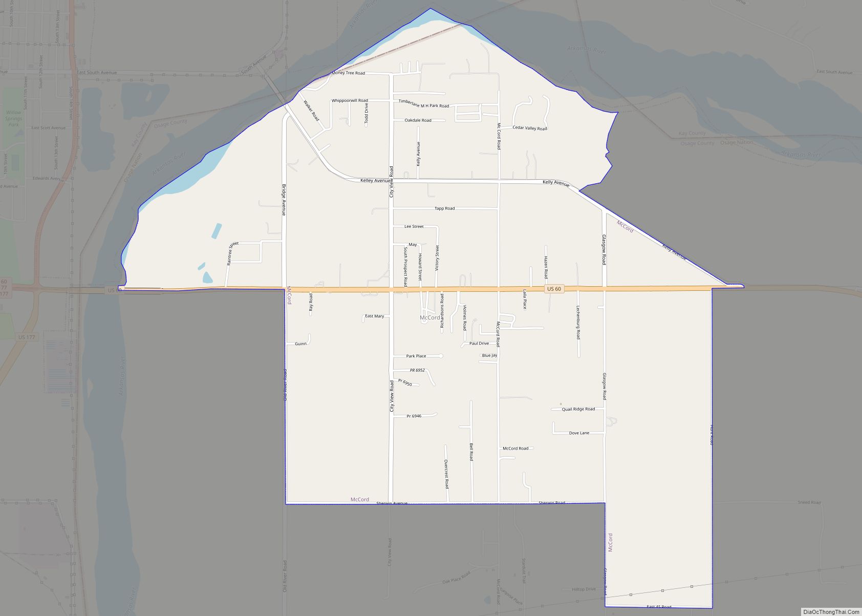
Online Interactive Map
Click on ![]() to view map in "full screen" mode.
to view map in "full screen" mode.
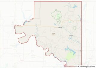
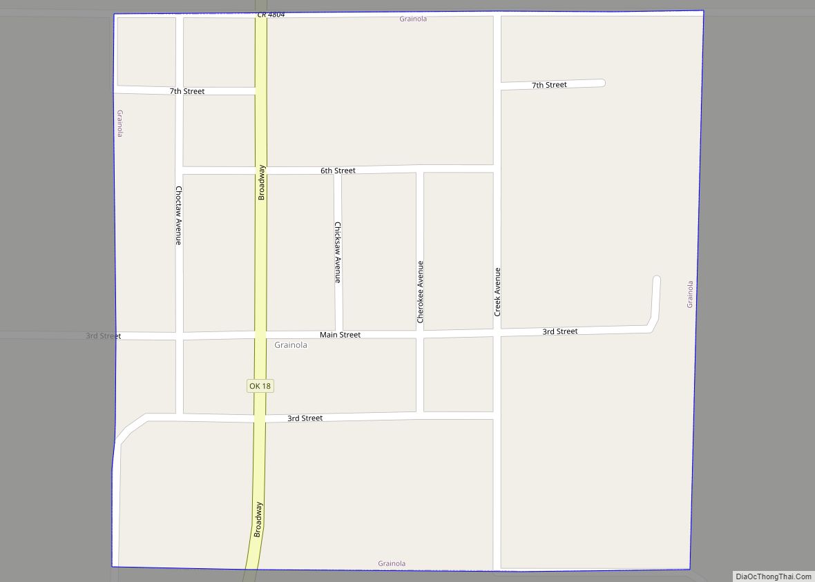
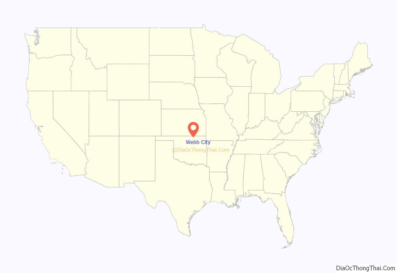
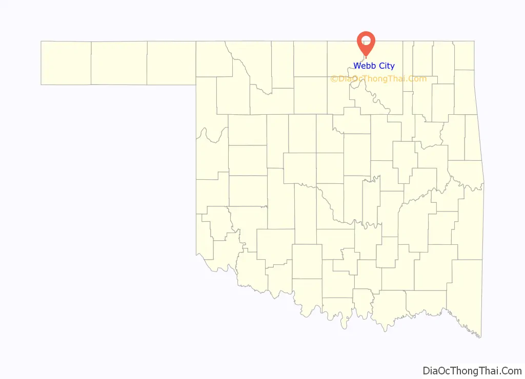
Webb City location map. Where is Webb City town?
History
Horace W. Webb, a native of Missouri, settled just south of Grainola, Oklahoma in 1910. He continued to purchase land and opened the area’s first school. The town of Webb City was incorporated on his land in September 1921. The post office opened in Webb City on December 16, 1922.
Webb City was located at the northern end of the Burbank Oil Field, discovered in 1920. All mineral rights in Osage County were owned by the Osage tribe of American Indians. The Osage Railway, one of the Muskogee Roads, built a line through the town in 1924 connecting Shidler and Lyman, Oklahoma. Although the oil find brought a degree of prosperity, Webb City never developed into a modern town. Water was scarce and there was no electricity. The business district had unpaved streets and most of the buildings were built of wood frame and false fronts.
The town began to decline in the late 1920s, as the oil boom faded. In 1928, it was heavily damaged by a tornado, and many of the businesses did not rebuild. The decline continued through the Great Depression. Its high school closed in 1944, and consolidated with the high school in Shidler. The elementary school closed in 1956, and consolidated with the elementary school in Shidler. The Osage Railway was abandoned in 1955.
The 1930 census (the first census taken in Webb City) showed 493 residents. The population declined thereafter.
Webb City Road Map
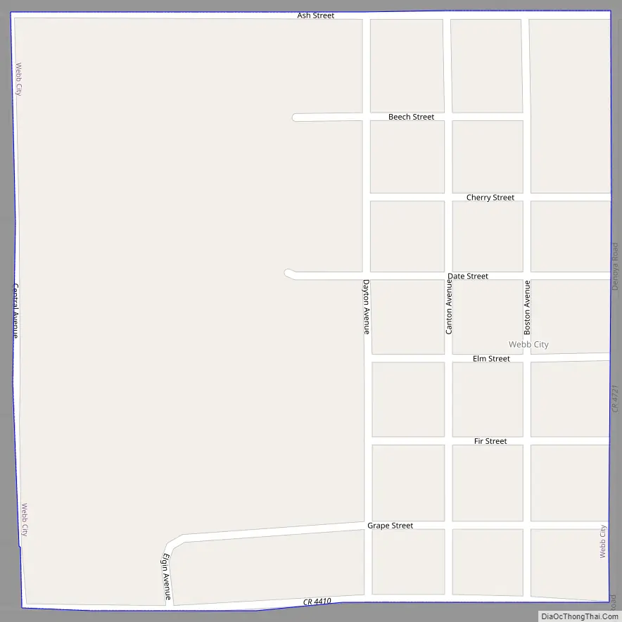
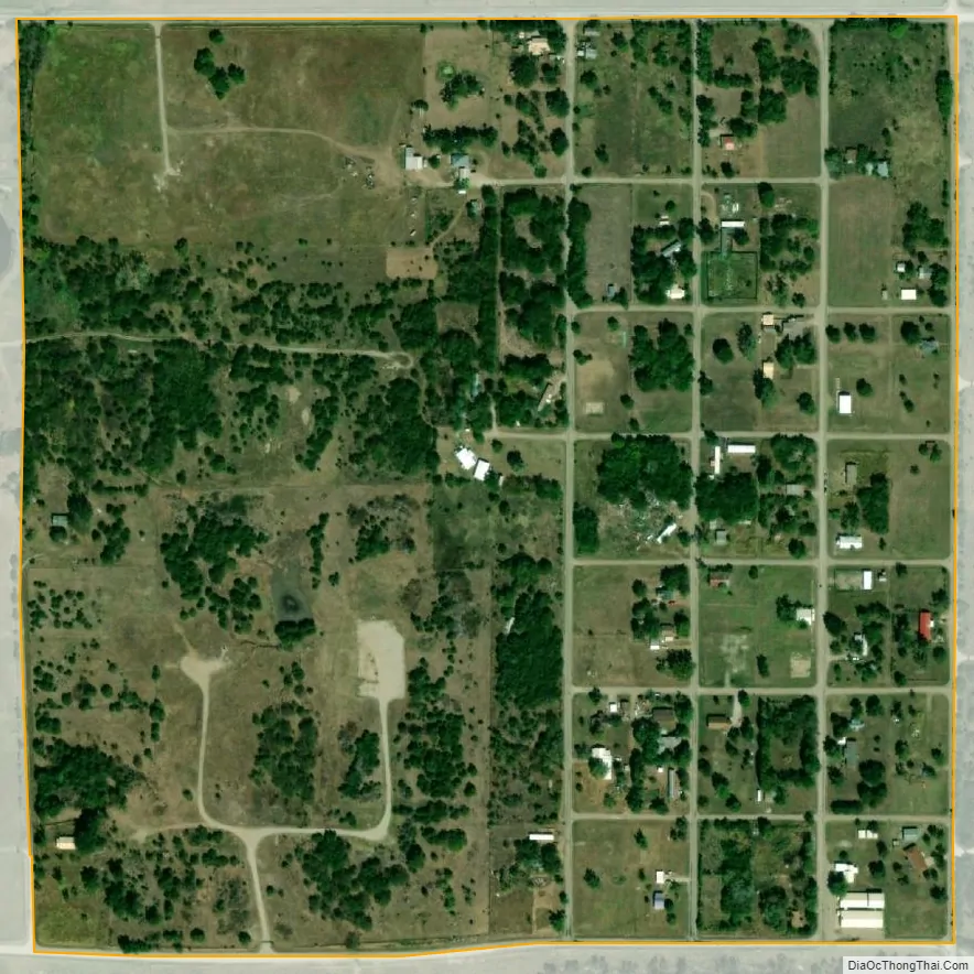
Webb City city Satellite Map
Geography
Webb City is located at 36°48′26″N 96°42′33″W / 36.80722°N 96.70917°W / 36.80722; -96.70917 (36.807311, -96.709265). It is 5 miles (8.0 km) northwest of Shidler and 30 miles (48 km) northwest of Pawhuska.
According to the United States Census Bureau, the town has a total area of 0.2 square miles (0.52 km), all land.
See also
Map of Oklahoma State and its subdivision:- Adair
- Alfalfa
- Atoka
- Beaver
- Beckham
- Blaine
- Bryan
- Caddo
- Canadian
- Carter
- Cherokee
- Choctaw
- Cimarron
- Cleveland
- Coal
- Comanche
- Cotton
- Craig
- Creek
- Custer
- Delaware
- Dewey
- Ellis
- Garfield
- Garvin
- Grady
- Grant
- Greer
- Harmon
- Harper
- Haskell
- Hughes
- Jackson
- Jefferson
- Johnston
- Kay
- Kingfisher
- Kiowa
- Latimer
- Le Flore
- Lincoln
- Logan
- Love
- Major
- Marshall
- Mayes
- McClain
- McCurtain
- McIntosh
- Murray
- Muskogee
- Noble
- Nowata
- Okfuskee
- Oklahoma
- Okmulgee
- Osage
- Ottawa
- Pawnee
- Payne
- Pittsburg
- Pontotoc
- Pottawatomie
- Pushmataha
- Roger Mills
- Rogers
- Seminole
- Sequoyah
- Stephens
- Texas
- Tillman
- Tulsa
- Wagoner
- Washington
- Washita
- Woods
- Woodward
- Alabama
- Alaska
- Arizona
- Arkansas
- California
- Colorado
- Connecticut
- Delaware
- District of Columbia
- Florida
- Georgia
- Hawaii
- Idaho
- Illinois
- Indiana
- Iowa
- Kansas
- Kentucky
- Louisiana
- Maine
- Maryland
- Massachusetts
- Michigan
- Minnesota
- Mississippi
- Missouri
- Montana
- Nebraska
- Nevada
- New Hampshire
- New Jersey
- New Mexico
- New York
- North Carolina
- North Dakota
- Ohio
- Oklahoma
- Oregon
- Pennsylvania
- Rhode Island
- South Carolina
- South Dakota
- Tennessee
- Texas
- Utah
- Vermont
- Virginia
- Washington
- West Virginia
- Wisconsin
- Wyoming