Yeager is a town in Hughes County, Oklahoma, United States. The population was 75 at the 2010 census. Developed in the early 1900s, the town grew with the help of an oil and gas field, but has always had a low population.
| Name: | Yeager town |
|---|---|
| LSAD Code: | 43 |
| LSAD Description: | town (suffix) |
| State: | Oklahoma |
| County: | Hughes County |
| Elevation: | 787 ft (240 m) |
| Total Area: | 0.19 sq mi (0.49 km²) |
| Land Area: | 0.19 sq mi (0.48 km²) |
| Water Area: | 0.00 sq mi (0.00 km²) |
| Total Population: | 45 |
| Population Density: | 240.64/sq mi (92.98/km²) |
| FIPS code: | 4082650 |
| GNISfeature ID: | 1100043 |
Online Interactive Map
Click on ![]() to view map in "full screen" mode.
to view map in "full screen" mode.
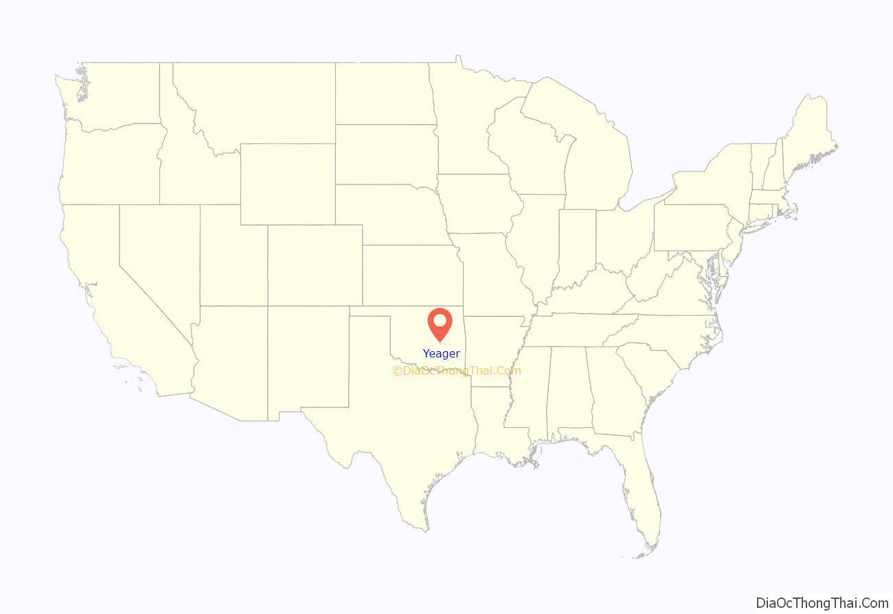
Yeager location map. Where is Yeager town?
History
According to the Encyclopedia of Oklahoma History and Culture the present community was named for a Creek allottee, Hattie Yargee. The town was developed along the St. Louis, Oklahoma and Southern Railway, which was built between 1900 and 1901. When a post office was established on February 6, 1902, the Post Office Department changed the spelling of the office to the present Yeager. An oil and gas field opened in the town in 1917 and helped support the railroad industry in the 1920s.
In 1917, the Yeager Oil Field opened, producing 25 to 2500 barrels of oil per day. As the Yeager field developed during the 1920s, the railroad’s revenue dramatically increased by transporting lumber, rig timber, and oil-field equipment to the community. By 1918 citizens had established a Baptist Church and a Church of Christ. In 1918 R. L. Polk’s Oklahoma State Gazetteer and Business Directory estimated Yeager’s population at 350.
In the mid-1940s Fred A. Ashburn and C. D. Wood operated grocery and filling stations. By the mid-1950s Yeager had a grocery and a filling station. After a fire destroyed the school building on January 18, 1957, voters approved a bond issue to rebuild the facility.
Yeager Road Map
Yeager city Satellite Map
Geography
Yeager is located six miles north of Holdenville. Its geographic coordinates are 35°9′26″N 96°20′25″W / 35.15722°N 96.34028°W / 35.15722; -96.34028 (35.157355, -96.340218). According to the United States Census Bureau, the town has a total area of 0.2 square miles (0.52 km), all land.
The town lies at an elevation of 870 feet above sea level and has an average of 39 inches of rain and 6.1 inches of snowfall annually.
See also
Map of Oklahoma State and its subdivision:- Adair
- Alfalfa
- Atoka
- Beaver
- Beckham
- Blaine
- Bryan
- Caddo
- Canadian
- Carter
- Cherokee
- Choctaw
- Cimarron
- Cleveland
- Coal
- Comanche
- Cotton
- Craig
- Creek
- Custer
- Delaware
- Dewey
- Ellis
- Garfield
- Garvin
- Grady
- Grant
- Greer
- Harmon
- Harper
- Haskell
- Hughes
- Jackson
- Jefferson
- Johnston
- Kay
- Kingfisher
- Kiowa
- Latimer
- Le Flore
- Lincoln
- Logan
- Love
- Major
- Marshall
- Mayes
- McClain
- McCurtain
- McIntosh
- Murray
- Muskogee
- Noble
- Nowata
- Okfuskee
- Oklahoma
- Okmulgee
- Osage
- Ottawa
- Pawnee
- Payne
- Pittsburg
- Pontotoc
- Pottawatomie
- Pushmataha
- Roger Mills
- Rogers
- Seminole
- Sequoyah
- Stephens
- Texas
- Tillman
- Tulsa
- Wagoner
- Washington
- Washita
- Woods
- Woodward
- Alabama
- Alaska
- Arizona
- Arkansas
- California
- Colorado
- Connecticut
- Delaware
- District of Columbia
- Florida
- Georgia
- Hawaii
- Idaho
- Illinois
- Indiana
- Iowa
- Kansas
- Kentucky
- Louisiana
- Maine
- Maryland
- Massachusetts
- Michigan
- Minnesota
- Mississippi
- Missouri
- Montana
- Nebraska
- Nevada
- New Hampshire
- New Jersey
- New Mexico
- New York
- North Carolina
- North Dakota
- Ohio
- Oklahoma
- Oregon
- Pennsylvania
- Rhode Island
- South Carolina
- South Dakota
- Tennessee
- Texas
- Utah
- Vermont
- Virginia
- Washington
- West Virginia
- Wisconsin
- Wyoming
