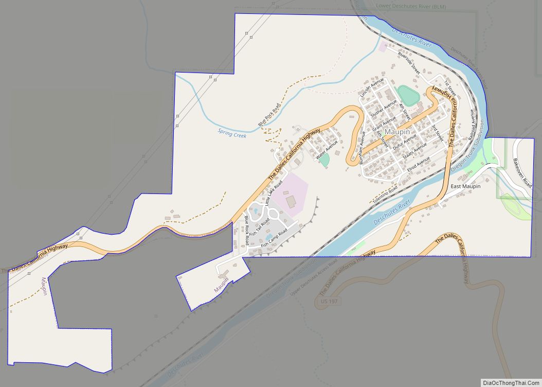
Shaniko (/ˈʃænɪkoʊ/, SHAN-i-koh) is a city located in Wasco County, Oregon, United States, on U.S. Route 97 and about 8 miles (13 km) north of Antelope. The population was 30 at the 2020 census.
| Name: | Shaniko city |
|---|---|
| LSAD Code: | 25 |
| LSAD Description: | city (suffix) |
| State: | Oregon |
| County: | Wasco County |
| Incorporated: | 1901 |
| Elevation: | 3,343 ft (1,019 m) |
| Total Area: | 0.50 sq mi (1.29 km²) |
| Land Area: | 0.50 sq mi (1.29 km²) |
| Water Area: | 0.00 sq mi (0.00 km²) |
| Total Population: | 30 |
| Population Density: | 60.24/sq mi (23.28/km²) |
| ZIP code: | 97057 |
| Area code: | 541 |
| FIPS code: | 4166700 |
| GNISfeature ID: | 1126791 |
| Website: | http://www.shanikooregon.com |
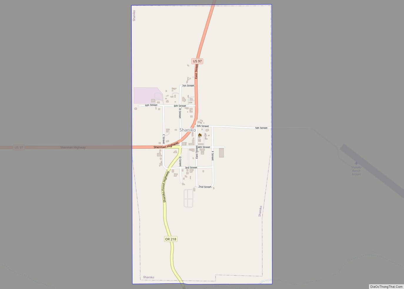
Online Interactive Map
Click on ![]() to view map in "full screen" mode.
to view map in "full screen" mode.
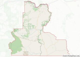
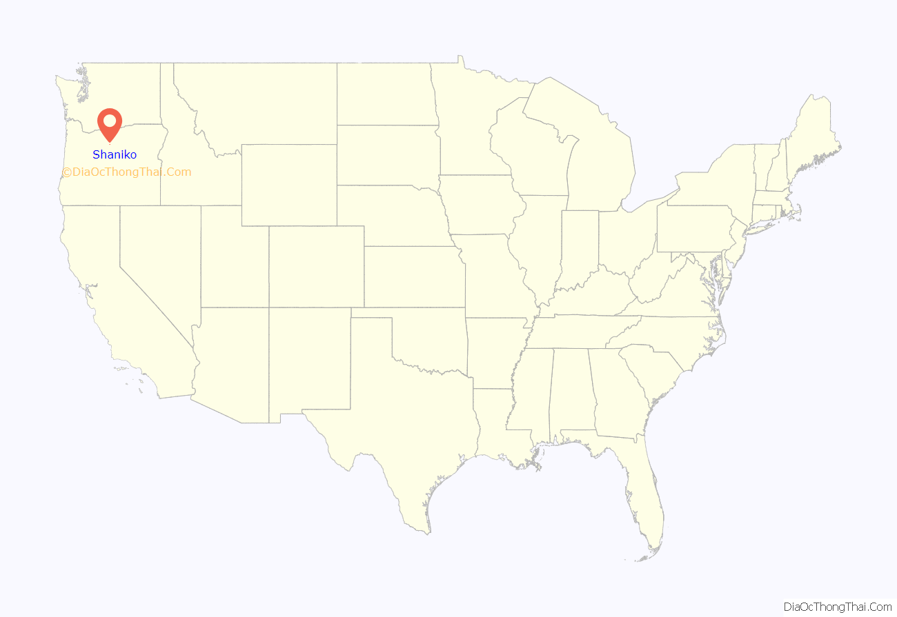
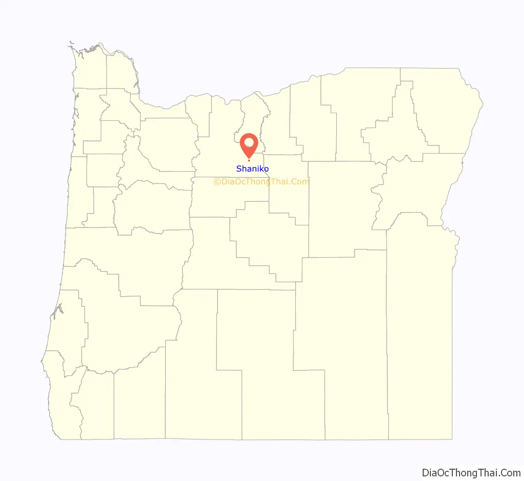
Shaniko location map. Where is Shaniko city?
History
The first European Americans came to the Shaniko area after the discovery of gold in Canyon City, Oregon, in 1862. The route to Canyon City started at the early settlement of The Dalles, 190 miles (310 km) away. Camps were made wherever water could be found. One camp, which became the farming community of Bakeoven, was closely associated with the future town of Shaniko, while another camp, Cross Hollow, was within the present Shaniko city limits. In 1867, following complaints of hostile Indians and fear of robbery of those transporting gold, the State of Oregon received a grant from the United States government to build a military wagon road from The Dalles to Fort Boise in what was then Washington Territory, (now Idaho). Following this road, homesteaders began claiming land in Central Oregon that previously had been fairly inaccessible.
One of these settlers was August Scherneckau, who came to the area after the Civil War, in 1874. The spelling of the town’s name reflects local Native American pronunciation of Scherneckau’s name. The town was originally called Cross Hollow, and a post office by that name was established in May 1879 with Scherneckau as postmaster. Cross Hollow post office closed in 1887, and Shaniko post office opened in 1900. An application to incorporate the city was submitted February 9, 1901, and the first official meeting of the Shaniko city council occurred on March 16, 1901.
The town’s heyday was the first decade of the 20th century, when Shaniko served as a transportation hub spurred by the presence of the Columbia Southern Railway, a subsidiary of Union Pacific Railroad, which built a branch from Biggs Junction to a terminus in Shaniko. That branch was completed in May 1900. At the time, the city was known as the “Wool Capital of the World”, and it was a regional center of 20,000 square miles (52,000 km) of wool, wheat, cattle and sheep production, with no other such center east of the Cascade Range in Oregon. The region served by the city even stretched into Idaho, south to Klamath Falls, Oregon, and beyond, because of rail connections to the main line.
The residents of Shaniko voted to incorporate Shaniko and elected a mayor, F. T. Hurlbert, and other city officials on January 1, 1902. It was Wasco County’s fifth largest city, boasting the largest wool warehouse in the state, from which 4 million pounds (1.8 kt) (2,000 tons) were marketed in 1901. It was surrounded by cattle ranches, which produced livestock for shipment that filled 400 railroad cars that year. In 1903, when Shaniko gained the nickname, “Wool Capital of the World”, they shipped 2,229 tons of wool and 1,168,866 bushels of wheat. They made $3,000,000 in wool sales in 1903. The second sale of that year one warehouse deposited a million into the bank. There was a third sale that year as well. In 1904, total annual sales were five million dollars.
By 1911, the Oregon–Washington Railroad and Navigation Company, another Union Pacific subsidiary, began using an alternate route linking Portland to Bend by way of the Deschutes River canyon. The new line, advertised as the “direct, quick and natural route”, diverted traffic from the Columbia Southern, and Shaniko began to decline. Passenger rail service to Shaniko ended in the early 1930s, and the entire line was shut down by 1966. By 1982 Shaniko was nearly a ghost town. Shaniko was first called a “ghost town” at the Oregon Centennial Exposition in Portland in 1959.
In the 1980s, an out-of-town developer attempted to restore the Shaniko Hotel but later sold the property to Robert Pamplin Jr. Though the hotel was listed for sale for quite some time, it has been taken off of the market.
Shaniko attracts ghost town tourists, but a wastewater issue still prevents any large scale tourism efforts from forming. Local businesses operate seasonally from April to September to accommodate the tourists, including those in “Shaniko Row”.
Shaniko Road Map

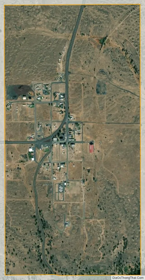
Shaniko city Satellite Map
Geography
Shaniko is in Wasco County, in north-central Oregon, at the intersection of U.S. Route 97 and Oregon Route 218. The city is 69 miles (111 km) north of Redmond and 131 miles (211 km) east of Portland. According to the United States Census Bureau, the city has a total area of 0.50 square miles (1.29 km), all of it land.
The city is at an elevation of 3,343 feet (1,019 m). On the high plateau on which Shaniko was built, the soil is thin and the vegetation sparse, consisting mainly of sagebrush, bunchgrass, and occasional junipers. Many peaks of the Cascade Range, including Hood, Jefferson, Adams, St. Helens and Rainier, are visible from the city.
See also
Map of Oregon State and its subdivision: Map of other states:- Alabama
- Alaska
- Arizona
- Arkansas
- California
- Colorado
- Connecticut
- Delaware
- District of Columbia
- Florida
- Georgia
- Hawaii
- Idaho
- Illinois
- Indiana
- Iowa
- Kansas
- Kentucky
- Louisiana
- Maine
- Maryland
- Massachusetts
- Michigan
- Minnesota
- Mississippi
- Missouri
- Montana
- Nebraska
- Nevada
- New Hampshire
- New Jersey
- New Mexico
- New York
- North Carolina
- North Dakota
- Ohio
- Oklahoma
- Oregon
- Pennsylvania
- Rhode Island
- South Carolina
- South Dakota
- Tennessee
- Texas
- Utah
- Vermont
- Virginia
- Washington
- West Virginia
- Wisconsin
- Wyoming